Where's the best spot on-trail to head off-trail to get to the two Quarter Domes?
advTHAaNKSnce

The Moon is Waxing Gibbous (56% of Full)
Re: How to get to Quarter Domes?
All posts are those of the individual authors and the owner
of this site does not endorse them. Content should be considered opinion
and not fact until verified independently.
November 15, 2010 10:59PM | Registered: 15 years ago Posts: 670 |
|
Re: How to get to Quarter Domes? November 15, 2010 11:27PM | Registered: 14 years ago Posts: 755 |
Quote
qumqats
Where's the best spot on-trail to head off-trail to get to the two Quarter Domes?
advTHAaNKSnce
It's easy. As you come up the Half Dome Trail, keep an eye on the terrain to your right. When you can see the low point in the saddle between the trail and the ridge up to Quarter Domes, just ease on over there and walk up the ridge. It's pretty open terrain. You can eyeball it. The easiest route, once you get through the low point, is along the ridge. I think that there is more brush to the right of that, but haven't tried it. If you do it as I described, you will never have to touch a bush.
The traverse cross country from the Clouds Rest Trail is also quite doable, but I don't recall that you can find the start visually. You need the map or an altimeter, or something, to figure out where to leave the trail.
November 16, 2010 12:32AM | Registered: 15 years ago Posts: 670 |
November 16, 2010 07:25AM | Registered: 14 years ago Posts: 7,421 |
It's even easier than what whatever said.
Lookie on your map. See the really long switchback as you head up.
You'll know when you are on that one. Well from the Western most portion of
that switchy... just head due north and it'll be obvious. There is very minimal
working around some shrubbery.
If coming from Clouds... it's quite possible to simply go "straight" down to it
once you get W of the Pinnacles.
As for the "spring"... uh.. I don't know about that... just was up there 2 weekends
ago and we didn't see anything from the directions I just described.
We just carried water up from below... One tidbit you may use.. (used it on
Basket) is, if you know it is wet and has rained or snowed recently...
you can find water in solutions pockets. There is actually some big ones
on the Sharkie.
November 16, 2010 07:31AM | Registered: 14 years ago Posts: 7,421 |
Here's a map of routes we've done in the last few years.
The route that zigs across w/o going up QD... I don't recommend that..
although that water course will have water until prob. July.
The route down from above on the edge was pretty steep but great fun.
Not for everyone. When you are on the W QD you will prob. say
"I came down what?"
All those other routes are fairly open and good fun.
November 16, 2010 07:35AM | Registered: 14 years ago Posts: 7,421 |
One more note on the map above.
If you look at the trail E of "YOSEMITE" where it heads almost due W...
E of that is where the stream starts that you get water from down below
(that stream ALWAYS has water running) (it has fish in it)
So... if you go E from that pt. (you will know you are there... believe me)
you should be able to find that water course. Haven't investigated myself...
but it shows on the map.
That location would almost make an excellent LNT campspot. Just
great views from there... but you'd have to prob. camp v. close to the trail.
Have fun
November 17, 2010 03:17PM | Registered: 14 years ago Posts: 675 |
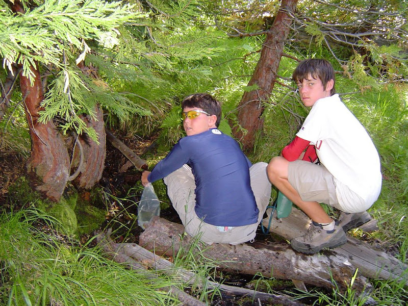
About the spring...I remember as a kid seeing a hand-made sign on the route up to Half Dome pointing to the spring, and there being a use trail over to it. I had seen it shown on my Yosemite Valley topo map (not USGS but an aftermarket map) from the 80's, so I looked for it with my kids on one of my Half Dome hikes (2003)...and found it.

Heading up the Half Dome trail, while still in the wooded area and about a quarter mile north of the trail junction where the Half Dome trail leaves the John Muir Trail, at the last of what I call the "forested" switchbacks, the trail turns back to the left (west). Cut over to the east at this spot, just over a little rise to a small drainage that flows back down to LYV and follow the drainage uphill until you see the 2" pipe coming out of the ground.
As I recall it appeared that the area well was visited by bears after their raids on the LYV campsites, based on the foil-infested scat that was all around. But the water was good!
November 17, 2010 04:24PM | Registered: 14 years ago Posts: 7,421 |
Bearproof,
My understanding is that he was asking about a spring along the trail to Clouds.
As far as that pipe. Thanks for that photo! (it didn't show up but was able to
get it by doing a reply quote to get the link)
Within the last couple of years I have looked in vain a couple of times for that
darn pipe. We were able to find it many many years ago. I was thinking that
they removed the pipe for some stupid reason... since had absolutely no
luck locating it... with your photo I'll give it another go in the future.
|
Re: How to get to Quarter Domes? November 17, 2010 05:17PM | Registered: 15 years ago Posts: 619 |
|
Re: How to get to Quarter Domes? November 17, 2010 06:41PM | Registered: 14 years ago Posts: 755 |
Quote
Bearproof
About the spring...I remember as a kid seeing a hand-made sign on the route up to Half Dome pointing to the spring, and there being a use trail over to it. I had seen it shown on my Yosemite Valley topo map (not USGS but an aftermarket map) from the 80's, so I looked for it with my kids on one of my Half Dome hikes (2003)...and found it.
Heading up the Half Dome trail, while still in the wooded area and about a quarter mile north of the trail junction where the Half Dome trail leaves the John Muir Trail, at the last of what I call the "forested" switchbacks, the trail turns back to the left (west). Cut over to the east at this spot, just over a little rise to a small drainage that flows back down to LYV and follow the drainage uphill until you see the 2" pipe coming out of the ground.
As I recall it appeared that the area well was visited by bears after their raids on the LYV campsites, based on the foil-infested scat that was all around. But the water was good!
I don't know why your photo won't post, but here it is:
November 17, 2010 07:32PM | Moderator Registered: 15 years ago Posts: 1,942 |
Quote
Bearproof
About the spring...I remember as a kid seeing a hand-made sign on the route up to Half Dome pointing to the spring, and there being a use trail over to it. I had seen it shown on my Yosemite Valley topo map (not USGS but an aftermarket map) from the 80's, so I looked for it with my kids on one of my Half Dome hikes (2003)...and found it.
Heading up the Half Dome trail, while still in the wooded area and about a quarter mile north of the trail junction where the Half Dome trail leaves the John Muir Trail, at the last of what I call the "forested" switchbacks, the trail turns back to the left (west). Cut over to the east at this spot, just over a little rise to a small drainage that flows back down to LYV and follow the drainage uphill until you see the 2" pipe coming out of the ground.
As I recall it appeared that the area well was visited by bears after their raids on the LYV campsites, based on the foil-infested scat that was all around. But the water was good!
I don't suppose you have the coordinates for that spring? I have heard the route described a few times and I found it in 1968 when I spend a month in Yosemite, but have not found it since.
Thanks
The cure for a fallacious argument is a better argument, not the suppression of ideas.
-- Carl Sagan
November 17, 2010 08:05PM | Registered: 14 years ago Posts: 675 |
Quote
Frank Furter
don't suppose you have the coordinates for that spring? I have heard the route described a few times and I found it in 1968 when I spend a month in Yosemite, but have not found it since.
I don't have a coordinate for the Half Dome spring, but will by next summer as I plan to spend plenty of time up there. I recall talking to a ranger down in LYV later that day in 2003 about the spring and he did not know anything about it. If the pipe is still there, as it was in 2003, I suppose it is kept rather secret as it would otherwise be decimated by the Half Dome hoards. And the legal folks would add that it likely does not meet federal water quality standards.
And btw thanks to all for the help with the picture!
November 17, 2010 09:27PM | Registered: 14 years ago Posts: 7,421 |
We found it before 2004. In 2004 I looked extensively but couldn't find the darn pipe.
Did find a spoon in the area though to replace one a marmut stole from me while
staying on Quarter Dome.
This year looked again to no avail... With your pict. in hand someone should be
able to find it... at least the same spot... USGS maps are pretty much spot on...
(found the Yose. Grant marker w/it in < 5 minutes)
and I looked right where it said spring for quite some time. Only conclusion I came
up with is that someone removed it.
Coord of the spring from USGS map is:
37 44'58" N
119 30'50"" W
Maybe the pipe itself is in the water course instead.
Anyone out there finds the pipe... please post... thx
|
Re: How to get to Quarter Domes? November 17, 2010 11:31PM | Registered: 14 years ago Posts: 755 |
Quote
chick-on
We found it before 2004. In 2004 I looked extensively but couldn't find the darn pipe.
Did find a spoon in the area though to replace one a marmut stole from me while
staying on Quarter Dome.
This year looked again to no avail... With your pict. in hand someone should be
able to find it... at least the same spot... USGS maps are pretty much spot on...
(found the Yose. Grant marker w/it in < 5 minutes)
and I looked right where it said spring for quite some time. Only conclusion I came
up with is that someone removed it.
Coord of the spring from USGS map is:
37 44'58" N
119 30'50"" W
Maybe the pipe itself is in the water course instead.
Anyone out there finds the pipe... please post... thx
In decimal degrees it's N37.7497, W119.5139. See link: Spring

|
Re: How to get to Quarter Domes? November 18, 2010 06:07AM | Registered: 13 years ago Posts: 1,697 |
September 27, 2011 09:34PM | Registered: 14 years ago Posts: 675 |
Quote
Chick-on
Anyone out there finds the pipe... please post... thx
It is still there! Here is what it looked like last Thursday:
I have it at 37.75079 latitude, -119.51276 longitude, which puts it slightly north and east of where it shows on the USGS topo. Looking at the location on USGS I wonder about the accuracy of the reading (I admit that it was late on a big day and the tree cover is pretty dense, as were the mosquitoes)...but I had no problem finding it. I had been there twice before..once along time ago and I recall at that time a hand-done sign and a use trail that went to it. Last time was about 8 years ago with my kids. This time I took off from the trail about halfway up that last switchback and angled uphill and to the east-northeast, looking for greenery. Got to some braodleaf shrubs and it was right there...I was pretty lucky, I almost tripped over it.
September 28, 2011 08:28AM | Registered: 14 years ago Posts: 7,421 |

April 12, 2012 08:05AM | Registered: 14 years ago Posts: 7,421 |
I ended up with 37.75012 -119.51352
or 37 45'00N 119 30'49W
Went there twice to get a good reading. Regardless... it's as you say... a good 100 ft.
above (N) and a tad east of where shown on the USGS map. Currently there are
two very huge dead standing trees very near it... if that helps anyone.
or 37 45'00N 119 30'49W
Went there twice to get a good reading. Regardless... it's as you say... a good 100 ft.
above (N) and a tad east of where shown on the USGS map. Currently there are
two very huge dead standing trees very near it... if that helps anyone.
Sorry, only registered users may post in this forum.

