Welcome! Log In Create A New Profile Recent Posts
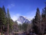
Half Dome, Yosemite National Park

The Moon is Waxing Gibbous (54% of Full)


Advanced

Ostrander-Hart-Edson Lakes Loopy

All posts are those of the individual authors and the owner of this site does not endorse them. Content should be considered opinion and not fact until verified independently.

avatar Ostrander-Hart-Edson Lakes Loopy
June 13, 2011 02:35PM
The big boss finally could go. Some fun in the snow.... but a lot of snow free trail walking and bunch of xcountry.
Second saw the snow along GP knew the boots and snowshoes were staying in the car.
Went up a couple of domes had my eyeballs on awhile.
Saw no one except for a cluster of tents camped too close to Illiouette crossing and trail.
Was surprised that from Mono Mdw. trailhead up Horizon Ridge that there was very little snow until about, maybe 7800.
And bummed we couldn't glissade down any slopes due to angle of the dangle and overnight refreeze.

Funniest thing was the Buena Vista Trail had a lot of deadfall... the wife says "The xcountry was easier". Love her.

Bunch here:
https://picasaweb.google.com/yosemite.chick.on/OstHartEdson

A couple I like:


Chick-on is looking at you!
avatar Re: Ostrander-Hart-Edson Lakes Loopy
June 13, 2011 02:37PM
First one is above Edson where we camped.
Second one is atop Dome 8312. There were a number of arches and holes up there...


Chick-on is looking at you!
avatar Re: Ostrander-Hart-Edson Lakes Loopy
June 20, 2011 03:12PM
Question (now that you're back from your latest trip to Yosemite -- was waiting for your return): Where exactly is Dome 8312? I was trying to locate it on my topo maps of Yosemite, and couldn't seem to find it.
avatar Re: Ostrander-Hart-Edson Lakes Loopy
June 20, 2011 03:19PM
Sir, did you looky at the map in the set?
https://picasaweb.google.com/yosemite.chick.on/OstHartEdson#5618468583843438818

The photos are in order (counter-clockwise loop)... it should be pretty clear.

If still not clear.. it is the dome with the little red loopy thingy dingy
(we walked around on top of it quite a bit)
Make sense?


Chick-on is looking at you!
avatar Re: Ostrander-Hart-Edson Lakes Loopy
June 20, 2011 04:07PM
Quote
chick-on
Sir, did you looky at the map in the set?
https://picasaweb.google.com/yosemite.chick.on/OstHartEdson#5618468583843438818

Yes I did. But what was odd, though, is that last week, when I tried to use the Picasa Zoom function (by clicking on the magnifying glass icon), I couldn't on that topo map you included, because for that one single image, the magnifying glass 'Zoom' icon was grayed out. On all the other photos, the Zoom function was enabled, but not for that one image. Weird.

And without being able to zoom in on the topo map you included, it was too hard to read the elevation numbers. Today, it works. (Don't know why it didn't work last week on my computer.)


Quote
chick-on
The photos are in order (counter-clockwise loop)... it should be pretty clear.

If still not clear.. it is the dome with the little red loopy thingy dingy
(we walked around on top of it quite a bit)
Make sense?

I spotted it now. Thanks for your help. And of course, thanks for all the photos. It's much appreciated!
avatar Re: Ostrander-Hart-Edson Lakes Loopy
June 20, 2011 07:53PM
Great pics there chick-on. I too echo the sentiment about the snow. I was out by Kibbie two weeks ago, and it was hard and crunchy the whole way. Very easy to move on, yet still soft enough to track the two mountain lions I saw. Of course, as we came out on a Thursday there was a group of 10 kids (under 13 years old) and 3 adults, and I remembered why I never go to Kibbie. Did they know the max size for a group was 6, yes. Did they care? No. Was I glad we were leaving? Hell yes.

We hit Kibbie and past Kibbie the week after the forest service opened the gate at Cherry Lake. At that time, the snow level was 6300+ and there was still ice floating on the lake. I assume its risen due to the heat in the last week or so, but I'll be out Wednesday afternoon for a couple nights to know for sure. Not sure where we'll end up going, but due to the snow level, the odds are it will be out of Shingle Springs again. Even so, I'm sure it will be interesting...either cross country to follow "not Kibbie Creek" up or to go out Kibbie Peak (depending on the snow level). Haha, but whatever, I'm happy to be out. New pad to try out and a few cigars to smoke, plus some bourbon in an aquafina bottle, what else could you ask for?
Sorry, only registered users may post in this forum.

Click here to login