Quote
plawrence
Thanks for posting all those photos.
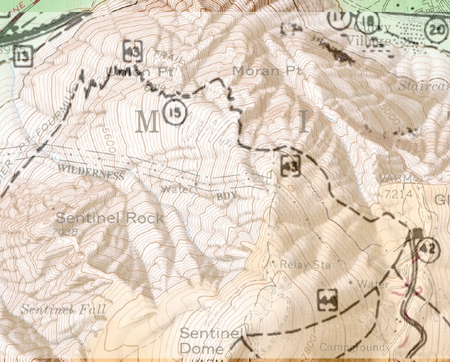
How hard did you find hiking the Old Four Mile Trail that runs below the traverse portion of the current trail? How was the exposure on that portion of the old trail?
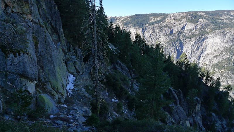
I also admire you bushwhacking skills. That portion closest to Union Point appeared to be seriously overgrown with manzanita and other shrubs.
You are welcome
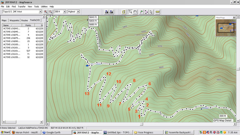
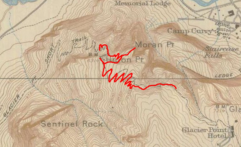
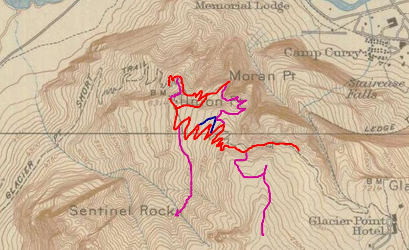
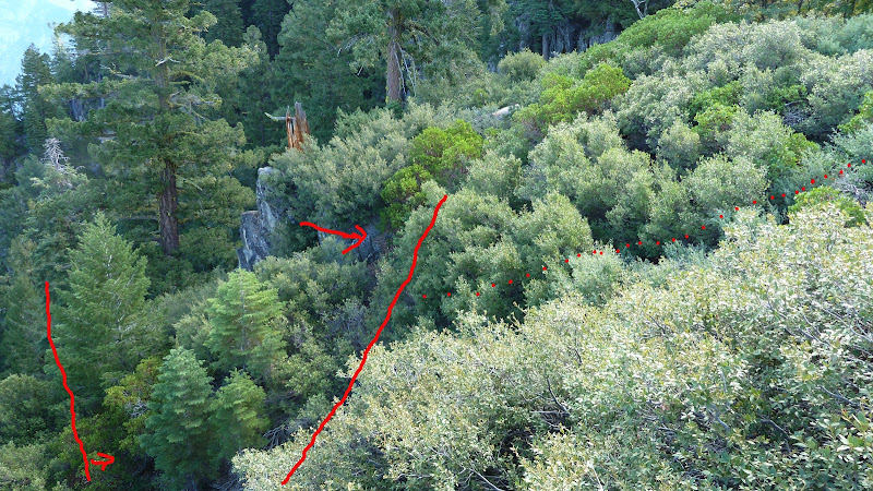
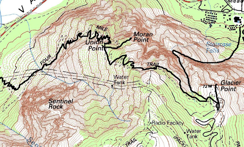
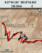
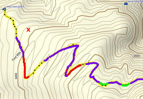
Here's the map above marked up a bit:
Red = Seriously Overgrown - good luck - be happy it's not ALL Manzanita (sections I would only do maybe once again)
Purple = Not bad at all or nothing really serious IMO (definitely sections I would do again without hesitation)
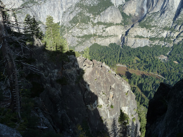
Green = Avalanche traverse (1st one closest to GP) and Super Steep dirt slope (2nd one - closer to Union)

The traverse section was a cakewalk in my book. So much so I did it coming back up too. The two sections marked in the map
are the only worries. It would definitely give some people pause and you have to work around the huge down tree.
If there is snow on those slopes you better have the gear to handle it or turn around. A false step and you could definitely be
in for serious trouble. I recommend you at least have hiking sticks to cross those sections.
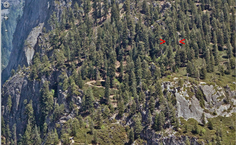
I have a question for you. I think I saw a relay tower in your photos at one time... near Union. I haven't a clue where the heck that is.
Is it lower than Union? Below the section from Agassiz?
Next year when the sun is furthest north... need to get back on it and take some pictures in better light... not so much of
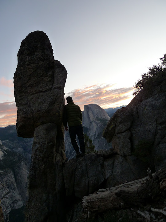
this old trail but the great rock features. Would be fun to hike the entire old section down past Ag... then hike up the new trail.
With the Custom Maps on a Garmin GPS I should also be able to better location the old trail portions heading to Sentinel
and also the sections near the Valley.