Airplane Gully is named for the airplane that crashed and lay there from 1959 to 1975, before being cleaned up and hauled away by the authorities. They left behind a couple of items: One propeller blade blade near the top of the gully (probably overlooked), and a radial aircraft engine about halfway down the gully.
Airplane wrecks are well reported on the web, so I will just excerpt a few facts about this one.
"On Tuesday March 24, 1959 a flight of 3 AD-6 Skyraiders left Moffett Field on a training flight. They flew up Yosemite Valley below cloud cover with the ceiling at the valley rim. They then continued up Tenaya Canyon and climbed to the ceiling. Seeing that they had entered a blind canyon, the three planes attempted a 180 degree turn to the left. The lead plane flown by Lt. Fox completed the turn. The second plane flown by Cdr. Rippa struck his right wing on the right canyon wall, continued across the head of the canyon and impacted the left wall belly first in a steep bank, then exploded at about 1440 hours. The third plane flown by Ensign Fennel climbed out through the top of the canyon.
One propeller was found on top of the cliff some 500 feet above the impact. The tail and engine fell to the bottom of the gully. At some later date, possibly around 1970, the park service removed the wreckage leaving the huge 18 cylinder radial engine."

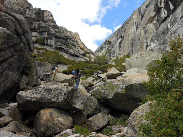
The gully makes for a very strenuous diversion from the otherwise easy off-trail hike from Olmstead Point over to Mt Watkins saddle. Yes, there is a trail that goes between those two points. But it is more interesting to head down closer to the edge of Tenaya Canyon, and follow along it to Mt Watkins. The hike goes as follows: Follow the drainage downward from Olmstead Point until it plunges over the canyon rim at Airplane Gully. At this point you can send the energetic people part way down it (see below), while the others gawk at the propeller (one of four giant blades on the engine...I don't know how they ever landed the plane without having a prop blade hit the ground).

The blade is currently at N37.79368, W119.49050. Though, as you can see, it could have moved around a bit.
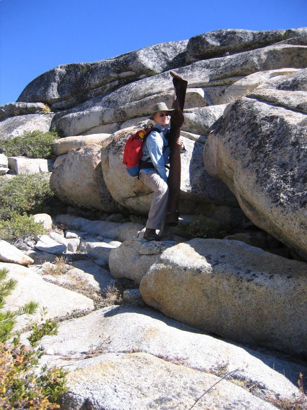
It was spinning when it hit the cliff.

To continue the hike over to Mt Watkins, wander across the interesting terrain until you get below the trail that you see on the left edge of the map. The only route finding difficulty is deciding where to head up to the trail without getting into brush. The best place is below and slightly to the left of the saddle, where you can walk up the left border of the brush, on the edge where it turns into granite. It is also possible to head east from the propeller, up onto the rock rib that goes back towards Olmstead Point. I can't really recommend it, because when you are up there it's hard to see the easy way down at the north end.
If you want to go down the gully, you are in for a workout. I have only been down to the bottom once, though I have been down to the engine three times. The important thing is to not follow the stream over the cliff. It soon becomes a waterfall. But just a few yards to the left is an improbable easy entrance into the talus-filled gully, partly open rocks and boulders and partly (sometimes) jungle. The problem is that it is a snow avalanche chute. Depending on last winter's snow and the time of year that you do it, the brush could be all swept away or not. There are also a couple of huge boulders to get around, and like all talus piles they change slightly after each winter. You can do the easy boulder climb down (with 20 feet of very scary exposure), or as I did last time, climb down in an adjacent thicket.
Here is the engine as it was (a Wright R-3350 engine, about 3000 horsepower), which was installed in the AD-6 attack plane:

and as it is today:


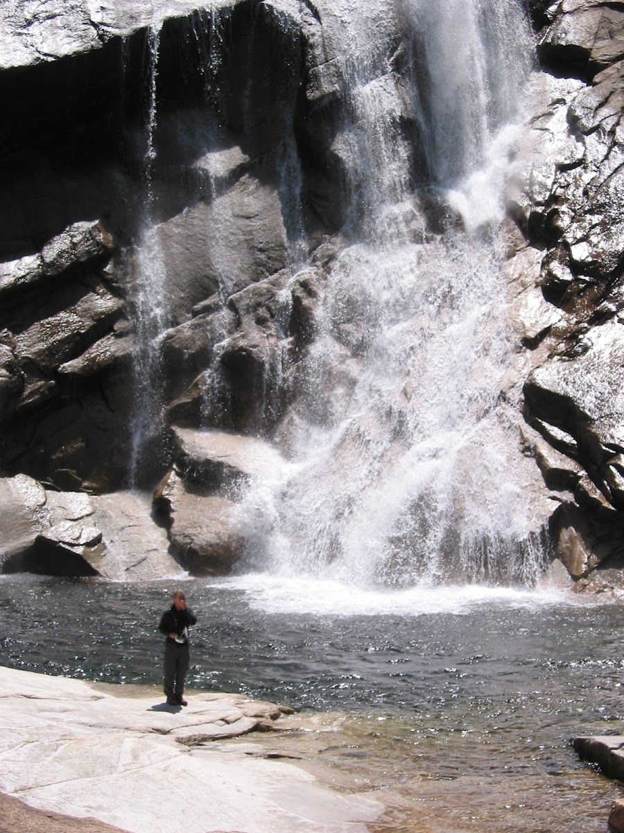
Pywiack Pool is at the base of the gully (see red X), and is a neat place. You can see it here as a black dot:

That was the view from Mt Watkins. Airplane Gully comes down from the left, and goes straight to the pool.
I apologize for so many photos, but remember that the forum doesn't store anything but pointers, so I'm not overloading their storage....
Edited 1 time(s). Last edit at 06/30/2012 04:28PM by wherever.