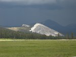
For those who have hiked the Ten Lakes trail, can you recall if there are any sources of water for camping purposes at the eastern foot of Tuolumne Peak before reaching the Glen Aulin/May Lake junction? The National Geo Trails Illus map does not show anything in the way of creeks in the 8,750' to 9,250' range but the map scale does not permit showing everything. I'm talking mid-July.
Jim
Home
>
General Discussion
>
Topic
Tuolumne Peak question
All posts are those of the individual authors and the owner
of this site does not endorse them. Content should be considered opinion
and not fact until verified independently.
November 22, 2008 10:12AM | Registered: 15 years ago Posts: 1,876 |
November 22, 2008 10:55AM | Registered: 15 years ago Posts: 2,321 |
November 22, 2008 11:24AM | Registered: 15 years ago Posts: 1,918 |
If you look closely you will see 2 very small ponds before the switchbacks
down to the May Lake Trail Jct. Those ponds are at about 9750ft.
The camping there is very nice with just awesome views of Mt. Conness.
It's a spot I'll go back to again, it was just so nice.
I've been there twice, once in early july and once in late Sept.
There was water aplenty both times. (still some snow in early July)
There WILL be water in those ponds.
Tuolumne Peak actually has a register too...
Also on the NG map you cross 3 creeks before those 2 ponds coming from
Ten Lakes and after climbing up out of SF Cathedral.
Anyway, I wouldn't worry about water... I'd worry about mosquitos.
Have fun
Everything I know I learned from
down to the May Lake Trail Jct. Those ponds are at about 9750ft.
The camping there is very nice with just awesome views of Mt. Conness.
It's a spot I'll go back to again, it was just so nice.
I've been there twice, once in early july and once in late Sept.
There was water aplenty both times. (still some snow in early July)
There WILL be water in those ponds.
Tuolumne Peak actually has a register too...

Also on the NG map you cross 3 creeks before those 2 ponds coming from
Ten Lakes and after climbing up out of SF Cathedral.
Anyway, I wouldn't worry about water... I'd worry about mosquitos.
Have fun
Everything I know I learned from

November 22, 2008 11:32AM | Registered: 15 years ago Posts: 2,321 |
I went back and looked at the pictures form the trip I referred to and there was still lots of snow and all the creeks were flowing nicely. Like Billy said, don't worry about the water. There was a very friendly chipmunk where we camped also.
This might be a picture of one of the ponds Billy mentions.
http://yosemitephotos.net/main.php/v/mrcondron/P7020072.JPG.html
Post Edited (11-22-08 11:41)
Old Dude
This might be a picture of one of the ponds Billy mentions.
http://yosemitephotos.net/main.php/v/mrcondron/P7020072.JPG.html
Post Edited (11-22-08 11:41)
Old Dude
November 22, 2008 12:50PM | Registered: 15 years ago Posts: 1,876 |
My original plans called for a 1-nighter to the second of the major Ten Lakes and back the same way but I've just scrapped a day hike elsewhere so I can do the whole loop, coming out at Murphy Creek. Those ponds now look look like an ideal camping spot and it would probably be about July 20th. Thanks for the tip.
Jim
Jim
November 22, 2008 01:49PM | Registered: 15 years ago Posts: 1,918 |
Mike,
The pond in that picture was actually between the SF of Cathedral and
the two ponds I mentioned. Right around the 9716 mark on the USGS maps.
In this instance the picture was actually better than the real thing... sorta..
The pond itself was stagnant and brownish... with the reflections it looks
so delightful... It is one of the pictures I actually have hanging in my
house...
The two ponds in question had snow and ice still in them in early July
that year.

November 22, 2008 02:59PM | Registered: 15 years ago Posts: 2,321 |
November 22, 2008 04:26PM | Registered: 15 years ago Posts: 1,876 |
Sorry, only registered users may post in this forum.


