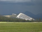
During the month of February 2011, 57 earthquakes were located in the Yellowstone National Park region. The largest was a magnitude 2.3 event on February 18 at 11:00 AM MST, located about 6 miles north northwest of West Thumb, YNP. No earthquake swarms were recorded in February.
Earthquake activity continues at normal background levels.
Ground Deformation Summary: Careful analysis of the Yellowstone GPS data shows that the period of accelerated Yellowstone caldera uplift, beginning in 2004, has stopped. Some GPS stations exhibit little change and others reflect slight subsidence. A record of recent ground displacement can be found at: http://pboweb.unavco.org/shared/scripts/stations/?checkkey=WLWY&sec=timeseries_plots×eries=raw
The Yellowstone Seismic Network, operated by the University of Utah, continues to function well throughout this winter's harsh operational conditions. Early in the month some irregular telemetry interruptions caused the automatic earthquake location system to issue false reports which then required manual deletion from the earthquake listings. University seismologists addressed the problem by changing the automatic recording software and continue to review data as they do normally. Their professional action has minimized the noise effects. The Yellowstone Seismic Network remains fully operational and its' data can accessed at: http://www.seis.utah.edu/req2webdir/recenteqs/Maps/Yellowstone.html
Yellowstone Monthly Update issued Mar 1, 2011 21:10 MST Volcano Alert Level NORMAL - Aviation Color Code GREEN
All posts are those of the individual authors and the owner
of this site does not endorse them. Content should be considered opinion
and not fact until verified independently.
Sorry, only registered users may post in this forum.


