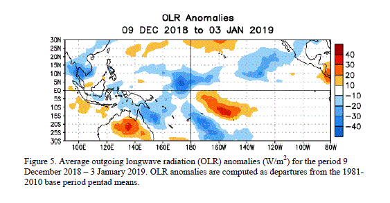
The models continue to disagree on the eventual peak strength of El Niño (Fig. 5). At this time, it is expected that the 3-month Niño-3.4 SST average will exceed +1.5oC during the winter (e.g. November-December-January and December-January-February). Regardless of its precise peak strength, El Niño is expected to exert a significant influence on the global weather and climate in the coming months. Most models indicate that SST anomalies in the Niño-3.4 region will begin to decrease in early 2010, and that El Niño will persist through April-May-June 2010.
Expected El Niño impacts during January-March 2010 include drier-than-average conditions over Indonesia and enhanced convection over the central tropical Pacific Ocean, which will likely expand eastward and influence portions of the eastern equatorial Pacific, as well as coastal sections of Peru and Ecuador. For the contiguous United States, potential El Niño impacts include above-average precipitation for the southern tier of the country, with below-average precipitation in the Pacific Northwest and in the Ohio and Tennessee Valleys. Below-average snowfall and above-average temperatures are most likely across the northern tier of states (excluding New England), while below-average temperatures are favored for the south-central and southeastern states.
2
http://www.cpc.ncep.noaa.gov/products/analysis_monitoring/enso_advisory/ensodisc.html

