Welcome! Log In Create A New Profile Recent Posts
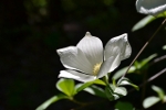
Dogwood bloom in Yosemite Valley

The Moon is Waxing Gibbous (73% of Full)


Advanced

Re: First time visit - Route Advice

All posts are those of the individual authors and the owner of this site does not endorse them. Content should be considered opinion and not fact until verified independently.

First time visit - Route Advice
March 25, 2008 03:07PM
Hi
I'm an Icelandic guy in my mid twenties and plan on spending a few nights (2-4) in Yosemite in early May as a part of my road trip across the US. I've got a feeling this will be the highlight of my trip.
I'm having a problem picturing how things work once you're in the park. I'll be travelling from San Francisco/Seattle so I'll be entering the park on the west side by car.

The 13 "official" campsites that are in the park, are they all car accessible? Seems to me most people on this forum do multi day trails but since I'm not the most experienced hiker I'm guessing it would suit me better to do day hikes.

I'd love to see the Half Dome, Glacier Peak, Yosemite Falls to name most of the landmarks I know of in the park winking smiley There were so many possible trails on the Yosemite Website that quite frankly I got lost. I'd love to hear of day trips that you've done in the past and would recommend. I'm in good shape so the trail lengths are not so important. And since I have a car I could travel to different campsites in the early morning.

I'm planning on camping in the campgrounds although I don't have a reservation. But from what I can tell it seems many of the campsites are on a first come first serve basis so if you show up at dawn you should get a spot. Could anyone comment on this?

One more thing. Is the natural water in the park drinkable? I'm guessing you need to boil it like most places but I figured I'd ask.

Thanks a lot,
Tumi


Post Edited (03-25-08 15:07)
avatar Re: First time visit - Route Advice
March 25, 2008 03:37PM
Tumi wrote:

> Hi
> I'm an Icelandic guy in my mid twenties and plan on spending a
> few nights (2-4) in Yosemite in early May as a part of my road
> trip across the US. I've got a feeling this will be the
> highlight of my trip.
> I'm having a problem picturing how things work once you're in
> the park. I'll be travelling from San Francisco/Seattle so I'll
> be entering the park on the west side by car.
>
> The 13 "official" campsites that are in the park, are they all
> car accessible? Seems to me most people on this forum do multi
> day trails but since I'm not the most experienced hiker I'm
> guessing it would suit me better to do day hikes.

All should be accessible by an ordinary car. Some aren't accessibly by RV. Be very careful about food storage, since Yosemite bears are notorious for breaking into cars at night or for raiding unprotected food supplies. The backpackers campgrounds aren't directly accessible by car. There is a dropoff area (15 minute limit) where a permitted backpacker can drop off gear. Most of the listed campgrounds don't take reservations. Many are less developed, and don't have running water or flush toilets.

Day hikes are fine. There's a lot of talk here about multi-day route plans, but most visitors don't venture far from the roads or maybe take in a moderate day hike.

Any overnight camping in the backcountry near trails requires a permit. They require a $5 per party reservation fee if reserved, and are free if you can manage a first-come/first-served permit (40% of each trailhead quota).

> I'd love to see the Half Dome, Glacier Peak, Yosemite Falls to
> name most of the landmarks I know of in the park winking smiley There were
> so many possible trails on the Yosemite Website that quite
> frankly I got lost. I'd love to hear of day trips that you've
> done in the past and would recommend. I'm in good shape so the
> trail lengths are not so important. And since I have a car I
> could travel to different campsites in the early morning.

I think you're referring to Glacier Point. You can walk there, but many would recommend driving. It would also be possible to take a bus in from Yosemite Valley and then hike down back to the Valley via Four Mile Trail.

http://www.yosemitepark.com/Activities_GuidedBusTours_GlacierPointTour.aspx

If you're fit, try the hike up to Vernal Fall and Nevada Fall. The portion leading to Vernal Fall is called the Mist Trail and is amazing. There still might be a little bit of snow in early May, but I wouldn't think that would scare off anyone from Iceland.


The ultimate day hike is round-trip to/from Half Dome. I did it as part of a multi-day trip, but most do so as a 14-18 mile round trip hike from the Valley floor. My following picture was taken at an angle (to get more of the line in the photo), so it's considerably steeper (steepest portion is a 50 degree angle).


> I'm planning on camping in the campgrounds although I don't
> have a reservation. But from what I can tell it seems many of
> the campsites are on a first come first serve basis so if you
> show up at dawn you should get a spot. Could anyone comment on
> this?

Sure. Show up early. Find an unoccupied spot. Fill out the permit and drop in your money.

> One more thing. Is the natural water in the park drinkable? I'm
> guessing you need to boil it like most places but I figured I'd
> ask.

The water may contain giardia or bacteria. Crytosporidium isn't out of the question but should be rare. Close to the valley people wade in the rivers, and viral and fecal contamination may be an issue. Boiling water should be enough although you should be able to find ordinary treated running water sources all around Yosemite Valley. Backcountry visitors use disinfection chemicals (iodine or chlorine based) and/or filters designed to trap 99.9+% of bacteria/protozoa/ameobae. Boiling is also an option, although most people I know are sensitive about fuel use.

Sounds like you've got a nice little trip planned. Be safe, and be careful with the bears.

Re: First time visit - Route Advice
March 26, 2008 01:01PM
Thanks a lot for your excellent answers and advice YPW and Bruce. It's very helpful.


> I think you're referring to Glacier Point. You can walk there,
> but many would recommend driving. It would also be possible to
> take a bus in from Yosemite Valley and then hike down back to
> the Valley via Four Mile Trail.

But isn't reaching the Glacier Point after the elevation gain much more rewarding than starting the day at the top and then hike down? Sounds like a good option though.


> If you're fit, try the hike up to Vernal Fall and Nevada Fall.
> The portion leading to Vernal Fall is called the Mist Trail and
> is amazing. There still might be a little bit of snow in early
> May, but I wouldn't think that would scare off anyone from
> Iceland.

So is this hike along the Mist Trail the whole time or is that only the last portion. Is this "Panorama Trail" ?
http://www.nps.gov/yose/planyourvisit/valleyhikes.htm


> The ultimate day hike is round-trip to/from Half Dome. I did
> it as part of a multi-day trip, but most do so as a 14-18 mile
> round trip hike from the Valley floor. My following picture
> was taken at an angle (to get more of the line in the photo),
> so it's considerably steeper (steepest portion is a 50 degree
> angle).

I read on the national park services website that the cables usually aren't up until late May. Is the hike still worth it or is it the view from the half dome that is the best part?


> Of course Camp 4 is the bargain of the bunch, at $5 per person
> (not per site). They've also got a parking lot, but the tent
> needs to be carried to the site.

I guess Camp 4 is the way to go for me since there'll be people to hang out with before hitting the hey in the evening and maybe even join someone on a day hike. I'll just make sure to be there early.


> > There will be dozens of great hikes that you could take. YPW
> > already mentioned some of these. I would also suggest the
> top
> > of Yosemite Fall, and even on to the top of Eagle Peak if you
> > feel strong that day (14-mile / 23km round trip).

So is Eagle Peak close to the top of Yosemite Fall? Looks like the Upper Yosemite Fall hike from Camp 4 is about 7 miles so that must be the case. Does the "Upper Yosemite Fall Trail" continue to Eagle Peak or is there another name for that trail?


Another thing, is there going to be mosquito season in early May and would you recommend wearing on of those things around your face for protection or is it not that bad?

You pictures are awesome buy the way and I hope to be able to take some nice ones myself come May.

Many thanks again for you help,
Tumi
avatar Re: First time visit - Route Advice
March 26, 2008 01:29PM
Tumi wrote:

> Thanks a lot for your excellent answers and advice YPW and
> Bruce. It's very helpful.
>
>
> > I think you're referring to Glacier Point. You can walk
> there,
> > but many would recommend driving. It would also be possible
> to
> > take a bus in from Yosemite Valley and then hike down back to
> > the Valley via Four Mile Trail.
>
> But isn't reaching the Glacier Point after the elevation gain
> much more rewarding than starting the day at the top and then
> hike down? Sounds like a good option though.

Sure. It's less than 10 miles round trip, and there. However - the shuttle bus can be used for an easier trip.

> > If you're fit, try the hike up to Vernal Fall and Nevada
> Fall.
> > The portion leading to Vernal Fall is called the Mist Trail
> and
> > is amazing. There still might be a little bit of snow in
> early
> > May, but I wouldn't think that would scare off anyone from
> > Iceland.
>
> So is this hike along the Mist Trail the whole time or is that
> only the last portion. Is this "Panorama Trail" ?
> http://www.nps.gov/yose/planyourvisit/valleyhikes.htm

The Mist Trail is a short section. It can be wet with mist from Vernal Fall.

> > The ultimate day hike is round-trip to/from Half Dome. I did
> > it as part of a multi-day trip, but most do so as a 14-18
> mile
> > round trip hike from the Valley floor. My following picture
> > was taken at an angle (to get more of the line in the photo),
> > so it's considerably steeper (steepest portion is a 50 degree
> > angle).
>
> I read on the national park services website that the cables
> usually aren't up until late May. Is the hike still worth it or
> is it the view from the half dome that is the best part?

If you keep on checking here, eeek usually reports when the cables are up. They might be up before late May depending on conditions. Even without Half Dome there's plenty of things to do. Most don't recommend going up Half Dome with the cables down flat against the rock. I've heard of people who have tried using them in the down position and have fallen to their deaths.

> > Of course Camp 4 is the bargain of the bunch, at $5 per
> person
> > (not per site). They've also got a parking lot, but the tent
> > needs to be carried to the site.
>
> I guess Camp 4 is the way to go for me since there'll be people
> to hang out with before hitting the hey in the evening and
> maybe even join someone on a day hike. I'll just make sure to
> be there early.
>
>
> > > There will be dozens of great hikes that you could take.
> YPW
> > > already mentioned some of these. I would also suggest the
> > top
> > > of Yosemite Fall, and even on to the top of Eagle Peak if
> you
> > > feel strong that day (14-mile / 23km round trip).
>
> So is Eagle Peak close to the top of Yosemite Fall? Looks like
> the Upper Yosemite Fall hike from Camp 4 is about 7 miles so
> that must be the case. Does the "Upper Yosemite Fall Trail"
> continue to Eagle Peak or is there another name for that trail?

Here's the map. It's a little big, so I'm not going to embed the image. Eagle Peak is west of the top of Upper Yosemite Fall Trail. This is also the day hiking map issued at the visitor center. The online image isn't sharp, but the printed version should be better.

http://www.nps.gov/yose/planyourvisit/upload/valleyhikes1200.jpg

> Another thing, is there going to be mosquito season in early
> May and would you recommend wearing on of those things around
> your face for protection or is it not that bad?

I think June to August is the peak mosquito season, although May could still be bad. I now use something with Picaridin/Icaridin.

> You pictures are awesome buy the way and I hope to be able to
> take some nice ones myself come May.

Well thank you. I've had a lot of fun visiting these places.
Re: First time visit - Route Advice
March 25, 2008 09:19PM
Hi, Tumi - The landmarks you list that you'd like to see are in Yosemite Valley. Glacier Point is reached by either a 25-mile drive or a nearly 5-mile hike. It is 3,400 feet above the Valley floor.

You should know that Yosemite Valley is VERY popular this time of year. In the Valley, the campgrounds are *mostly* reservation-only in May, and virtually all sites are already reserved. As YPW suggested, it is possible to get campsites in the campgrounds if you arrive early, but if my memory serves me correctly, you need to check for cancellations or no-shows at the camping reservation kiosk at Curry Village parking lot.

There is a first-come, first served campsite just west of Yosemite Village, mostly used by backpackers and rock climbers. It tends to be crowded and busy. At this time of year, your best chance is to try on a day from Monday through Thursday. There are campgrounds outside the Valley where it may also be easier to get a campsite. The camgrounds on Glacier Point Road and Tioga Pass Road are not likely to be open yet due to snow.

The Valley has treated, potable water at dozens of locations.

There will be dozens of great hikes that you could take. YPW already mentioned some of these. I would also suggest the top of Yosemite Fall, and even on to the top of Eagle Peak if you feel strong that day (14-mile / 23km round trip).

I ma not sure where else you will stop, but the American West is full of wonderful places - the Cascade Mountains, Yellowstone, the southern Utah desert - all amazing and spectacular. Have a great time!


Wilderness forever,
Bruce Jensen
avatar Re: First time visit - Route Advice
March 25, 2008 10:38PM
bpnjensen wrote:

> You should know that Yosemite Valley is VERY popular this time
> of year. In the Valley, the campgrounds are *mostly*
> reservation-only in May, and virtually all sites are already
> reserved. As YPW suggested, it is possible to get campsites in
> the campgrounds if you arrive early, but if my memory serves me
> correctly, you need to check for cancellations or no-shows at
> the camping reservation kiosk at Curry Village parking lot.

Sorry - didn't think of when the first-come/first-served campgrounds outside of Yosemite Valley would open for the season.

> There is a first-come, first served campsite just west of
> Yosemite Village, mostly used by backpackers and rock climbers.
> It tends to be crowded and busy. At this time of year, your
> best chance is to try on a day from Monday through Thursday.
> There are campgrounds outside the Valley where it may also be
> easier to get a campsite. The camgrounds on Glacier Point Road
> and Tioga Pass Road are not likely to be open yet due to snow.

Of course Camp 4 is the bargain of the bunch, at $5 per person (not per site). They've also got a parking lot, but the tent needs to be carried to the site.

> The Valley has treated, potable water at dozens of locations.
>
> There will be dozens of great hikes that you could take. YPW
> already mentioned some of these. I would also suggest the top
> of Yosemite Fall, and even on to the top of Eagle Peak if you
> feel strong that day (14-mile / 23km round trip).

Top of Yosemite Fall in winter:


> I ma not sure where else you will stop, but the American West
> is full of wonderful places - the Cascade Mountains,
> Yellowstone, the southern Utah desert - all amazing and
> spectacular. Have a great time!

I've been to all three of these areas:


The Cascades start in the northern end of California and extend to Canada. I've been to Lassen Volcanic NP in California, the site of a dormant volcano (Lassen Peak) that last erupted in 1917. They have thermal features there like fumaroles and mudpots. However - this is a view of Lassen Peak from Manzanita Lake:


Yellowstone is spectacular, although I'm not sure if geysers would be anything special for someone from Iceland. This was Beehive Geyser in the Upper Geyser Basin (the Old Faithful area).


Of course Delicate Arch is the iconic symbol of the southern Utah desert.


Re: First time visit - Route Advice
March 26, 2008 05:20PM
YPW - your photos are great, and I love your Beehive! :-)

Tumi - the Eagle Peak Trail begins a short distance beyond Upper Yosemite Fall and continues along a relatively easy uphill to Eagle Peak. That hike adds a fairly easy 6.5 miles total to the hike. Be forewarned, however - the last time I hiked this in May in an average snow year, the upper part of the trail was still clad in snow, and apparently NOBODY had gone before my friend and I. Between Yosemite Creek and the Eagle Peak summit, the trail is mostly in forest and is on a north-facing slope, so the snow melts late. If you want solitude and a stunning view, this may be the trail to take, but route-finding may be necessary.

The Mist Trail, as YPW suggested, is technically the short section just below Vernal Fall - and you WILL get wet :-). This trail continues to the top of Nevada Fall, and even if you cannot get up Half Dome due to cables being down, this is still one of the most scenic trails in the world, and well worth the hike. Return by the John Muir Trail for more high-flying views of Nevada Fall and Liberty Cap. The Panorama Trail, in my opinion, is not as interesting as the John Muir Trail, and is largely wooded.

For an easy and rewarding hike, it is also worthwhile to go to Mirror Lake and beyond. Mirror Lake is beautiful in the morning when the water is still and perfectly reflects the upper Tenaya Canyon mountains. You can make this hike steeper and tougher by going up the Snow Creek Trail, the steepest official route out of Yosemite Valley (except for the Ledge Trail, which is officially closed and unmarked, and also very dangerous).


Wilderness forever,
Bruce Jensen
avatar One comment
March 26, 2008 09:48PM
Personally I'd love to visit Iceland. I enjoy geothermal features and look forward to seeing Geysir (if it's kind enough to erupt) and Strokker in my lifetime.
Re: First time visit - Route Advice
March 27, 2008 10:56PM
If you're going to do the four-mile trail to Glacier point, I agree that it's much more fulfilling to go up yourself; while it's pretty steady uphill, it's not such a strenuous hike...certainly easier than the Upper Yosemite Falls trail, though longer.

However, you might consider that trail up and down one day, then take the bus to Glacier on another day, and hike down the Panorama trail to the Mist trail or John Muir trail, and eventually to Happy Isles. This will take you past Nevada Falls, Vernal Falls, and some great views of the valley and beyond. It's about 8.5 miles, and will leave you pretty tired if you go down the mist trail steps, which is why I don't suggest going up the 4-mile trail and then down the Panorama/mist on the same day. It can be done, but you may be too tired to enjoy some of the best scenery.

The Half Dome cables may not be up by early May; supposedly they'll be up by the third weekend in May, but that's weather permitting. With the cables down, I don't recommend going up anyway (2 people died last season doing that), but you could certainly take the hike up TO the base of the cables...very scenic and a great hike. If you're going when the cables are up, I'd suggest leaving very early before daybreak, and on a non-holiday Monday through Thursday.

You might have some luck with campground cancellations in early May; once summer season hits, it's less likely. Camp 4/Sunnyside is really dependent on how much you mind crowding together with folks you don't know, or how quiet you like it. The Pines campgrounds are great for many day hikes, and may not be too bad in early May; later and on holidays they tend to get cluttered with giant RV's and other toys, and folks who go for group social events rather than hikers and such.

> One more thing. Is the natural water in the park drinkable? I'm
> guessing you need to boil it like most places but I figured I'd
> ask.

I drink straight from the Merced River, and it tastes so good and is so icy-cold it's hard to describe. Never had any issues from it. Using basic river-drinking common sense, of course...dipping in where the water is moving and not stagnant, not downstream from populated areas, etc. There's always some risk, but a lot of the "giardia is everywhere" stuff is just hype. Of course, you should use your own judgment as to what you feel comfortable with, but having drank from streams as a kid in Colorado, I really missed that out here. Then I read some articles online by Bob Rockwell and others which pointed out that much of the scare is not necessarily based on reality; people go camping and practice poor sanitation, get sick afterward and blame the water, when it's often from food or poor sanitation by the camp cook etc.

Your mileage may vary, but I carry a metal cup with a carabiner handle clipped to a belt loop, and when I see a safe spot to get a scoop from the river, get a good drink and fill the water bottles. (I also carry a filter in my pack for less obviously-clean situations).


Post Edited (03-28-08 13:41)


Gary
Yosemite Photo Galleries: http://www.pbase.com/roberthouse/yo
Sorry, only registered users may post in this forum.

Click here to login