All posts are those of the individual authors and the owner of this site does not endorse them. Content should be considered opinion and not fact until verified independently.

avatar La Niña is expected to transition to ENSO-neutral conditions by the end of April 2012
March 11, 2012 01:17PM
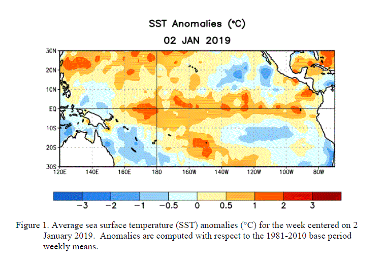
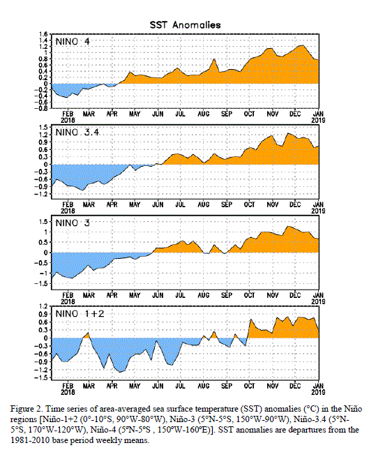
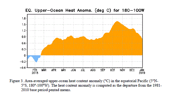
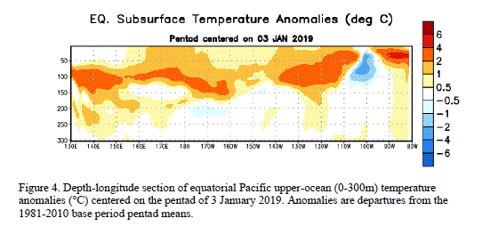
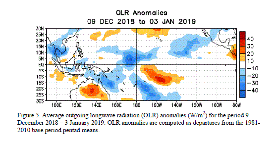
La Niña weakened during February 2012, as near- to- above average sea surface temperatures (SST) emerged in the eastern equatorial Pacific Ocean (Fig. 1). However, below-average SSTs persisted in the central Pacific, as indicated by the latest weekly Niño-3.4 and Niño-4 indices which were near -0.5oC (Fig. 2). The oceanic heat content (average temperature in the upper 300m of the ocean) anomalies also weakened notably (Fig. 3), as reflected by a shallow lens (0m to ~25m depth) of positive temperature anomalies east of 125oW and by diminished below-average temperatures east of the Date Line (Fig. 4). These changes are partly associated with strong low-level westerly wind anomalies across the eastern Pacific, which at times reflected the absence of equatorial easterlies in that region. Nonetheless, the larger scale atmospheric circulation anomalies continued to reflect the ongoing La Niña. Enhanced low-level equatorial easterlies persisted over the central and west-central Pacific, while convection remained suppressed in the western and central Pacific, and enhanced over Malyasia and the Phillipines (Fig. 5). Collectively, these oceanic and atmospheric patterns reflect a weakening La Niña.

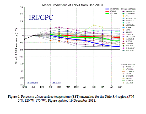
A majority of models predict ENSO-neutral conditions to return during March-May 2012 and to continue through the Northern Hemisphere summer 2012 (Fig. 6). The rapid weakening of the negative surface and subsurface temperature anomalies during February 2012, combined with the historical tendency for La Niña to dissipate during the Northern Hemisphere spring, lends support to the return of ENSO-neutral conditions in the coming months. Therefore, La Niña is expected to transition to ENSO-neutral conditions by the end of April 2012 (see CPC/IRI consensus forecast).

Because impacts often lag the demise of an ENSO episode, La Niña-like impacts are expected to persist into the upcoming season. Over the U.S. during March - May 2012, La Niña is associated with an increased chance of above-average temperatures across the south-central U.S., and below-average temperatures in the northwestern U.S. Also, above-average precipitation is favored across western Washington, the Ohio Valley, and lower Great Lakes, while drier-than-average conditions are more likely across Florida, the Gulf Coast, and the southwestern U.S. (see 3-month seasonal outlook released on 16 February 2012).


Edited 1 time(s). Last edit at 03/11/2012 01:19PM by eeek.
Sorry, only registered users may post in this forum.

Click here to login