
The "Blue Hole" is one of the premier scrambles of Kauai. Since there is some internet-induced confusion: the Blue Hole is the informal name of the valley at the head of the North Fork of the Wailua River, which is roughly northeast of Kawaikini (Kauai's highest point) and southeast of Waialeale (one of the wettest spots on Earth). From the bottom of the Blue Hole you are surrounded by 3200' cliffs from which tall waterfalls cascade into the river below. The Blue Hole is also known as the "Wailua River back wall" and, inaccurately, the "Waialeale Crater" (it is neither a volcanic nor meteor crater).
And no, I don't know why it's not called the "Green Hole".
The trek to the Blue Hole starts at the end of a rough 4WD road. (For those following along on the USGS topo, this is where the Gaging Station is at approx. 1100', just below the "h" in "North", approx. 2 miles east of the midpoint between Waialeale and Kawaikini.) This road was constructed to service a water diversion weir for an irrigation/hydroelectric facility and thus receives minimal maintenance. (Supposedly there's a gate on the road that had a cameo in Jurassic Park, for those who care about that kind of thing.) When we did it, a true 4WD (not just AWD) was required.
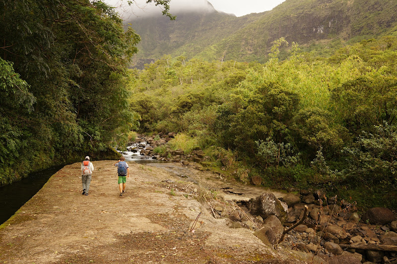
From the end of this road, the trek is roughly an equal mix of informal use trails (which are never far from the creek) and walking in the creek itself. Since the route isn't marked, the terrain is rough, and we didn't have a 4WD vehicle, we decided to hire a local guide--probably net cheaper, and much safer, than renting an off-paved-road 4WD. Having done the trip, we'd recommend a guide to anyone considering this trip who doesn't have extensive cross-country travel experience (you know who you are). We can recommend Scott at Kauai Hiking Adventures, who was our guide.
One thing: if you do this trip, your feet will get wet. And you'll be in the river a lot. Scott recommended felt-soled "tabi" (Japanese fishing shoes--not unlike neoprene scuba booties, but with thick felt soles), and the trip would be much more difficult without these. They stick to the muddy, algae-covered volcanic rock, while (as Lily had learned last year, and I'd learn later), normal hiking shoes slip right off Kauai mud and clay. On the other hand, they have minimal support, so your feet may get tired walking all day over uneven terrain with them.
We started early in the morning and finished after sunset--this is a long trip despite what the short "as the bird flies" mileage appears to be. The "jungle" is fairly dense and the creek/river is rocky. Since the area is also used by local pig and goat hunters, near the start there are several flagged "false leads" that don't head to the Blue Hole (another reason to have a guide). The route we took was never far from the creek until the end was almost in sight.

At roughly the 1/3rd point we encountered "Guardian Falls", which in other reports is described as the waterfall where three creeks converge.
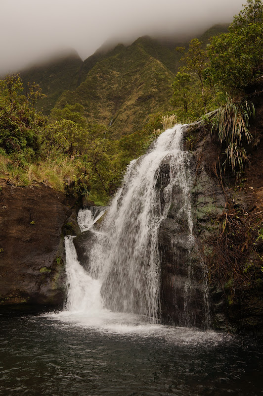
A steep climb to the left of the falls provided the first real exposure--and experience using the local flora for handholds. We learned which plants were "bomber" (guavas) and which weren't (mostly everything else...) Since the pool below Guardian Falls is a popular destination itself, the route beyond these falls was even more obscure, with more steep and exposed sections.

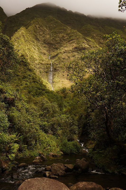
Most of the day was overcast--(Mount?) Waialeale, which was maybe a mile north of us, is one of the wettest spots on Earth, receiving over 400" of rain a year, so it is often cloaked in clouds. Occasionally we'd get a break in the sun which would highlight one of the many falls pouring from the valley walls.
Since this area does receive so much rain, there was of course a short section of gratuitous calf-deep mud:

As we approached the Blue Hole/backwall we were able to see some of the falls up close:

As mentioned above, hunting is common in the Kauai forest reserves, despite the damage that the pigs cause to the land, birds, and water quality. Because of this, fences are installed in places--including the Blue Hole--to keep the pigs out:

Not too far past the fence we finally had a clear view of the entire back wall, where water literally pours out of the valley walls to become the Wailua River.

By this time, we'd been hiking/scrambling for hours, but we decided to press on to "touch" the back wall. This resulted in a late return, but it's worth it. Despite a few steep ravines, the travel past this point was generally easier and more open.

After a short scramble up loose rock, we reached the back wall and enjoyed a quick lunch.

Gratuitious Bop-shot:

The return trip wasn't much faster--there is more up/down/scrambling/thrashing than real elevation gain, so it's hardly "downhill" on the return. In fact we didn't return to the trailhead until a bit after dark. We saw only one minimal camp site along the entire route--best to do this as a long day trip. Oh, and be prepared to have tired feet and legs if you're not used to walking on uneven terrain with minimal footwear.
More Pictures
For those who choose to ignore the "hire a guide" advice, here's a rough sketch that will still most likely still get you lost: Cross the creek at the trailhead/weir (just get your feet wet--there's no avoiding it...), and generally stay on the north side, never far from the creek, crossing it a few times, and walking in it a bit, until Guardian Falls. There is a use trail immediately to the left of Guardian Falls that climbs steeply around and above it. From here, the route stays on the south a bit, crosses to the north, then crosses back to the south until the next major obstacle, where a steep use trail will climb away from the creek, traverse a bit, then drop into a gully. After crossing near the bottom of a major waterfall, a pig fence is encountered--you should be at the northern end of this fence, basically against the valley wall. On the return, be sure to stick to the north side of the valley. From here the route to the back wall is fairy obvious.
Oh, and don't ask for a GPS track: box canyons and heavy foliage don't make for useful tracks... sorry!

