As expected, clouds threatened as we walked into Hag’s Glen.

Work crews were working on drainage and gravel along the rather rutted and muddy road that leads into the Glen. This area gets a lot of foot traffic, and the fragile terrain cannot absorb the impacts of all the hikers who are continuously trying to find drier, less-muddy routes on the edges of the trail. The result is a trail that is wider than many Irish roads.
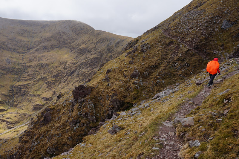
Just before the rock-hop crossing, we left this wide path and followed the faint path that leads to Heavenly Gates, O’Shea’s Gully, and other routes up the mountain.

We passed another group that was heading the same general direction we were, but they eventually turned back. There are a few “steps” along this route that require some simple rock-climbing-like moves; the rock is solid and the holds are firm, but there is some exposure—perhaps these turned back the others.

We climbed above the lakes in Hag’s Glen, traversing under the Hag’s Teeth, and eventually reached the lower level, Cummeenoughter, where the path forks. A pretty waterfall flowed into this small valley. We choose the familiar branch towards the mountain shelter and Heavenly Gates.

We later learned that the shelter has fallen into disuse; apparently helicopters have rendered the facility somewhat obsolete.

Past this shelter we started the steep climb to the Gates themselves. There were a few loose rocks, but overall the climb was nice and the footing solid.

We eventually reached the top of the gully, where we could look down on the area around the refuge, including almost all of our route from the main path.
From this point a well-defined path traversed around the mountain on a “ramp” between steeper, rockier cliffs. As we started hiking along the “ramp”, the wind became quite chilly and a few sprinkles fell on us, so we put on our rain gear, although more to protect against the wind than the rain.
This path eventually reached the obvious main summit route, and we began the final slog to the top.

The clouds came and went, but the chilly breeze was consistent. Several other hikers heading to the summit—or quickly heading off of it—didn’t seem to have been prepared for the cold wind.
We knew we were at the top only when the prominent cross appeared through the clouds. We huddled in a small stone wind shelter with another couple and had lunch. A few times the clouds would lift for a few moments and I’d pop up to snap a few pictures. Another ill-prepared group arrived, had a quick lunch, and left; they were concerned about heading down the Ladder so we suggested the Zig-zags, which fortunately we could point out to them through a rare break in the clouds.

Miss me...? ;-)
We too decided to take the Zig-zags down. This route requires an additional 100 meter climb, but follows a decent trail instead of a crowded, rutted gully.

The trail to the top of the Zig-zags follows a bog-covered ridge; some rocks had been placed in some of the muddier sections to improve the route.

Despite being the safest route up and down the mountain, neither the bottom nor top of the Zig-zags are well-marked; fortunately we were familiar with the route and recognized the small rock cairn that marks the top of the switchbacks.

The trail was perhaps a bit more rutted in places than it had been a few years ago, and the bottom was a bit fainter and boggier than we had remembered, but we descended it safely without incident. As we headed down the summit continued to appear and disappear in the clouds.
Eventually we reached the base of the Zig-zags, which is near the base of Devil’s Ladder, and we were soon on the wide, well-trod path back to the trailhead. Even though it was late in the afternoon, a group near the base of the Ladder asked us how far it was to the top--a few hours or so. The stroll out of Hag’s Glen was chilly and windy but otherwise uneventful.

Our third summiting of Carrauntoohil had been a success, despite the limited views—clouds are apparently the norm for this mountain.

Or "The Carrauntoohil" as "The REI" calls it in their guided trips...
More Pictures

