
Quail Mountains in the "Bowling Alley," transferred from BLM to NPS.
NPS Photo
DEATH VALLEY, CA – The largest national park outside of Alaska just got bigger. On March 12, President Trump signed public lands legislation that included several changes to Death Valley National Park. The John D. Dingell, Jr. Conservation, Management, and Recreation Act (Public Law 116-9) transferred approximately 35,000 acres of land from the Bureau of Land Management (BLM) to the National Park Service. Already nearly the size of Connecticut, Death Valley National Park increased by about 1% to 3,422,024 acres.
One part of the transfer is a 6,369-acre lollipop-shaped section of land adjacent to the Big Pine – Death Valley Road in the northern part of the park. It includes the Crater Mine, a colorful former sulfur mine.
The 28,923-acre “Bowling Alley” is a long, narrow swath of land on the northern border of Fort Irwin National Training Center. This area includes a portion of the Quail Mountains.
About 93% of the park is designated as the Death Valley National Park Wilderness, which is the sixth-largest wilderness area in the nation and the largest outside of Alaska. The Dingell Act added 87,999 acres of wilderness in North Eureka Valley, Panamint Valley, Warm Springs, Ibex, Bowling Alley, and Axe Head.
The Act designated 5.3 miles of Surprise Canyon Creek as a Wild River. The wild river designation provides further protection to this rare desert creek and adjacent Panamint City, a 1870s silver mining ghost town.
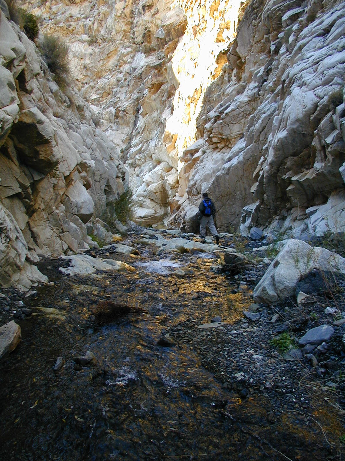
Surprise Canyon Creek
The Dingell Act authorizes the operation and maintenance of the existing microwave telecommunications infrastructure on Mormon Peak. AT&T owns this facility, which has been in legal limbo since the land it sits on was designated as wilderness in 1994. With the exception of satellite connections, the Mormon Peak facility relays all land-line telephone, cell phone, and internet connections for Death Valley residents and visitors.
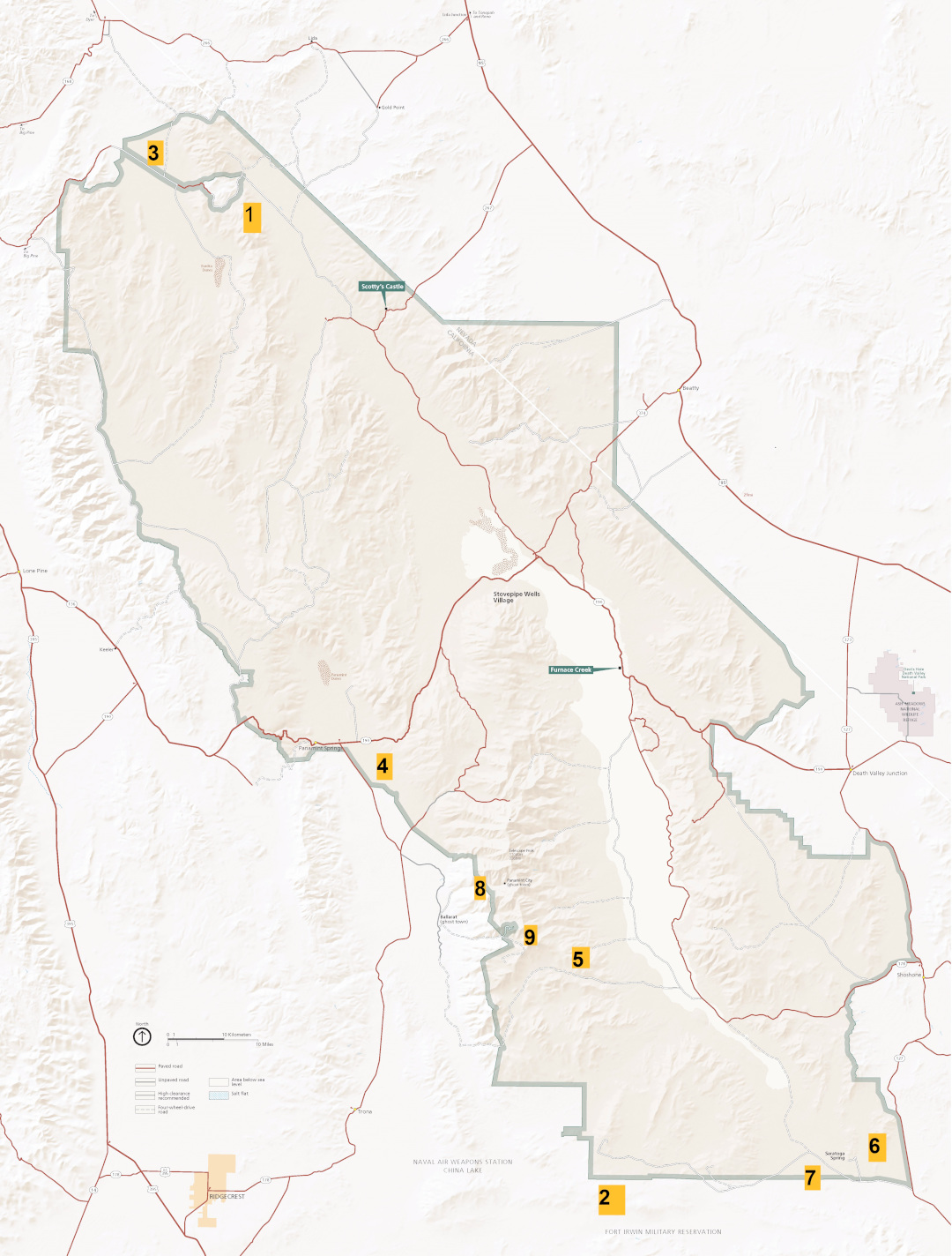
The green line indicates Death Valley National Park's former border. 1) Crater Mine 6,369-acre land transfer, 2) Bowling Alley 28,923-acre land transfer and wilderness addition, 3) North Eureka Valley 11,496-acre wilderness addition, 4) Panamint Valley 4,807-acre wilderness addition, 5) Warm Springs 10,485 wilderness addition, 6) Ibex 23, 650-acre wilderness addition, 7) Axe Head 8,638-acre wilderness addition, 8) Surprise Canyon Creek Wild River, and 9) Mormon Peak telecommunication relay facility.

