Welcome! Log In Create A New Profile Recent Posts
Nevada Falls

The Moon is Waxing Gibbous (86% of Full)


Advanced

Yosemite Ridge, from Porcupine Flat to Yosemite Point

All posts are those of the individual authors and the owner of this site does not endorse them. Content should be considered opinion and not fact until verified independently.

Yosemite Ridge, from Porcupine Flat to Yosemite Point
November 03, 2013 02:43PM
This hike has been on my to do list for over a year. See hike 8-2 at
http://yosemitenews.info/forum/read.php?3,67811,67811

Chick-on did it a month ago, while I was back East, and that finally got me fired up to do it with my hiking buddy.

We drove up to the Valley on Halloween, intending to do the hike the next day. But Tioga Road was still closed after a snowfall five days earlier, so we spent Friday poking around up on the Diving Board, looking for the easiest way to get a photographer friend up there next year. It's a great place, but hard work to get to.

On Saturday morning the road was open, and we did the hike. In the map below, dark blue is the route of the Old Mono Trail (see http://yosemitenews.info/forum/read.php?3,58253,59965#msg-59965 ), and the red line is the hike along the ridge after leaving the Mono Trail route.


The hike starts at the pullout and pay phone at Porcupine Flat meadow. In round numbers, the hike starts at elevation 8100', climbs to 8400', and leaves the Mono Trail (after having gone 2 miles) at 8250'. Then it's 3 more miles along the ridge to where I picked up the main trail from Yosemite Point. Half a mile farther than that is the high point of that trail at the south end of the ridge, 7350', then it is a steep half mile down the trail to Yosemite Point at 6750'. Total off-trail distance is only 5 miles.

This hike is much shorter and easier than the El Cap Ridge hike ( http://yosemitenews.info/forum/read.php?3,26797,26797 ). Moreover, the El Cap Ridge hike ends at Ribbon Meadow, which is still a long way from anywhere via the trail system. From the end of Yosemite Ridge, it is a straightforward 5 mile, 3300 foot descent to the Valley on the excellent Yosemite Falls Trail. It took us only two hours to get down from Yosemite Point, though with some sore legs afterwards.

In our particular case, the first three miles were not so easy. In the meadows we got 6 inches of breakable crust. In the woods, it was more like a foot of soft snow. Both were slow and tiring after a while. We took four hours getting to Yosemite Point, which is a lot longer than it would take in the summer. Other than that, there were almost no obstacles. Shortly after leaving the Mono Trail, there was a short section where the ridge top was a boulder and bush maze. My buddy went straight through it, and I dropped down to pass it on the right; he beat me easily, so it wasn't much of an obstacle. As we approached the final bump on the ridge, there was another bushy section ahead, but I just dropped down to the main trail and joined it at that point. This also what you would do if you intended to descend to the valley by the Indian Canyon Trail ( http://yosemitenews.info/forum/read.php?3,49133 ).

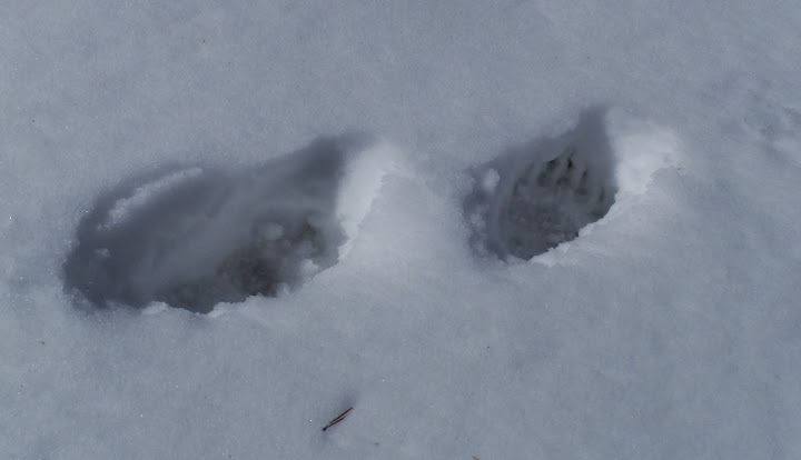
We saw lots of tracks wherever there was snow. Even lower down, just before where we joined the the main trail, there were bear tracks. Here is one from a smaller-than-average bear:


Up near Porcupine Meadow, we saw a set of bear tracks that stopped us dead. These seemed to be from a very large bear, walking upright with a least a four foot stride! After some close examination, it turned out that he was loping along while placing each hind foot exactly in the print of the foot in front of it. But he was really stretching out while doing so. It was nothing like the other bear tracks that we saw...

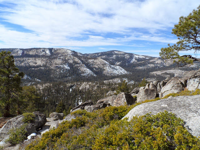
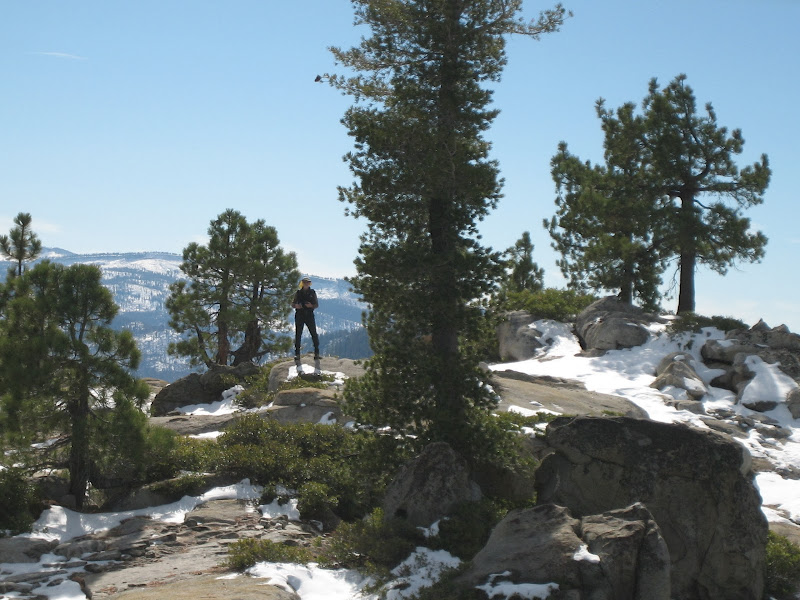
Eventually the non-forested part of the ridge was clear of snow;


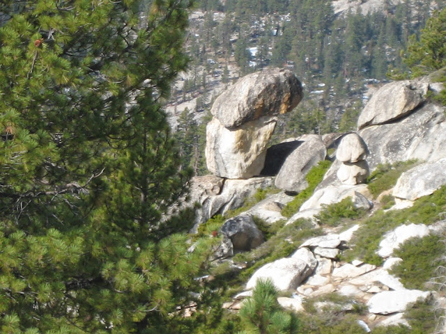
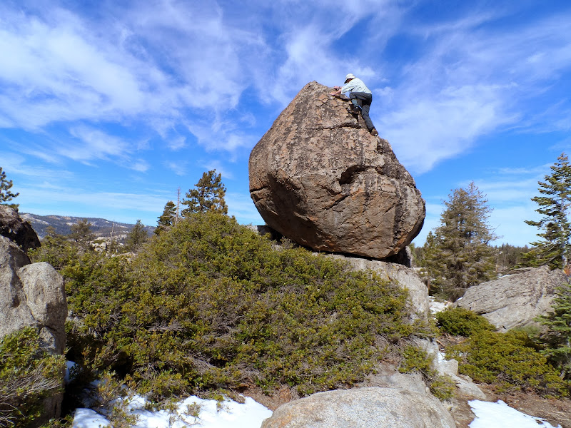
There was at least one difficult boulder to climb:


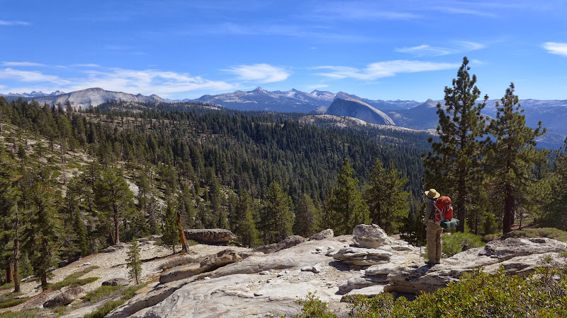
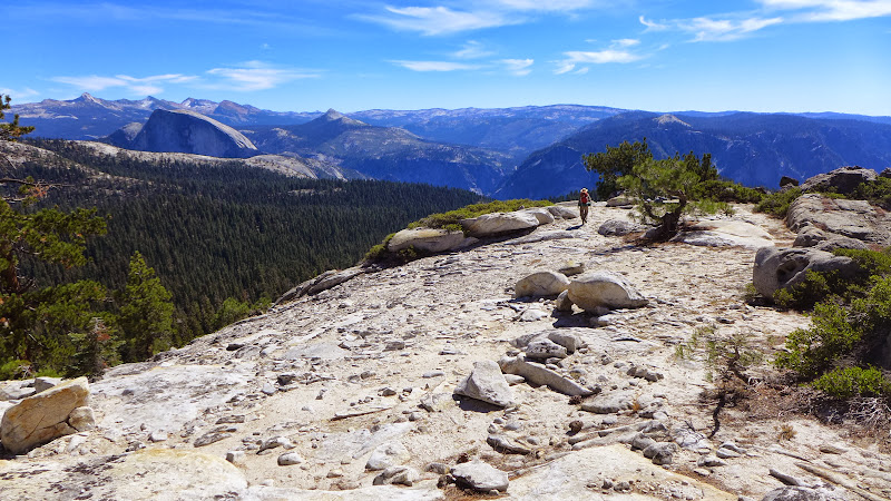
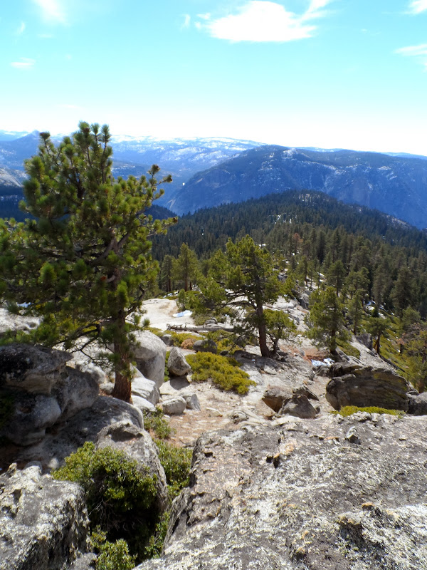
Here is a view down the ridge. That forested bump ahead is the location of Yosemite Point; the next bump is Glacier Point and Sentinel Dome.


All in all, this is an excellent off-trail hike for someone who isn't sure about this sort of thing. The off-trail portion is only five miles, with less than 500 feet of climb and only about 1000 feet of easy descent. Once you get onto the correct ridge, there isn't any route finding to do. However, it is very useful to carry a GPS gizmo, in order to be sure that you have found the start of that ridge.

On a summer day, this hike would certainly be preferable to puffing up the Yosemite Falls Trail to get to Yosemite Point...
avatar Re: Yosemite Ridge, from Porcupine Flat to Yosemite Point
November 03, 2013 04:06PM
Thanks for the trip report and photos!

Besides dealing with the snow, how was the bushwhacking along the Old Mono Trail portion of your hike? Was it shrubby or was there a lot of deadfall to deal with? Is there any semblance or reminders of the former trail (like blazes, benchmarks and such) or is it pure cross-country hiking, finding your own path?

And while you mentioned that this hike to Yosemite Point via the ridge would be preferable in the summer compared to slogging up the Upper Yosemite Falls Trail from the Valley, in terms of speed, ease, and views, how would the ridge route compare to taking the established and maintained trail from the Porcupine Creek TH that roughly parallels this ridge route. I presume the ridge route would have better views overall and the established trail better ease, but how about the speed (time taken to reach Yosemite Point)? From the Porcupine Creek TH via the established trail, it's a 5.5 mile hike to Yosemite Point with a cumulative elevation gain of about 500' and a cumulative elevation loss of about 1600'. How does this compare to the ridge route that you took?

.
Re: Yosemite Ridge, from Porcupine Flat to Yosemite Point
November 03, 2013 07:37PM
Quote
plawrence
Thanks for the trip report and photos!

Besides dealing with the snow, how was the bushwhacking along the Old Mono Trail portion of your hike? Was it shrubby or was there a lot of deadfall to deal with? Is there any semblance or reminders of the former trail (like blazes, benchmarks and such) or is it pure cross-country hiking, finding your own path?

And while you mentioned that this hike to Yosemite Point via the ridge would be preferable in the summer compared to slogging up the Upper Yosemite Falls Trail from the Valley, in terms of speed, ease, and views, how would the ridge route compare to taking the established and maintained trail from the Porcupine Creek TH that roughly parallels this ridge route. I presume the ridge route would have better views overall and the established trail better ease, but how about the speed (time taken to reach Yosemite Point)? From the Porcupine Creek TH via the established trail, it's a 5.5 mile hike to Yosemite Point with a cumulative elevation gain of about 500' and a cumulative elevation loss of about 1600'. How does this compare to the ridge route that you took?

.

On the Old Mono Trail portion, there is no brush to speak of. It's all forest, or open meadow. There are plenty of dead branches and fallen logs and rocks, but if you keep looking a couple of tree lengths ahead there no problem in avoiding them.

On the ridge itself, there are bushes, but you step around them.winking smiley

The Old Mono Trail is completely gone. The route, however, is obvious, given that there is a string of meadows for horses to browse in and mountain saddles to determine the route.

That's not to say that your path is straight. The established trail would be faster. The ridge route is about a half mile longer, and off-trail is always slower. The views are definitely better from the ridge. I just like to get up where I can see things. Some of them, like Mt. Hoffman and the top of Half Dome are very familiar.


But how often to you get this view of Eagle Peak and Eagle Tower, or of the El Cap Ridge?


And sometimes it's just fun to gawk at things that you haven't seen before...

avatar Re: Yosemite Ridge, from Porcupine Flat to Yosemite Point
November 04, 2013 06:22AM
There's a number of old trails in the area. Here's an overlay with old trails in red.
Originally was thinking of looking for the old trails some... but after you start on the ridge
pretty much you say to yourself "this is way toooo nice not to follow for a bit" and saved it for next next time.


An incredibly excellent loop would be Yosemite Pt. Ridge / Trail / El Cap Ridge... and then Old Tioga Road...
if only Old Tioga Road wasn't in such horrendous shape. It's gotten so bad now I doubt I'll ever do it again.
Instead I'll just xcountry up via the open areas.

Yose Pt. Ridge:


Chick-on is looking at you!
Sorry, only registered users may post in this forum.

Click here to login