
Some notes...
1) The trees at Diamond O Campground (closed as part of Fire Area) looked like they weren't burned. Between Diamond O (and the cabins just to the north) and Evergreen Lodge there was a very intense burn area, but the Evergreen Lodge area looks fine and was occupied by tourists.
2) On the drive into Hetch Hetchy...the utility lines are partly on the ground, and are being actively worked on - you may come around a curve and find a utility worker parked in the middle of the lane, take care. There are moderate burn areas scattered all the way down towards the dam, most near the top of the descent. From the road, it looks like the area around North Mountain saw intense burn. Further east from there, there were areas where fingers of fire looked like they had started near the river and shot up the ridge, sometimes in many-branched patterns. There was a substantial one from Poopenault Valley heading north (up the valley in the direction of Swamp Lake), and there was one from the wood area near the seasonal creek just before the Laurel Lake/Rancheria junction which shot up the switchbacks and the peaklet west of the switchbacks.
2a) At Hetch Hetchy the overnight parking area restroom is locked. The day use area restroom is open, and the water spigot has a note from SF-DPW saying that the water is untreated until utilities are restored. There is a generator running in the middle of the dam, guess they want to limit what they run off the generator.
3) Hiking in...the burn area heading up the switchbacks noted above - there is a sign noting trail rehabilitation work on the (still closed) trail up the switchbacks - target completion October 2013, cost 200K+. Hopefully the completed work survives the upcoming winter runoff. East along the trail to Rancheria Falls, there is a burn area (and a few downed trees) for about a mile or so, spotty (some low intensity, some areas where mineral soil is visible). On the south side of the resevoir, it looked like a high intensity fire shot up the slope just behind the buildings, then spotted along the line towards the gap just south of Kolana Rock, then a high intensity burn straight up from there. Spotting on the back side of Kolana.
4) On the north side, no burn areas beyond the one noted - in particular the trees before Wapama Falls weren't burned (a mama bear and two yearlings was hiding there on my way out). There is a small flow in Wapama, the water is mostly clear but some of the pooled water has small amounts of ash and burn debris floating in it. There is a decent flow (by fall standards, but still) on Rancheria Creek and Falls, as well as a small flow on the creek just before Rancheria (which flows out of Tiltill)
5) I think there was a moderate burn area going up Smith Peak on the south side of the resevoir - east of there is still part of the burn area, but it looks more spotty.
6) I asked about plans for Cherry Lake Road and was told next September, they're apparently quite worried about some of the slopes that the road is cut into. I was told "spring" when I asked about the switchbacks and getting to Laurel Lake. Forgot to ask about routes to Cherry Lake from CA-108 when I got my permit, and the ranger I saw afterwards on Sunday didn't know.
Pics...
Rancheria Falls:

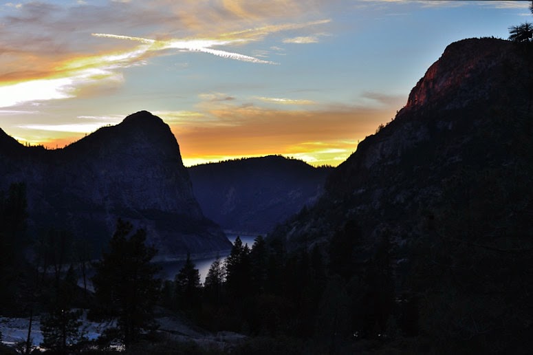
Sunset:
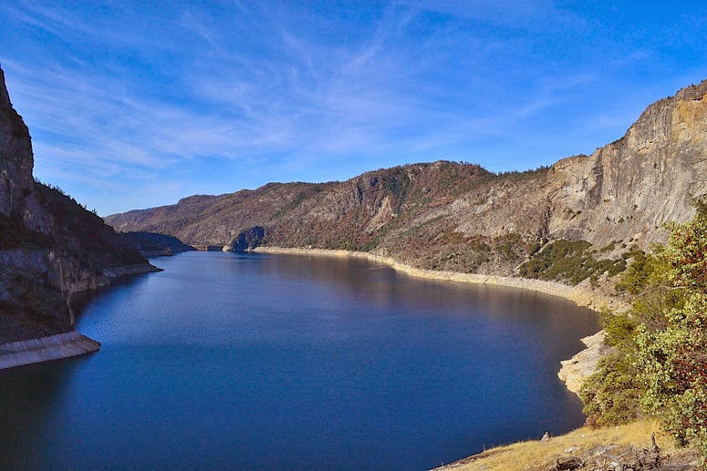
Hetch Hetchy Resevoir:
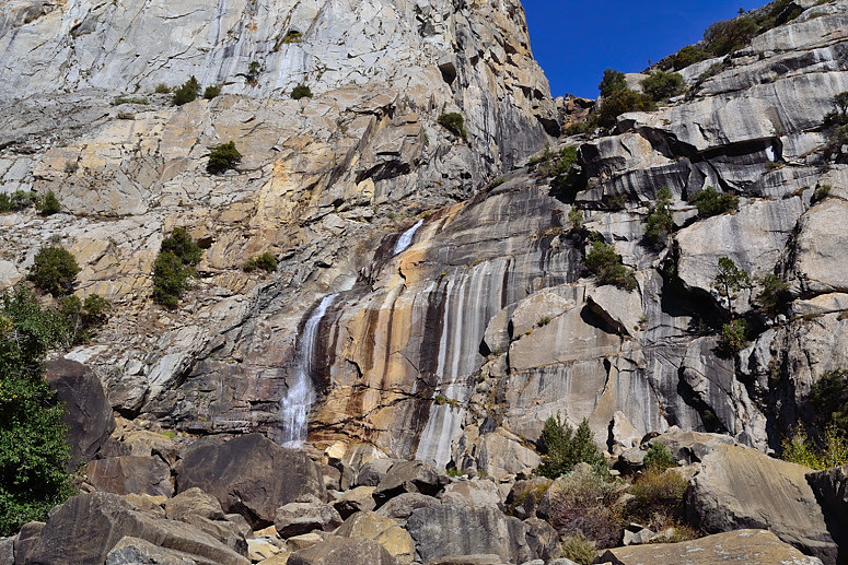
A greatly diminished, but still flowing, Wapama Falls:
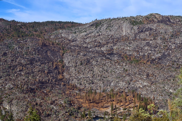
Poopenaut Valley and Rim Fire burn:
Edited 3 time(s). Last edit at 11/09/2013 04:12PM by ttilley.

