Welcome! Log In Create A New Profile Recent Posts
Tenaya Lake, Yosemite National Park

The Moon is Waxing Gibbous (79% of Full)


Advanced

Re: Lake Vernon - Tiltill Valley

All posts are those of the individual authors and the owner of this site does not endorse them. Content should be considered opinion and not fact until verified independently.

Lake Vernon - Tiltill Valley
June 04, 2014 09:23PM
Taking advantage of the recent re-opening of the Rancheria Falls trail, we decided to do a repeat of one of our first Yosemite backpacking trips: the Lake Vernon - Tiltill Valley loop.

There was some evidence of the Rim Fire along the switchbacks climbing up the side of Hetch Hetchy Valley, but it seems that most of the trees that provide much-needed shade along this stretch had survived.


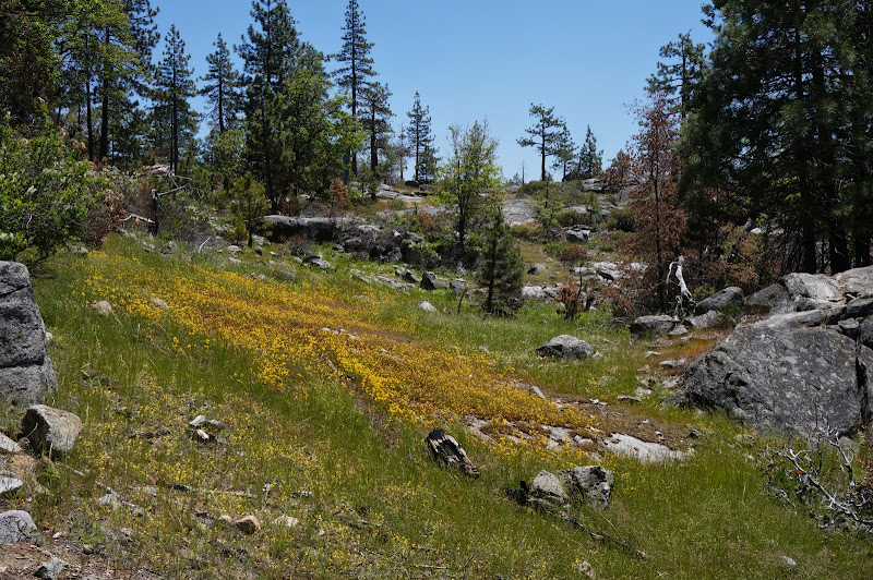
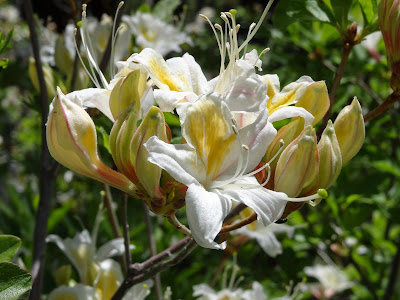
Still, there were many places where wildflowers were taking advantage of the recent fires.


Despite the dry winter, many of the smaller meadows were also exhibiting flowers.


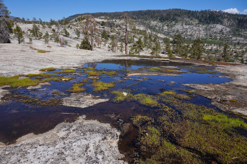
On the other hand, the "Frog Pond" was bone dry.


Near Beehive itself we were reminded that mosquito season is upon us as we filled our water bottles from its spring.


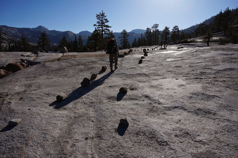
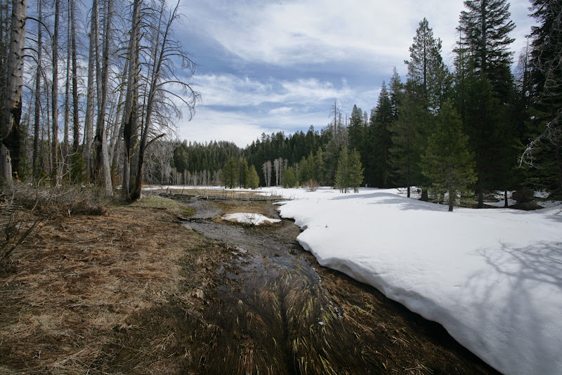
After cresting at the Moraine Mountain/Jack Main Canyon trail junction, we descended to Lake Vernon, soon reaching the large, flat expanses of granite below the lake. The usual early-season creek that crosses this area was reduced to a few puddles.


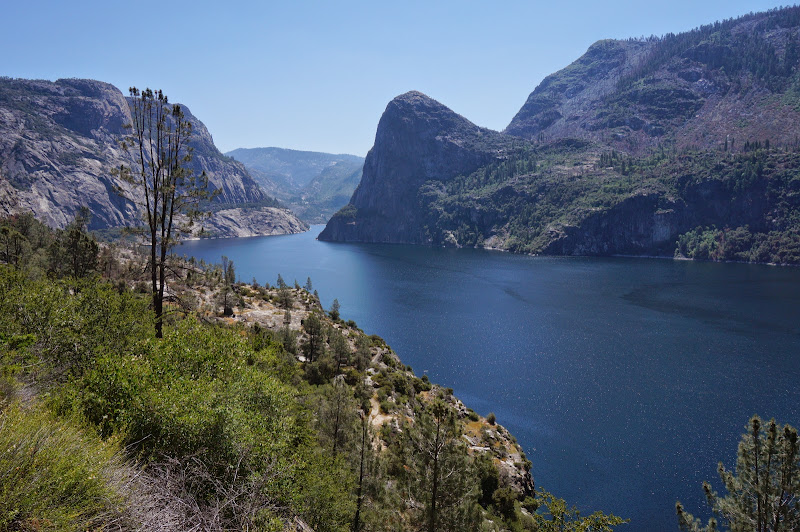
Not far from there, the trail crested and we got our first glimpse of Lake Vernon itself. Branigan Lake's outlet stream was as low as we'd seen it.


When the water is sufficiently high, there can be a significant wade to get to the bridge:


This time, Falls Creek was well below the bridge, and after crossing it we found a nice campsite on flat, smooth polished granite, where we rested and enjoyed the evening. There were a few other groups at the lake, but everyone had their privacy. The afternoon breeze kept the mosquitos from bothering us.


The next morning (which also is our anniversary!) was perfect--few bugs and no wind at all. After breakfast and packing, we were on the trail towards Tiltill Valley, Rancheria Falls, and the trailhead.


The climb away from Vernon was beautiful in the morning, with improving views of the lake as the well-engineered trail climbs an open granite dome dotted with Sierra junipers and other trees.


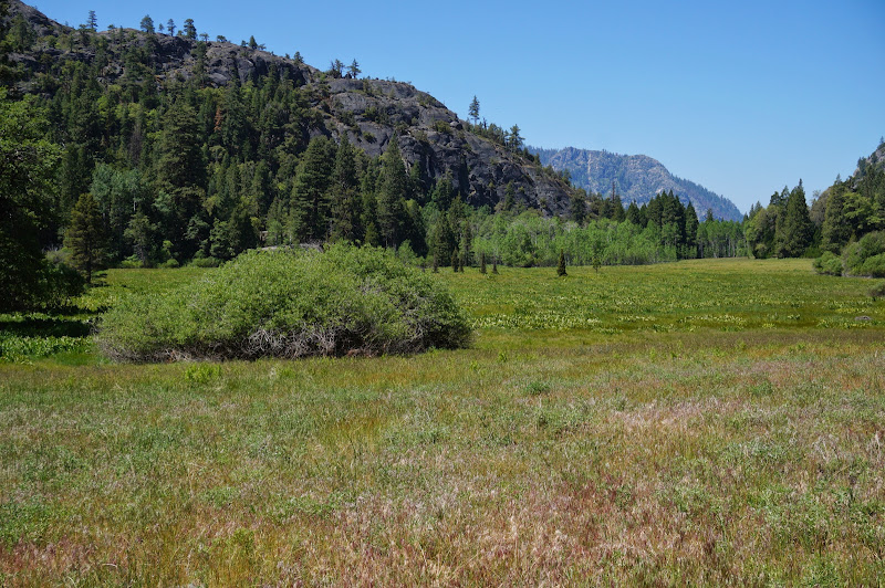
Almost every other time we have done this loop we encountered significant snow above these switchbacks, but this year we saw only a few tiny patches of snow along the trail. The large meadow at about 7500' near the trail was lush and vibrant.


(From a previous trip, for comparison:

)

We stopped for lunch just above the final descent into Tiltill Valley, which also was still bright green.


Bugs were a nuisance along the trail as it skirted the edges of Tiltill's meadows, but once it crossed the meadow itself, a breeze kept most of the bugs at bay.


The first time we did the Vernon-Tiltill loop, we had planned it as a three day trip, but we arrived at Tiltill around noon, and despite there being some nice campsites near where the trail crosses the creek, we decided then to push onto Rancheria Falls. Since Rancheria wasn't too much farther, once there we decided to finish the loop as an overnighter. Ever since then we've always done this trip that way, with a roughly 30-mile total distance.

We were able to avoid getting our feet wet where the trail crosses the meadow.


(Contrast to a previous trip:

)

After the short climb out of Tiltill, we began the long descent to Rancheria Falls. Fire had burnt through this section years ago, so there wasn't much shade. Fortunately, the wildflowers were on full display.


Once at the bottom of these more open, dry, and hot switchbacks, we refreshed ourselves with the cool waters of Rancheria Creek and had a snack before resuming our trek to the trailhead.


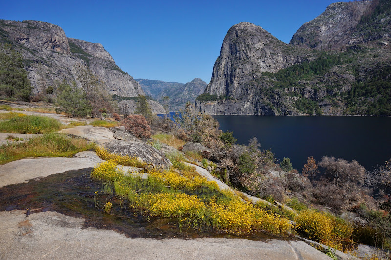
More flowers greeted us as we contoured high above the reservoir.


Just before the Falls Creek/Wapama Falls bridges, we saw the aftermath of the recent rockfall that had closed the trail.


The trail crews are to be commended for the excellent repair and rerouting work.


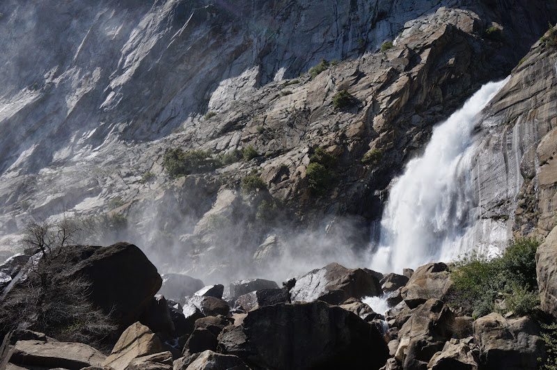
Wapama Falls itself had decent flows, although barely enough to cool us as we crossed the bridges.


Tueeulala Fall--fed mostly by Falls Creek when it's high enough to overflow its channel--was barely a trickle.


We had encountered only a handful of people on the second day--all dayhikers encountered within 3 miles of the trailhead. Overall, it was a long day, but we had great, near perfect conditions.

More Pictures
Re: Lake Vernon - Tiltill Valley
June 05, 2014 08:19AM
Really beautiful pix. I haven't really explored this area enough. Thanks for sharon (as the pink bird would say)!
Re: Lake Vernon - Tiltill Valley
June 06, 2014 08:53AM
Thanks Basilbop, well done report with well captured annotated photography. Over the years I've done quite a lot of late spring wildflower photography both along Hetch Hetchy Reservoir and along the road from Mather so know those species well. Nice capture of clarkia williamsonii, aka farewell-to-spring clarkia that is one of my favorites in that area.

I backpacked into Vernon Lake a few times during the 1970s and it will always be one of my favorite lakes though I have not been there in decades mostly due to the 3300 foot vertical and 12 mile distance that is two days for this person. Approaching from the west on a sunny day about 5pm with puffy cumulous clouds east in the background above Andrews Peak and Tiltill Mtn, I think it has one of the most beautiful landscape views of lakes below 7000 feet or so in the Sierra. It's population of rainbow trout along with those in Laurel and Kibbie Lakes were one of the earliest planted lakes in the Southern Sierra during the late 1800s each of which has developed mature strains of well adapted colorful trout. And because Vernon among the 3 has the best all summer inflow, it has superior spawning that is always most visible in Falls Creek from late May to early June. Although early season mosquitoes can be numerous because when the inflow is high, the lake has considerable swampy lake edge zones, a wise backpacker can wander just downstream of the outlet a bit and find open locations to camp in the sunny granite flats squeeters avoid. Additionally there are some fine areas below the lake in the glaciated granitoid flows of the creek for mid-summer swimming. Because the lake is quite low elevation at 6564 feet, it warms up better in summer and the outflow from the surface is considerably less cold than inflow.


http://www.davidsenesac.com


Edited 1 time(s). Last edit at 06/06/2014 08:56AM by DavidSenesac.
avatar Re: Lake Vernon - Tiltill Valley
June 07, 2014 07:19AM
Nice pictures.

Shocking to see no water in Frog Pond early-season!
avatar Re: Lake Vernon - Tiltill Valley
June 08, 2014 03:12PM
Nice to c Hetchy full.
Tank for Sharon Aaron

Did they have the gate up all the way?


Chick-on is looking at you!


Edited 1 time(s). Last edit at 06/08/2014 03:13PM by chick-on.
Re: Lake Vernon - Tiltill Valley
June 16, 2014 09:31AM
Your pictures have inspired me to hike this loop starting next friday. any advantages to going counter clockwise? Oh, also, since I've never hiked here before, I guess you just find parking near the trailhead? take the Hetch Hetchy turn off (left) from 120?


Edited 1 time(s). Last edit at 06/16/2014 09:34AM by hegel.
avatar Re: Lake Vernon - Tiltill Valley
June 16, 2014 10:18AM
Quote
hegel
Your pictures have inspired me to hike this loop starting next friday. any advantages to going counter clockwise? Oh, also, since I've never hiked here before, I guess you just find parking near the trailhead? take the Hetch Hetchy turn off (left) from 120?

Since the ol Stick N Feathers didn't answer my question...
I'll answer yours.

Vernon is "nicer" than either Rancheria Falls or Tiltill Valley (imo) ... so if only doing 2 days...
Clockwise

PLEASE - Get your permit at the HH Entrance station. Especially true if going early in
the morning or weekend. They will give you a placard to put on your car and you park
at the backpackers lot (they will give u directions if req'd). Hike clockwise (against traffic)
down to the dam (you can no longer park overnight at the dam).
I was being nice once (yes, it's true) and was kindly telling some fellow backpackers
that the quickest way to the dam was clockwise... to which they rudely replied
"that's against traffic" uh... der... hello... McFly... a) that is how you WALK... and
b) even the park service put up a sign for clowns like you (not you the poster..
those turkeys) (hint... the sign points to the right... clockwise on the road)

Please do not get your permit at BOF entrance or valley. Pretty much you are just
wasting peeps time who want to hike other THs in the park.

Hope this helps. Have fun


Chick-on is looking at you!
Re: Lake Vernon - Tiltill Valley
June 16, 2014 01:26PM
Ooops, missed your question :-( The gates were partially up, and plenty of water was still flowing under them.

I'd add that if the goal is to stay at Tiltill one night (and Vernon the other), doing the switchbacks from Rancheria Falls to Tiltill in the hot summer afternoon would not be fun--they are all exposed and south-ish facing.
Re: Lake Vernon - Tiltill Valley
June 16, 2014 02:16PM
I've got my wilderness permit all locked in nice and neat. I was told that I could pick it up at BOF. But I understand about clogging the line at BOF unnecessarily. Sorry for my unpreparedness here...again, I've never hiked from this trailhead...happy to go to to HH entrance station...I'll google it, but is it on the way in? And yes I'll be driving in from Berkeley and setting out on Friday, so a late start. I'll check my topo at home but avoiding exposed switchbacks mid day sounds like a good idea. But if it's only an hours worth of switchbacks or so, that's o.k. I'm planning on three days to do the loop.
Re: Lake Vernon - Tiltill Valley
June 16, 2014 02:59PM
You'll pass by the HH entrance station on the way to the trailhead (dam). You can enter/leave the HH area only when the gates are open (7am - 9pm this time of year), so be sure to plan around that.

Oh, and let us know how your trip went when you're back!
avatar Re: Lake Vernon - Tiltill Valley
June 16, 2014 03:36PM
You get exposed... or exposed...

Up the switchers to Beehive.. or from Ranch Falls up to Tiltill... so pick ur poison.
Just don't pick your poison oak.

Word to the wise... if you go clockwise... after you do the switchers... and come to the
fork in the (Eleanor) road... be advised.. you've only climbed 1/2 way...
If you come back this way... when you get to this pt.... you'll feel like you are done.
On the way up... you've only just begun.

BOF involves driving a bit more distance thru the entrance station ... pickup up your permit...
then turning around and leaving the BOF entrance station... hanging a right onto Evergreen Rd.
etc. etc.. then entering the park again at the HH entrance station... where you
could have gotten your permit from the get-go.

It will all make sense in time.

Have fun


Chick-on is looking at you!
avatar Re: Lake Vernon - Tiltill Valley
June 16, 2014 04:49PM
Quote
hegel
And yes I'll be driving in from Berkeley and setting out on Friday, so a late start.

To repeat the warning posted by basilbop; you have to be at the HH entrance station before 9PM as the gate to the the park entrance is closed at Camp Mather at that time and you will have to spend the night somewhere outside the park.

If you do get to the HH kiosk before 9PM and get your permit but don't want to start hiking until the morning you can stay at the backpackers campground near the dam for $5 per person. (quite nice there)

Edit:
On a second reading of your post it looks like you will be leaving Berzerkley Friday morning and just getting a late start hiking as opposed to a late start driving.


Old Dude


Edited 1 time(s). Last edit at 06/16/2014 04:53PM by mrcondron.
Re: Lake Vernon - Tiltill Valley
June 17, 2014 09:02AM
Yep, I'll be leaving in the morning, so the gate shouldn't be a problem--but thanks for pointing this out; could have been a real issue for sure!

so after consulting a map at home, everything is much clearer. I'm looking forwrd to this hike!
Sorry, only registered users may post in this forum.

Click here to login