Hello, I was hoping a Yosemite maven might lend me his or her counsel. I and 3 friends are planning on driving to Camp Curry on Friday, doing an epic day hike Saturday, and driving back Sunday. Original plan was Half Dome (to take advantage of the early cables' opening) but I see that weather reports forecast some rain and possible thunderstorms on Sat. I am under the impression that the cables should not be used if the ground is even a little slick from a squall so I'm making alternate plans and humbly request advice.
We are males in our twenties and moderately fit. I have done the Half Dome dayhike before and want something comparable in difficulty. My friends have never been to Yosemite and I want to blow their mind with a HD-level epic journey.
Option 1: Happy Isles to Clouds Rest and back. I understand this covers much of the same ground and ends with a better view. Is this much harder than HD? It is farther and somewhat more elevation gain, but no scary subdome or cables might even it out, no?
Option 2: Tenaya Lake to Clouds Rest to Happy Isles (one-way). Drive to Sunrise Lakes parking lot and take the CR trail, then down to Little Yosemite Valley and down via Nevada Falls to Happy Isles. This would require two cars since the backpacker's shuttle is not yet in service. It seems to be less strenuous than Option 1 because its downhill. Is this a viable option?
Option 3: Tenaya Lake to Clouds Rest and back. More normal way to do CR, but misses out on the waterfall on the Mist Trail and LYV
Option 4: Some other peak such as Hoffman or Cathedral? Open to suggestions.
Any thoughts or advice would be greatly appreciated! As of now I plan to monitor the weather and hope the precipitation % goes down. We are hardy males and don't mind walking through intermittent drizzle but obviously don't want to be caught in the high country in a full-blown storm or snow. I am hoping this will be a one or two hour drizzle that blows over quickly. If the precip % falls below 20 or so I will go ahead and secure HD permits Thursday night and start the hike, with the plan to diverge to CR if it looks hairy.
Thanks in advance!

The Moon is Waxing Gibbous (59% of Full)
Re: Saturday May 16 Day Hike Advice
All posts are those of the individual authors and the owner
of this site does not endorse them. Content should be considered opinion
and not fact until verified independently.
|
Saturday May 16 Day Hike Advice May 11, 2015 04:11PM | Registered: 8 years ago Posts: 10 |
May 11, 2015 06:11PM | Registered: 10 years ago Posts: 83 |
Quote
Alex L
I see that weather reports forecast some rain and possible thunderstorms on Sat. I am under the impression that the cables should not be used if the ground is even a little slick
Correct.
Quote
Alex L
I want to blow their mind [...]
Option 1: [...] Clouds Rest [...]
Option 2: [...] Clouds Rest [...]
Option 3: [...] Clouds Rest [...]
Option 4: Some other peak such as Hoffman or Cathedral? [...]
Do you really want to be on top of a peak when there's thunder? I suppose it would blow their minds....
May 11, 2015 07:06PM | Registered: 13 years ago Posts: 1,351 |
Beyond that...
The Tuolumne Meadows Forecast calls for snow...probably a somewhat rainy snow Saturday (high 47), but below freezing Friday night (low 24). Tuolumne is at 8600 elevation, Half Dome's summit is 8800. Things could be a bit icy at various points in the day.
All of the options include higher locations.
If you're going anyway then wait and see what happens, looks like the weather's currently supposed to start coming in Thursday and continue onward.
|
Re: Saturday May 16 Day Hike Advice May 11, 2015 08:08PM | Registered: 8 years ago Posts: 10 |
Thank you both for your very sensible and wryly expressed points. I of course won't be going anywhere high if the weather forecast suggests a thunderstorm. I am imagining a situation where the forecast is a chance of light rain for the afternoon. In that kind of scenario, might I be able to get to CR before the storm comes in, and back down into LYV and points below without much danger? Starting at 5 am, etc. Or should I assume all "20% chance of rain in the p.m." type forecasts foreclose the high country.
Here is another option- assuming that weather makes the high country inaccessible, is it feasible to do a hike from Happy Isles to Glacier Pt.. I'm thinking Mist Trail to Panorama Trail, ending in Glacier Pt and grabbing the bus back down? I know the usual route is the other way round, but it seems to me the payoff view should be at the end, not the beginning (I've already done Four-Mile and don't want to repeat it). Or is Glacier also dangerous under weather conditions?
If it seems likely to thunderstorm or snow Saturday I'll just forfeit my deposit at CC and try again later. I guess I'm gauging how much weather is enough that I ought to abandon altogether. A little rain never hurt anybody, but I understand weather changes quickly and unpredictably sometimes.
Edited 1 time(s). Last edit at 05/11/2015 08:09PM by Alex L.
May 11, 2015 09:01PM | Registered: 10 years ago Posts: 83 |
Quote
Alex L
I of course won't be going anywhere high if the weather forecast suggests a thunderstorm. I am imagining a situation where the forecast is a chance of light rain for the afternoon.
I don't see a difference. It's not like on the flatlands, where you have a light rain come through but never hear thunder. In the mountains I feel that if you have enough moisture in the air for rain, the orographic effects can easily produce lightning.
Quote
Alex L
"20% chance of rain in the p.m." type forecasts foreclose the high country.
I associate this particular forecast, specifically "20% chance of rain after 11 a.m.", with orographic storms that appear around 2pm and dissipate around 4pm. I judge the risks by how many clouds are in the sky.
I should mention that I knowingly took a group of novices out into a thunderstorm last July, after warning them. But we retreated short of the pass before Sunset H.S.C. when lightning struck 400m away, then another 100m away while we were hunkering.
So, no, they don't foreclose the high country. But you need to know what to look for and not to do. Wandering around the flat parts of the high country should be pretty safe, even with lightning around. Usual caveats apply: peaks, ridges, cliffs, next to tall objects, exposed areas, near bodies of water, etc.
Quote
Alex L
ending in Glacier Pt and grabbing the bus back down?
They could close Glacier Point Road again if the snow is enough.
Quote
Alex L
Or is Glacier also dangerous under weather conditions?
Lightning is drawn to sharp edges, like cliffs. I recall a story of a person standing on a metal platform up at Glacier Pt. for a photo op, when his/her hair stood on end. Jumped off the platform just before a strike.
XKCD
|
Re: Saturday May 16 Day Hike Advice May 11, 2015 10:08PM | Registered: 8 years ago Posts: 10 |
That is terrific information and I will follow your advice in thinking about lightning risk, thank you. From looking at the various weather forecasts it seems that rain/ snow is very likely Thursday and Friday but possibly it will pass by Saturday. Weather Underground at least has Saturday dry so I can cling to hope. I will have to wait and see, hopefully the predictions will converge on a clear day for me.
Assuming that it is clear or at least low rain risk, is it plausible to do CR from either Happy Isles or Tenaya Lake direction so soon after a moderate snow storm (assuming they keep the roads open)? Or would the trail be obscured? I will assume HD is right out no matter what because of the slickness factor. I guess Happy Isles to Glacier Pt via Mist Trail and Panorama might be a moderate alternative if the picture is uncertain on Saturday morning but GP Road is still open.
Edited 1 time(s). Last edit at 05/11/2015 10:10PM by Alex L.
May 12, 2015 07:00AM | Moderator Registered: 14 years ago Posts: 7,421 |
Your friends have never been to Yosemite....
So take them up 4 Mile and down Panny / JMT ... or vice-versa.
GP road open or closed doesn't matter....
Or up Mist / LYV / Clouds Rest... though imo...
I would do
JMT/Mist/Top of Vernal/Clark Pt/JMT/Top o Nevada/Turn around/Panorama/GP/Sentinel Dome/Turn around/4 Mile
very moderate hike
and more butter than Clouds Rest hike (CR is MUCH more woods than .. )
Obliviously don't go up Sentinel if it's lightning out...
rest can be done
Have fun
May 12, 2015 08:42AM | Registered: 13 years ago Posts: 1,351 |
The chicken is offering good advice, as usual.
The Weather Service forecast pages include the technical forecast discussion which, if you read it carefully, can tell you about the level and range of uncertainty in the forecast. Yosemite is covered by the Hanford regional office, whose Forecast Discussion is here.
As I type this, a couple key points:
and...
Wait and see, and don't expect to hike Clouds Rest (9900 ft!), seem reasonable here. While the forecast is for a few inches of snow Thursday through Friday, the forecast discussion suggests uncertainty on the high side. The latter quote is a result of the orographic factors SierraMiguel discussed, above - residual moisture being forced up the range.
The Weather Service forecast pages include the technical forecast discussion which, if you read it carefully, can tell you about the level and range of uncertainty in the forecast. Yosemite is covered by the Hanford regional office, whose Forecast Discussion is here.
As I type this, a couple key points:
Quote
NWS Hanford
SNOW LEVELS WITH THIS STORM SYSTEM WILL GENERALLY RANGE FROM 6,000
TO 7,000 FEET THURSDAY INTO FRIDAY. AT THIS TIME IT LOOKS LIKE
MUCH OF THE SIERRA CREST WILL PICK UP AT LEAST A FEW INCHES OF
SNOW...WITH SOME OF THE HIGHER ELEVATIONS POSSIBLY RECEIVING
NEARLY A FOOT OF SNOW BETWEEN THURSDAY AND FRIDAY.
and...
Quote
NWS Hanford
BY SATURDAY THE UPPER LOW WILL CONTINUE MOVING EAST OUT OF THE
REGION...ENDING ALL CHANCES OF PRECIPITATION...EXCEPT OVER THE
SIERRA NEVADA.
Wait and see, and don't expect to hike Clouds Rest (9900 ft!), seem reasonable here. While the forecast is for a few inches of snow Thursday through Friday, the forecast discussion suggests uncertainty on the high side. The latter quote is a result of the orographic factors SierraMiguel discussed, above - residual moisture being forced up the range.
|
Re: Saturday May 16 Day Hike Advice May 12, 2015 06:42PM | Registered: 8 years ago Posts: 10 |
OK these are just great tips.
Since I am staying at Camp Curry anyways, I guess I will just start at Happy Isles 5-6 am and just see how things look once I reach Nevada Falls. If its turned out to be clear and sunny, I'll continue across LYV and attempt CR, monitoring the clouds as I go to make sure I don't end up exposed (and preparing mentally for the risk of too much snow and ice at the higher elevations turning me back). If its looking ambiguous, I'll follow the chicken's suggestion and walk from Nevada Falls across Panorama to GP and maybe Sentinel, and back down via Four-Mile. If it is seriously stormy by then, I will be able to get back down via JMT without danger. Pretty confident we will have a great adventure either direction.
I have read a number of Yosemite books and websites and have never come across insights as useful as these offered by you folks. I really appreciate the thought put into these tips. As an aside- do any of you have a particular Yosemite research resource you consider to be definitive or go-to? A book or source guide, say?
May 12, 2015 07:49PM | Moderator Registered: 14 years ago Posts: 7,421 |
Schaffer if you want to see probably all the trails in the park described...
I personally have an older version and it's my understanding that he includes
lots of xcountry options in the latest addition.
It's really what made me really dream and scheme about seeing "everything"
in Yosemite National Park ...
http://www.amazon.com/Yosemite-National-Park-Complete-Hikers/dp/0899973833/
I have no idea if it's the best or not. But if you like books and guidebooks I think it's
worth the money spent. Opinions vary.
A nice Topo map is also useful with some semblance of trail mileage ...
Something like NG Topo or Tom Harrison fits the bill...
The Schaffer book comes with a map also.
Of course nowadays there is The Web with probably too many resources.
The nps site itself is very good.
Have fun
|
Re: Saturday May 16 Day Hike Advice May 12, 2015 09:17PM | Registered: 12 years ago Posts: 953 |
We started with Schaffer decades ago. Talked to a lot of friends, made a lot of visits, but weren't as dedicated to Yosemite and weren't as nutty about XC for as long.. search for Chick-on's posts. He's been in every nook and cranny (almost) in the park. And probably in multiple seasons, not just multiple trips. There may be a teeny section of trail he hasn't walked yet. His tracks around the park seem like they color the park solid. Search this site for articles/posts by him on topics of interest to you. Most difficult bit is interpreting Chick-on-speak.
|
Re: Saturday May 16 Day Hike Advice May 18, 2015 12:37PM | Registered: 8 years ago Posts: 10 |
Thanks again for all the planning advice. I have relied on Schaffer, Moon, and the Tom Harrison maps so I'm glad to see I'm not too far off from what informed people do.
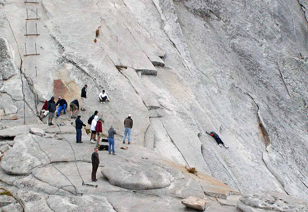
Saturday ended up being clear and mostly sunny, so we went up Half Dome. The cable route was completely dry and my friends found it more fun than scary. There were some ominous clouds in the far distance that seemed a couple hours away all day but they never actually moved in our direction or dropped any rain. As always, everyone up there on the trail was friendly, helpful, and blissful. I met one fellow who mentioned he camps on CR every couple weeks and was tempted to ask if he posts on this forum as Chick-On. It was a perfect hiking day, and of course my friends are raving uncontrollably about it and already dying to come back. As we enjoyed our pizza and beer at camp curry we made a point of toasting the health of the people here who helped our planning.
Sitting in my office in SF, I already miss it and can't wait to return and try another trail or introduce new people to HD. What an awesome place.
May 18, 2015 01:09PM | Moderator Registered: 14 years ago Posts: 7,421 |
Berry kewl.
w/r to CR every couple of weeks... definitely not me. every couple of weeks... same place?
uh huh... sure... sure... not buying that bridge...
dunno why you would do that... there's too much other great stuff to explore...
and different views to be had...
Dis bird was further west... playing in the snow... and along a creek in The Emigrant

Have fun out der
w/r to CR every couple of weeks... definitely not me. every couple of weeks... same place?
uh huh... sure... sure... not buying that bridge...
dunno why you would do that... there's too much other great stuff to explore...
and different views to be had...
Dis bird was further west... playing in the snow... and along a creek in The Emigrant
Have fun out der
Sorry, only registered users may post in this forum.

