I was on the trail by 4:30 pm, and fortunately, there was a cool breeze; the day was otherwise quite warm. After a quick dash up Kibbie Ridge and a short stroll through mostly open forest, I was looking down into Cherry Creek Canyon, my destination for the next morning.
I had contemplated several places to stop for the night along the way, but it was "too early" as I passed each. However, it had been a long day, and I was running out of steam just as the day was running out of light.

I stopped for the night with a view of where I would be the next morning...

...and where the others I'd be joining were already camped.

The breeze died down as I was swarmed by an unexpectedly large number of mosquitoes--despite being camped on open granite. The sounds of nearby frogs suggested nearby pools.
On the radio I gave an estimate of the distance to the clouds and said good-night to the advance party.
After watching a short movie I was sound asleep.
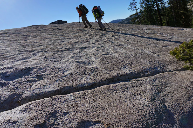
The next morning I dropped to "Flintstone", where the others were starting to pack up--and where I would be assuming some of the weight that JKW had hauled in a few days ago. We were all soon appropriately loaded and on our way up canyon.

We stopped at the Cherry Bomb "Observation Deck", but the lighting wasn't ideal for photographing the gorge. The water level was higher than the previous trip here--a result of the quickly melting snows from a recent storm.

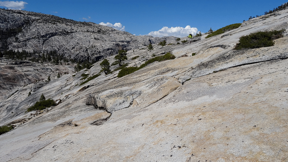
After a slow-and-steady ascent we were on top of the dome that is to the east of Cherry Bomb--and almost at the same elevation as my campsite.

JKW and
 had explored the area up-canyon the previous day, and the going was surprisingly good--we were able in fact to avoid almost all brush from Flintstone to a section just east of the Hyatt Lake outlet confluence. Even logs and branches that have always been a nuisance on the "standard" route were not issues at all.
At the top of the high point along the bypass section, we got our first glimpse of Cherry Creek--and the route we had descended just a few weeks ago.

After another previously brushy segment that they had found a way around, we were finally on open granite; with one short exception, we would be brush free all the way to Lord Meadow.

The walk up Cherry was pleasant--the water was high enough to make the cascades interesting, but still low enough that most near-creek routes were passable.

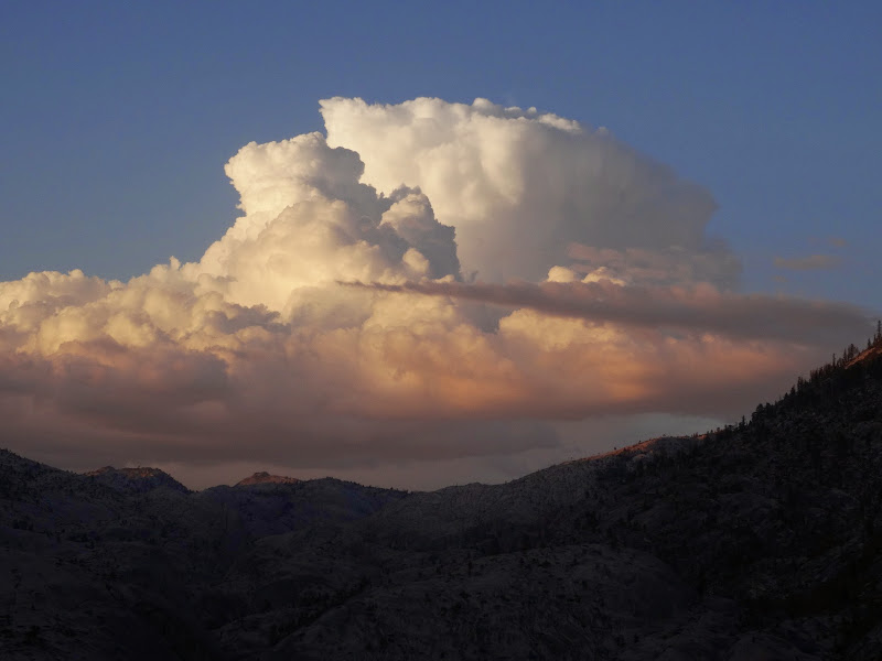
We eventually reached the Hyatt Lake outlet area, where we started heading towards the east. For JKW, everything upstream of here would be new. In the distance we could see a few storm clouds forming--but, so far, nothing too concerning.

The one brushy area was fortunately short.

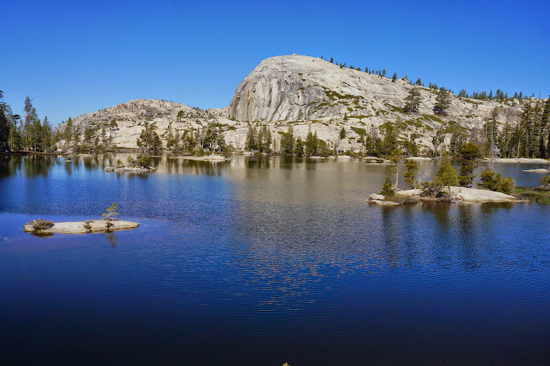
Past that, we emerged onto a large, open area south of the creek, from where in the past we had ascended gentle slabs up to Mercur Ridge and Lake. I had not been upstream of this location since my first trip down Cherry Creek in 2005.

The terrain continued to be open, gentle granite as we headed to the Big Lake outlet area.

We decided to stop for lunch near a cascade that would be just short of the "kink"--the final "crux" of the Cherry Creek route.

Just after we packed up after lunch, we saw three kayakers paddling down-water. It's still amazing that people manage to haul watercraft this far into the backcountry.
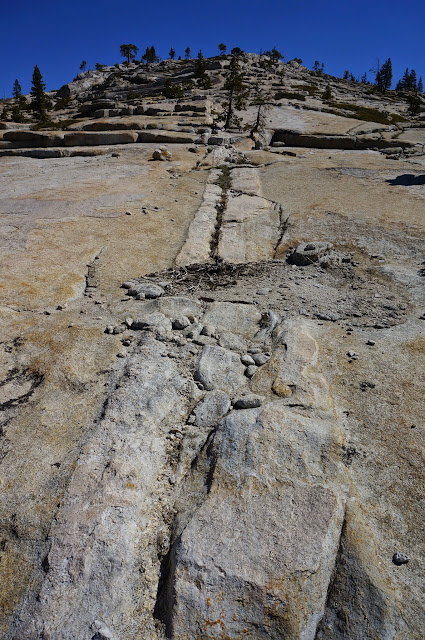
Bypassing the "kink" required the use of some narrow ledges and trust in shoe friction--fortunately, everyone's soles held.

In the distance we could see where Lord Meadow was--we were in the final stretch of the heart of Cherry Creek Canyon.

The clouds in the distance never really grew that much larger, so we felt in no way rushed as we continued up canyon.

Eventually we reached the end of the flat, open granite; after one final cascade, we would be in Lord Meadow.

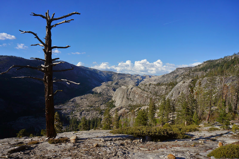
From a small dome we looked back on Cherry Creek Canyon. Good-bye again, but hopefully not for long.

Our destination was in fact Many Island Lake, so we started a final climb up towards--and across--the Styx Pass trail.

We crossed Kibbie Ridge at a low gap where there are two small ponds--and a lot of brush. This route didn't have the benefit of the many collective trips up Cherry in which the brush-free routes had slowly been discovered.

We paused at a modest-sized lake on our way down to Many Island and had some fun with the echoes from the steep cliffs on the far shore.

While descending broad, open granite, we called out on the radio for OD, who was supposed to be joining us. (As we would learn later, his plans had changed--and he didn't know what frequency we were using; we would not see him until we returned to the trailhead a few days later.)

We reached our campsite with plenty of time to set things up, secure our food, and prepare to check out the lake's many islands--up close and personal. This would be the inaugural expedition for the "Blue Bomber's" replacement--another Supai Matkat. (I'd say Google it, but you'll probably end up back here... it's that new.)

There was a bit of a breeze that we had to paddle into as we headed south; it of course decided to die down during the return.

Near the south end we discovered that we were sharing the lake with three others, who were working on removing their tan lines. We waved "Hi!", then eventually headed back to camp.

The next morning was mild, and fortunately the mosquitoes were not much of an issue. Even better: the pink one made pancakes for us--quite the treat!

One of JKW and my first backpacking trips was in this area, and our first significant cross-country travel was from Boundary to Many Island. With much more experience, the route wasn't nearly as challenging as it had been back then.

There were a few tricky sections near the two unnamed lakes between Many Island and Little Bear, but nothing too bad.
The calm air and waters promised another wonderful day.

After passing both of the small lakes on their left shores, we rounded the dome between these lakes and Little Bear.

We circled around the south shore of Little Bear, which had not quite as many islands.
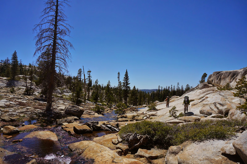
From there, we started to climb to our next destination: Inferno Lakes. Except for a few steep forested sections, much of the route was over open granite.
From the tops of various ridges we could see the various peaks and domes surrounding us.

Eventually we reached the ridge to the west of Inferno Lakes; from it we could see into the Emigrant Wilderness to the north.

After a short descent, we reached the west shore of the upper Inferno Lake. The west and north shores were cliff-bound--not a problem, except that our true destination was on the opposite shore.

After securing our food and packs, JKW and I headed across the lake in pursuit of the pink one. The destination? Boundary Monument 68. After landing on the far shore and helping JKW secure the boats, I followed the trail of pink feathers towards the monument. Bearproof's survey notes had allowed us to calculate an accurate location, and another century-old marker was recovered.

First!
After having lunch on the northern shore, we crossed back to the west.

Inferno wasn't very large, but did have a few interesting islands and cliffs to check out from waterline.

We really didn't have a firm destination after Inferno and #68, so we headed back in the general direction of Kibbie Lake.

The terrain downstream of the Inferno Lakes was mostly more wonderful open granite.
With much reluctance we passed up a small waterfall and pool that would have been perfect for an afternoon soak.

After more open granite...

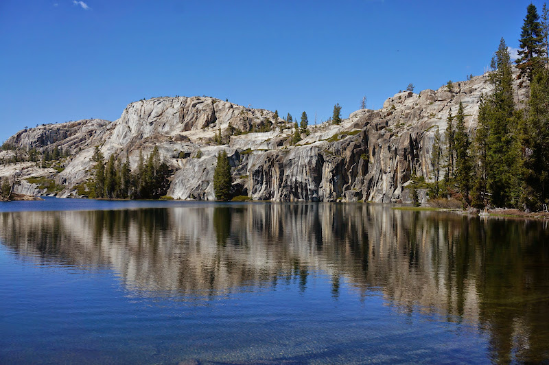
...we reached the top of the cliffs that form much of the eastern shore of Spotted Fawn Lake.

Unfortunately, despite a good start, all possible routes down to the shore cliffed out; we ended up having to climb back up a few hundred feet and loop back around to a nearby gully, which offered a brushy descent route to the lake. We circled the lake on the south and stopped for a snack.
We didn't find any exceptional campsites near Spotted Fawn, so after crossing its outlet we headed up and over the ridge separating it from Bartlett Creek.

We ended up climbing up a steep dome to get access to a gully that would drop us down the other side.

As we climbed we could see Spotted Fawn and the cliffs that had frustrated us earlier. Far in the distance storm clouds were again forming.

After descending the ridge, we found ourselves just south of where we had been earlier that day--the dome we had passed on the way to Little Bear was just north of us. Below us was a lake that we hoped would offer good camping.

In fact the lake did have a nice campsite on flat, open granite, and after setting up camp, JKW took a short swim while the Matkat gang checked out this lake's islands and bays.

That night, despite the full moon, I slept well.

Our campsite was well situated to catch the early morning light, and despite a light layer of frost on our packs and other gear, we were soon warmed by the rising sun. After a leisurely breakfast (pancakes again!) and packing up, we were ready to head towards Kibbie Lake, where we'd hopefully meet up with OD. Unfortunately, despite the deceptively flat appearance of the terrain to the west of us on the map, navigating it required a lot of working around obstacles just small enough to be invisible on a 40' contour map. On the other hand, the lakes in the area promised future boating fun.

The intricate terrain eventually gave way to flat granite with only a few trees. We soon reached a crest where we could look down to upper Kibbie Creek as it emerged from Many island Lake, and, in the distance, Kibbie Lake. After a few attempts to contact OD via radio, we started our descent.

JKW and I had hiked from Many Island to Kibbie years ago, and we remembered the wonderful open granite immediately south of the lake. Despite thousands of miles of experience since this early hike, the return visit did not disappoint. I suspect that like Cherry Creek, the difficulty in accessing this beautiful area limits visitation.

We took our time walking down gentle granite slabs while observing the waterfalls on Kibbie Creek, but we knew that the smooth granite would soon end.

Where Kibbie Creek takes a turn to the west, the tortured, convoluted terrain began. The descent to Kibbie Lake involves hiking down and/or around several cliff bands that cut across the creek. One is about 400' tall. We never got hung up, but many times we had to backtrack or accept that our route was down a steep, brushy gully.

The terrain was interesting and fun to navigate through, but progress was slow, and Kibbie Lake was not getting any closer to us.

Eventually, we descended the final granite ramp that would land us in the valley that leads to Kibbie Lake's inlet--although we would have to backtrack a few more times before we were at the lake.

That valley of course had its own variety of obstacles and puzzles.

We did eventually reach the lake, where we stopped for a belated and well-deserved lunch.

When JKW and I had done this route years ago, we went around the lake far to the north, for there are tall cliffs on either side of Kibbie Lake--a problem that equipment would solve this time.

On the other hand, a stiff breeze was blowing from the south--all of our hand paddling would be into the wind. Nevertheless, we were soon on the water, packs and all, heading towards Kibbie Lake's outlet. Behind us, clouds were forming yet again.

With some effort, we crossed the choppy waters of Kibbie Lake.

We chose to cross the lake to where we had camped a few weeks ago--the water was a bit more calm there, and if we got too tired, we could look for a landing spot somewhere along the shore.
We persevered, however, and made it to the small beach near the south end of the lake.

After deflating and packing the boats for the final time, we were on the Kibbie Lake trail. Despite all the hiking--and padding--so far, JKW and the pink one basically made a race of it back to the car.

OD had in fact been at Kibbie Lake earlier, but had not been on the right radio frequency. He had, however, waited for us at the trailhead.
Overall, another great trip--for some places it was a long-overdue return, and for others it was all-new.
And we found another one of those boundary monument things!
More Pictures