
We did make it to Obelisk Lake; however, this was in my pre-digital days, and unfortunately the camera I was using (a Rollei 35 SE) had a bad meter, so the photographic evidence (very underexposed Velvia 50 slides...) didn't do justice to the lake. This trip was one of our last trips during which we stayed at the High Sierra Camps--to branch out father we'd need to start backpacking--and once that started there was no going back to day packs, filet mignon, and hot showers. K moved on to work in the Valley, first at the Ahwahnee, then later at Yosemite Lodge, and we managed to keep in touch all these years.
Several years later, and also a few years ago, our friend E had the crazy idea of hiking the Grand Canyon of the Tuolumne from White Wolf to Tuolumne Meadows in a day, which JKW and I were able to pull off the next year, and E, A, and I the year after. Another endurance challenge that JKW and I had come up with--the High Sierra Camps loop in a weekend--took a bit longer to complete--first bad mosquitoes, then late-season snow, slowed us down too much, but last year we were blessed with a dry, relatively bug-free weekend and completed the challenge.
There were a few asterisk-worthy nuances with this "double marathon": we had stayed at Merced Lake's backpacker's camp, and thus saved a few pounds of bear canister weight, and the final "touch" of Glen Aulin was done as an in-and-out day hike without full backpacking gear.
E and J identified one other issue: White Wolf is also a High Sierra Camp. They wasted no time in throwing down this year's challenge: all seven Yosemite High Sierra Camps in three days. Estimated distance: 70-75ish miles.
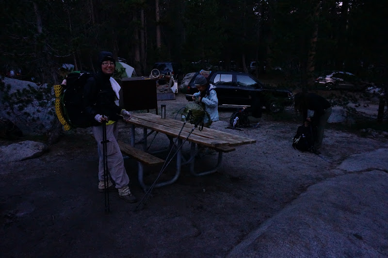
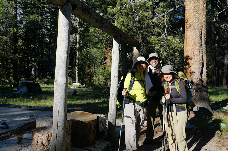
So, at 4:15am on Saturday morning, on the weekend closest to the summer solstice, our alarms woke us up at the White Wolf campground, and after breakfast, we were packed and ready to go. One down, six to go.
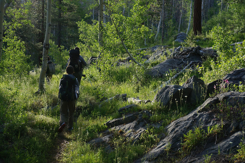
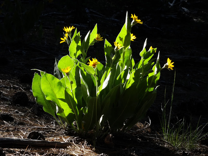
The first day's destination was somewhere around Glen Aulin--hopefully past the camp--thus the first day would be not unlike the previous GCT day hikes, except with heavier packs. We wanted to make good time and get past Pate Valley as early as possible: the forecast was for hot temperatures in Yosemite Valley, which is similar in elevation to Pate. Despite the dry winter, the Harden Gardens were quite lush, and even overgrown in places.
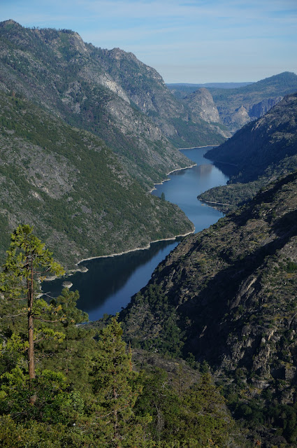
Hetch Hetchy was perhaps unexpectedly high given the drought, but it's also the last reservoir to be drained in the Hetch Hetchy system.
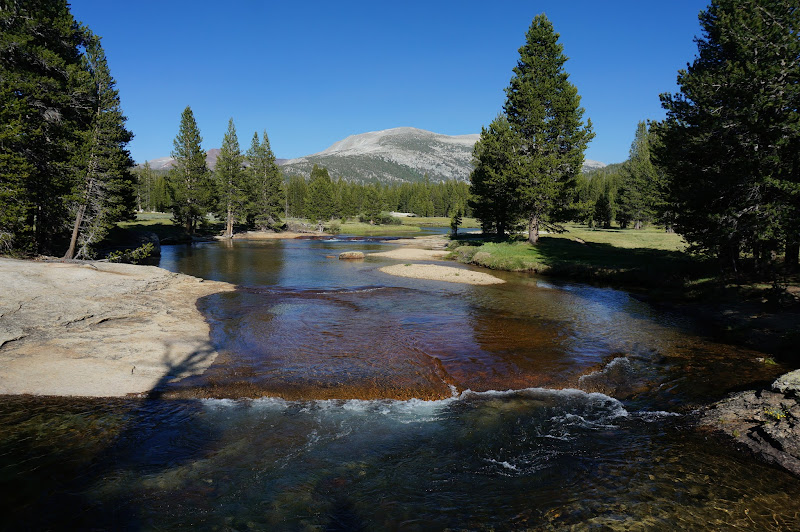
The low level of the Tuolumne River, some 3500' lower than White Wolf, was a more realistic indicator of how dry the winter had been.
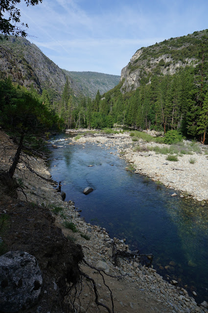
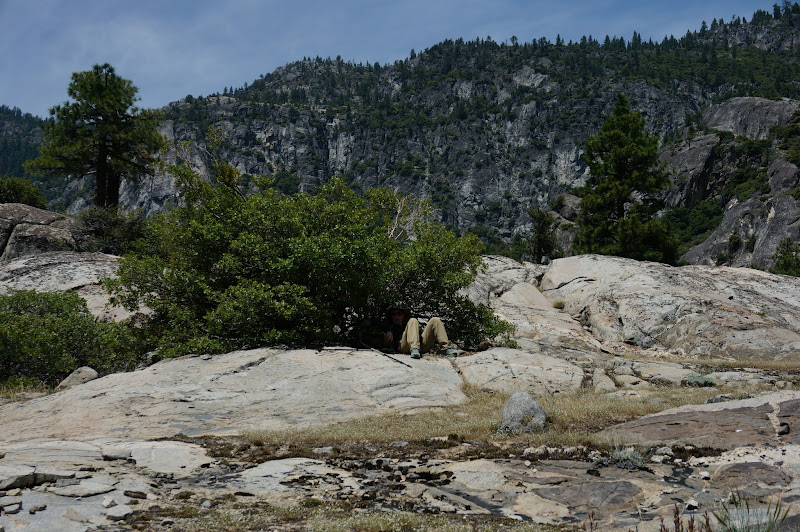
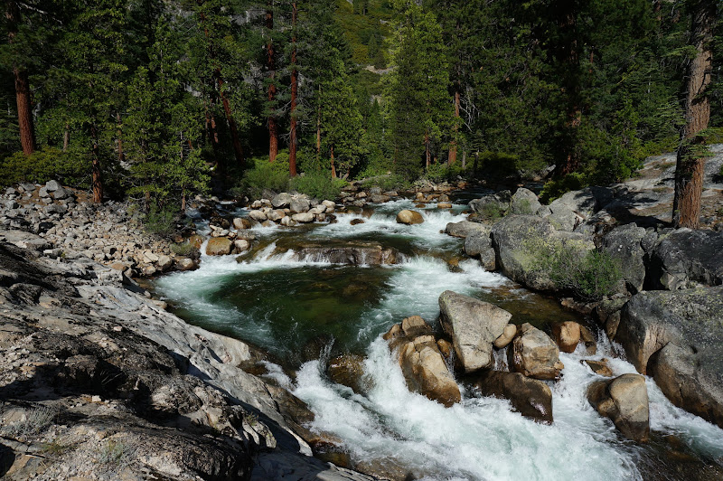
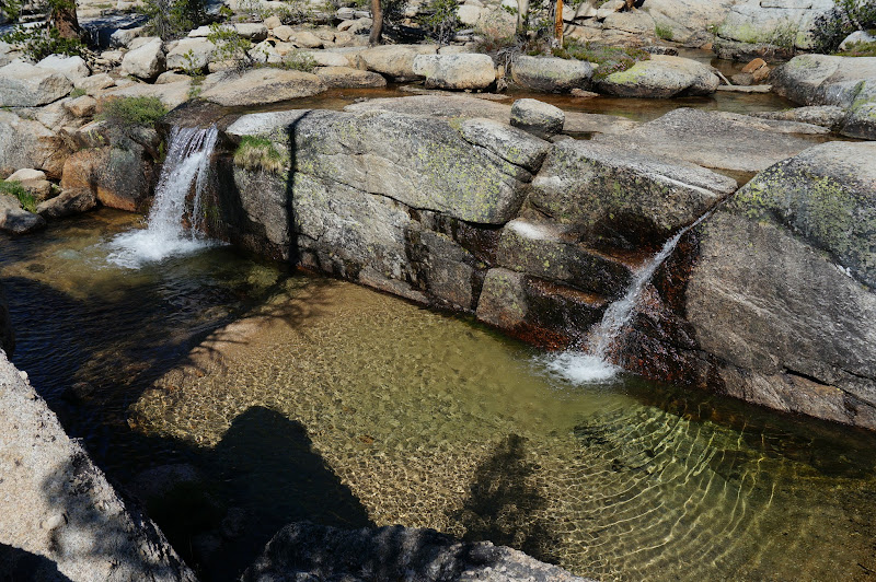
After the mostly level, wooded trek to central Pate Valley, we all found relief from the heat by diving into the river, which was cool, not cold. As so often, we could have stayed for hours, but we had to press on, passing by numerous inviting pools and cascades.
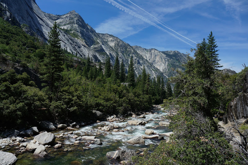
The stretch of canyon between Pate Valley and Register creek is perhaps the most "grand" portion of the Grand Canyon of the Tuolumne--at least in terms of the contrast in elevation between the canyon floor and high points such as Double Rock, Colby Mountain, and of course the eternal favorite "Jorge's Mountain" (or is it Gorge's Mountain, or even just (Muir) Gorge Mountain...?) In this section the canyon walls are particularly steep and close in, especially along the south rim.
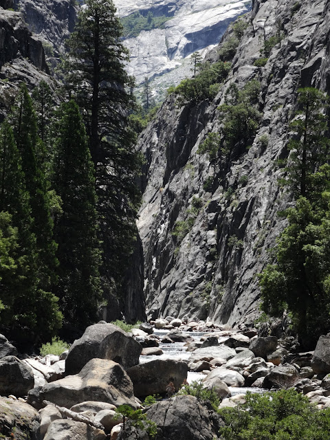
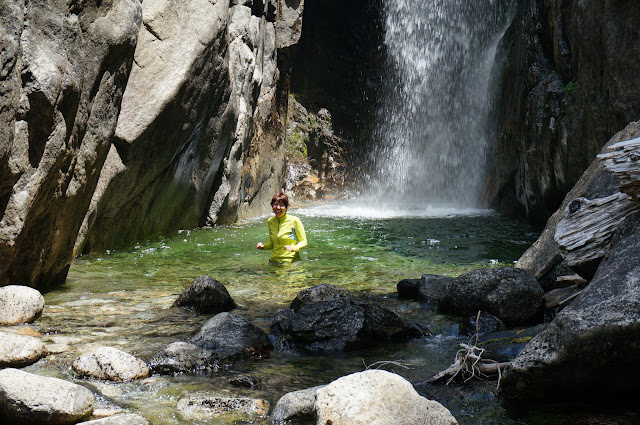
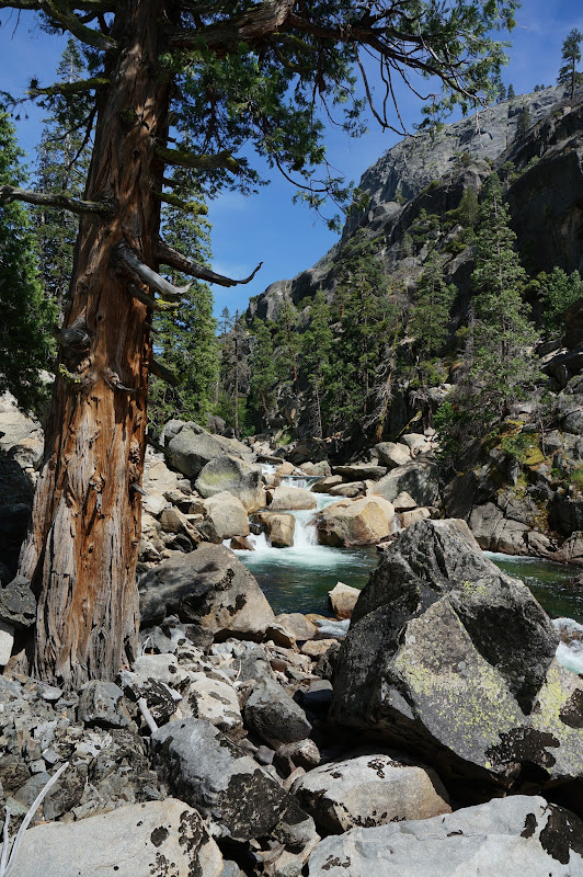
Eventually we neared Muir Gorge, which meant some good news and some bad news. Good: the Register Creek waterfall. Bad: the 700' climb to bypass the narrow gorge.
We of course paused our trek to enjoy the brisk, cool water and some lunch before attacking the first serious climb of the day.
We had learned that L wasn't doing too well in the heat and J was hanging back with her. In fact they arrived at Register Creek just after we had left; they were not too far back.
The climb up from Register Creek wasn't too bad despite the warmth. Fortunately, near the top we were greeted with a nice breeze, and we rested for a bit before descending back to the canyon floor.
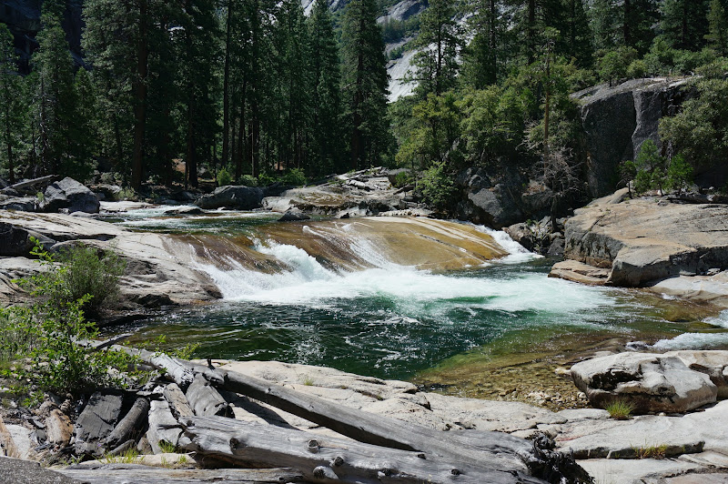
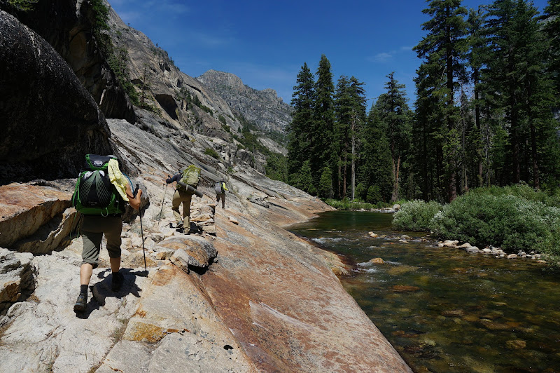
The portion of the GCT between Muir Gorge and Return Creek may be a bit less of a "grand canyon", but makes up for lack of absolute depth with more trademark Yosemite polished granite.

Of course, it was all we could do to prevent being tempted back into the water; in fact, E couldn't resist the temptation.
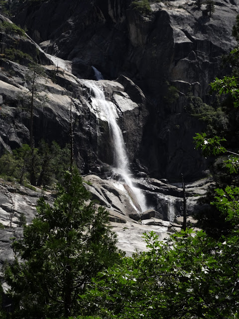
To me the Register - Return stretch often seems like the longest part of the GCT, perhaps due to fewer landmarks; fortunately, one very nice and prominent one is the waterfall of Cathedral Creek splashing down into the Tuolumne.
Past Cathedral Creek, the river's gradient picks up a bit as it is now paralleling the aptly-named Falls Ridge.
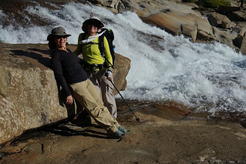
Below the Return Creek bridge we paused for another dose of cool water. We were within a few miles of our goal, but we still had a lot of climbing to do: the next section would be dominated by major waterfalls: Waterwheel, LeConte, and California. Just as we left J and L arrived at this same spot; they had not fallen back any farther since Register.
The climb to the top of Waterwheel Falls was hot and exposed, and the few glimpses of the waterfall revealed little waterwheel action. On the other hand the views down canyon confirmed how much ground we had covered since morning.

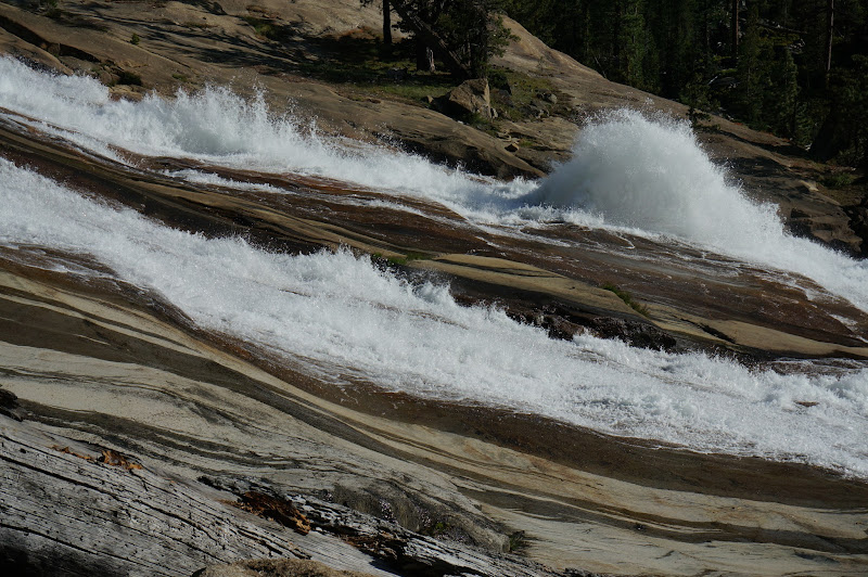
We rested at the top of Waterwheel for a bit. Given the low water, there was no sense going down to see the waterwheel itself--it was barely a splash, but Waterwheel Cascade was still a nice place to hang out.
On the other hand, LeConte Falls came through with a few waterwheels, as it so often does. We took a short spur trail to see more of this more reliable waterfall/cascade.
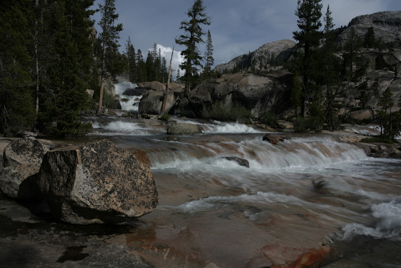
Above LeConte we paused again to enjoy a "regular" stop; the low level of the Tuolumne was all too apparent here.
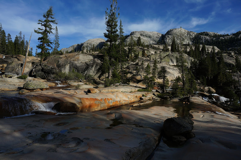
Contrast the above picture with conditions from our 2011 GCT hike:
We continued to make decent progress up the chain of waterfalls and cascades, but we were running out of daylight. We had all but given up on our plans to forge on past Glen Aulin HSC.
Eventually we reached the top of California Falls--we were in Glen Aulin proper, with a mile-plus of mostly level trail.
We had been concerned a bit about the often--and recently--flooded portion of trail near the Mattie Lake outlet in lower Glen Aulin, but the water hadn't lasted even a week.

Fortunately A knew about some nice campsites midway across Glen Aulin, and although we were short of our goal, we all decided to stop for the night. We left a few sticks arranged as an arrow in the trail for J and L before taking a short spur trail to this campsite. We arrived there with enough light to pitch camp and get dinner going. As we were preparing dinner J and L arrived. Despite being a mile or two short of our original goal, it had still been an impressive trek for everyone.
Even with the mild evening, we didn't really hang out much after dinner. There were a few mosquitoes, but a fraction of the worst that Glen Aulin can offer. It had been a long day; not long after we retired to our tents or bivy sacks we were asleep.
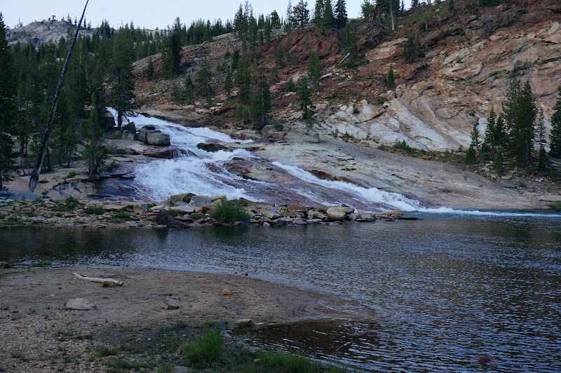
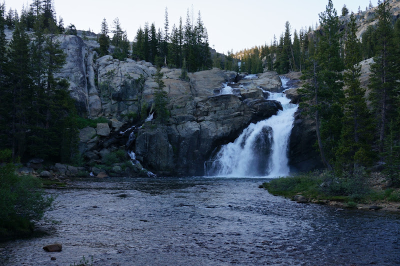
After a breezy night which resulted in some restless sleep, we still had to start early the next morning: we were facing another long day. After the normal breakfast and packing, we resumed our stroll through gentle Glen Aulin, passing the cascade at the head of the valley.
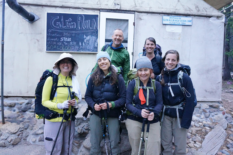
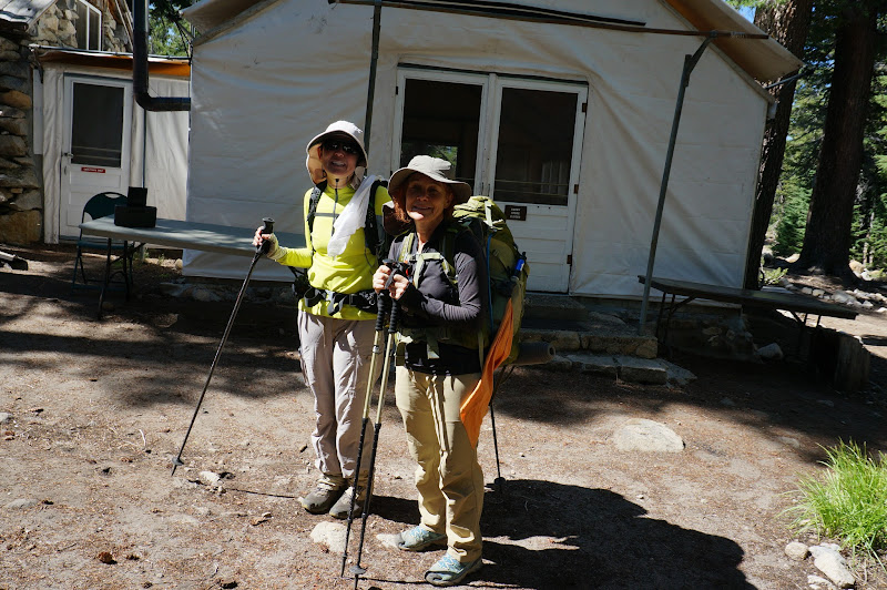
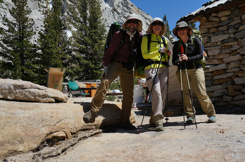
After availing ourselves of the facilities at the backpacker's campground, we took the obligatory celebratory picture at the camp itself. Two down, five to go.
Unfortunately, various minor health issues resulted in four members of our group taking the reluctant but prudent decisions to bail at Glen Aulin. E and A would head directly back to Tuolumne Meadows, while J and L would continue on to May Lake before exiting at Sunrise trailhead. M and JKW (despite well-documented recent injuries) were still going strong, so after good-bye hugs, the remaining group pushed on to the next camp, passing by a much diminished White Cascade along the way.
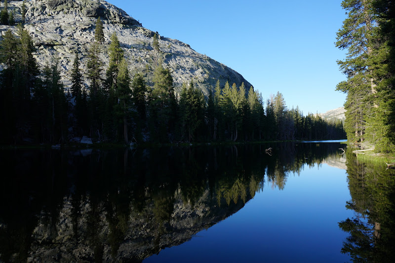
Despite the breezy morning, McGee Lake was calm as we passed by. A short bit later, we were at Cathedral Creek, our original "stretch" goal for the first day.
Overall this day was a bit cooler than the previous one, possibly due to the persistent breeze or the higher elevation.
The bit of trail from Cathedral Creek to the Ten Lakes/Murphy Creek/May Lake/Glen Aulin junction area was a pleasant stroll with a few views of Tuolumne Peak or Mt. Conness behind us. This section can be notoriously bad for mosquitoes, but they were not much more than a nuisance.
Eventually we reached the place where the trail climbs the granite spur between Murphy Creek and Raisin Lake.
Not too long after, at the top of a short climb, we reached the choppy waters of May Lake.
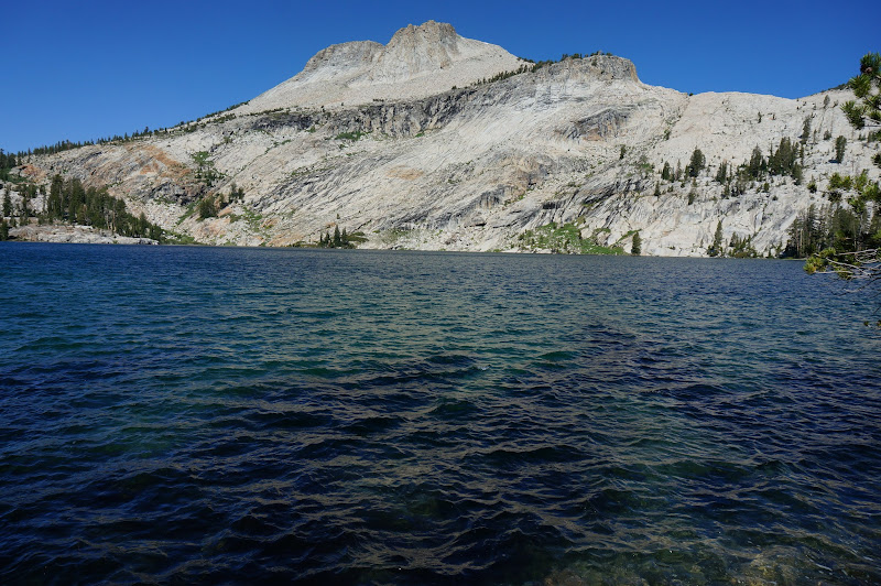
A few steps past the first views of the lake we could see that May Lake's camp would soon be open. The remaining three of us were now three for seven.
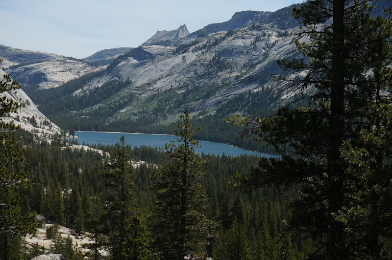
The stroll down the old Tioga Road was uneventful, although we were treated with a few peeks at Tenaya Lake in the distance, which would be our next destination.
At the Sunrise Lakes trailhead we stopped for lunch and adjusted our food for the remaining leg of our trek. As we were eating E and A drove up to pick up some items they had left in the bear boxes. After chatting a bit--and taking advantage of the water and cold drinks they offered, it was another round of good-bye hugs, then we had to press on.
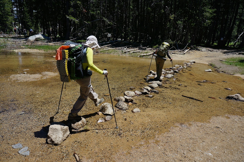
Tenaya Creek was barely flowing at the crossing; our shoes remained dry, as they would for the rest of the trip.
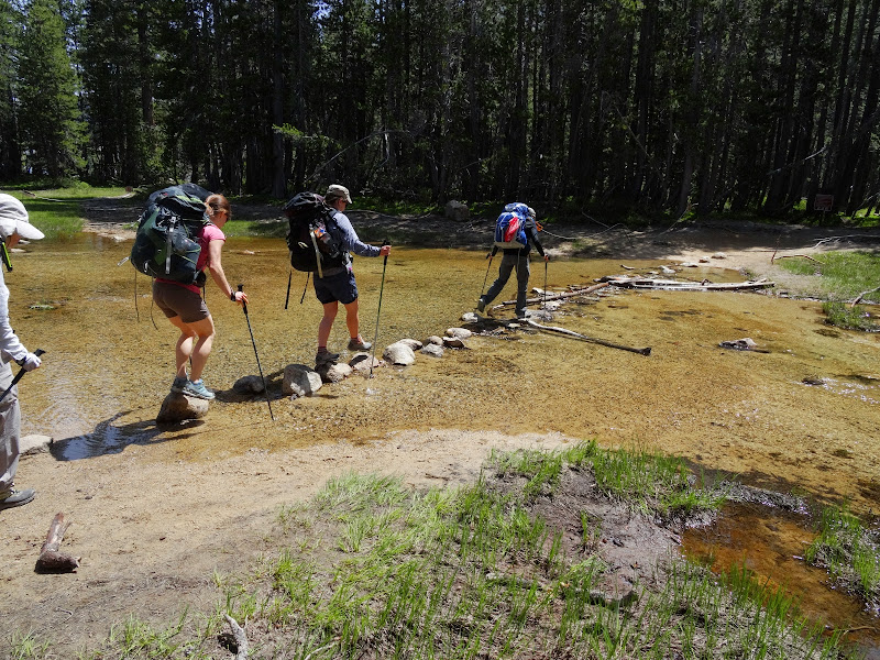
For comparison, last year appeared to have a bit more water--and hikers.
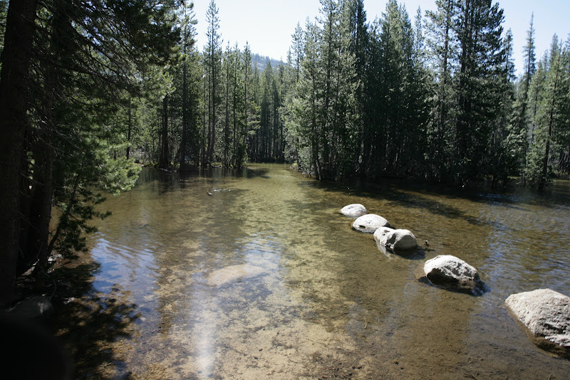
Or, for stark contrast, early July, 2011:
Note that this is well before the actual creek crossing with the stepping stones pictured above--that place is beyond the trees in the middle of the photo.
The climb to the Sunrise Lakes junction was our first steep climb of the day, and for the first time, period, M showed that she was perhaps of only human hiking abilities. (This curious theory would of course later be disproven...) After a rest at the junction, we continued to the lowest Sunrise Lake to fill up on water.
We climbed past the other two Sunrise Lakes, then after reaching the broad saddle of Sunrise Mountain, descended to the High Sierra Camp. Unlike the previous ones we'd visited, Sunrise exhibited no signs of life--either in the HSC or, surprisingly, the nearby backpacker's campground.
Us three were four for seven, and it was basically all downhill from here to our planned campsite.
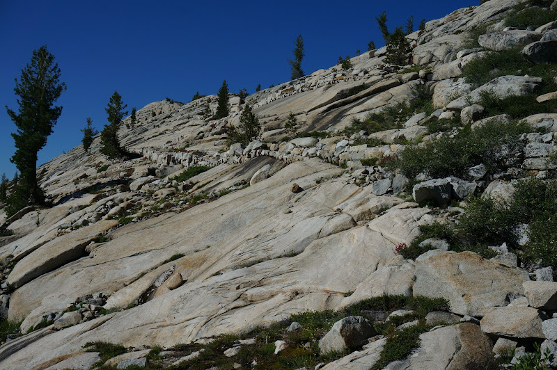
Last year we crossed buggy Long Meadow and navigated the more intimate areas of the Dolly Domes (or, for those who may remember, the Mansfield Domes); this year we chose a more distant "shoulder and arm" route to descend more directly to the Echo Creek trail.
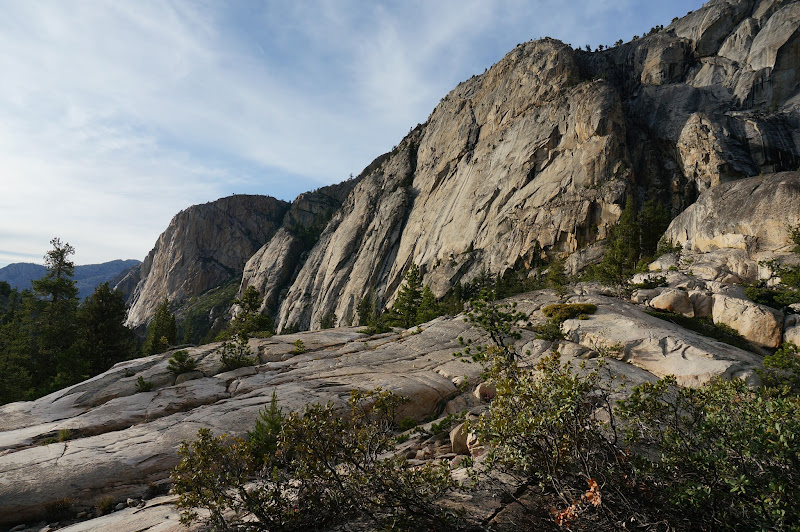
The cross-country route was fortunately quite nice and straightforward--very little shrubbery or deadfalls, no significant cliffs or other problems, and a few places with quite nice views.
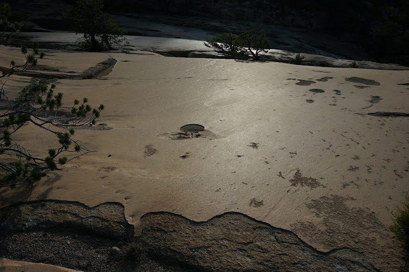
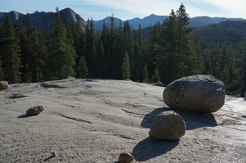
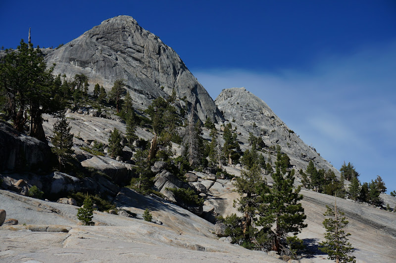
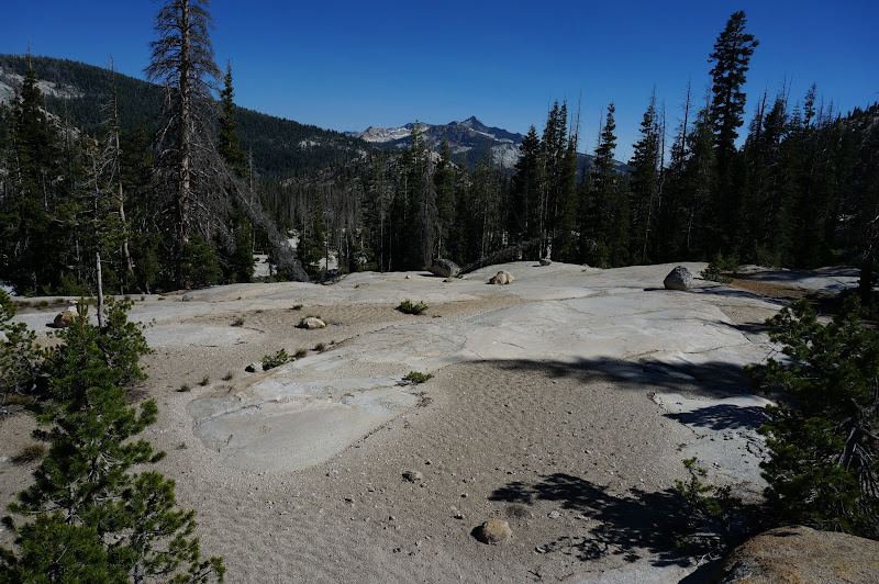
Eventually we emerged on a broad, flat granite expanse south of the impressive Dolly Domes.
We followed the flat, polished granite as far as we could, but we still had to navigate a few hundred yards of burnt-out logs before reaching the trail. Fortunately, it appeared that the maintenance crew had recently cleared the trail of offending logs and other obstacles.
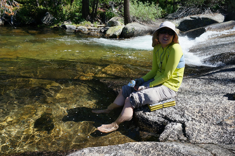
At the first good place where the creek had good creek access with decent smooth granite, we stopped for a well-deserved foot soak and snack break. A quick check of our GPSs and maps confirmed we were only 2.5 easy downhill miles or so from where we needed to camp--we'd be able to arrive there with ample light. We also would be back on track for our original itinerary, leaving a more reasonable sub-20 mile final, out day.
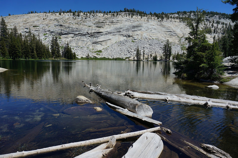
Our campsite above Echo Valley would be a dry one; while JKW and M headed on towards camp, I loaded up on water at the lower Echo Creek crossing. A few months ago when we'd been in the same area, the small creek that seasonally flows by this area had been all but dry, and there was no reason to expect this condition to have improved.

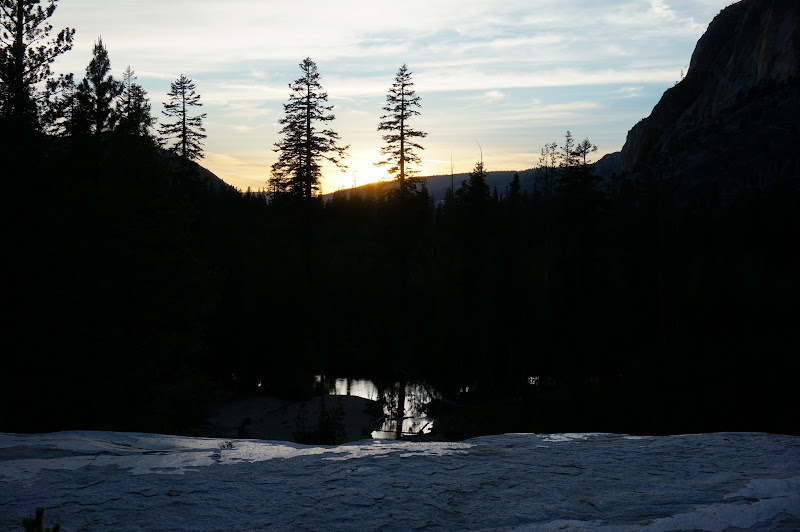
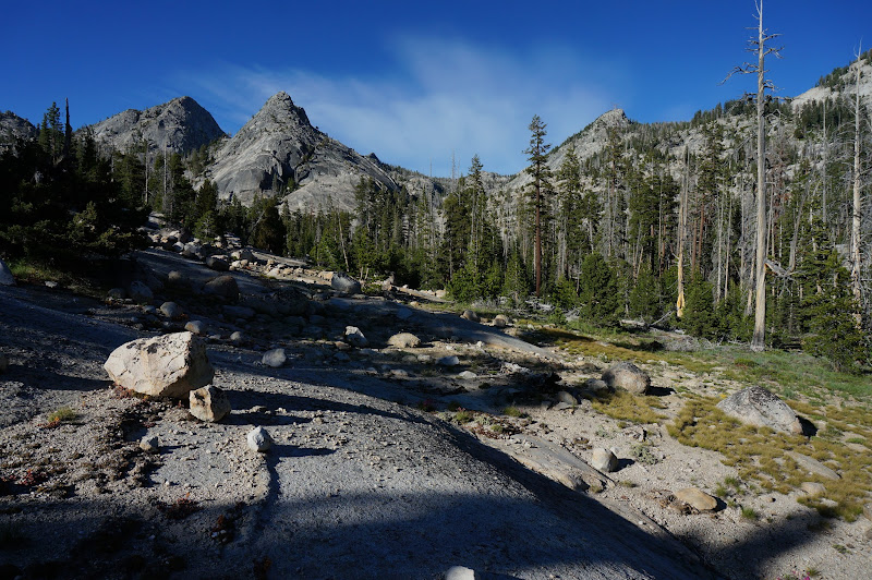
The campsite was very nice, with decent granite and wonderful views, and although it was in the shade, there was plenty of light reflecting from the distant domes and mountains. We set up camp and had a very relaxing evening preparing dinner and just hanging out. There were a few mosquitoes, but not enough to drive us into our shelters. It was also clear that we would most likely succeed in the challenge--it was about 14 miles to civilization no matter what route we took, so we might as well take the one that passes through Merced Lake and Vogelsang.
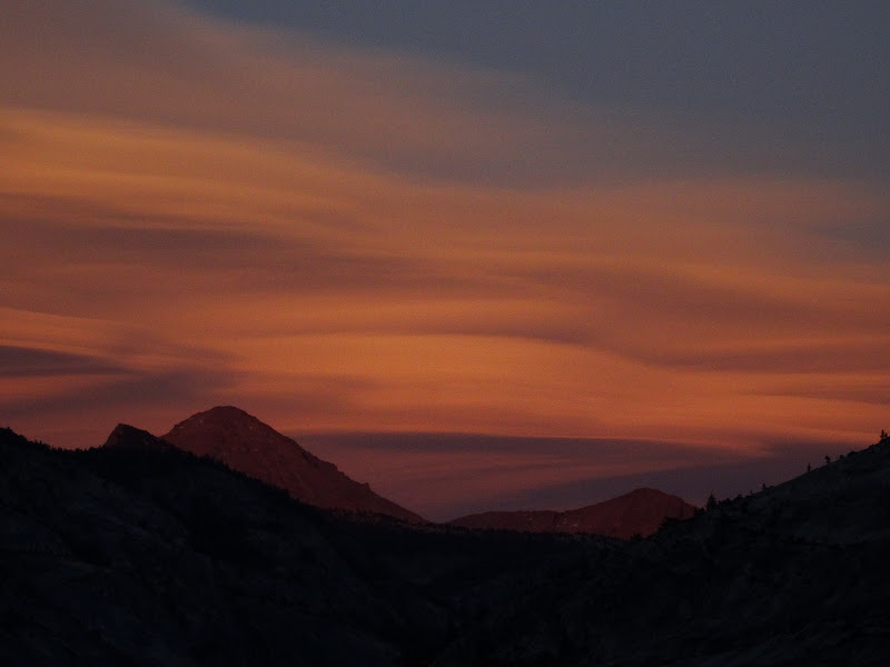
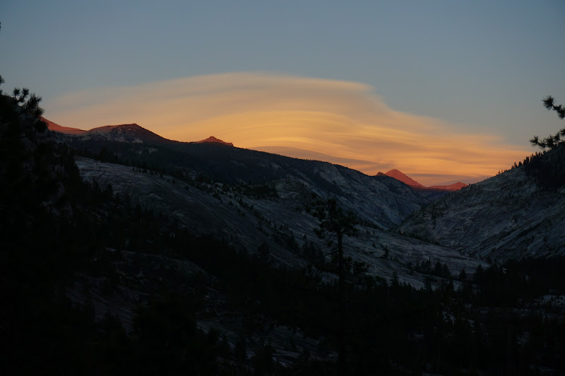
After dinner we were treated to a wonderful sunset. Once it was over we were all soon asleep. After over 50 miles of backpacking, rest was well-deserved.
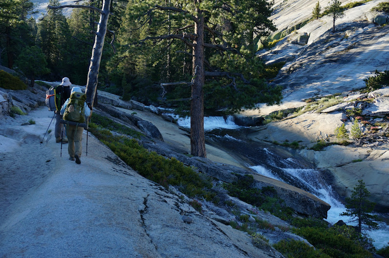
Since our third and final day would be a short one--under 20 miles!--we set our alarms for a luxurious 5:30; however, we were all awake by just after 5:00. After a nice breakfast and breaking camp, we were on our way down into Echo Valley, then following the Merced River's cascades up a bit to Merced Lake.
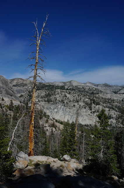
The largest White Fir in the world is still alive, although some of the top branches no longer have needles.
Oddly, there was no one at the Merced Lake backpacker's campground, but a few tents had been set up within the still-unassembled High Sierra Camp area. One obvious reason--this area got the morning light much earlier than the backpacker's camp area. We paused for the obligatory picture at Merced Lake. Five of seven, but we were facing a 3500' climb. JKW and I had done this climb before--several times, in fact, but not with almost 60 miles on the odometer already.
We strolled a mile or so through "Ranger Station Valley" before attacking the cobblestone stairway to Vogelsang.
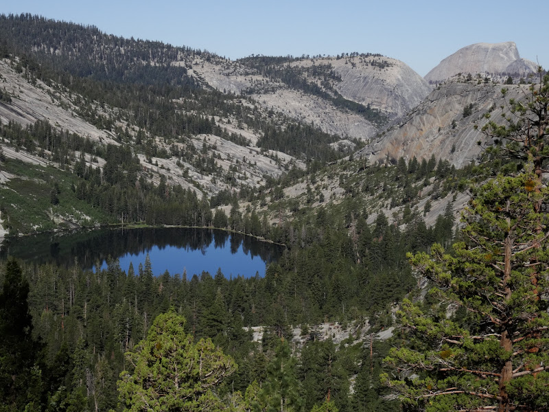
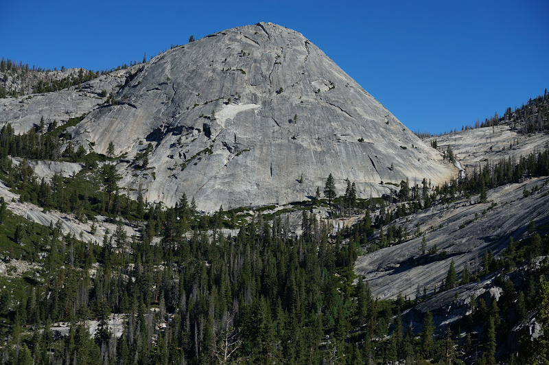
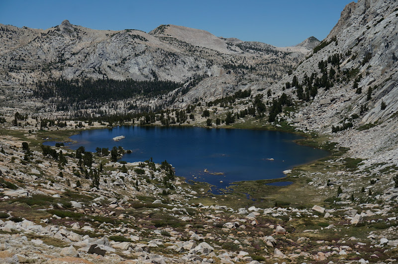
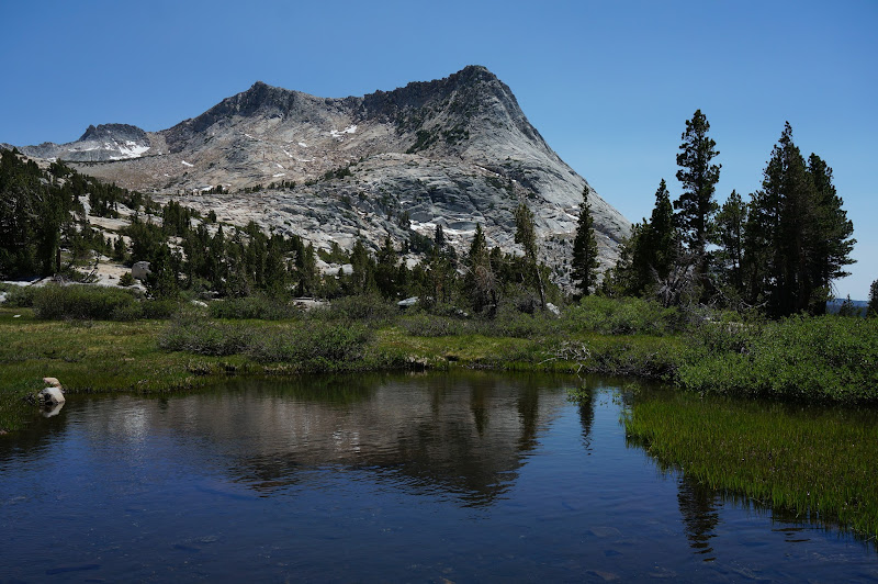
As we climbed, we got views of the lake we'd passed by, and the dome we'd visited months ago.
Babcock Dome and the cascade that flows around tempted us to head up towards Fletcher Creek, but we decided to go for the bonus round--Lewis Creek and Vogelsang Pass--since, well, why not?
Near the junction with the High Trail we leap-frogged the maintenance crew a few times before stopping at a pool for a soak and snack; past this stop there weren't too many more logs for them to cut, so the crew was soon well ahead of us, never to be seen again.
The Florence Creek falls were spectacular as always; it was tempting to stop, but we still had a lot of climbing--and ultimately driving--to do.

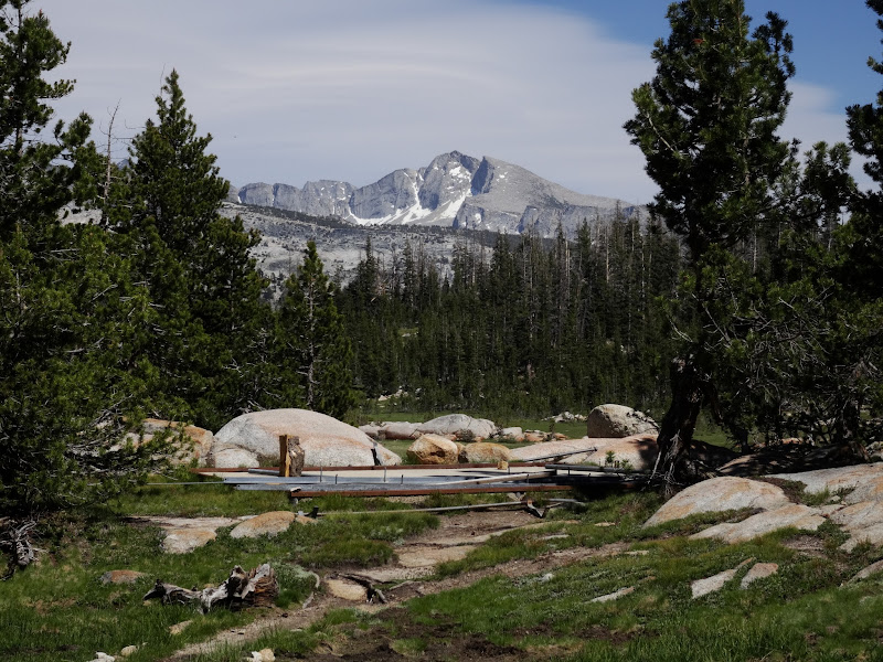
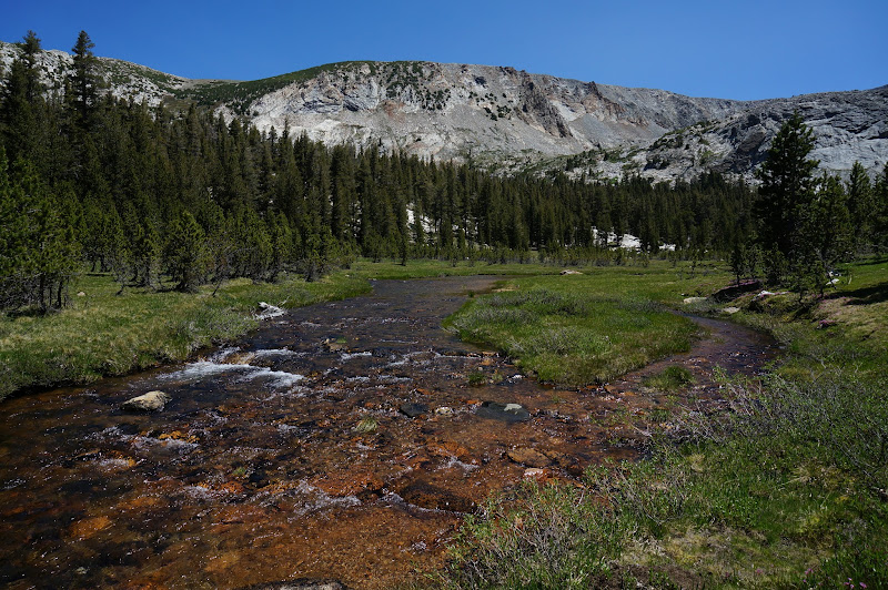
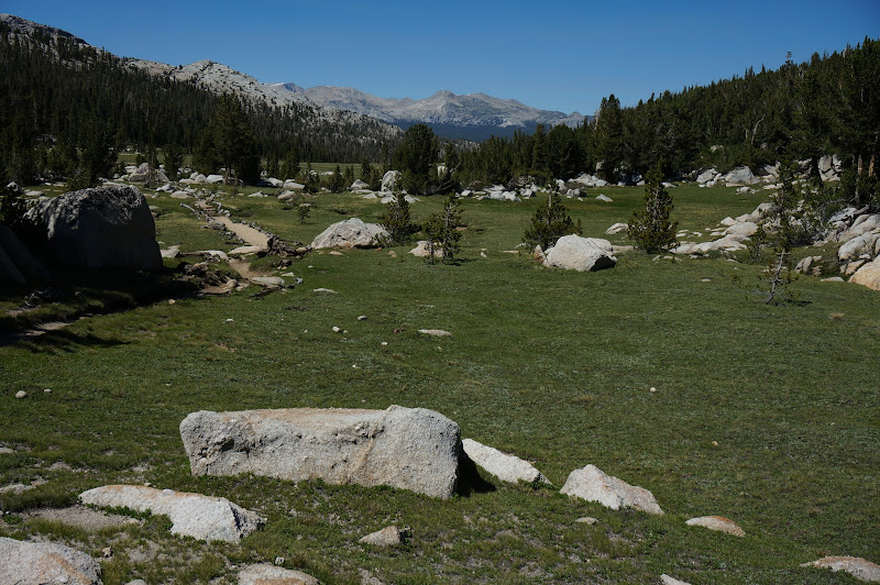
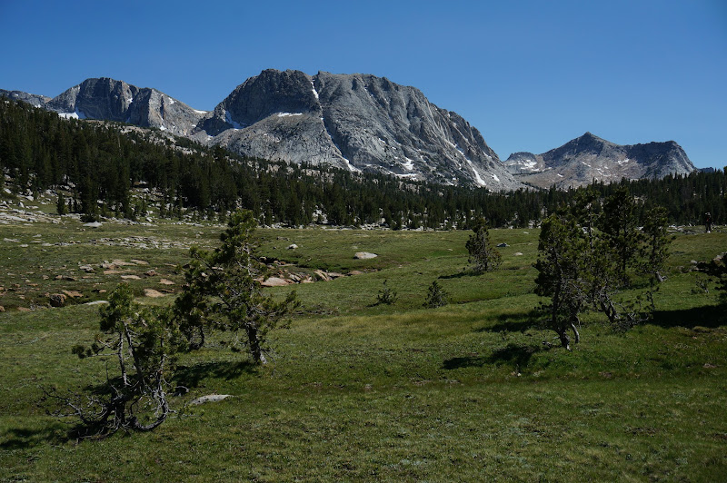
We eventually reached the open meadows near the Bernice Lake junction near perhaps the only place on the High Sierra Loop that has a High Sierra feel to it.
The trail attacked the final push to Vogelsang rather directly with steep switchbacks, but slowly and steadily we eventually got a peek at Gallison and Bernice Lakes and Simmons Peak in the distance.

We took a well-deserved rest at the top of the pass. There was a slight breeze, but for being on a high mountain pass, the air was actually quite calm.
Reluctantly we continued on, first dropping down to Vogelsang Lake.
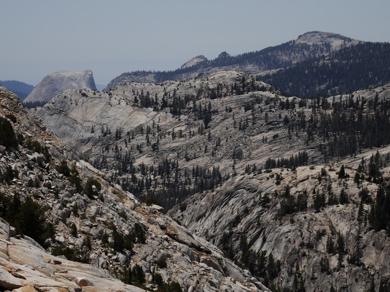
Past the lake, we could see the back sides of Clouds Rest and some other partial dome-y thing.
We took another break below the camp, where the crew was busy assembling the small canvas village. In years past, Merced Lake was one of the earliest camps to open due to its low elevation, but apparently few people are willing to visit it if one of the intervening camps (Sunrise or Vogelsang) are open. We've had some of our best Merced Lake experiences when the other camps were closed, but it's probably not cost effective to operate a 60+ bed camp with only a handful of guests.
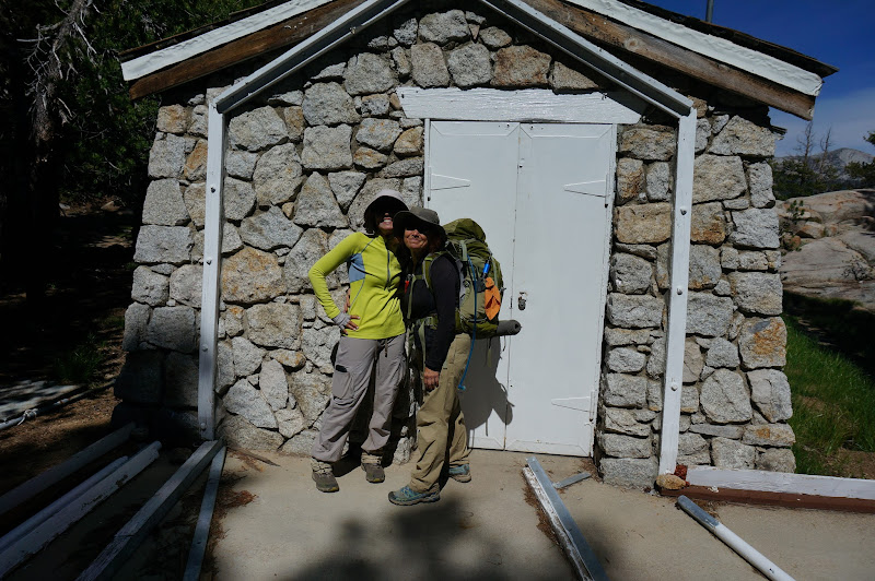
After another soak and snack, we stopped near the dining room area for the requisite picture. Six of seven, but we were effectively done since we'd pass right by the final camp on the way to our car.
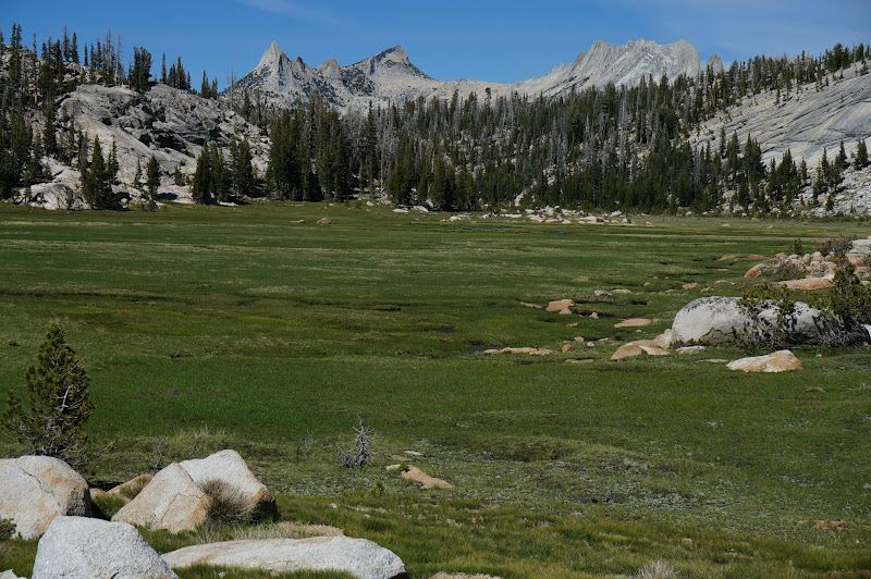
Since this was M's first trip, and we were closing in on 70 or so miles, we took the Rafferty Creek trail. Unfortunately, I can't really recommend this trail--the scenery is great, especially the open meadows near Tuolumne Pass.
However, it's clear that the sandy soil of Rafferty Creek is not up to the constant barrage of the pack trains that keep Vogensang stocked--even with the knee-jarring eyesore of a granite stairway/causeway that was constructed years ago through the upper meadow. Worse, besides hikers, the pack animals don't seem to like the causeway and were creating new, parallel trails outside the causeway, just as the previously restored parallel paths were finally starting to disappear. Fortunately there are other ways to the Vogelsang area that are not rutted sandpits--but most people will end up slogging up and down this miserable trail to reach Vogelsang. It is unfortunate that the camp's impacts are extending so far beyond its immediate bounds.
Off soapbox, deep breath, happy place: nice meadow, pay no attention to trail off-frame to right...
Not surprisingly the Rafferty Creek falls near the trail were much reduced. It was tempting to take another dip, but it was getting late and we still had several miles to get to the final camp, our car, and home.
At these falls M found her second wind and decided to go on ahead; we wouldn't see her until just outside the Tuolumne Meadows Lodge, grinning ear to ear. It's clear that the few times when she seemed to be falling behind were probably just her sandbagging things. Be warned!
We eventually reached the Twin Bridges area--another tempting stop, but not for this trip.
Not too long after, we were at our final camp. Seven of seven. Success!

While looting the small store at the lodge for a well-deserved treat (ice cream and beer), K and I recognized each other--she was back at Tuolumne managing the camp. We chatted a bit and I told her what we had done (she had correctly guessed "something crazy"--I guess we're getting a bit of a reputation). Anyway it was great to bump into one of our earliest acquaintances from Yosemite; I'm sure we'll see each other again.
During the hike E tossed out next year's challenge, since this one had been so easy (?!): All seven camps in two days. Stay tuned...!
The route we took provided a nice sampling of the Yosemite backcountry and would make a worthwhile itinerary, especially with a more reasonable number of days. There are only a few comparatively monotonous "transit" sections where the scenery isn't typical world-class Yosemite--and even these are probably infinitely better than a typical stretch of many other trails. One alternative we considered for doing all seven camps: instead of heading to Glen Aulin from White Wolf, head to May Lake via the Lukens Lake/Ten Lakes trails, then loop around and end at Glen Aulin. This would avoid the GCT, but would replace it with excellent views into and across this grand canyon.
More Pictures


