

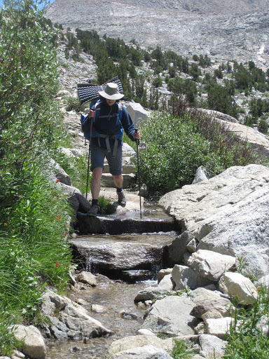
It’s easy to understand why this is such a popular trailhead. The first half of the climb up to Paiute Pass is through forested slopes along the side of a creek. But it gets more serious as it nears Loch Leven, with sections of big stone steps. Because of the rains of the previous days, we were often stepping from one large step to the next trying to stay out of the puddles of water in between.
Not so much fun.

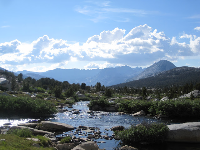
The small alpine ponds above the lake were charming ©http://backpackthesierra.com
But the views from Loch Leven onward were lovely, and as we climbed we could see the string of lakes and smaller tarns stretched out behind us into the morning sun.
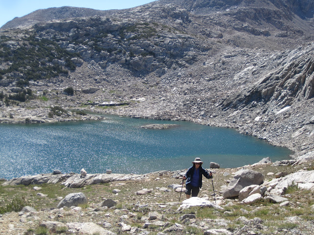
Once above Paiute Lake, the views were even better. And when we got to the pass, the whole Western slope came into view—including just a peek at the top of Mt. Humphreys. Later on, the whole mountain came to dominate the landscape. That's it's at the beginning of this post.

On the far side of the pass the trail is gradual and in better condition, so we were able to wander into Upper Golden Trout Lake in the early afternoon and set up camp on a sheltered rocky knoll just east of the lake itself. From here we had great views of Humphreys and some of the lesser peaks of the Glacier Ridge. I fished the steam with success for smaller brook trout and a few brilliantly colored golden trout, and then we ate dinner and enjoyed the evening show. This was a nice first day.
The second day we decided to do some exploring. We headed up cross-country to Wahoo Lakes, two small lakes sitting on a bench a few hundred feet higher than our campsite. And from there we continued cross-county to Muriel Lake, closer to the pass.
Muriel Lake with M in the foreground
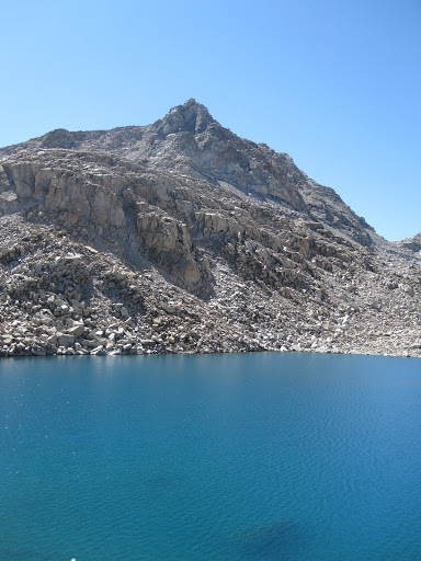
Then we hiked straight up the ridge to see the last two lakes in this chain—the smaller has no name, but the larger lake at the back is Goethe, after the German scholar. These last two last were incredibly blue, and seemingly barren—only rock and water. But we’re been assured that there are trout in both of them. We didn’t see any. But we did see the route up to Alpine Col---a rough trip over big talus that would get you into Darwin Canyon on the west side.
Alpine Col is at the extreme right of the photo...
On our way out, we met three intrepid guys who planned on hiking over Alpine Col and climbing a few peaks before hiking out over Lamarck Col.
The trip back to camp was easy and beautiful…and we finished up just around lunchtime. Then it was time for a nice siesta on our z-rests under the trees. After lunch we spent some time fishing and relaxing around the lake, then enjoyed a nice dinner and the usual sunset show in the High Sierra.
That night we had very heavy condensation on the tent, and we noticed a few other campers dealing with the same issue. Since we were staying another day, we just let everything dry out in the sun and hoped for the best for the next day.
Day three was dedicated to the north side of the basin, and we started by hiking up past Lower Desolation Lake to Desolation Lake itself. There’s an easy use trail for this trip, and it took us to the eastern shore of the upper lake. It was cold, blue and windy up there, and we decided to have a bit more fun on the return trip.

We hiked over to the outlet stream, where we saw some large trout in deep pools between the rocks, and then followed the stream downhill---stopping from time to time to fish, admire the flowers, take a few photos, eat lunch, etc. What a great way to spend the day. The cross-country travel could not have been easier, and the stream kept us entertained at all times.
A great way to spend a day.

By the time we got back to camp, it was time for another shady siesta, and the some fishing and exploring down to Lower Golden Trout Lake. No camping is allowed within 500 feet of this lake, and while it was larger than the Upper Lake, it also seemed a bit less welcoming—with more rock along the shore.
The last night was lovely, and we took even more photos near the end of the day. From our campsite we had a really nice view of Pilot Knob further down the canyon. There must have been an article about Pilot Lake recently, as many of the people we met on the trail were either headed towards Pilot Lake, or coming from Pilot Lake.
There was a big different in the appearance of Mt. Humphreys. When we arrived, the recent storms had left it nicely powdered with snow. Now there was very little snow to be seen. Here's the first day:

And four days later

The last day we packed up and headed out over the pass early in the morning. It was a wonderful day for a hike, and we sailed up to the pass quickly.
But then we hit that same old combination of mud wallows and high stone steps—now augmented with plenty of horse manure from pack train that had come over the night before. If you didn’t like this trail on the way in, you were going to like it even less on the way out.
We were at the trailhead by lunchtime, and drove down to Aspendell for a quick bite at the café before getting into the car and driving back to our cabin above Sonora, filled with some pretty nice memories of a beautiful part of the Sierra.
Check our our website: http://www.backpackthesierra.com/
Or just read a good mystery novel set in the Sierra; https://www.amazon.com/Danger-Falling-Rocks-Paul-Wagner/dp/0984884963

