

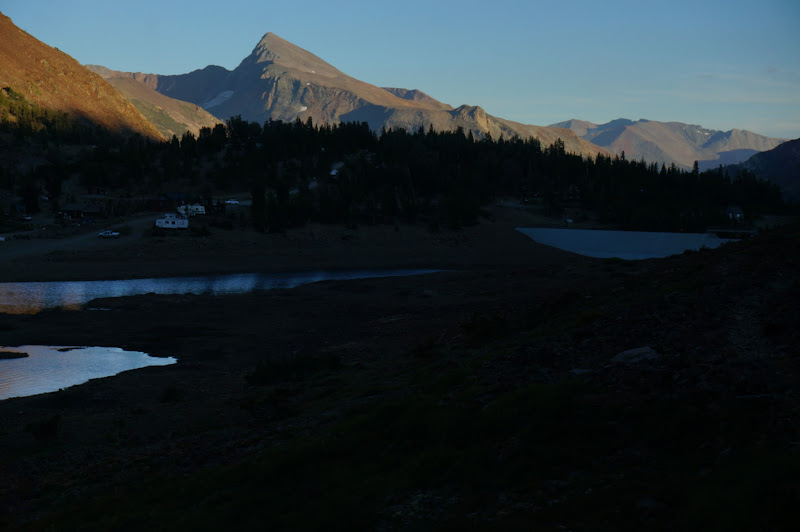
I headed around Saddlebag Lake itself and then directly to Cascade Lake, eventually stopping at some nice granite north of it. A short hike, but it was already getting dark.

There was no wind that evening, night, or morning, and the air was warm and humid--all making for a very comfortable night. I awoke early and refreshed the next morning, ready for a big day--including a new (for me) section of the Sierra High Route.

After breakfast--where I used my one and only Esbit tablet for a hot cup of coffee--I was on the well-defined use trail up to Secret Lake.

The clouds from the previous day were gone; the sky was clear and the sun brightly lit up North Peak. Already, it was warm and a bit muggy.

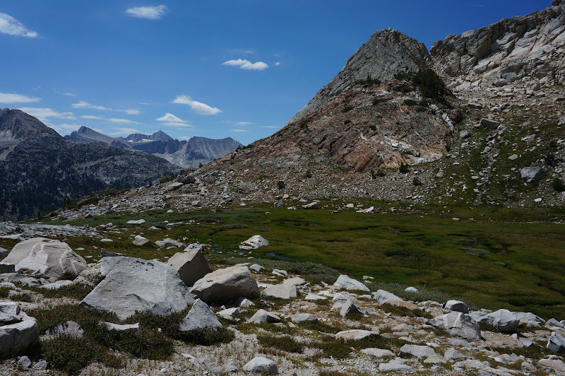
Secret Lake itself was quite pleasant, although the talus and scree slopes heading up to Sky Pilot Col behind it appeared intimidating from lake level.

But first, a minor detour. Previous expeditions had already discovered that the Yosemite Boundary Survey had misplaced at least one boundary marker (#119). It was not inconceivable that the survey had not in fact placed #122 at Conness Pass--now known informally as Secret Lake or McCabe Pass--and in fact had chosen a slightly higher, but more accessible, saddle along the long ridge between North Peak and Shepherd Crest. So, I headed away from Sky Pilot Col along a broad, gentle ramp that led to a not-quite-so-low gap on this ridge. While I found no marker, the views down into upper McCabe Lake were worth the diversion.

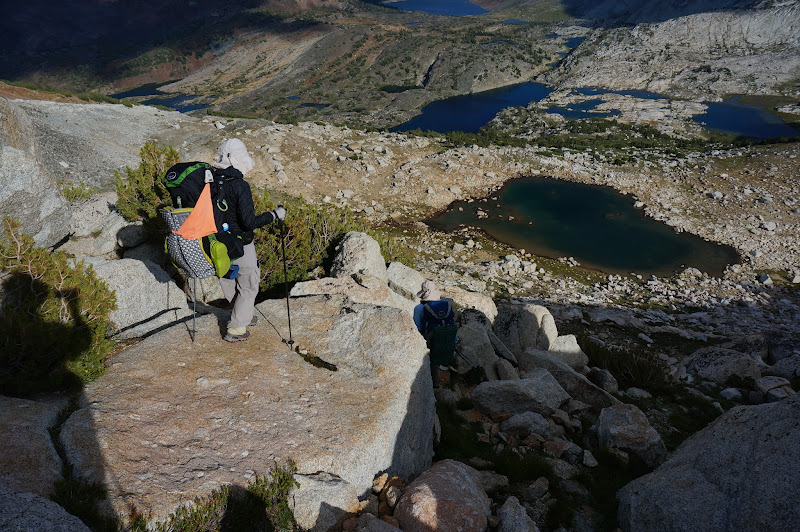
After abandoning the search, I headed back towards the real pass, checking out low points on the ridge along the way--all in vain. Eventually I was at the broad saddle of Conness Pass, where I could look down at many of the 20 lakes and my campsite.

I took out my sleeping bag to dry it out in the warm sun and used the drying time to look for the marker in what should have been the correct general location. Around this time, I heard on the radio that JKW and the Hashbrugular had found the marker near Summit Lake and would be searching Virginia Pass for its marker--but they were having a leisurely start to their day.
Eventually my sleeping bag was dry enough and I had to abort the search--clouds were starting to form above the high peaks, not too far from where I was heading.

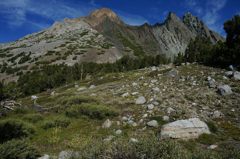
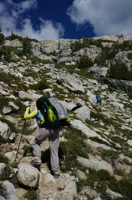
Instead of dropping down to the scree slopes that the Sierra High Route follows on its slog up to Sky Pilot Col, I headed directly up Shepherd Crest over mostly stable talus. Along the way I got great views of distant, but familiar, landmarks.

I reached the top of the crest, where I could see Shepherd Lake and, in the distance, Soldier Lake--both destinations for the day. Mr. Potato Fed tried to find me with his zoom camera, but I had to descend to the Col itself before he could see me.

Although Shepherd Lake was only a mile away, and 1600' down, getting to it was quite tedious--the terrain ranged from very loose scree, large talus, and other nasty terrain. The first 1/2 of the descent was the worst, the route choices often being steep, loose scree; large, loose talus; or steep, sandy and slippery granite.

By the time I reached a muddy "flat" I was past the worst of it, but it still took what seemed like forever to reach the lake.
The tedious descent had been worth it; the lake was quite lovely.

While I was enjoying a late--and well-earned--lunch near its outlet, dark clouds formed overhead. A few sprinkles hit me just as I was packing up to continue; fortunately, they didn't last long. Around this time I learned that the Virginia Pass marker had been located, albeit in an odd place not quite consistent with the survey notes.

The descent below Shepherd Lake was almost the opposite of the descent down to the lake; instead of talus and scree the main obstacles were willows--easily avoided by heading onto granite slabs or into open forests.

At one point the forest floor was covered with lush, green grass. I slipped and fell down in this area, and the landing was so soft as to be quite pleasant--unlike what a fall higher up would have been like.

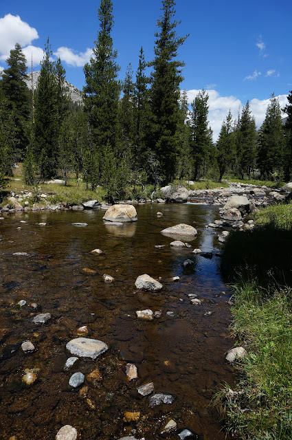
At Return Creek I was at the low point of the day--approx. 9200'. From there I'd have to climb back up 1400' to Soldier Lake where I'd meet the others.
The ascent was at first hot and humid, and unfortunately just as the forest opened up a bit, the sky darkened. I learned on the radio that the others had had to don their rain gear. The sprinkles were never enough to force me into my rain gear--which was nice given that it was quite warm and humid during the steep ascent to Soldier Lake.

Just as the steep climb leveled out and opened up even more, a few more sprinkles hit.

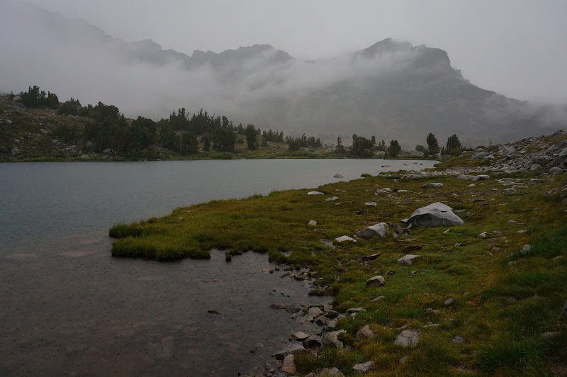
Not too long later, it started to rain in earnest. After some deliberations carried out over the radio, both parties decided to pitch their shelters to stay dry and wait out the storm a bit. We were no longer targeting Spiller Lake; Soldier would do--and for me at least it was only a half hour or so away.

Not a real campsite: surface not durable, less than 100' from water. No actual camping occurred at this location. Do not attempt.
I think we waited out the storm for an hour and a half or so, during which I had a nice nap. It rained heavily only a few times, but the thunder and lightning were constant, and a few strikes were quite close. The few times when it seemed to be letting up I got out to check out the views, but each time I was eventually driven back under the shelter.

From what I could tell over the radio it seemed to be raining much harder over the Return Lake gang than what I was experiencing. We discussed our options a bit, eventually deciding that I'd head up to Soldier, check it out for campsites, then continue on towards Return Lake-- instead of having them head towards me. There were in fact a few acceptable campsites at Solider Lake, but they were all somewhat exposed to the elements--such as the nearby lightning.

After confirming that the other party was content to stay at Return Lake, I headed over a gentle pass and down to that lake.

Oddly, it was in fact raining harder at Return Lake, and I was quite wet when I arrived at camp.
I pitched my shelter to have a place to put my gear, then joined them in the big tent for dinner. After dinner, the rain stopped for a bit.

In The Sierra High Route Roper mentions a saying that it never rains at night in the Sierra in August; our previous evening had disproven that saying, as it rained on and off through the night, punctuated by a few strong gusts of wind. However by morning the clouds were dissipating, and after a leisurely meal of breakfast burritos, we dried out our gear as best we could, packed, and were on our way back towards Soldier Lake.
Soldier Lake was as nice on Sunday as it had been on Saturday. While we discussed following the ridge above it to Spiller, that would end up making a very long day, and we couldn't quite tell what the weather was going to do. Some clouds were forming, but it was mostly clear--just like it had been at the same time yesterday.

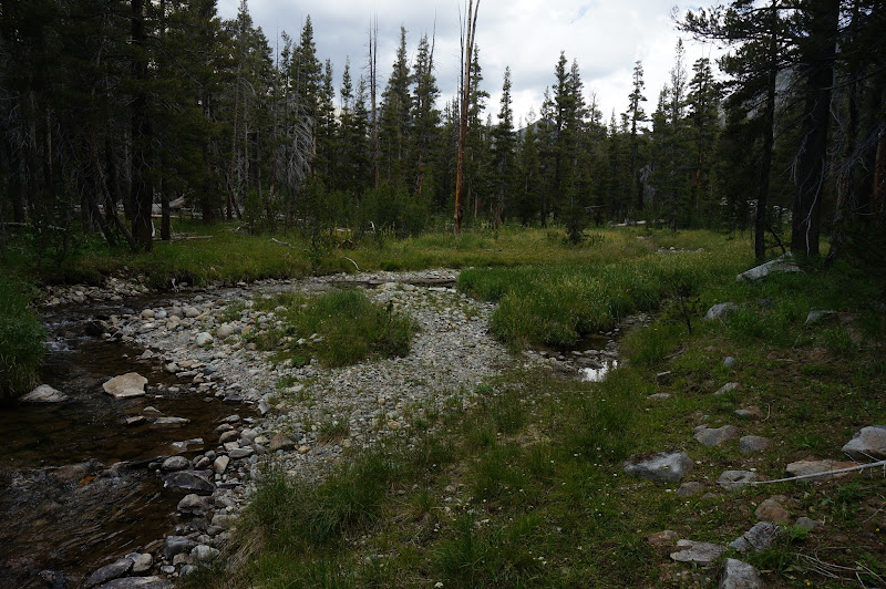
After filling up our water bottles at the lake, we decided to head into the next "hanging valley", then descend to Return Creek.

The hanging valley was wonderful--a meandering stream in a green meadow. We were fortunately to locate an easy route down into this valley.

We stopped for a somewhat early lunch near the meadow.
From there, we descended down into Virginia Canyon while the clouds threatened more rain in the distance. The descent from the hanging valley was not too steep, and we checked out a nice granite dome before descending into open forest.

We eventually reached the trail, but opted to ascend the other side of the canyon instead of following the trail down to the PCT, which would involve another 400' of elevation we'd have to lose--and regain.
The climb up the other side of the canyon was not quite as nice as the trip down--the forest was a bit more dense and there were many downed trees due to avalanches in the past. Fortunately the views improved as we climbed towards the ridge separating Virginia Canyon from the McCabe Lakes basin.

At the top of the ridge we could see our route up towards the upper McCabe lake and the saddle of Conness/Secret Lake/McCabe Pass, where I had been a day or so ago.

We strolled for awhile through mostly open forest, with occasional views of Shepherd Crest above us.

In a nice open meadow near the creek we stopped for our second lunch--still 1200' below the pass.

The stroll through the meadow was nice, but the route to upper McCabe lake itself appeared to be a willow-choked gully; luckily most of the willows could be avoided in the forests and on the granite to the south.

McCabe lake basin has an other-worldly, high country feel, not unlike say the Hitchcock lakes below Mt. Whitney.

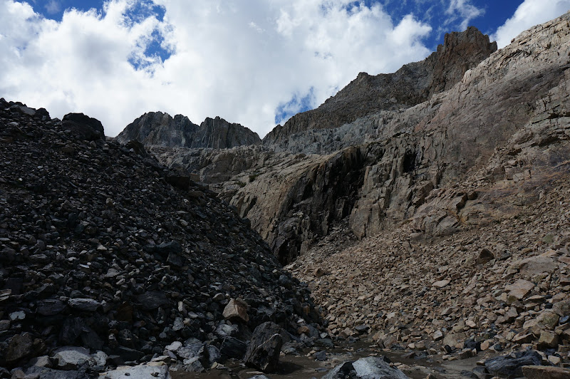
The climb up to Conness Pass had three sections: steep...
...very steep...

...and not quite so steep.

Despite the steepness, we were soon at the top of the pass.

Even with a bigger search party, we failed to locate the Conness Pass boundary marker. We didn't spend a lot of time searching--the terrain was open and flat enough that any tall rock pile that the surveyors built next to the marker should have stood out, but there were no signs of any such pile. It was also getting late, and we still had several hours to hike--and a long drive home.
There are numerous routes back down to Secret Lake; we choose the direct assault route.
It had a few exposed sections and one minor tricky bit to descend.

Secret Lake was just as nice in the evening light.

The final march to the car was uneventful; the temperatures were mild and the setting sun enhanced the colorfulness of the terrain.

In the distance we could see some tall clouds, but above us was only clear, blue sky.

The trailhead was in shadow as we arrived.
We still needed to get dinner and the other car. We would not make it home until early Monday morning. It was a full weekend--one with no regrets!

More Pictures

