OD and I headed up Saturday morning to join the advance party. Before we were to reach our trailhead, the Pink One insisted that we search out boundary marker #41. While OD and I tried to joke that we had already been there and claimed the marker, in fact it was the advance party who had sniped it from us—and left the obligatory water bottle and other decorations.

Compared to 58, 41 it was a walk-up. Just sayin'
After the marker detour, we continued along our logging road to the park boundary, which was also perhaps the most non-descript trailhead in Yosemite, a gate and barbed-wire fence being the only indication that one could start a hike from here.
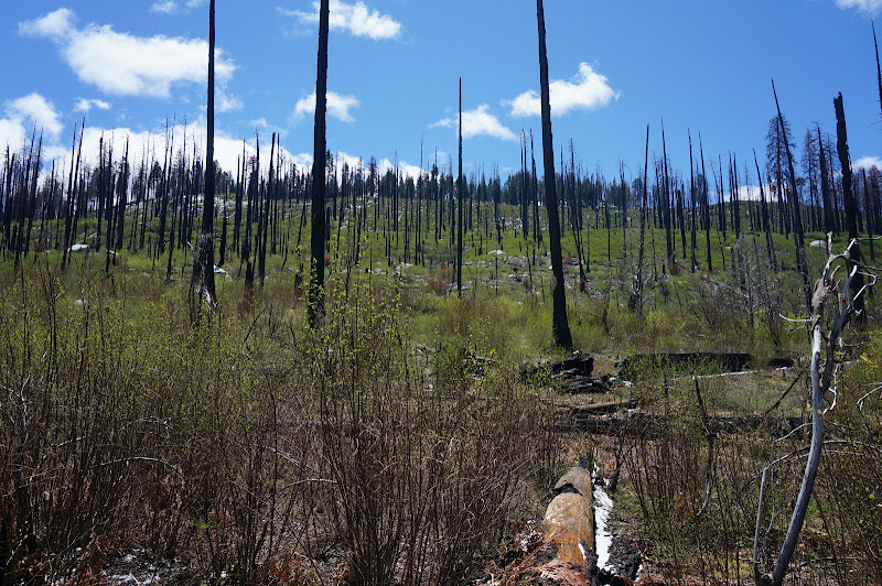
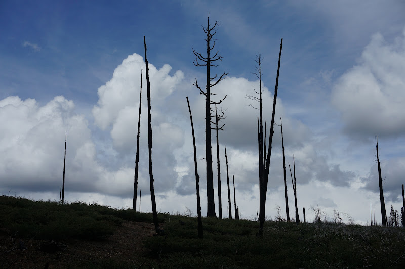
Our hike started in a nice forest, and there were a few peek-a-boo views of Tueeulala and Wapama Falls—and in the distance Smith Peak--but we soon entered a large burnt out area, the results of the Rim Fire and others before it.
Our trail—really a road—ended at a small water tank that fed a small pipe that apparently provides water for Camp Mather and the Mather entrance station. A small creek flowed below this water tank and crossed the trail below a small waterfall.

Past this area the trail climbed a few hundred feet somewhat steeply up an open, burnt hillside.

We could see the remains of the light snow from the past few days; JKW and the Pink One had experienced it first-hand the previous night. Eventually we reached the crest of the hill.

After a brief descent we were at Cottonwood Meadows, a location indicated by a small sign. It seems that “destination” signs are slowly disappearing from the Yosemite backcountry. Perhaps in this GPS-enabled age you don’t need a sign to tell you that this meadow is Cottonwood Meadow.

There was a short boggy stretch that resulted in a few wet feet, but the meadow itself was fairly dry to walk across. The trail we were following went straight through the meadow, perhaps a relic from its origin as a way to move cattle between Smith, Cottonwood, and Ackerson meadows and the Hog Ranch area. A more modern trail would certainly have been routed through the surrounding forest to reduce impacts, and our trail would have been relocated were it more popular than it is. In fact, the tread was barely visible here, as in many places.
Just past the meadow was a small rock almost completely covered with mortar holes; perhaps this route pre-dated the cattlemen.

Around this place we started to encounter persistent snow—just a few inches at most, but a clear indication that winter was not completely gone. The snow was never deep, but was a bit slushy and slippery in places. Fortunately it was never deep enough for us to lose the Trail Quest-certified route.

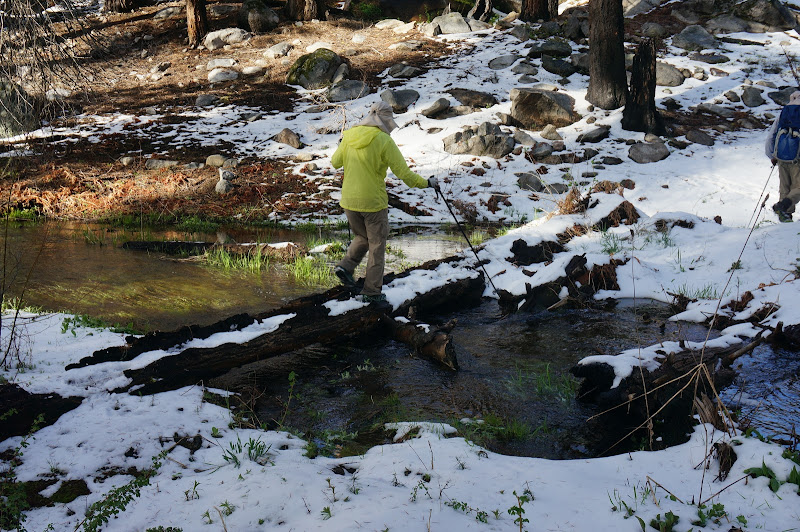
The first crossing of Cottonwood Creek involved carefully trying to keep our feet dry despite marshy conditions everywhere. Fortunately a small log provided for a mostly dry crossing of the creek itself.
After another climb, we faced a short, snowy descent to Smith Meadow and the second crossing of Cottonwood Creek. The meadow itself was mostly snow covered, and in a few places we could see the tracks of bears who had crossed it in the past day or so.

Another party was camped near the location of the former cabin; we decided to give them their privacy and head to another location. From their camp they were day hiking Smith Peak—something we were also planning on doing.
By the time we got our camp set up, there wasn’t quite enough time to do Smith Peak, so instead we opted to finish another missing Trail Quest segment that had been the result of some unfortunate navigational guidance a year ago. The trail had been obscured by deeper snow and brush then; the snow we encountered this weekend wasn’t deep enough to completely conceal the correct route, although we also were not surprised that we had lost it where we did—several tall willows and other shrubs were growing in the middle of the trail.

After making sure the current and previous GPS tracks joined, we headed back to camp.
Despite there being snow all around us, the evening was quite mild and we enjoyed a nice dinner in the backcountry—and after that a nice night’s rest.
Our goal for Sunday morning was Smith Peak, so after breakfast and some packing, we left OD and our camp behind for our summit push. The tracks of the other campers lead to the top—but since they hadn’t followed the official trail, we had to go our own way. (In fact, they may have been trying to follow the trail as it appeared on the topo map; as with our previous evening’s segment, the topo map did not have an accurate alignment for the trail.)
The snow was a bit firm compared to the mushy conditions of the previous day, but it mostly made for easy travel, and as we climbed we enjoyed the views to the south and southwest.

Butter Mountain: Home of Marker 45. We hope.
At some point our guide did manage to lose the trail (“I think I went this way… no, maybe this way…”)—the only markers indicating the current alignment of the trail were cut logs large enough to have not burned in the recent fires. However, the route to the peak was obvious, and soon we were at the sign marking Smith Peak—still a few hundred feet below the summit. (Apparently in the past it had been located closer to—but still not on—the summit itself.)

Unfortunately the steep climb to the real summit involved crusty, compacted snow that was challenging to make steps in. Of course we hadn’t bothered to bring our crampons or microspikes—it was spring, after all. We slowly and carefully climbed to the summit, step by step.
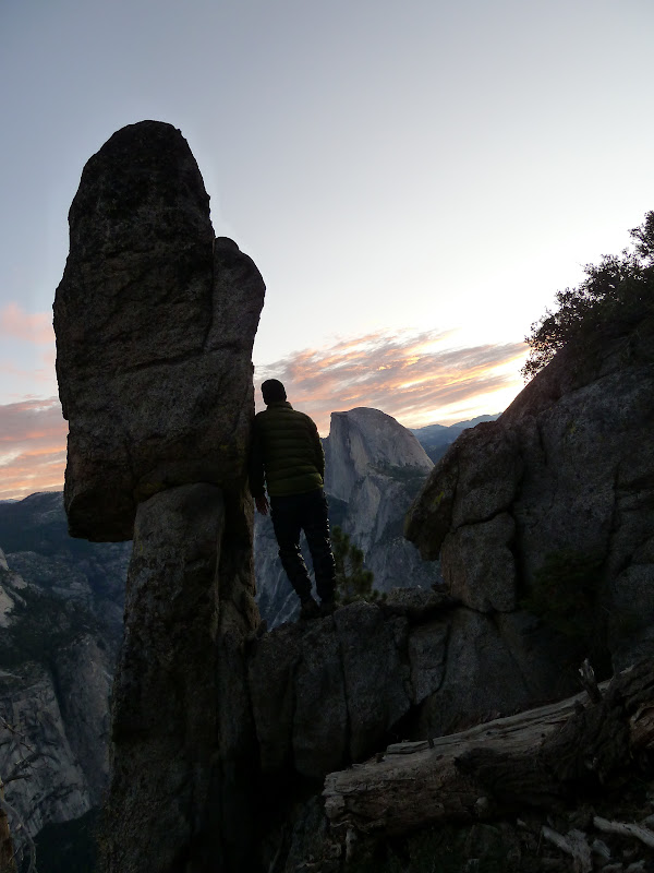
We eventually reached the broad flat area just west of the summit, then after a short brushy scramble were on the summit block itself. The views all around were worth the effort. We couldn’t see the two major waterfalls of Hetch Hetchy from the summit, but we could see many of the peaks surrounding us, including Nance, Tower, Conness, Volunteer, Hoffmann, Clark, and world-famous “Jorge”.

The forecast had been for rain by noon, but it looked like the weather would hold off until later in the day.
After the obligatory photo ops and signing the trail register, we carefully returned to the summit sign. The snow had fortunately softened just a bit.

On the way down we were able to locate the few sections of trail we had missed on the way up, with only one minor stretch of backtracking to satisfy the Trail Quest judges.*

Both the judges and the contestant were smiling
Another segment checked off, we returned to camp to pack. The Pink One had to be somewhere more important than Yosemite so he left us and bombed back towards the trailhead. (That’s the theory at least—we understand there were a few exploratory diversions along the way.) OD, JKW, and I opted to return via the Smith Meadow trail, connecting back to the Cottonwood Meadow trail via a short cross-country segment that would avoid the two creek crossings and a major boggy section.

This section of trail followed some pretty cascades along Cottonwood Creek. It seems that this creek should dump into the Tuolumne River in several places—and its waters probably do seep through to feed several streams that do join the river-- but it stubbornly avoids the main river and instead joins the Middle Fork south of Cottonwood Meadow.
After leaving the Smith Meadow trail we stopped for a nice lunch. The clouds were threatening rain by this time, but we stayed dry. The cross-country section was short and straightforward; the only routefinding challenge was locating a clear path through the sharp thorns of the buck brush, something the deer that had been there before us had done quite well.

Once on the trail, we headed back to our trailhead, stepping off the faint path only to bypass the short boggy part of Cottonwood Meadow.
The clouds were getting a bit darker and the wind a bit more chilly, but we remained dry, perhaps in part due to JKW putting on her pack cover.

Because of the threatening weather, we skipped checking off a few minor Trail Quest sections near our trailhead; they would be easy enough to do at a later date. JKW and I would be leaving in just a few days for the Emerald Isle and would probably experience more than enough rain there, so we didn’t want to have to worry about drying our gear before packing again a few short days later. As it turned out, just a few drops hit us—enough to bring out the umbrellas, but not enough to get them really wet.
It was too bad the Pink One had had to rush out; we had a great hike back to the trailhead with OD. We had an excellent and enjoyable trip in another “boring” corner of Yosemite. But as the Great Pink One says, “It’s all good!”. Or is that “Yosemite is better!”
* On the radio, we were informed that if we had made it to the peak from the meadow, we were Trail Quest approved. Unfortunately this was a split opinion between the judges, so to play it safe we made sure to hit all the bits of trail we could identify.
More Pictures
Edited 1 time(s). Last edit at 04/28/2016 01:38PM by basilbop.