All posts are those of the individual authors and the owner of this site does not endorse them. Content should be considered opinion and not fact until verified independently.

Bearing North
September 12, 2016 07:20PM
For the first time in several weeks I started from the trailhead with the usually Advanced Party. The first day would be repeating familiar terrain, albeit under different, mostly drier, conditions.


Wapama Falls was surprisingly dry given how large the Falls Creek drainage is. No water flowed under any of the numerous Wapama Falls bridges.


The mountain mahogany were all displaying white, fuzzy... flowers?


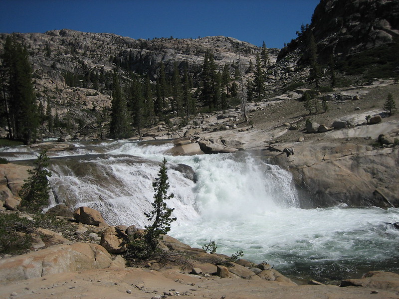
We stopped for lunch--and filled up with water--just below the Rancheria Creek bridge. Fortunately this creek had a bit more water than Falls Creek had.


After lunch we started the long climb up Rancheria Mountain, hoping that the usually dependable water near our intended camp site would not let us down. Unfortunately, small black flies bugged us during the climb up. JKW was smart enough to use her head net; the bird brains for some reason did not.


There were a few light clouds which thickened into the afternoon. A breeze gave some welcome relief from the mid-elevation warmth.


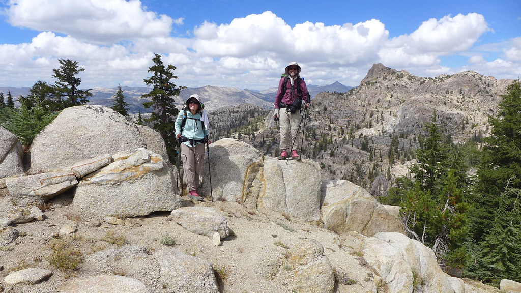
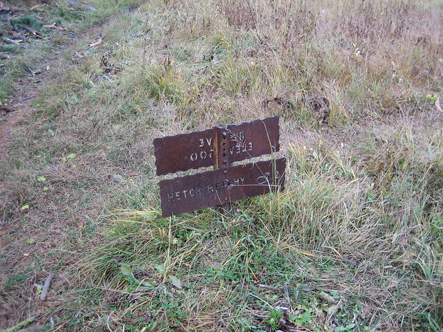
Unlike the previous weekend's well-worn trails, this one appeared to receive few visitors.


Fortunately, the small creek near our intended campsite--the only obvious one on Rancheria Mountain--was still flowing. We set up camp, then the Pink One and I searched for, and failed to find, a historical cabin supposedly in the area. We returned to camp to enjoy dinner and a good night's sleep.


The next morning was chilly and overcast, with a slight (to me) or strong (to JKW) hint of fire smoke. The Pink One decided to bop along a few ridges, while JKW and I followed the trail towards the Pleasant / Bear Valley Junction, where new trail for both of us would begin. We had completed most of the climb up Rancheria Mountain already, so the walk to this junction was quite pleasant despite the overcast conditions.


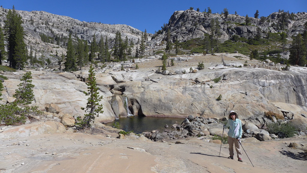
After passing the junction and starting fresh trail, we climbed to a small lake and had lunch near it.


Eventually our mostly wooded path led to an open meadow near the high point for our (or at least my) weekend.


From the high point, we could see Bear Valley below us to the north as well as other prominent high points of Northern Yosemite.


After dropping down a series of decent switchbacks, we reached the floor of 8400' Bear Valley.


We had one more short climb to the base of a prominent rugged spire.


The lake's water was warm; except for the cool breeze and the dark clouds that constantly blocked the sun, it was a perfect lake for swimming--and boating. There ended up being a bit of down-clad boating, and much less swimming.


Fortunately our campsite had some protection from a few small pine trees. At one point we heard some voices from the other side of the lake, but we didn't hear or see anyone else that evening. The breeze continued into sunset as we prepared and enjoyed dinner and the sunset show.


A few strong gusts of wind hit us during the night, but fortunately the wind calmed a bit, allowing for another good night's sleep.


The next day would be all-new for me, but the Advance Party had already hiked a good bit of it--with Payday-deprived Bearproof, in fact, en route to meeting M and me at Bond Pass. After breakfast, we left the lake, passing the two hikers whose voices we had briefly heard the previous evening. They were the only people we had seen since the Rancheria Falls area. We then began the descent into Kerrick Canyon, which reminded me a bit of Muro Blanco.


After a good descent we reached the valley floor. Rancheria Creek was dry here, and JKW was back on familiar trail.


Perhaps if the trail connecting Kerrick and Stubblefield canyons had been built in the post-cavalry era, judicious use of dynamite may have allowed the trail to stay closer to the canyon floors, but the actual trail climbed up several hundred view-filled feet, only to drop down into Stubblefield.


Fortunately a small, developed spring on the drop into Stubblefield was still flowing with cool water. We filled up here, then had lunch on a dome a bit farther down the trail.


After lunch, we dropped to the shallow creek in Stubblefield Canyon. JKW and Bearproof had wanted to take a dip in it, but the shallow, gravelly bottom disappointed them. Worse, the promised Payday bar apparently was a reward for climbing out of Stubblefield, not into Stubblefield. While the descent had been through rough and blocky granite, the climb was up smooth, white granite.


Our climb brought us almost as high as where we had started that morning; the spire we had camped below was a prominent landmark.


Eventually we reached the top of "Payday Hill", with nice granite to sit on, great views, and a distinct lack of a Payday bar.


From there we had a shorter, wooded descent to where we would leave the PCT. I was surprised how close we were to Tilden Lake and Bond Pass--we were really in Northern Yosemite, which JKW (until recently) and I had long neglected. A few more free days would have allowed to finishing some more trail segments in this area, but I left with a good reason to return, as if I needed one.


We headed south, passing through gentle, wooded terrain. We had left the steep canyons behind us.


We still had one more decent climb before reaching our destination; fortunately we were treated to views of Rancheria Mountain's broad, forested "summit", and in the distance Mt. Hoffman, Florence Peak, and Tuolumne Peak. Oh, and finally we could see "Jorge" (a/k/a (Muir) "Gorge" ) Mountain.


Before our final drop, we could see down into Jack Main Canyon. I would be hiking out without the Advance Party the next morning--they would stick around for a few more days to finish off some more trail segments. I had two choices for my hike out: via Jack Main or Tiltill Mountain. Both seemed to be about the same trail mileage, and I ultimately decided I'd head out via Tiltill, since Jack Main would be the better route for the inevitable return.


We eventually reached our destination. After quickly setting up camp, there was some quick Boat Quest action and late-evening swimming. The previous day's clouds were gone, but the cool breeze was not, making for a quick, brisk dip in the lake.


We had just a few minutes of direct sunshine to warm up a bit before the sun set behind the ridge across the lake from us. After it disappeared we enjoyed dinner as the day slowly faded away. Once again we all slept well that night.


After breakfast, JKW boated the lake. We would have to return in the future to put a significant dent in the BoatQuest for this area, so I volunteered to hike out the boat.


I had decided to hike out via Tiltill Mountain and Valley. The Advance Party would spend a few more days checking off some trail segments, but I had to return home. Just past the junction we had passed the previous afternoon were some wonderful dry campsites with excellent views.


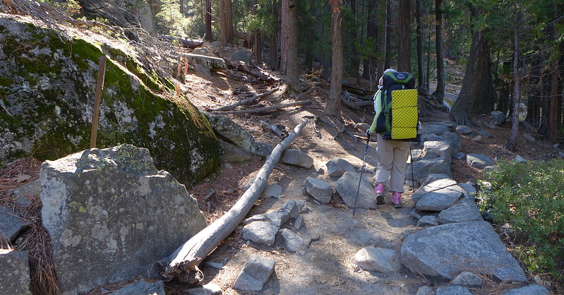
The hike towards Tiltill Valley was a nice stroll through open forest at first, with occasional openings exposing typical Yosemite granite.


I looked for another historical cabin at a small meadow where a century-old map said I might find it, but I could find no remains of the cabin.


Eventually the gradual trail started its steep descent into Tiltill Valley. It was obvious I was still several hundred feet above it, not to mention Hetch Hetchy itself.


The nice trail became a rocky, gravelly, and slippery adventure as it dropped steeply into Tiltill, but the views did not disappoint. Somewhere early in this descent the black flies became enough of a nuisance that I gave in and put on my headnet, sacrificing some access to the cool breeze for improved levels of sanity.


There were a few faint paths through the grassy valley towards the junction I knew was somewhere "in the middle". I picked the one that headed in that general area, and after meandering around a bit, arrived at the junction, thus completing my TrailQuest segments for this weekend.


The historic maps indicated that another cabin had once occupied Tiltill Valley, at the base of an old trail alignment. I was a bit ahead of schedule, so I retraced my steps a bit and checked out an area that looked like it would have been the obvious place for a cabin--flat, open, yet shaded well from the hot summer sun. I found no signs of the cabin itself, but did find a few axe-chopped stumps and, confirming that I was in the right general area, a few T-shaped blazes along what was almost certainly the old bottom segment of the Tiltill Mountain trail (located west of the current alignment).


I left Tiltill Valley and headed down to Rancheria Creek, aiming for the base of the cascade area for lunch. The cascade was not much given the creek's meager flow, but I found a nice place in the shade to have lunch and rest a bit, and a nearby pool provided clear, cool water.


The final several miles back to the dam were a contrast of hot sun and cool breeze.


I stopped at the high point where open rocks overlook the reservoir; there were no trees to get between me and the breeze.


I met the first day hikers I encountered since the first day in near Wapama Falls; I suspect they were all disappointed at the trickle of a fall they had hiked three miles to see. One, who had hiked a bit past Wapama, asked how much farther to "the waterfall". I said it was another 3-4 miles and that the flow wasn't much better than Wapama's.


I made it to the car at a reasonable time, and after washing, exchanging some gear with the Advance Party's vehicles, and raiding their food bin, I was on my way home. It was another excellent trip along a trail that I'm not sure I would have ever hiked without TrailQuest... but am glad that I did.
avatar Re: Bearing North
September 13, 2016 06:37AM
Regarding Wapama Falls' lack of water...there was water flowing in Falls Creek when I hiked from Dorothy south to Wilma at the end of August, does it just evaporate in Vernon and not flow out, or is there some porous ground it peters out in downstream from Vernon?
avatar Re: Bearing North
September 13, 2016 06:52AM
We were there w/i days of you... Wapama was actually still flowing...
You just had to look closer... smiling smiley

Here is Jack Main Canyon / Falls Creek JUST below Wilma...

WATERFALL!


in comparison... high water... same area...


Chick-on is looking at you!
Re: Bearing North
September 13, 2016 09:20AM
To be fair, for Wapama, we saw "water" dripping over rock above us while on bridges, but dry dry dry at bridges. Just soaked in/evaporated by that point.

Tiltil had water flowing. Same with Rancheria, obviously.
avatar Re: Bearing North
September 13, 2016 06:57AM
THANKS for the TR and the awesome trip!


You prolly keep hear me whining about "where the heck is the XYZ sign!?"
Well... argh!

Kerrick Canyon
Moraine Meadows
Chiquito Pass
Benson Pass
Benson Lake
Miller Lake
Merced Pass

why? these are amazing! why remove them!?????!?!?!?!?!

from 2006:


sigh


Chick-on is looking at you!
Re: Bearing North
September 16, 2016 09:16AM
Quote
chick-on
why? these are amazing! why remove them!?????!?!?!?!?!

Are you referring to the location/destination signs? I believe that they are removing them as they are superfluous signs in Wilderness. Trying to keep the installations to a minimum.


Edited 1 time(s). Last edit at 09/16/2016 09:16AM by buster.
avatar Re: Bearing North
September 16, 2016 04:29PM
Quote
buster
Trying to keep the installations to a minimum.

And full employment for SAR?
avatar Re: Bearing North
September 19, 2016 11:12AM
Quote
buster
Quote
chick-on
why? these are amazing! why remove them!?????!?!?!?!?!

Are you referring to the location/destination signs? I believe that they are removing them as they are superfluous signs in Wilderness. Trying to keep the installations to a minimum.

Hi Buster.

Yeah, the "desination" signs...

Personally I like them... I hope that whomever decided this... keeps them somewhere... and doesn't just junk them...
I would think that would be a shame...
There are still some out there... so it's a bit of a "what da heck?!" for me...
Lower Ottoway
Bear Valley
Lower Twin Lake
Summit Lake
Summit Pass

Are the ones I can think of off the top of my noggin. Not sure what the harm was/is...
Benson Pass had more than just the pass sign...

So yeah, not really pleased that they have been removed.


Chick-on is looking at you!
Re: Bearing North
September 19, 2016 09:25PM
Speaking of signs...

Have you noticed the difference between the NFS and NPS signs when crossing a boundary into/out of said areas? I was again reminded of the stark difference in aesthetic quality again when crossing over Mule Pass between Inyo NF and Yosemite NP. The NF signs blend in very nicely, with carved (routed) letters in natural wood stylized boards. The Yosemite signs look like they were ordered from some 60's era Soviet factory: block letters in a stark rectangular aluminum sheet. No doubt the NPS signs will last far longer than the NFS signs. Still, the contrast is striking to me.

Of course, if I had to choose between spending funds on signs or keeping wilderness wild, I'd choose the latter without hesitation.
avatar Re: Bearing North
September 20, 2016 07:59AM
Trail Sign!

tongue sticking out smiley

Ah... it took me awhile to see what you mean... (was trying to find if there ever was a Mule Pass sign there)
(I couldn't find one in my sets o pix ... have one of the Hoover sign... so I'm guessing it's been the same since 2007)
(In 2002 there was a nice Peeler Lake sign) (guess since it doesn't flow into Yosemite... they removed it long ago)
smiling smiley

Anywho... I see what you are saying... the "Entering Yosemite Wilderness" signs... definitely agree...
A Lot to be desired there... but the rusty metal signs... are iconic imo and at minimum should be
kept and displayed somewhere...


Chick-on is looking at you!
Re: Bearing North
September 20, 2016 08:59AM
Yes, I should have made that clearer to avoid confusion. I meant the signs indicating entering/leaving the NFS/NPS designated areas.

I do like the old, rusted, torch-cut (apparently?) metal trail signs in Yosemite. They seem (to me) to be a reminder of "the olden days" in the park - but not environmentally damaging, like the firefall (I did not ever see that myself...). On the recent Benson loop we saw several that that had been reduced from their original state being proudly displayed on stakes at about 3-4' level to boot-level on a pile of rocks with about a 6" post to keep them somewhat upright.

Several years ago (maybe 10...) when on trail in Yosemite, after being approached by a Park Ranger to produce a wilderness permit, I asked a question that had been on my mind for some time: "how can it be that the trail distances on the (metal) trail signs are often so incorrect, and not even consistent with one another?". I was referring to the case where, say there are contiguous points A, B and C along a trail - two consecutive segments, A-B and B-C. A sign at point A says "B: <m> miles, C: <n> miles". Then at point B a sign says "A: <!=m> miles, C <!=n-m> miles". How can that be?

The answer was: "In the old days, the trail distances were marked by someone pushing a wheeled mechanical measuring device along the trail. It would bounce along and often be quite inaccurate. With modern GPS measurements we can see how inaccurate they are. The NPS is slowly replacing signs with more accurate distance markings, and until they are all replaced, you'll not only see inaccurate distances but distances that are not even self-consistent".
avatar Re: Bearing North
September 20, 2016 10:31AM
Ya. It's interesting to find these mileages on some maps...

And then hear this map is better than that map... That map has errors..
yadda yadda yadda...

ALL maps have some errors... nothing is perfect... and obviously the signs
are incorrect in many locations... but having a general idea of how far
something is ... is better than having no idea at all...
But that's me.

smiling smiley

Also interesting to see some things misspelled...
Booth
Chiquita
Wilmer

And then there's the old
Olmstead v. Olmsted

Sigh...


Chick-on is looking at you!
avatar Re: Bearing North
September 20, 2016 11:53AM
Quote
chick-on

ALL maps have some errors... nothing is perfect... and obviously the signs
are incorrect in many locations... but having a general idea of how far
something is ... is better than having no idea at all...
But that's me.

Two Tenths count as a general idea?
avatar Re: Bearing North
September 20, 2016 12:29PM
Quote
Bearproof
Quote
chick-on

ALL maps have some errors... nothing is perfect... and obviously the signs
are incorrect in many locations... but having a general idea of how far
something is ... is better than having no idea at all...
But that's me.

Two Tenths count as a general idea?

0.2 leagues? 0.2 Astronomical Units?
avatar Re: Bearing North
September 20, 2016 01:15PM
Quote
ttilley
Quote
Bearproof
Quote
chick-on

ALL maps have some errors... nothing is perfect... and obviously the signs
are incorrect in many locations... but having a general idea of how far
something is ... is better than having no idea at all...
But that's me.

Two Tenths count as a general idea?

0.2 leagues? 0.2 Astronomical Units?

Yeah, once again I suppose I was not specific enough in my question. Was hiking a while back and I asked Chickon "how much farther?"
"Two tenths" says he.
Half an hour of hiking later I ask again...how much farther?
He looks at his Garmin, chuckles and says "Two tenths"
Repeat once or twice more...you get the idea.
Clearly I should have clarified the units.....
avatar Re: Bearing North
September 20, 2016 08:22PM
Quote
Bearproof
Quote
ttilley
Quote
Bearproof
Quote
chick-on

ALL maps have some errors... nothing is perfect... and obviously the signs
are incorrect in many locations... but having a general idea of how far
something is ... is better than having no idea at all...
But that's me.

Two Tenths count as a general idea?

0.2 leagues? 0.2 Astronomical Units?

Yeah, once again I suppose I was not specific enough in my question. Was hiking a while back and I asked Chickon "how much farther?"
"Two tenths" says he.
Half an hour of hiking later I ask again...how much farther?
He looks at his Garmin, chuckles and says "Two tenths"
Repeat once or twice more...you get the idea.
Clearly I should have clarified the units.....

This is why I have my own GPS and altimeter. I never ask how far nor how high, only "Where are we going?"


Old Dude
avatar Re: Bearing North
November 01, 2016 06:44PM
Quote
Bearproof
Quote
ttilley
Quote
Bearproof
Quote
chick-on

ALL maps have some errors... nothing is perfect... and obviously the signs
are incorrect in many locations... but having a general idea of how far
something is ... is better than having no idea at all...
But that's me.

Two Tenths count as a general idea?

0.2 leagues? 0.2 Astronomical Units?

Yeah, once again I suppose I was not specific enough in my question. Was hiking a while back and I asked Chickon "how much farther?"
"Two tenths" says he.
Half an hour of hiking later I ask again...how much farther?
He looks at his Garmin, chuckles and says "Two tenths"
Repeat once or twice more...you get the idea.
Clearly I should have clarified the units.....

Returning from Illilouette Creek I went to Nevada Falls along the JMT. I'd hiked that trail from Nevada Falls westward, but not to Nevada Falls eastward. At the trail intersection there was a sign saying "Nevada Falls 0.2". A minute later, with no trail intersection or other motivating factor, there was another sign reading "Nevada Falls 0.2".


Edited 1 time(s). Last edit at 11/01/2016 06:45PM by ttilley.
avatar Re: Bearing North
November 01, 2016 08:54PM
Don't feel bad...


Bearpoof has nightmares about this...


Chick-on is looking at you!
avatar Re: Bearing North
November 01, 2016 09:42PM
Quote
ttilley

Returning from Illilouette Creek I went to Nevada Falls along the JMT. I'd hiked that trail from Nevada Falls westward, but not to Nevada Falls eastward. At the trail intersection there was a sign saying "Nevada Falls 0.2". A minute later, with no trail intersection or other motivating factor, there was another sign reading "Nevada Falls 0.2".


Isn't that second "Nevada Falls 0.2" sign you came across (with no obvious trail intersection) a tale-tale sign of a former trail intersection with a no longer used (or re-aligned) trail?


Leave No Trace
Re: Bearing North
November 02, 2016 10:26AM
Quote
plawrence
Isn't that second "Nevada Falls 0.2" sign you came across (with no obvious trail intersection) a tale-tale sign of a former trail intersection with a no longer used (or re-aligned) trail?

If this is the junction of the JMT and the Panorama trail, then yes: there used to be a "Y" junction here, but the eastern branch (which I think started near the phone "booth", which I think has also been removed...?) was removed/restored several years ago.
avatar Re: Bearing North
November 02, 2016 11:20AM
That's the right trail junction.

It did seem unusual that the old sign would have been left and a new, identical, sign installed, in preference to moving the old sign.
Re: Bearing North
November 02, 2016 01:09PM
There are more than a few former trail junctions that still have the signs indicating that a junction was once there. This is very helpful for those of us who try to re-discover these trails. In another thread I mentioned the Bald Mountain Trail to Ackerson Meadow trail; there's a sign where this junction presumably once was (it's all armpit-high buck brush now...). There are also some signs in the Canyon Ranch area for what was once the start of the Poopenaut Valley - Miguel/McGill Meadow trail--in this case it's all knee-high buck brush. And as discussed elsewhere on this forum the May Lake mystery trail (north of May Lake) has signs on each end of it.
avatar Re: Bearing North
November 08, 2016 06:55AM
The junction...


The old trail is obvious to the left there (we be heading back to the other junction...
where the single "Nevada Fall 0.2" sign is.. ) (junction to Deer Camp) tongue sticking out smiley
(it was easier to just take this photo last Thursday... than take half an hour looking
for it.. ) (of course it got the usual "why are we going this way?" )
(the distance of 0.2 is about right... and about right for both signs)

Have fun (eye dooz)


Chick-on is looking at you!
avatar Re: Bearing North
September 26, 2016 07:14AM
Case in point...

Beehive one ... removed...
Laurel Lake ... still there...

Why remove Beehive? It's on the sign post that tell distance to Hetchy...
So now there is a blank area above...

sigh


Chick-on is looking at you!
Re: Bearing North
October 03, 2016 02:03PM
Quote
chick-on
Case in point...

Beehive one ... removed...
Laurel Lake ... still there...

Why remove Beehive? It's on the sign post that tell distance to Hetchy...
So now there is a blank area above...

sigh


Not sure what happened there. It does seem odd so could have another explanation.
Re: Bearing North
October 03, 2016 02:02PM
Quote
chick-on
Quote
buster
Quote
chick-on
why? these are amazing! why remove them!?????!?!?!?!?!

Are you referring to the location/destination signs? I believe that they are removing them as they are superfluous signs in Wilderness. Trying to keep the installations to a minimum.

Hi Buster.

Yeah, the "desination" signs...

Personally I like them... I hope that whomever decided this... keeps them somewhere... and doesn't just junk them...
I would think that would be a shame...
There are still some out there... so it's a bit of a "what da heck?!" for me...
Lower Ottoway
Bear Valley
Lower Twin Lake
Summit Lake
Summit Pass

Are the ones I can think of off the top of my noggin. Not sure what the harm was/is...
Benson Pass had more than just the pass sign...

So yeah, not really pleased that they have been removed.

The sign removal started with the elevation signs, just the elevation - no name, and then continued on from there. Ran out of steam to remove them. Partially as the other signs aren't so 'bad' and also because the sign removal isn't trivial. Imagine packing out a big metal sign and post, and even just getting the post out. At this point, the sign removal is mostly stalled and is on a case by case basis.

I see your point, but I would flip it around and ask what is the need for them?

I'll ask around to see what happened with the signs. I suspect that they weren't just tossed.
avatar Re: Bearing North
October 04, 2016 10:12AM
Quote
buster
I see your point, but I would flip it around and ask what is the need for them?

I'll ask around to see what happened with the signs. I suspect that they weren't just tossed.

Ya... I can see that argument too. Definitely not needed. Kinda nostalgic on my part I guess.
Can definitely see the argument for removing signs atop Benson Pass, and signs like
Miller Lake and Benson Lake ... not sure the reasoning for removing signs that are on posts
that have mileage signs also (ala Beehive and Kerrick) .. but ok
I found it interesting the powers that be added the big PCT signs... probably a good idea
since you find peeps scratching PCT ---> on the other ones and such...

Ah... also.. found it interesting that the Smith Peak sign... made it's way down from the Summit
to before the climb to the top... smiling smiley (i.e. ridge below it)

Anyway, thanks Buster


Chick-on is looking at you!
Re: Bearing North
October 15, 2016 05:21PM
I don't like the PCT badges at all. They seem really garish and out of place in the backcountry. Last week when I came to the PCT junction hiking down the Summit Pass trail I noticed that someone had removed the PCT badge below the trail sign:


I assumed it was a souvenir collector.

Elevation/location signs were still in place for Summit Lake and Pass.

avatar Re: Bearing North
October 17, 2016 07:06AM
Yeah. We thought it was funny how the Summit Pass and Summit Lake signs were
back to back and had elevation of 10,250 and 10,203 ... both off ...
The Virginia Pass elevation sign is still there also... (JKW had done the pass
twice last year... but... ahem... cough cough... was with me... so... ahem...
oops... we had to do it properly this year... wink )
Anyzoo... they put PCT big signs on many of the posts... the badges on the trees
are disappearing (literally into the trees)..
Here is former Kerrick Canyon sign ... now with PCT sign..


Also interesting in this photo is how the tree has grown in 10 years (not a lot I would say!)
and how the stump hasn't decayed much... (ok, JKW is interesting too)
Look above in this thread for it in 2006 ... (this was from Aug 2016)


Chick-on is looking at you!
avatar Re: Bearing North
September 13, 2016 07:14AM
Payday Hill is quite honestly "Astounding!"

With a tasty treat at the TOP... to boot!


Tanks for Sharon Aaron


Chick-on is looking at you!
avatar Re: Bearing North
September 13, 2016 07:48AM
Quote
chick-on
Payday Hill is quite honestly "Astounding!"

With a tasty treat at the TOP... to boot!


Taunks for Sharon Aaron

Grrrrrrr
Re: Bearing North
September 13, 2016 04:43PM
great photos! Thanks for the share!
Re: Bearing North
September 16, 2016 09:33AM
Great trip and report.

I think that lake by Bear Valley is my favorite unnamed lake in the park. The lakes by Seavey Pass and the lake just off trail between Kerrick and Stubblefield Canyons are really nice too.
Re: Bearing North
September 28, 2016 10:35AM
Thank you, Basilbop, for enabling me to spend an utterly fabulous August (and early September) out there! I was so glad you could join us on the last trip and on the various other trips before!

Thank you, Chick-on, for putting up with me and showing me all kinds of neat stuff!

I wish I had the time to write up a trip report of our big trip.. but... it'll have to wait a little longer, lots of catching up still to do!
avatar Re: Bearing North
October 04, 2016 10:14AM
I'd do it all over again. (including the bickering)
smiling smiley


Chick-on is looking at you!
Re: Bearing North
October 10, 2016 01:26PM
Thank you for taking the time to write this very excellent trip report.
The photos are beautiful.
Sorry, only registered users may post in this forum.

Click here to login