All posts are those of the individual authors and the owner of this site does not endorse them. Content should be considered opinion and not fact until verified independently.

Hike To Sierra Point
June 27, 2017 11:05AM
I spent a week in the valley last week, and another chance to hike to Sierra Point. The route was in similar as it has been the past few years. The main difference was the amount of water you could see from there. The view was so amazing, that two 13 year olds with us were actually impressed (that didn't stop them from complaining about the steep hike it took to get there though grinning smiley).
Here is Illouette Falls from 6/23/17


Again from 4/29/16


Finally from 6/14/15


One more, just a bit closer from 6/21/17


The 90+ degree weather last week really made the falls look great, it just made hiking to them way more difficult, but it was worth the sweat!
Re: Hike To Sierra Point
June 27, 2017 03:01PM
Wow! that's a lot of water. I don't recall seeing that much in Illilouette, ever.

Thanks for the great pictures.
Re: Hike To Sierra Point
June 27, 2017 03:49PM
I've said it before-the last 30 feet of the Sierra Pt. hike
might be the coolest stretch of trail that I've found
in Yosemite.

Lucky you.
avatar Re: Hike To Sierra Point
June 28, 2017 07:18AM
Kewl beans!

Tank fur sharon!

Awesum

Yeah, dang... that's a whole lotta water coming down Illilouette!
Would love to see what the confluence above looks like...

Gotz any pix of Buena Vista / Clark Range... ???

ags might find interesting...


Chick-on is looking at you!
avatar Re: Hike To Sierra Point
June 28, 2017 07:33AM
Dang...

This was 2010 June 26...


and... um... yeah... you had more... so... what did Vernal Look like!???!

2010:


Chick-on is looking at you!
Re: Hike To Sierra Point
June 28, 2017 08:49AM
I have a few photos of the Clark Range from the Panorama trail, no zooms though. I'll be going there this September. Not sure the snow will be all melted by then.


A shot from the Vernal Falls railing. Water was flowing swiftly a good 5' inside the railing, so I wasn't able to get as close as in years past. I didn't feel like being one of those people that don't have a healthy respect for the raging river.


I'll post more if I can get some from others in my group.
Re: Hike To Sierra Point
June 28, 2017 11:33AM
Great pics, thanks! I don't think I've seen the perspective you have in the one with a good length of both the Merced and Illilouette in one view. The Merced falls are so spectacular that I hadn't really thought (or seen) how they account for just a small fraction of the elevation loss from LYV to HI.

I think you're right: there may still be snow in places in the Clark Range in September. I think that for our upcoming trip, Buena Vista/Horse Ridge may not have too much (hard to see from your pics). At least I know there are some places where one can walk on granite in the park. :-)
avatar Re: Hike To Sierra Point
June 28, 2017 01:08PM
ags, you'll mostly be on stuff like you see on Badger Pass webcam...

but the slopes of Horse and Buena still have a lot of snow ... so...
if you get to Horse or Buena you'll more than likely be in a lot of it...

Take pix

Have fun

And if the going is a pain in the boot... turn around... head back down...
and try another trailhead ... should be lots of options now... smiling smiley


Chick-on is looking at you!
Re: Hike To Sierra Point
June 29, 2017 11:48AM
Roger that on the pix.

We'll surveil and adapt to conditions. Wonder if we can get up on Horse Ridge on the "normal" route up the "ramp" from the west? (seems like (on YouTube) there is another route up a crack/chute that people seen to gravitate towards. Presumably more due south of Ostrander Lake. Not sure why it is so popular, but I bet it's not easy now) And down to the SE? (w/out crampons! smiling smiley )

If we do get to the Hart/Edison Lakes area, we may head north on trail - up to where there is the mega-confluence of Red/Clark/BV/Ililouette Creeks... it would be very cool to be able to XC over on the flat between that trail and the trail that parallels Illilouette on the north side (due west of Grayling Lake and NW of peak 8081) so we can get near Starr King... I'm hopeful because it would separate out the total mega-flow in the lower portions of Illilouette where it is currently impassible at the Mono Meadows junction (per latest NPS report) into the individual BV, Illilouette,Red, and Clark feeders (separately, smaller flows individually). But it looks like they each drain a pretty big basin on their own...

So much adventure to be had this year! :-)
avatar Re: Hike To Sierra Point
June 29, 2017 02:16PM
If you follow the map I drew... it's none of those options.
Unless the Ramp is what I drew on the map... and which was
/ is used to be the Buena Vista Crest Ski route...

I've been up and down Horse Ridge in 5 different locations...
and 3 of them are not going to be doable at the moment...
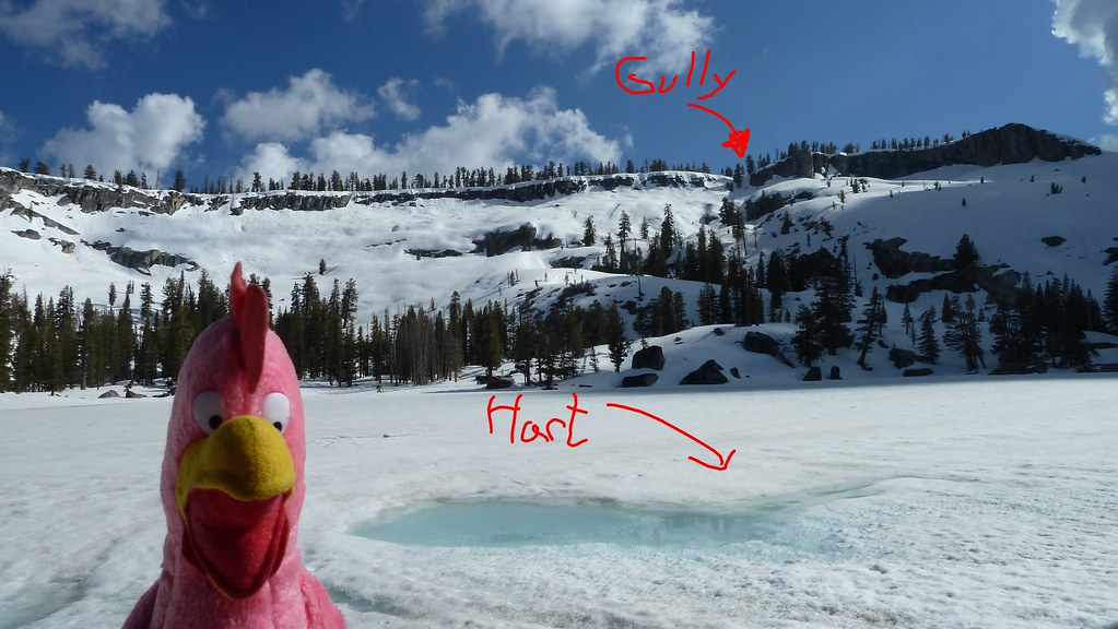
The two gullies are going to 100% snow coverage and therefore
moot about using them... almost certainly... and the westmost climb
is probably not very safe at the moment either...
I wouldn't recommend going down them without something to
self arrest yourself...

Anywho... I really don't think you are going to be able to safely
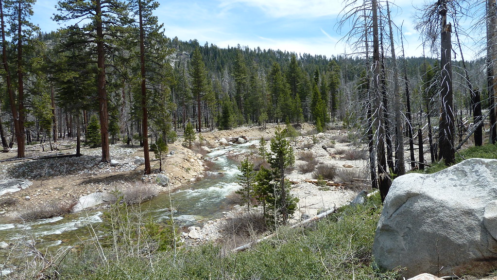
cross BV Creek or Illilouette Creek currently.

The Mono Meadows creek has been problematic in and of itself.
I put up pictures and such this year or last when it was brought up.

Anyway, whatever you do have a safe and fun trip


Chick-on is looking at you!
avatar Re: Hike To Sierra Point
June 29, 2017 07:21PM
This is Buena Vista in a higher flow time...


taken here:
https://mappingsupport.com/p/gmap4.php?ll=37.657766,-119.498956&z=15&t=t4

We didn't cross... be aware that area... has a LOT of buck brush too... and
MAY be yummy ...
And you still have to cross Illilouette and Ottoway Creeks...

Always be prepared to go back from wherest you came...

w/r to the Eastern-most Gully...


Be safe


Chick-on is looking at you!
Re: Hike To Sierra Point
June 29, 2017 07:38PM
Now THATS information I can use. If I am ever disoriented, I'll just look for the giant pink bird...

Looks like the chute/gully is NOT in my future this year.

And where you took the picture is pretty much exactly where I was thinking we might cross. It's just a picture... and what counts is what it looks like when you're standing there looking at it... but it doesn't look too bad (from this chair)... Looks fast, about a foot deep, no boulders to get smashed on or falls to go over... but like you say, there's still Illilouette and Red and...

Thanks.


Edited 2 time(s). Last edit at 06/29/2017 07:42PM by ags.
Sorry, only registered users may post in this forum.

Click here to login