All posts are those of the individual authors and the owner of this site does not endorse them. Content should be considered opinion and not fact until verified independently.

Buckeye Creek over the 4th
July 04, 2017 06:33PM
Each year we try to get in a backpacking trip over this four-day weekend, knowing that the conditions are never going to be great. It's always too early, the high country has too much snow, and the creeks are roaring. And this year that was putting it mildly.

Still, we had a plan. By driving over recently opened Sonora Pass, and then hiking up the relatively low elevation valley of Buckeye Creek, we hoped to explore a bit of the Hoover Wilderness that we hadn't seen before. And we had hopes of making up over the pass into Yosemite.

That didn't happen.


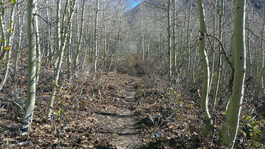
The trail crosses Buckeye Creek a couple of times going up the valley, and the first time the water was over our waist, and moving pretty fast. We chickened out. Instead, we decided to see how far we could get by hiking up the south side without a trail. We even hoped that we might make it to where the trail crossed back.


That didn't happen either. After a couple of miles, we were bushwhacking through a dense thicket of aspen trees that was no fun at all, and we couldn't see the end of it. So we called a halt, took stock of where we were, and decided to head back down to the last nice campsite we'd seen. Which is what we did.


And the next day, with our progress still blocked by high water, we headed back to the trailhead and drove back to our cabin above Sonora...where we spend a couple of luxurious days relaxing, barbecuing, and living a life of leisure.


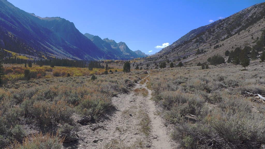
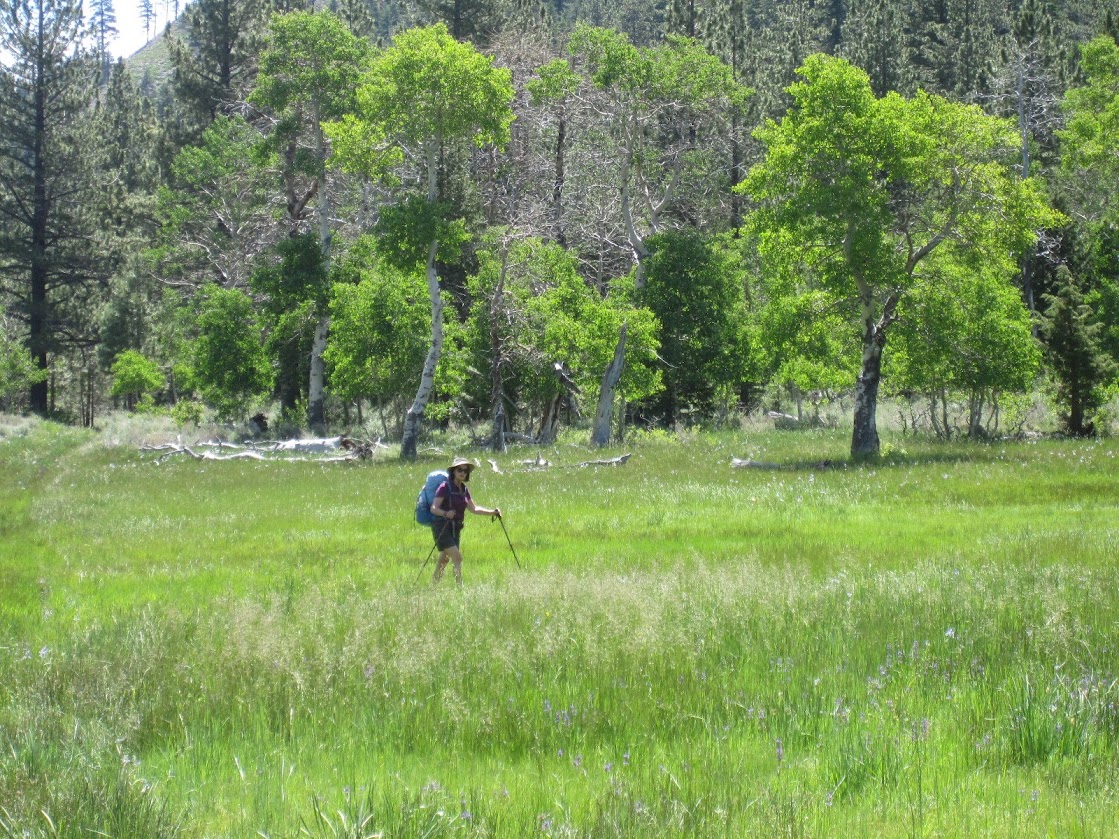
But we really did enjoy Buckeye Creek. We saw more swallowtail butterflies than we've ever seen in our lives, as well as a lot of other butterflies. The flowers were blooming everywhere. Once you get a few miles up the trail, the view up to Yosemite is spectacular. And we still got to log a few miles, sleep out in the peace, quiet, and isolation of the Sierra, and get some quality time together.


We also had a few missteps. Hacking through those aspens, we managed to pick up quite a few ticks, which we carefully removed that night before they did any real damage. But they did make for some interesting nerves that evening. And waltzing through those glorious meadows meant some soggy, muddy feet for P, whose boots are not waterproof. Big deal.

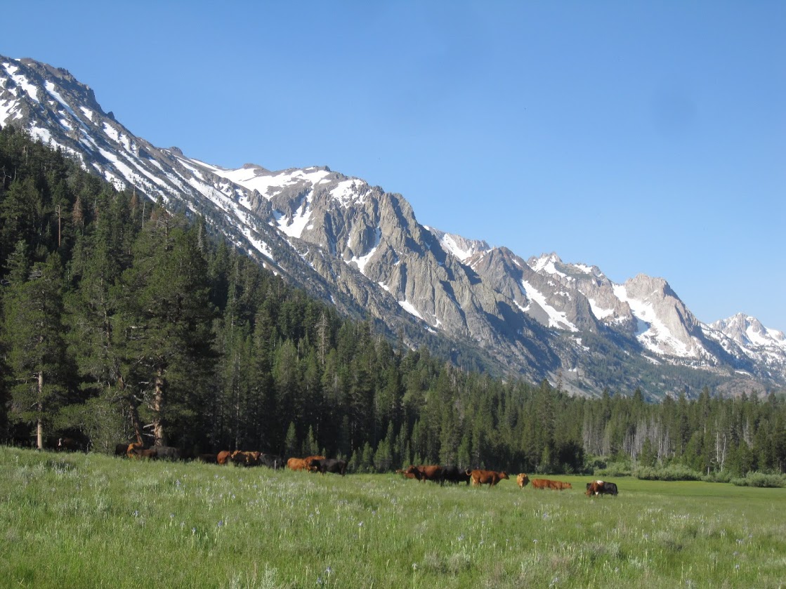
The local wildlife enjoyed the meadows:


Still, a small price to pay for a nice couple of days away from the rest of the world....


Here's a link to the rest of the photos: https://goo.gl/photos/T3NrrqFdTXexodLn8


Check our our website: http://www.backpackthesierra.com/
Or just read a good mystery novel set in the Sierra; https://www.amazon.com/Danger-Falling-Rocks-Paul-Wagner/dp/0984884963
Re: Buckeye Creek over the 4th
July 04, 2017 11:26PM
If one goes across the bridge north and then turns left west to the corral, there is a jeep road that goes through the sagebrush slope for 4.5 miles on the north side of that canyon ending up at Big Meadow. Beyond that are bunches of cattle tracks. But then Big Meadow is where the trail you took on the south side crosses to the north side:

http://mapper.acme.com/?ll=38.21372,-119.41120&z=19&t=H

Looking more at the satellite, expecting you 2 did not cross at Big Meadow, kept going along beyond there on the south side like you wrote until reaching this zone:

http://mapper.acme.com/?ll=38.20330,-119.41512&z=15&t=T

I'm not one to laugh though as if you read my second day going up Kuibbie Ridge last month, I got into an even worse marshy zone and then escaped through whitethorn.

sounds like a neighbor making popcorn all evening around here,
David

so you can take another wack at it on the north side

Check for a primitive camp spot here that looks like a protruding bench with a steep face including junipers. Lots of gnarly looking formations on the map and probably excellent
seep water supplies for plants.

http://mapper.acme.com/?ll=38.18901,-119.44703&z=15&t=T

David


http://www.davidsenesac.com


Edited 1 time(s). Last edit at 07/04/2017 11:27PM by DavidSenesac.
Re: Buckeye Creek over the 4th
July 05, 2017 07:38AM
Looking more at the satellite, expecting you 2 did not cross at Big Meadow, kept going along beyond there on the south side like you wrote until reaching this zone:

http://mapper.acme.com/?ll=38.20330,-119.41512&z=15&t=T

I'm not one to laugh though as if you read my second day going up Kuibbie Ridge last month, I got into an even worse marshy zone and then escaped through whitethorn.


That's right, David. Lovely area.


Check our our website: http://www.backpackthesierra.com/
Or just read a good mystery novel set in the Sierra; https://www.amazon.com/Danger-Falling-Rocks-Paul-Wagner/dp/0984884963
avatar Re: Buckeye Creek over the 4th
July 05, 2017 07:45AM
Believe it or not... but it's drier this year than it was in 2011...

There were no cows out yet then... only pies...

http://yosemitenews.info/forum/read.php?3,40408,40408#msg-40408

https://goo.gl/photos/rYh6vf1c7NxCN9YR9


Chick-on is looking at you!
Re: Buckeye Creek over the 4th
July 05, 2017 11:48AM
B, after posting I got interested in maybe doing a short backpack up there myself by using the north side of the stream as I suggested. Thus got out my Toiyabe NF map and noted a small area of private property that starts where the jeep road I related begins, at a corral. Probably used by cattle grazers and or horse packers. The private property only extends a short ways west and then beyond it is all national forest lands. The private property extends north to the base of where the canyon slope gradient increases and on the satellite is all typical sagebrush. Then phoned the Bridgeport Ranger Station and spoke to the gal there who related indeed there is private land there and it is signed as no trespassing.

I asked if there was any reason one could not avoid crossing the creek at Big Meadow by simply going around the private property by climbing up a minimal ways up on the slope, going west a wee bit, climbing back down beyond the private property, and then taking the jeep road to Big Meadow. She seemed to think that indeed was legal and an interesting idea that she had not heard of anyone doing before and if someone did so successfully to give her some feedback.

Looks like I am going to be stuck here in the SF South Bay into next week dealing with check engine light conditions that is preventing me from getting my Forester smogged so I can get past my delinquent registration. Otherwise would get on the road this week. I have some other queued places I want to do this July but snow conditions make those choices better after mid month so Buckeye Creek would work well now.


Oh and yesterday loaded my Ancient Bristlecone Pine Forest and Little Lakes Valley trips onto my 2017 Trip Chronicles feature.
David
http://www.davidsenesac.com/2017_Trip_Chronicles/2017_Trip-Chronicles-0.html


http://www.davidsenesac.com


Edited 1 time(s). Last edit at 07/05/2017 11:51AM by DavidSenesac.
avatar Re: Buckeye Creek over the 4th
July 05, 2017 12:00PM
fwiw...

Bridgeport Ranger told me that-a-way back in the day.
I can't remember his name though.

(ok, it's probably not worth much... )

Have come down that way. After awhile I start chucking cow pies...

Have fun


Chick-on is looking at you!
avatar Re: Buckeye Creek over the 4th
July 06, 2017 07:32AM
Still can't find his name... o well...

I'd go back in fall... we had talked about going back... but just too many other good stuff..
But if you hit it right... the colors... would be something...
(or for the east coasters... the color would be something)


z road:


further downstream:


(it kinda gets old... you could ride your bike... the wilderness boundary is a LONG way
up the canyon)

and the bridge...


I did some buckeye canyon comparison from high to low water somewhere too
around these parts..

o well... have fun


Chick-on is looking at you!
Re: Buckeye Creek over the 4th
July 06, 2017 08:25AM
Thanks for the trip report!

Hope others heed your good sense and don't do what isn't comfortable, be they water crossings, steep traverses, steep snow, sketchy snow bridges, you name it!
Re: Buckeye Creek over the 4th
July 06, 2017 05:36PM
There are some strange borders in that valley. Lots of small markers indicating where the national forest is, and where the private property is.

The cows didn't seem to pay much attention to them.

Then again, they don't have to, since it is all open to grazing, I assume. Too bad, because the cows tend to follow some of those trails in the meadows---and make them much deeper and muddier.


Check our our website: http://www.backpackthesierra.com/
Or just read a good mystery novel set in the Sierra; https://www.amazon.com/Danger-Falling-Rocks-Paul-Wagner/dp/0984884963
avatar Re: Buckeye Creek over the 4th
July 06, 2017 06:17PM
Guess at least they aren't in the wilderness...

http://yosemitenews.info/forum/read.php?3,28235,28235#msg-28235

sigh


Chick-on is looking at you!
Sorry, only registered users may post in this forum.

Click here to login