Welcome! Log In Create A New Profile Recent Posts
Vernel Fall, Merced River, Yosemite National Park

The Moon is Waxing Gibbous (81% of Full)


Advanced

Re: Help finding grouse lake

All posts are those of the individual authors and the owner of this site does not endorse them. Content should be considered opinion and not fact until verified independently.

avatar Help finding grouse lake
June 17, 2018 03:29PM
Hello all, its been a while since I've posted. Wanting to do an overnight backpacking trip up chilnualna fall trail to grouse lake. I know the lake (more like a seasonal miniature pond) is off to the side of the trail and can take a bit of scouting to find it. I just wanted to ask if anyone has any advice on how I can locate it and successfully navigate off the trail to find it. Thanks everyone! Someday I'll have to do the entire loop trail up there and visit the many lakes up there.
Re: Help finding grouse lake
June 18, 2018 09:09AM
I had a lot of fun finding it. We hiked past it, until we were well up the trail on the ridge leading to the next Lake. Then I triangulated a bit with the topo map and headed cross country down I to the valley to look for it. In the bottom of the valley I eventually got to a clearing and looked up the valley to the East to see where the lake could be. It wasn't there.

Then I turned around, and it was fifty yards away, in plain sight to the West.

Does that help? Grin.


Check our our website: http://www.backpackthesierra.com/
Or just read a good mystery novel set in the Sierra; https://www.amazon.com/Danger-Falling-Rocks-Paul-Wagner/dp/0984884963
avatar Re: Help finding grouse lake
June 18, 2018 08:54PM
Well... there really is a trail to the lake... more or less...

As you can see on the map... you could simply follow the outlet to the lake.
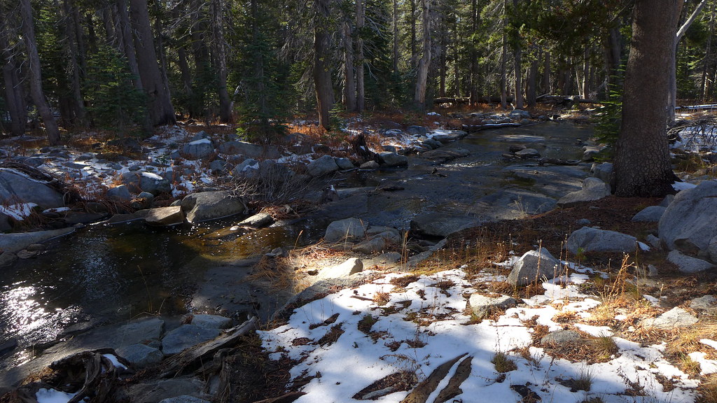
You'll see the outlet from the trail. It more or less may look like this:


about here:
https://mappingsupport.com/p/gmap4.php?ll=37.572826,-119.548567&z=15&t=t4

Once you see that... as I said you COULD just follow the outlet to the lake.

The trail has very few turns. However it turns DUE North at the "old" junction.
Once you realize this... you could simply turn around and head DUE South and you'd
hit the lake. You should be able / may be able to follow the old trail.
It really does take a 90 here:
https://mappingsupport.com/p/gmap4.php?ll=37.573098,-119.546206&z=15&t=t4

If you start pretty much doing any downhill... then you've probably gone to far and
are on your way to Crescent. That you will know unless they took out that sign too!
It was there in late 2016. But then again so was Fernandez Pass trail sign... and
that was gone a few weekends ago!
The ridge between Grouse and Crescent is here:
https://mappingsupport.com/p/gmap4.php?ll=37.573948,-119.538524&z=15&t=t4

Note that if you end up using a gps with a map (you have a phone ... no?)
Note that the trail on USGS is incorrect. The trail goes up this gully instead of
staying close to the outlet creek here:
https://mappingsupport.com/p/gmap4.php?ll=37.575955,-119.567002&z=15&t=t4

Turner Meadow/Chil Lake Jct to Grouse Trail is right around 2 miles.

Good luck.


Chick-on is looking at you!
Sorry, only registered users may post in this forum.

Click here to login