WED 7/21 – VOLUNTEER PEAK, SMEDBERG LAKE
3.1 miles
+1400’ / -1700’
(all mileages and elevation changes based on Caltopo)
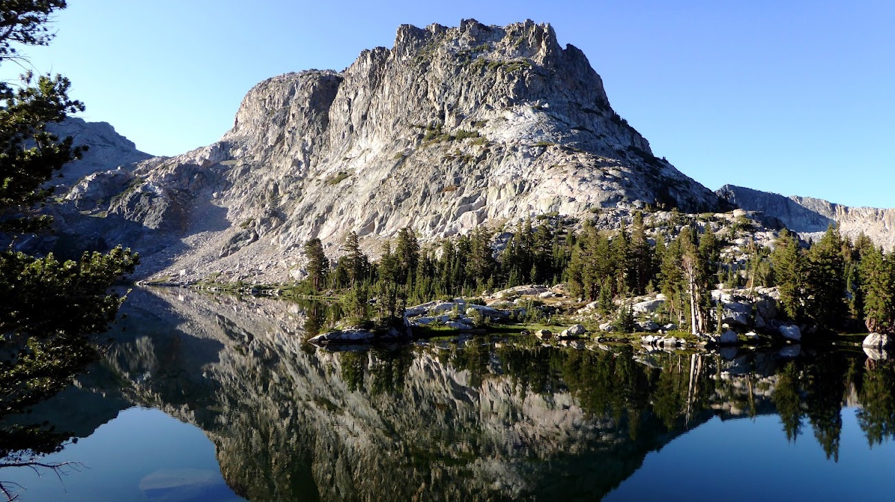
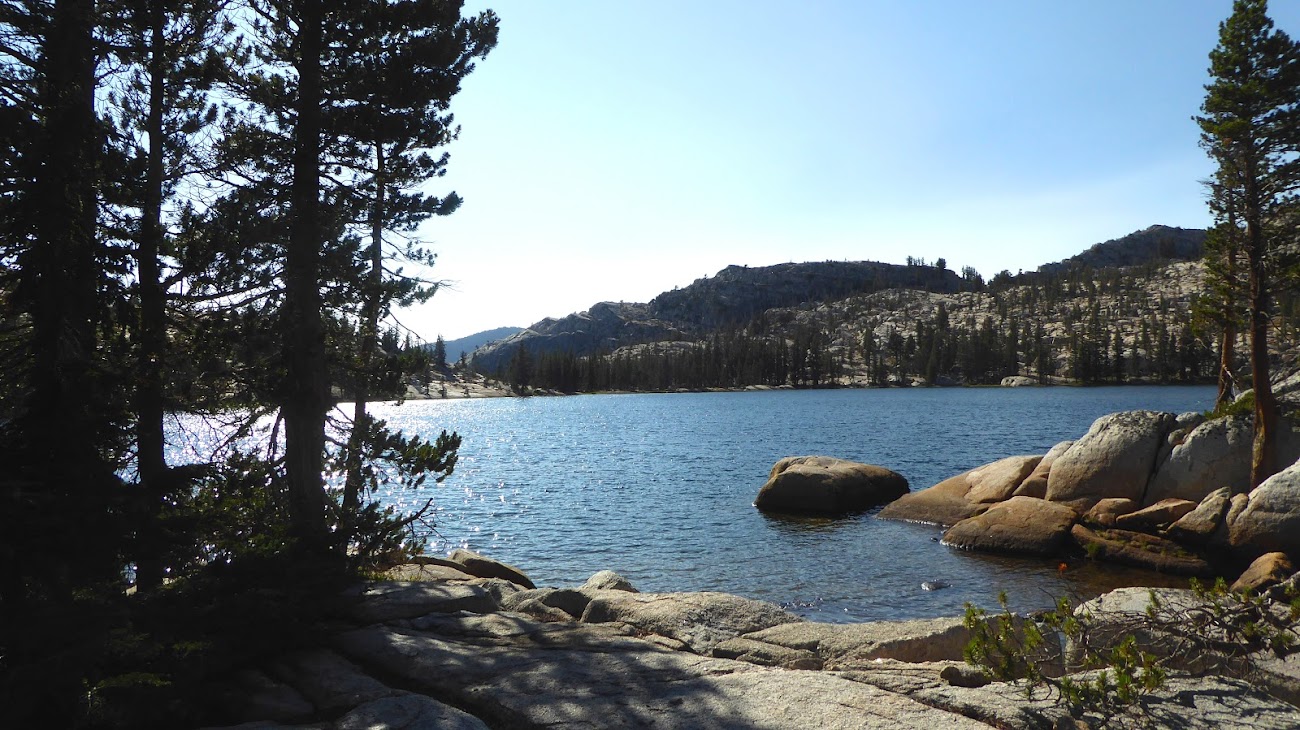
This was the day to summit Volunteer Peak. Waking up at Rodgers was lovely:


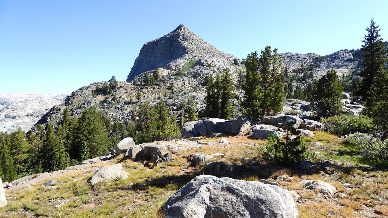
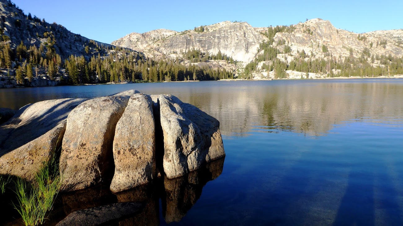
Climbing up out of Rodgers Lake:

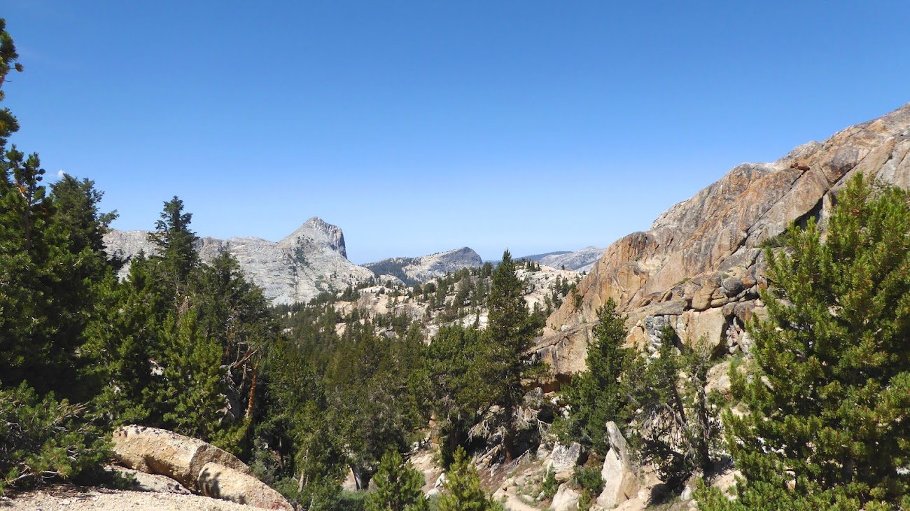
As the trail makes its closest approach to Volunteer Peak, I turned off the trail and headed for the top.
For the climb up the face of Volunteer I headed pretty much up the center of the SE face, which slopes up at a consistent 45°-ish angle and consisting of broken rock. The route I took was a full-on class 2 scramble, and it was challenging because the jumble of rock on this face of Volunteer isn’t climbed very much, so many of the rocks have not been pulled and pushed into settled positions, so instead there are many off-balance rocks that wobbled beneath my feet or were loose when I pulled up with my hand. If you do this climb with more than one person then spread horizontally on the face, no one should be directly below you and you shouldn't be directly below anyone else, just in case any rocks pull loose.
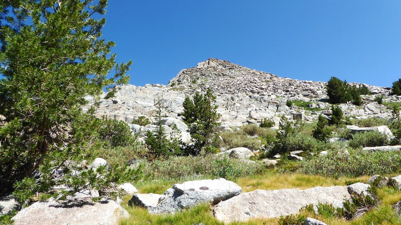

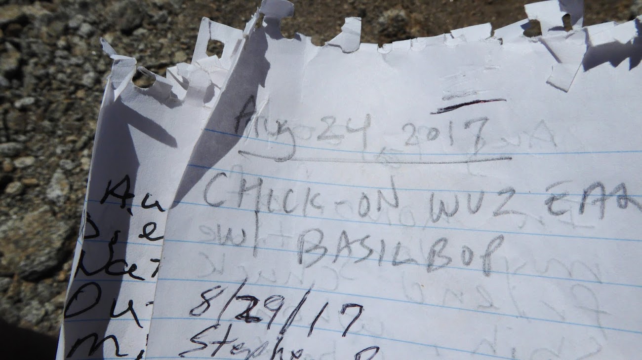
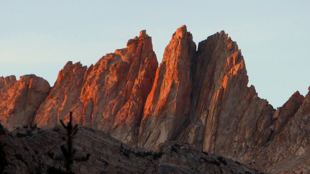
It was slow going and exhausting picking a route up this steep, unsettled jumble of granite, sometimes taking minutes to gain only a few feet. But I kept plugging away and then, suddenly, I pulled myself up to see what the next rock would be and I was standing on the top. Indescribable 360° top-of-the-world views up there – I have seen Chick-On proclaim this his favorite peak in the park, and I can see why. Not many folks make this climb, the summit register had only about 30 names in it since 2017. I found the names of a couple of friends in it and added my own.

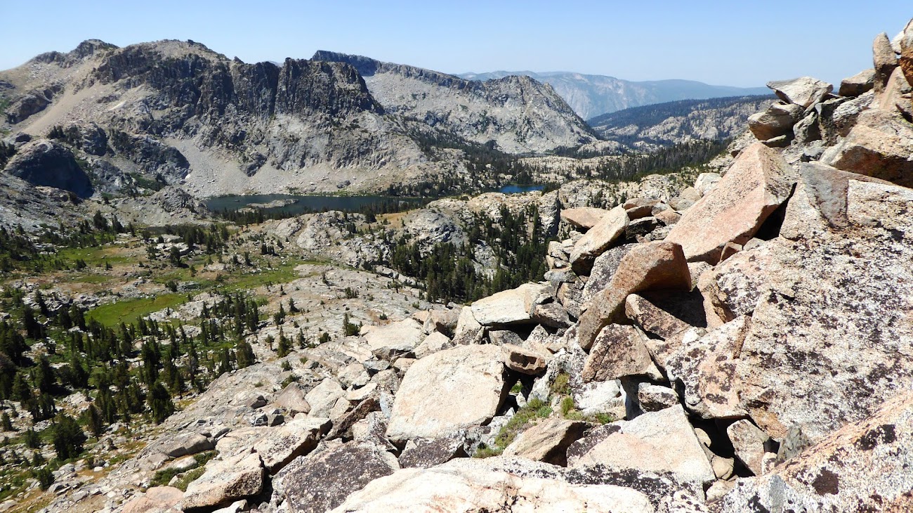
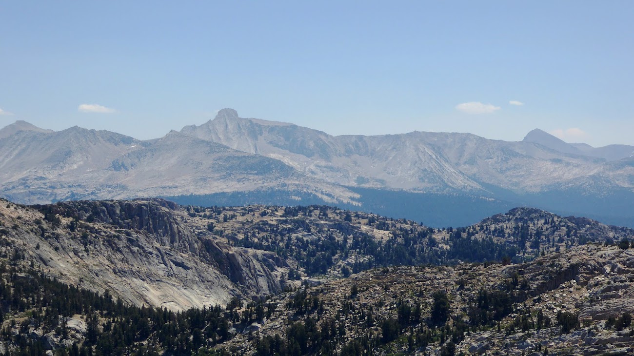
Looking down on Benson and Murdoch Lakes:

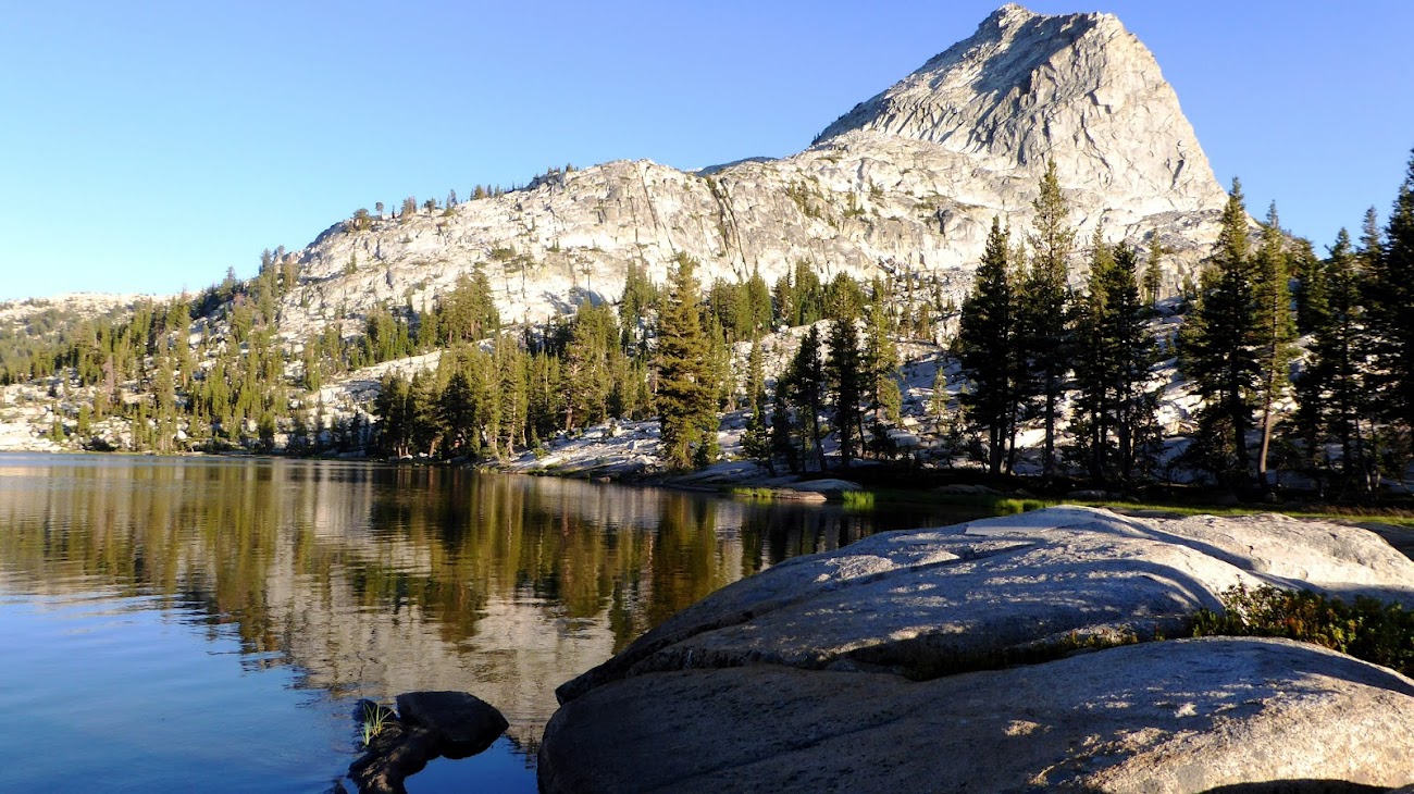
Smedberg, Sister and Surprise Lakes:

Way out to the north:
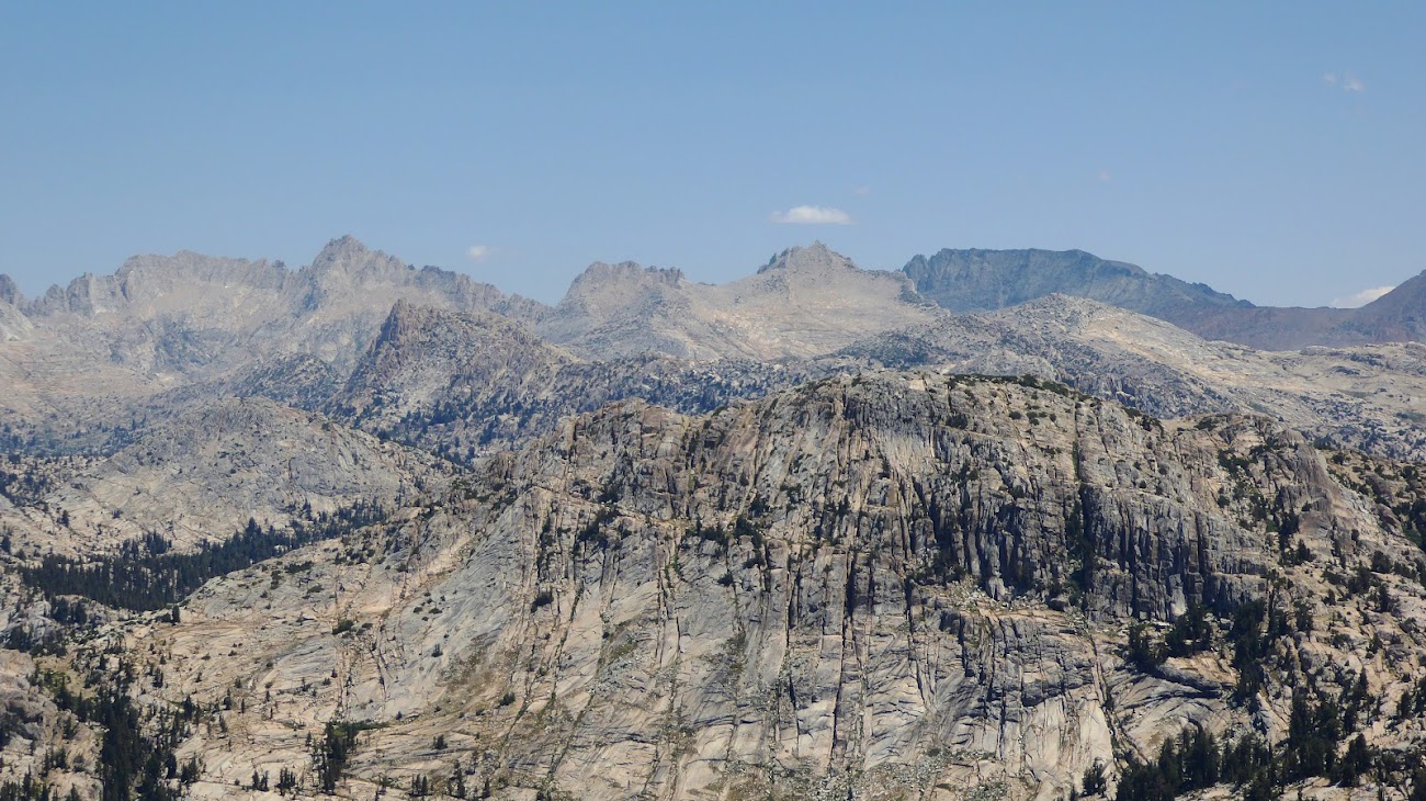
And south:
For the descent I came down more towards the saddle between Volunteer and the unnamed peak to its SE, then turned down to the right back towards the trail. But, it turns out I didn't turn far enough and missed the trail and then had a hard time finding my way back to it. But eventually I regained the trail and headed back down to the PCT and to Smedberg Lake.
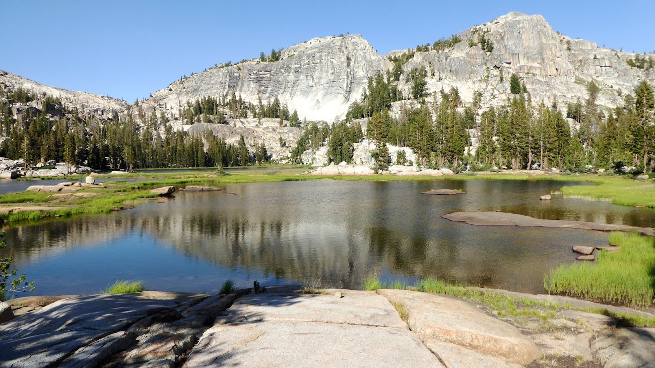
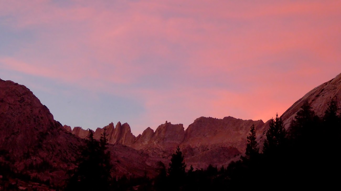
The trail from the Rodgers junction to Smedberg seems to drop a few hundred feet then climb back up unnecessarily, it seems from the topo map that there should have been an easier, flatter way to get there. Oh well. I camped at Smedberg Lake, following a use trail around the west end until I found an isolated spot that included views of both the lake and Volunteer Peak, now looking at it from the north.
 ’
’


Smedberg is very nice, but if choosing between Smedberg vs. Rodgers I definitely give the edge to Rodgers – more dramatic views, more isolated, and you get to see Volunteer Peak up close and from the south. So if you are in this area and debating camping at Rodgers vs. Smedberg, my unhesitating vote is for Rodgers. It does tack on an extra ~3 miles r/t, but worth it. Besides, getting to and from Rodgers likely involves taking the PCT, which passes right along the shore of Smedberg so you would get to see that lake anyway.
After this short but tough day, my shoe was in need of another fix-up, which I took care of that night, but I could see that at thst rate I would run out of duct tape before the end of the trek. Oh, and I also discovered that the seam at the back of that same shoe was starting to open, so I rigged up some high-strength multistrand fishing line I carry to hold that together as well.
THU 7/22 – BENSON PASS, MATTERHORN CANYON
10.7 miles
+2300’ / -2050’
This was my least favorite day of the trip. Don't get me wrong -- every day of this trip was amazing, but all in all this day had a higher drudgery factor for me, and it felt like the hottest day of the trip. The descent out of Benson Pass down to the floor of Matterhorn Canyon is supposed to be considerably less than the drop from Seavey to Benson Lake, but it seemed to take longer and was a harder on my knees.
But still, it was a fine day in the Yosemite wilderness, and there were definite highlights in approaching and crossing Benson Pass and then later heading up Matterhorn Canyon. Pretty good elevation gain on the day, but it didn’t really feel like it because most of that gain comes in Matterhorn Canyon, which has a steady but easy grade.
The day started off well enough:


Shortly after leaving out of Smedberg my shoe repair failed, so I begged and borrowed more duct tape as I went. A few PCT thru hikers shared some of their duct tape, not just for the repair needed right away but for re-repairs that would be needed until I got back to the trailhead in 2+ days.
The approach to Benson Pass is pretty mellow, certainly a climb but not much that's steep.

Benson Pass itself is one of the highlights of this day -- very nice, and approaching from the west it opens to a fairly broad, flat area so as you ascend the last few feet the views to the east open up dramatically with every step. And as you round the top, back to the west Volunteer Peak gives a final bow. At this point I had completed essentially a complete loop around Volunteer, starting with views from the west out of Seavey, from the south along the trail to Rodgers, from the north at Smedberg, and now finally from the east along the approach to Benson Pass.

I found the drop down from Benson Pass to be grueling. It felt like much more than the listed 1,000 ft decline. At least much of it is shaded, but the switchbacks down just kept going and going. I felt bad for the PCT NOBOers I passed climbing up this never-ending slog.

There is one confusing spot along this trail as it descends along Wilson Creek. The trail heads straight for the creek like it’s a crossing, but just at the creek’s bank it turns sharply to the left (for downhillers). But enough people have gone down to the water and even up the other bank that it looks like the trail crosses the creek. But on closer examination it’s clear that the banks of the creek are too steep here to be the actual trail.
The trail finally bottoms out in Matterhorn Canyon, turns north and begins the ascent. At the trail junction I left the PCT and found total solitude, not seeing another person from this point until the next night. The trail up Matterhorn Canyon is more exposed than I thought it would be – while this part of the canyon is pretty well forested, the trail mostly stays out in open ground.
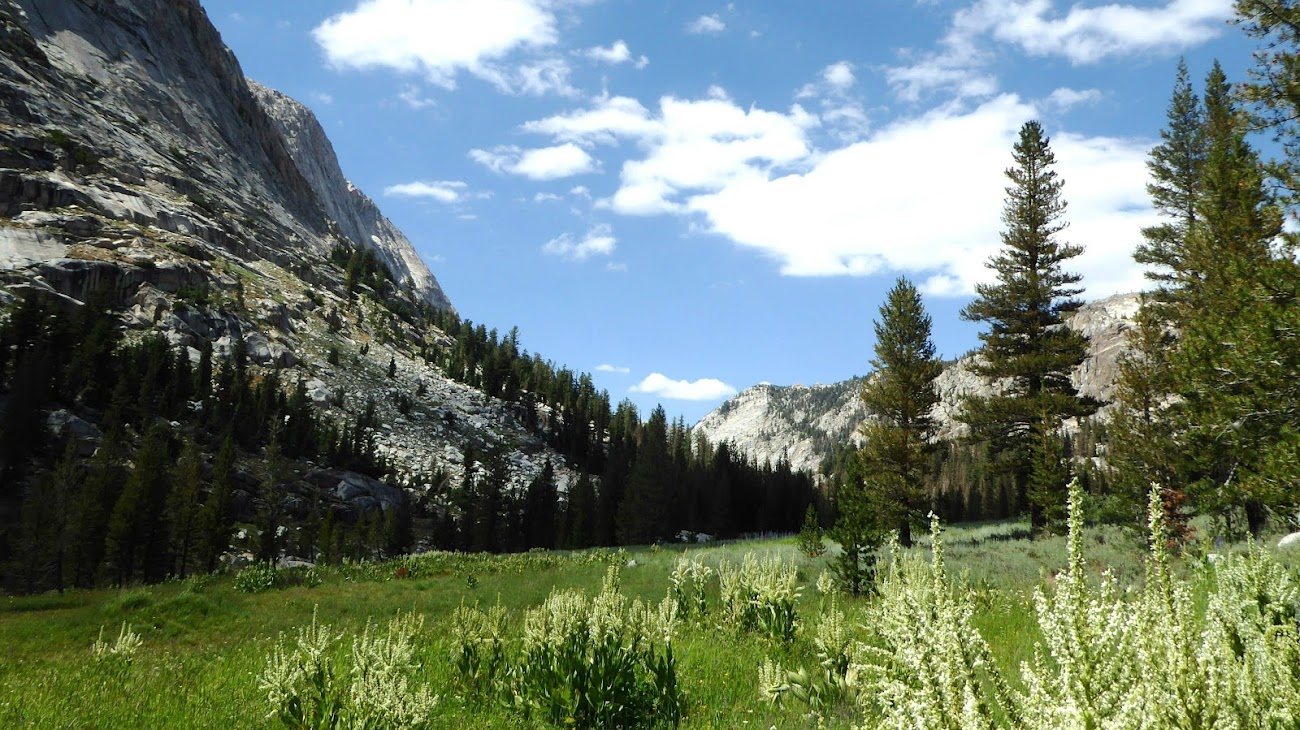


After a couple of miles beyond the PCT junction, the trail makes a broad “S” curve around Quarry Peak and the views upcanyon begin to open up, with first the Finger Peaks coming into view:

Then part of the Sawtooth Range coming into view, opening up more with every step.

After crossing Matterhorn Creek a few times the trail stays on the west bank as it climbs steadily but gently. Heading north of Quarry Peak I was running out of daylight in the deep, narrow canyon, and temperatures were starting to drop, so I found a great campsite up in the rocks. And while I may not have been the first person to ever camp in this spot, I probably was the first to camp here in a very long time because right there lying out in the open I found this antique can opener:
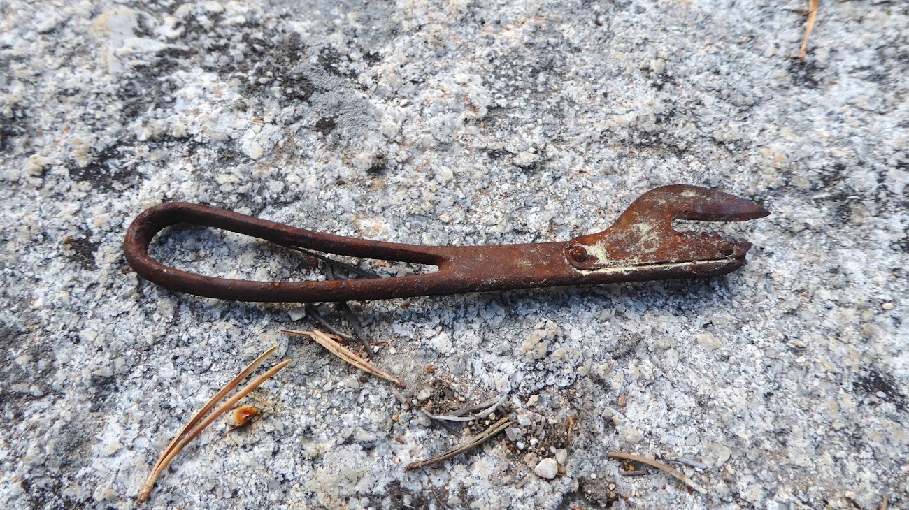
After I got home I got my google-fu on and found this exact can opener online. It dates to about 1890. So it’s been sitting there for as much as 130 years! Of course, I didn’t know this when I was on the trail, but it was clear to me at the time that this can opener was more than 50 years old, which I recall is the age at which the park considers an item to be a historical artifact, so yes, I left it where I found it, and when I got home I notified the park rangers about the item and its location. They were very appreciative. Hopefully if anyone else runs across it in the future they will leave it be as well. And in my trip report I purposely fiddled with the mileage and elevation change numbers for this day and the next so as not to identify the location on this public forum.
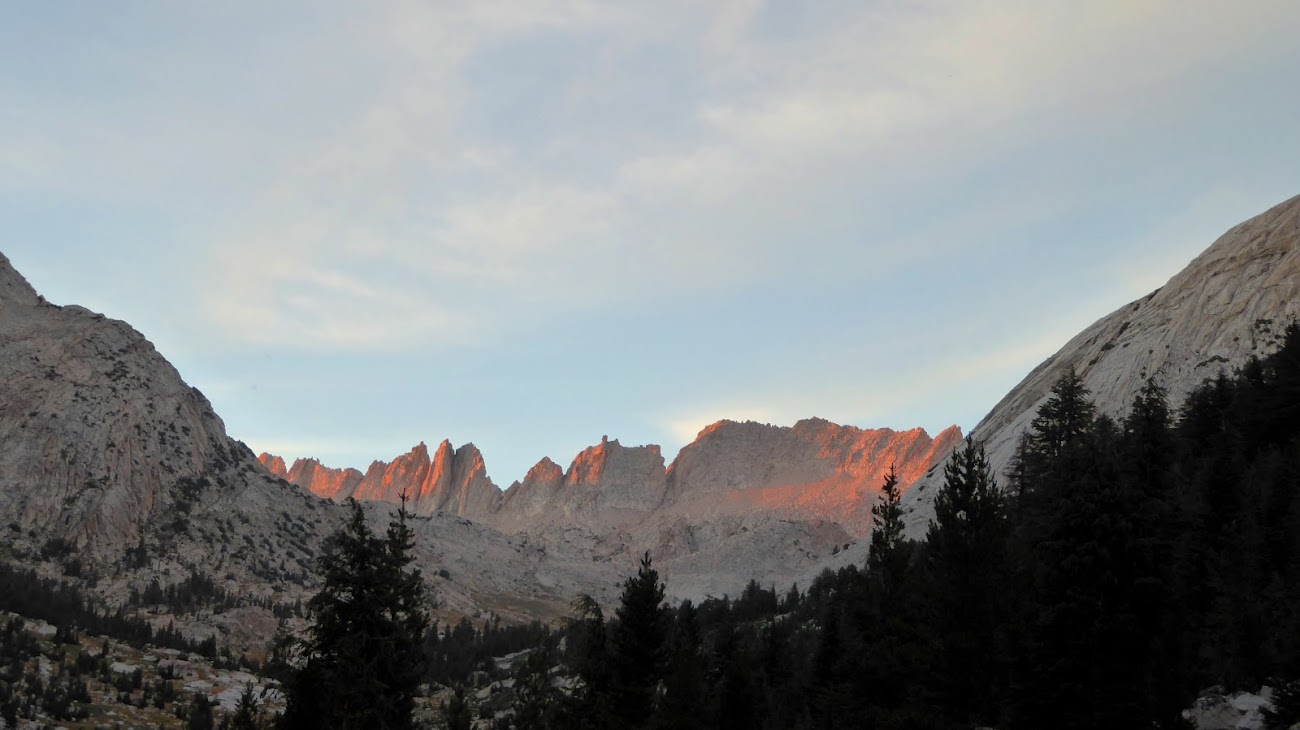
As the sun was setting I went a little nuts to get photos, because the alpenglow off the Sawtooths was spectacular. I criss-crossed the creek a few times and roamed up and down the canyon to get a bunch of photos from different angles:
This trip report continues here.
- Billy Joel
Edited 3 time(s). Last edit at 08/17/2021 06:52AM by JRinGeorgia.

