Welcome! Log In Create A New Profile Recent Posts
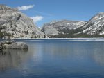
Tenaya Lake, Yosemite National Park

The Moon is Waning Gibbous (73% of Full)


Advanced

BLM Land at Briceburg Re-opens

All posts are those of the individual authors and the owner of this site does not endorse them. Content should be considered opinion and not fact until verified independently.

avatar BLM Land at Briceburg Re-opens
March 18, 2010 09:28PM
Storm damage has been repaired to lands along the Merced River at Briceburg managed by the Bureau of Land Management’s Mother Lode Field Office and roads are now open.

Bull Creek Road (Burma Grade) was closed in January from Briceburg to five miles north of the Merced River due to rockslides and the Merced River Campground Road was closed due to debris on road. Both roads are now open.

For more information on current roads conditions, please contact Jeff Horn, BLM outdoor recreation planner, at the Mother Lode Field Office, (916) 941-3101.

avatar Re: BLM Land at Briceburg Re-opens
March 18, 2010 10:12PM
A couple of years ago I was standing in the river with a few others doing a benthic invertebrate survey. We were talking to the ranger there about driving up the Burma Grade. He said it was a rough road and you need a truck or other such vehicle to go up it. All the time he was talking I was watching a mini van go up the grade.

I'm going to drive up that road this spring. Not sure where to go after I get to the top, but that's part of the adventure.
avatar Re: BLM Land at Briceburg Re-opens
March 26, 2010 09:26PM
UPDATE for March 2010: Merced River Recreation Area is OPEN

The road leading to the campgrounds has been re-opened and should remain open throughout the spring and summer camping season.

Bull Creek Road (Burma Grade section) is now open. The road is in fair condition for two wheel drive high clearance vehicles. Not recommended when wet.

From the high country of Yosemite National Park, the Merced River shows no mercy on its headlong rush through glacially-carved canyons, rugged mountains and foothills to the San Joaquin Valley. Ample access points allow you to punch rapids at your own pace. After a full day on the river, check out the Willow Placer, Railroad Flat or McCabe Flat campgrounds.

Wild and Scenic Rivers are a component of the National Landscape Conservation System.

When to go: April-August

Getting there: Highway 140 to Foresta Bridge. Take left on Foresta Bridge to Incline Road. Take left on Incline Road.

Put-in: Redbud, Cranberry, Briceburg and Indian Flat.

Take-out: Briceburg, McCabe Flat, Railroad Flat, Bagby Reservoir.

Portage: Mandatory at North Fork Falls.
Sorry, only registered users may post in this forum.

Click here to login