Welcome! Log In Create A New Profile Recent Posts
Half Dome, Yosemite National Park

The Moon is Waxing Gibbous (90% of Full)


Advanced

Old road and viewpoint?

All posts are those of the individual authors and the owner of this site does not endorse them. Content should be considered opinion and not fact until verified independently.

avatar Old road and viewpoint?
October 12, 2010 08:59PM
avatar Re: Old road and viewpoint?
October 12, 2010 09:11PM
This viewpoint? (eta: my bad, nope it's not this viewpoint. This is Inspiration Point on the other side of 41)


Edited 1 time(s). Last edit at 10/12/2010 09:14PM by calipidder.
avatar Re: Old road and viewpoint?
October 12, 2010 09:35PM
I'm going to have to check it out next time I'm in that part of the park.
Re: Old road and viewpoint?
October 12, 2010 10:31PM
It's not a lookout, and it's not an abandoned road. Roads and trails on a hill that steep are not built that straight. It consists of two straight line segments that lead directly from the Wawona Tunnel entrance to a point directly overlooking the old hydroelectric plant that used to be on the banks of the river.

So what you see was almost certainly cleared of trees for wires to carry power up to the tunnel. I don't see any power lines in the satellite photo, but they can be hard to see. Or they may have been replaced by a newer buried cable under the highway going up to the tunnel.

Feel free to check it out when you get there. The climbs of the Rostrum are nearby to the west, and the communications center on Turtleback Dome is up the hill (southwest) from this "lookout". The top of the Rostrum is a popular picnic area, and has almost the same views that this "lookout' would have, but is slightly to the west.
avatar Re: Old road and viewpoint?
October 13, 2010 07:02AM
Yup. Spot on.
This is in the same realm as the "Alien Landing Strip" near Gravel Pit Lake.
http://yosemitenews.info/forum/read.php?1,10240,10249#msg-10249
(remove the trailing > if you want to see the Condon pictures)

Was gonna check the one you mentioned eeek, but... at that opportunity didn't
have huge amount of time... and it's gonna not be as easy as what it
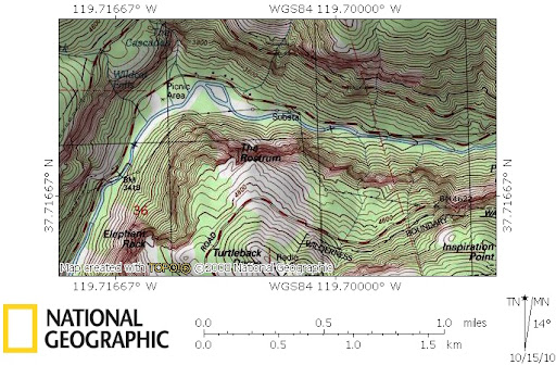
looks on the map. So instead jumped the wall west of there and went down
towards the Rostrum. It's a great place to go esp. when Cascade and
Wildcat are flowing... prob. the best views of those from there.

Maybe I'll check it out someday... I'm still waiting for that picture of the
huge "erratic" atop Turtleback. (was suppose to watch sunset there
last Sat. but the wifey refused after going up Indian Canyon ...
"you can go... I'm going for pizza... I'm not doing any more up today!" )
Geez
avatar Re: Old road and viewpoint?
October 15, 2010 06:29AM
It's on the USGS map:


If you look on google earth you can see the cut S of the river too


Edited 1 time(s). Last edit at 10/15/2010 06:54AM by bill-e-g.
Sorry, only registered users may post in this forum.

Click here to login