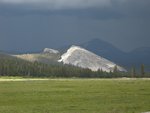
July fires managed for forest restoration and have been monitored with little intervention by firefighters:
- Slope: (37 54.572 x 119 40.924; 6900’ el., Tuolumne Co). The Slope fire is approximately 1911 acres. This lightning caused fire began July 25. Fire Crew 7 has piled and burned heavy fuels along the Harden Lake road, and they are not expected to grow. There is little heat within the perimeter of the fire and has little potential to spread due to receiving nearly 4 inches of rain.
- Vernon: (37 59.813 x 119 43.618; approximately 7000’ el., Tuolumne Co.) The acreage is at 909. The fire was observed to have one log burning within the interior perimeter of the fire. Yosemite Fire Crew 7 is scheduled to obtain final fire acreages by hiking the perimeter with hand held GPS units. They will cut any logs across trails and remove any ‘trail closures” signs, and rehab the fire “spike camp.”
- The July, Tuolumne and Wildcat 2 fires are now out.
All fire related trail closures have been lifted.
Weather: A cooling trend is predicted through the weekend, and a chance of precipitation beginning Monday, October 18. “The National Park Service manages wildland fire to protect the public, communities and infrastructure, conserve natural and cultural resources and restore and maintain ecological health.”
For Additional Information:
- Fire Information and Education Office: (209) 372-0480
- Current Yosemite Fire Activity Online: http://www.nps.gov/yose/parkmgmt/current_fire.htm
- Firenews: http://www.nps.gov/fire/public/pub_firenews.cfm
- Inciweb California: http://www.inciweb.org/state/5/
- NOAA satellite images of smoke: http://www.firedetect.noaa.gov/viewer.htm
- USGS regional webcam images of smoke movement: http://sierrafire.cr.usgs.gov/swifers/pages/WebCam.htm


