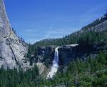
Avalanche Fire: (37 39.794 x 119 42.238; 6,400’el. Mariposa Co.) This lightning caused fire was found on the afternoon of July 31, 2011. It is located near Avalanche Creek, east of the Glacier Point Rd. and is approximately I mile north of the Wawona Rd at Chinquapin. The fire is within the park’s Wilderness boundary and will be managed for multiple objectives. A single standing dead tree (snag) was struck by lightning. Fire crews scouting the fire, initially reported a .3 ac fire, creeping and smoldering through duff and other surface fuels. Smoke is visible from many locations along the Wawona and Big Oak Flat Roads, and from the community of El Portal.
Combined with previous fires, roadside mechanical thinning, vegetation debris pile burning, and prescribed fires, this fire will provide a defensible fire buffer to the community of Yosemite West, Badger Pass Ski Resort, Glacier Point and other park infrastructures. Although numerous fires have occurred in the area, the most recent being the 2009, 3,500 ac. Grouse Fire, this area has no recorded fire history. Extensive logging did occur in the early 1900’s. Fire crews are gathering weather, fuel moistures and other fire data for fire managers to determine operational strategies. Wilderness values will be considered through the use of the Minimum Tool Requirement Analysis and the use of natural barriers to maintain the fire’s perimeter.
Lightning caused Wildland fires frequently occur during the summer, and are a natural part of the Sierra Nevada ecosystem. These kinds of fires have shaped the forest landscape for thousands of years. The fire will rid the forest of an overabundance of dead and down surface fuels and smaller diameter shad tolerant trees. The fire will enhance wildlife habitat and the ability of animals to move through the forest.
Smoke will be visible. Yosemite’s Division of Resources and Sciences crews have installed air quality monitoring equipment within the communities of Yosemite West, El Portal and Yosemite Valley. Fire mangers are working closely with the Mariposa County Air Pollution Control District concerning potential air quality impacts.
Three additional fires were found after the thunderstorm and were put out. The locations include: Moss Creek, near the Merced Grove; the Moraine Dome and Lost Fires, both located in Little Yosemite Valley. It is not unusual to “find” other lightning caused fires as the days warm. For additional Information, Fire Information and Education: Gary_Wuchner@nps.gov; (209) 375-9574 or (209) 372-0480. Yosemite Fire Management Website: http://www.nps.gov/yose/parkmgmt/current_fire.htm.
Yosemite Fires - Update #8
All posts are those of the individual authors and the owner
of this site does not endorse them. Content should be considered opinion
and not fact until verified independently.
Sorry, only registered users may post in this forum.


