
Yosemite 2012 trip. Day 2: Cascade Creek to Yosemite Falls
2012 Yosemite Trip, Part 3 (days 3-5): YOsemite FAlls to Olmsted Point and May Lake
2012 Yosemite Trip, Part 4 (days 6-8); Tuolumne Meadows, Glen Aulin, Cold Canyon, Miller Lake, Matterhorn Canyon, Burro Pass
2012 Yosemite Trip, Part 5 (days 9 and 10): Slide Canyon; Mule Pass; Crown, Robinson, Peeler Lakes; Kerrick Canyon, Peeler Lake, Rodgers Lake
2012 Yosemite Trip, Part 6 (days 11-13): Rodgers Lake, Rodgers Meadow, Pate Valley Grand Canyon of the Tuolumne, Waterwheel Falls, Le Conte Falls, Tuolumne Meadows
Aerial pics from plane of Northern Yosemite
Day 2:
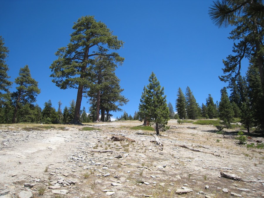
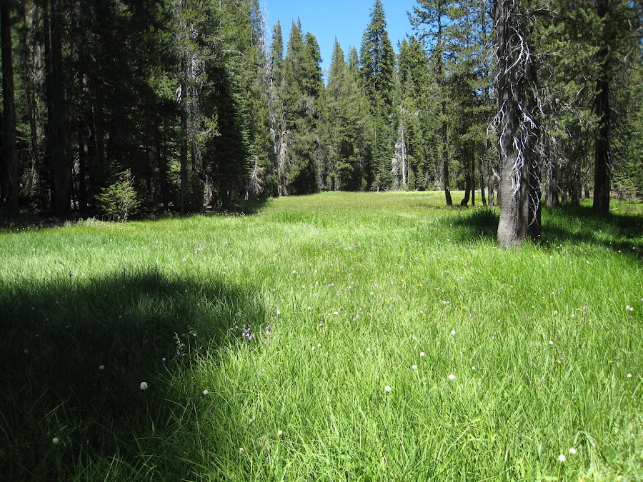
After camping at the Cascade Creek footbridge, we arose, watched the boys camp boys parade out, and then backtracked to the trail junction with the trail to El Capitan. We still had a lot of "UP" to do this day and it was pretty relentless once we headed up this trail. Eventually we came to some nice open areas, followed by a pretty meadow near a creek.
At one point we were passed by a couple guys moving pretty quickly with no pack and just some water. We were also ran into some guy coming towards us who had passed by our campsite that morning. We were not sure where these people were coming from for these 'day hikes'. After talking to them, it was clear they were coming from Tamarack Flat campground which was not far from where we had camped the night before. Before long we got our first view of the top of El Capitan! This image is kinda amusing to me as El Capitan appears to be right there, and as though one is looking at this small section of the top. But, as with all things in Yosemite, scale is everything. The part of El Cap that is visible is still HUGE.
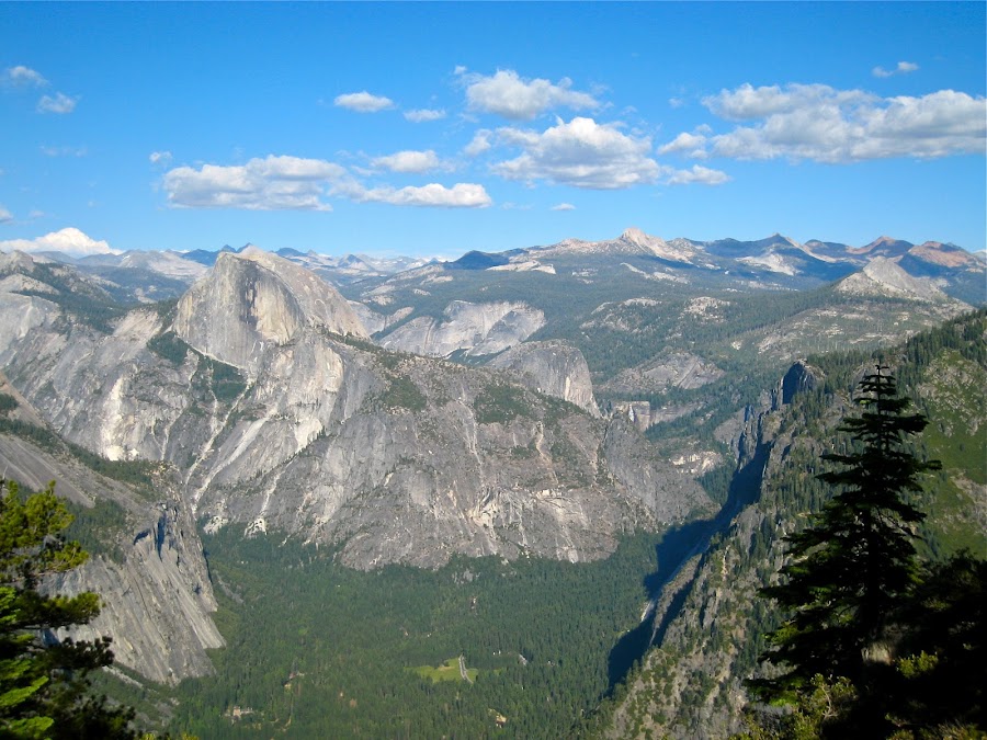
This is the view from the top of El Cap looking across the Valley with Sentinel Dome in the foreground, Mt. Starr King just behind it, and behind that the Clark Range.
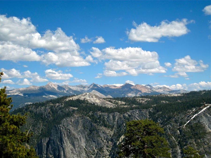
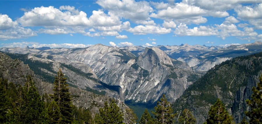
Looking east from the top of El Cap towards Half dome, Clouds REst, and beyond. The clouds were awesome on this day providing interest in the sky. We had been sprinkled on early in the morning on Day 1 before heading out, but never had any further rain during the entire trip with the exception of 5 minutes of light sprinkling in the middle of the night in the TM campground. Everyone from the area was of course praying for rain. This summer was in among the top 10 driest summers ever recorded in Yosemite, and the driest since sometime in the early 1970's.
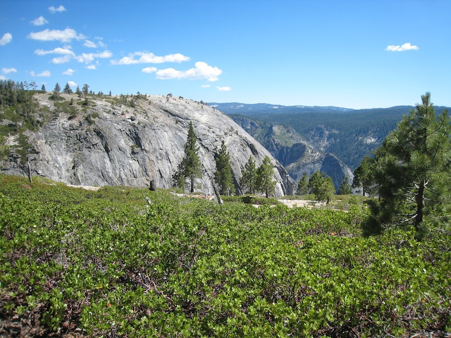
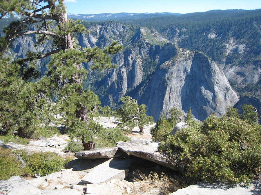
Here we had moved downhill on the top of El Cap towards its edge. I'm not sure where the edge actually was. I believe we decided to go no further than where we were when taking this picture. It just wasn't clear what was beyond. It was easier to identify an edge on the west side. I'm not sure what the green swooping slope that looks like a bike ramp is on the other side of the valley, but I'm obsessed with it. It looks like it would be fun to be up there.
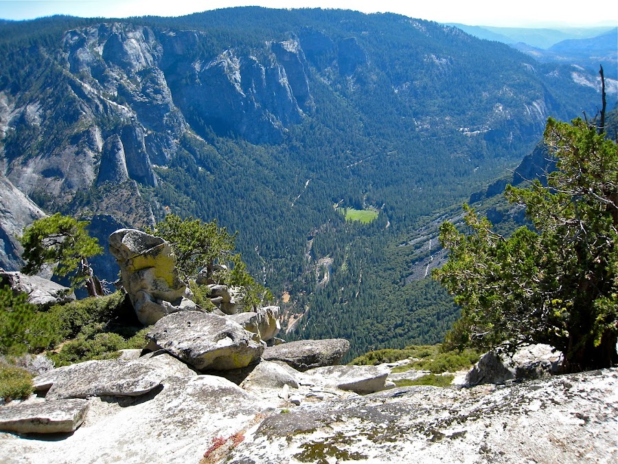
This is looking west from the top of El Cap. Note the Old big Oak Flat Road going through the middle of the rockslides down below. That is where we were the day before.
This pic is from somewhere in the vicinity of Eagle Peak. Two of us left the main trail and headed up to Eagle Peak. In retrospect, I'm not sure exactly where the real peak of Eagle Peak is. Upon returning and looking at pictures, there is some specific place that people have had their picture made for over a hundred years. It's the same place in many of the photos. I don't know where that place is, don't really know where I was, and have no idea where the "marker" is up there. I will want to figure all of that out before I go back there someday.
This was made at Yosemite Falls, from one of the lookouts along a railing, looking upstream, just before it goes over the falls. I've never been here before either. I can only imagine that it looks very different most of the time. Just how different, I do not know. Again, a good reason to go back.
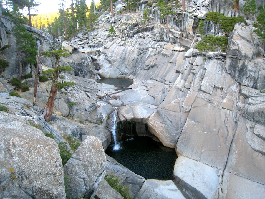
Here, we are at another "railing lookout', looking down on the "cascade" portion of the falls between the upper and lower falls.
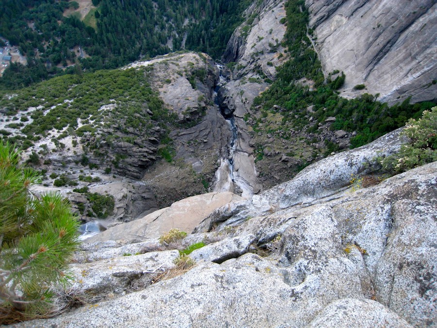
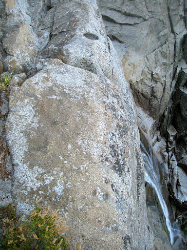
This is looking over at the brink of the falls (to the extent it is visible). There is not much water to fall. We did not get wet, moist, misted, or really anything other than sweaty at the sketchiness of the 'stairs" coming down to the lookout.
We were running a bit late, so spent a little time trying to figure out where we were supposed to camp. I knew there was camping just upstream. It turns out there were a LOT of people camped upstream (on the west side of the creek). There are some nice sites at the northernmost and most remote of this particular area, but it seemed well populated. We found a more exposed location, but it was fine. It was far enough away from a huge boy scout troop that we were not really impacted by them. They were in fact really nice folks! All in all it was a rather crowded area to camp -- not really what we were looking for, but it would have to do on this evening. We had to scramble to get some water before dark fell.
Day 3: Yosemite POint, NOrth Dome, Snow Creek....
Edited 3 time(s). Last edit at 02/19/2023 03:40PM by Frank.


