
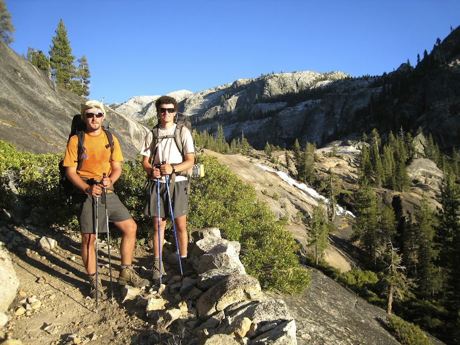
Yosemite 2012 trip. Day 2: Cascade Creek to Yosemite Falls
2012 Yosemite Trip, Part 3 (days 3-5): YOsemite FAlls to Olmsted Point and May Lake
2012 Yosemite Trip, Part 4 (days 6-8); Tuolumne Meadows, Glen Aulin, Cold Canyon, Miller Lake, Matterhorn Canyon, Burro Pass
2012 Yosemite Trip, Part 5 (days 9 and 10): Slide Canyon; Mule Pass; Crown, Robinson, Peeler Lakes; Kerrick Canyon, Peeler Lake, Rodgers Lake
2012 Yosemite Trip, Part 6 (days 11-13): Rodgers Lake, Rodgers Meadow, Pate Valley Grand Canyon of the Tuolumne, Waterwheel Falls, Le Conte Falls, Tuolumne Meadows
Aerial pics from plane of Northern Yosemite
Day 11. Morning dawn and we got our first glimpse of Rodgers Lake
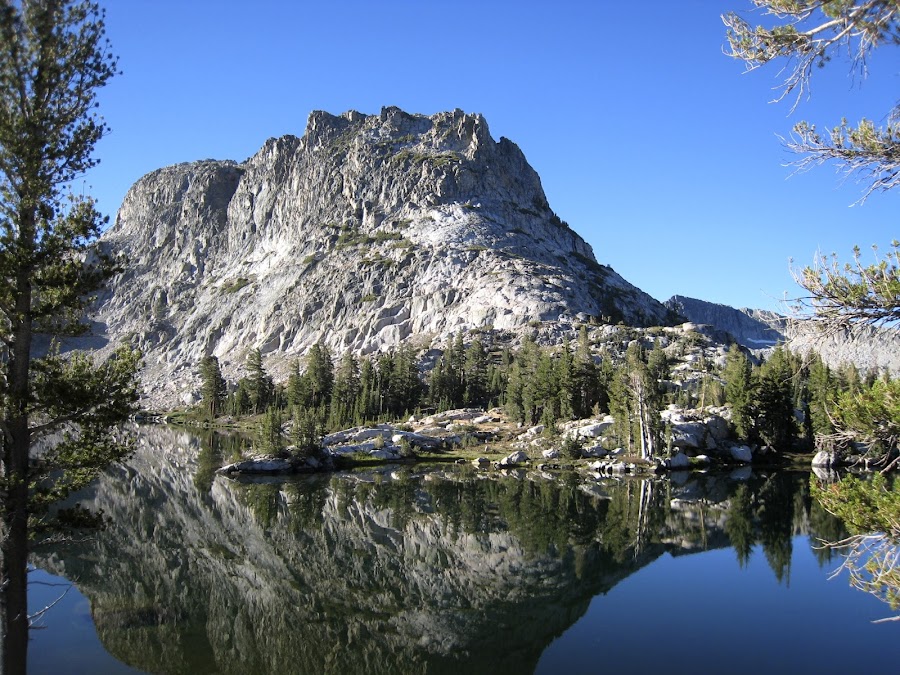
It was beautiful. Our original plans involved getting to Rodgers Lake earlier the previous day and heading to the top of Volunteer Peek, or doing it on this morning. After the previous day, and with the descent to Pate Valley in store for this day, we vetoed that idea. I want to go back though and do that.
Nick decided to swim out to one of the little islands. These islands are not on the maps. Perhaps they come and go with the water level?

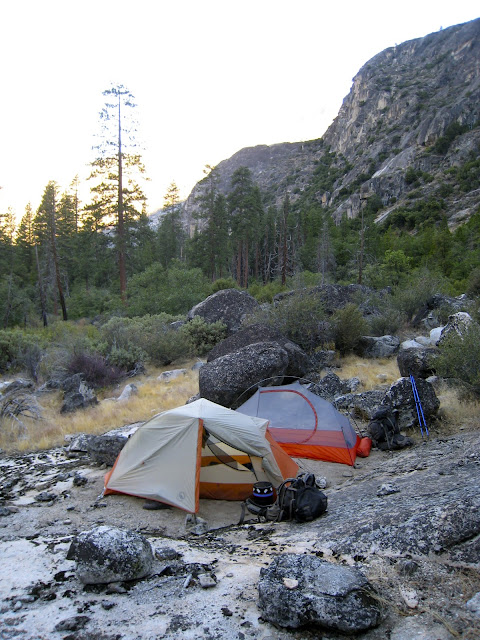
The campsite:

Soon after departing we find ourselves in the lovely Rodgers Meadow.

And we encounter another barbed-wire fence.

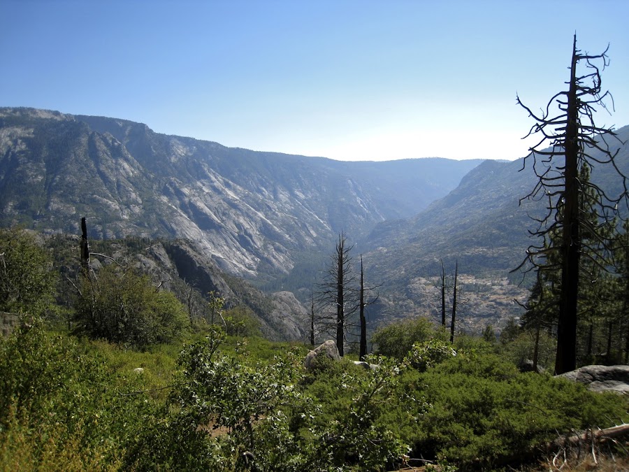
In the distance the mysterious place to which we're headed. We've never been here before and are not quite sure what the descent into Pate VAlley will be like. We had considered making the side trip to Loch Tablae. We made it a point to bring this up with everyone we met. Without exception, they thought we had lost our minds. It was unanimous that there was nothing "pleasant" in Pleasant Valley, and that the going and coming back is also equally special. So, we skipped that. Besides, after the previous day, we needed really compelling reasons to take on additional elevation gains / losses. WE also had rattlesnakes on the mind as we headed towards the descent into Pate VAlley. Everyone we had talked to who had come up from Pate Valley had encountered one or more. We were aware that they are generally not a problem but wanted to be alert nonetheless. I very briefly encounter some kind of snake which skidaddled across the trail so fast I could not begin to identify it.


And there was much rejoicing!


NOw, we were headed to find a campsite about a mile or so upstream which people here had told me about. On the way, we passed a group of 3-4 folks who were literally camped on top of the trail. It was odd. They had to move so we could walk through.
We found what I believe was the appropriate site, which was off to the left of the trail on a large black/white slab and adjacent to a beautiful spot on the river. That night we had this great experience of waiting for the full moon to crest the mountain ridge to the east. The glow was growing ever brighter, and we could watch the illumination to the west and the line of light as it raced across the land towards out campsite. Finally, the moon poked its head above the crest. It was beautiful! The next morning found one of the nephews sleeping "cowboy style" as he calls it and the other who started off that way, but decided tents were made for a reason.

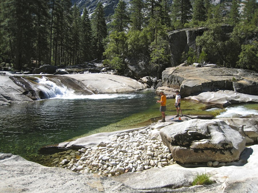
The River by the campsite was particularly beautiful. There, we found an abandoned rod & reel.

The previous day, another group of boy scouts coming up from Pate Valley had warned us of a hornets nest they had encountered along the trail in the GCT. SEveral were bitten. Here, we find the NOTE:

The really mysterious part of this was the cap. Was the President wandering around down here somewhere getting his head sunburned? We debated what to do. Two of us took the trail option, while the other opted to rock-hop in the river. WE had no problem.
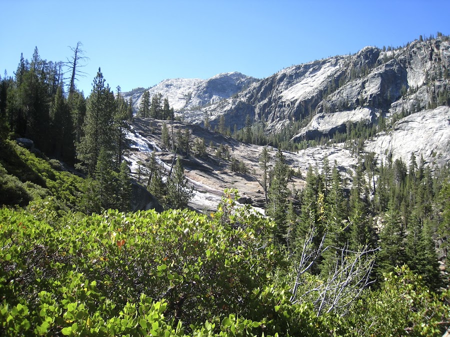
Today, we're headed up towards Waterwheel falls area. On the way we see this, which I imagine is pretty special when the water is at high levels. I don't know what it is called.

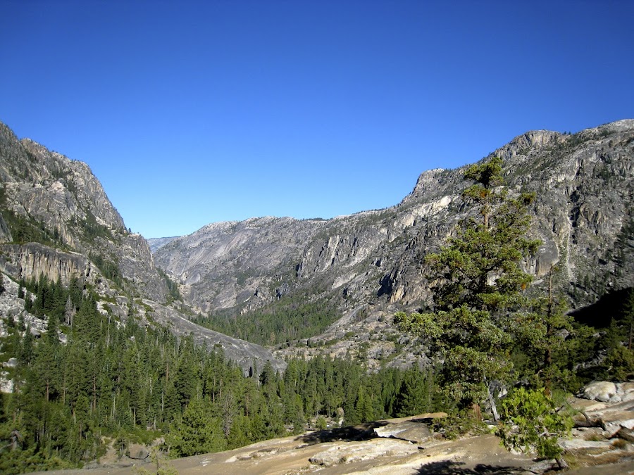
The view down-canyon. I'm wondering if this is the area of Muir Gorge?

The river is filled with little rocks and Big rocks.


WE make it to Waterwheel Falls. Again, I have to wonder what it is like at other times. I've since looked at pics on this site and know that it is VERY different.


Looking downstream from the Falls:


One can literally walk right out into the middle of the Falls.
Just a few minutes further up the trail we found a campsite.

And a rock in the campsite that seemed rather philosophical. Is that really a question mark?

Another view down-canyon:
On our last day, headed up and back to TM, we pass Le Conte Falls.
I think the next few pics are of California Falls.


And this is the Tuolumne River immediately upstream of California Falls:

I believe the footbridge here is the second bridge just after the trail into Glen Aulin.

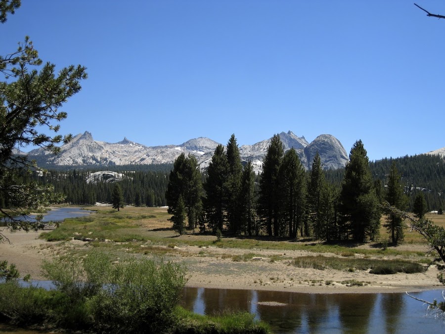
Familiar sites from 8 days ago.

I have to say, in all honesty, the steps leading up out of Glen Aulin seemed like they went on forever and were some cruel form of punishment at this point. My 'stepper-upper" had just about "stepped out". I was very glad to get to the footbridges again, and the site of Tuolumne Meadows was bittersweetly beautiful. The mixture of feelings at the end of a hike is very complex: Sad at leaving, glad to rest and get something cold to drink and something different to eat, the afterglow of the preceding couple weeks of amazing scenery, the awkwardness of being back around people, cars, etc. And it happens so fast. Within about 30 hours of leaving the park we are back in Cleveland and Nashville.
We stayed in the TM Backpackers campground that night, had burgers from the Grill for dinner, and had a close encounter with some other scout-like group in the middle of the night in the backpackers campground. We were sharing a site with some others. In the wee hours, there was a bit of a commotion, then some sounds from some guy from an adjacent campsite, and stern exchanges. About 30-40 japanese "scout equivalents" had entered the camp, all with bear bells a jingling and they were setting up tents all over the place -- literally on top of other tents, etc. It was absolute mayhem. WE stayed in our tents, but there were some rough exchanges, some other campers went to find rangers, etc etc. Ultimately the pack of kids / leaders left and then we noticed a thousand twinkling lights and tinkling bells from down the hill between the backpackers campground and the other campground, where there were no official campsites. They were all setting up there, each with a headlamp on bright, shining up into all the tents up the hill. Then the sounds of hammers and axes started as they were doing God knows what. Eventually, we all went to sleep for the second time.
After breakfast at the grill, we caught the bus into the Valley, showered at Curry Village, ate some Pizza, and caught the YARTS to Merced. The Amtrak took us back to Sacramento, and a plane on home.
There persists the awkwardness of having ones mind and spirit in Yosemite, while the body is in the city.
Until next time...
Edited 4 time(s). Last edit at 02/19/2023 03:43PM by Frank.


