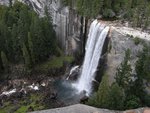
The US Forest Service has released the National Insect and Disease Risk Map (http://foresthealth.fs.usda.gov/nidrm/), a nationwide strategic assessment of the hazard of tree mortality due to insects and diseases, displayed as a series of maps. Risk is defined as: the expectation that, without remediation, at least 25% of standing live basal area greater than one inch in diameter will die over a 15-year time frame (2013 to 2027) due to insects and diseases. Factors like high tree density also increase risk from abiotic causes such as fire, storm damage, and drought.
Yosemite is 92% treed and 41% of the treed area is at risk, primarily from bark beetles and root diseases. The most extensive land cover type at Yosemite is lodgepole pine (27%) and 50% of that is at risk. Whitebark pine covers only 1.1% and is 48% at risk. Other cover types at risk include Jeffrey pine/9%/26% California red fir/24%/10%, white fir/12%/23%, ponderosa pine/4%/36%, and sugar pine/4%/20%. More specific Yosemite reports will be released soon.
Workers, residents, and visitors can help by reporting new areas of dead trees, being careful with fire, and Don't Move Firewood (more than 50 miles).
Yosemite Forest Risk 2013-2027
All posts are those of the individual authors and the owner
of this site does not endorse them. Content should be considered opinion
and not fact until verified independently.
Sorry, only registered users may post in this forum.


