http://www.davidrumsey.com/luna/servlet/detail/RUMSEY~8~1~224281~5506364:Yosemite-National-Park#
The map can be downloaded in several resolutions, including an incredible 20 MB zipped JPEG. But you don't need to download it, you can just view it in your browser and blowup what you want using the sliding bar within the lower center of the picture.
The map shows the 1890 boundary along the outside, and the new boundary inside of it, except for a small (commercially worthless) addition along the northern boundary.
But what may be more interesting is the road recommendations made by the commissioners. Here is a small blow-up around Yosemite Valley. It shows the existing roads, such as the Coulterville, Old Big Oak Flat, and Old Wawona roads:
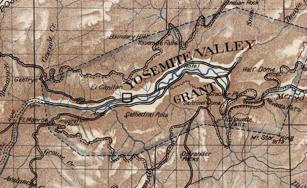
In this map, the double black lines show existing roads and the solid line paired with a dashed line shows the roads recommended for an adequate road system. It shows a new road from Ft. Monroe (atop the current Wawona tunnel) to Glacier Point, but another from there more or less along the Panorama Cliffs to the top of Nevada Falls. From there it continues to Merced Lake and has a spur alongside Couds Rest to Tenaya Lake. It also shows a road down from Nevada Falls to the Valley. Oh, the blasting! On the north side of the valley, it shows a road from Gentrys to Porcupine Flat, more or less following the old northern branch of the Mono Trail (see link).
Of course, new replacement routes for the existing roads were not envisioned in 1906, so they remain unchanged. The Tioga Road still passes through Aspen Valley, and terminates at the old Tioga Mine. The Big Oak Flat Road still has the Great Zigzag. They show a proposed road and railroad up the river to El Portal, but have them on opposite sides of the river from how they ended up....
Your Congress at work.