Found this on youtube this morning:

The Moon is Waxing Gibbous (59% of Full)
Re: Ledge Trail
All posts are those of the individual authors and the owner
of this site does not endorse them. Content should be considered opinion
and not fact until verified independently.
May 23, 2010 10:25AM | Moderator Registered: 15 years ago Posts: 1,918 |
May 23, 2010 11:56AM | Registered: 15 years ago Posts: 1,876 |
May 23, 2010 12:47PM | Moderator Registered: 15 years ago Posts: 1,876 |
May 23, 2010 02:23PM | Registered: 14 years ago Posts: 7,421 |
May 23, 2010 02:30PM | Moderator Registered: 15 years ago Posts: 1,876 |
May 23, 2010 02:55PM | Registered: 14 years ago Posts: 7,421 |

May 23, 2010 05:58PM | Moderator Registered: 15 years ago Posts: 1,942 |
May 23, 2010 09:17PM | Moderator Registered: 15 years ago Posts: 1,918 |
Yes.Quote
Frank Furter
Does this mean that the chicken whisperer climbed the entire Ledge Trail?
Unfortunately I didn't camp atop Sentinel Dome due to the very windy conditions
so no "Turlock from Sentinel Dome" picture.
Additionally the guy I got the permit from said that I couldn't camp anywhere
remotely near to Glacier Pt. even though the road was closed.
Didn't see anyone all day except CCC crew sweeping some blacktop paths
right on Glacier Pt.
|
Re: Ledge Trail May 05, 2013 05:34PM | Registered: 10 years ago Posts: 2 |
|
Re: Ledge Trail May 05, 2013 05:38PM | Registered: 10 years ago Posts: 2 |
|
Re: Ledge Trail May 05, 2013 07:04PM | Registered: 14 years ago Posts: 755 |
There are two different hazards being reported in this thread. One is the loose rock associated with the upper part (which is an avalanche gully) and also loose stuff on the sloping ledge which is below the top of Staircase Falls. Those are all under-foot hazards.
The second hazard is the frequent rain of loose rock from above onto the ledge. Twice in recent years I have been in Curry Village on trips where I expected to hike the Ledge Trail and personally witnessed major rock falls onto the ledge....Clouds of granite dust, load booms, etc. As far as I am concerned, we are in a decade of bad stuff going on up there. I'm not going anywhere near it.
The second hazard is the frequent rain of loose rock from above onto the ledge. Twice in recent years I have been in Curry Village on trips where I expected to hike the Ledge Trail and personally witnessed major rock falls onto the ledge....Clouds of granite dust, load booms, etc. As far as I am concerned, we are in a decade of bad stuff going on up there. I'm not going anywhere near it.
|
Re: Ledge Trail May 06, 2013 10:26AM | Registered: 11 years ago Posts: 324 |
May 24, 2010 12:08AM | Moderator Registered: 15 years ago Posts: 1,347 |
May 24, 2010 06:35AM | Moderator Registered: 15 years ago Posts: 1,918 |
Quote
Bee
Did the permit dude make any fuss about your destination (a-Ledge-d Trail)
Uh... I only told the wife where I was going. I was fully expecting to hike a couple
hundred feet up scree and rubble and say "uh... I'm not going up this with
snowshoes, crampons, ice axe, a full pack.... a squawking bird...".
If you go the right way it's nothing like that at all. I spied the gully from the
grocery store (1000 ft. of snow) and decided it was doable with crampons.
On the way up the snow field there were bear prints skittering down the slope.
I thought peeps would get a chuckle outta the video...
Anyway... maybe I shoulda posted this instead (Taft Pt. TH Parking Lot):

May 24, 2010 12:13AM | Moderator Registered: 15 years ago Posts: 1,347 |
May 24, 2010 07:10AM | Moderator Registered: 15 years ago Posts: 1,918 |
May 24, 2010 09:18PM | Moderator Registered: 15 years ago Posts: 1,942 |
Quote
bill-e-g
(how many of you stuck the paper clip in the outlet after you mom told u not to?)
Actually, not a paper clip-- I tried to build an electromagnet with AC current. Household circuits never worked quite the same after that shocking experience.
The cure for a fallacious argument is a better argument, not the suppression of ideas.
-- Carl Sagan
May 24, 2010 09:29PM | Moderator Registered: 15 years ago Posts: 1,347 |
My sister stuck a screwdriver in the light socket while the night light was plugged in(lucky for that rubber handle??) The next thing that happened was a loud clapping sound, a terrible smell, and the wire to the nightlight was blown apart. Of course, sis told mom that the night light "malfunctioned", so mom went around and gathered up the rest of them and threw 'em away......!
The body betrays and the weather conspires, hopefully, not on the same day.
The body betrays and the weather conspires, hopefully, not on the same day.
|
Re: Ledge Trail September 06, 2010 07:07PM | Registered: 13 years ago Posts: 2 |
Actually the trail up to that sign is not bad. Pretty easy scramble and much recognizable trail. Beyond this, however there is new slide activity and about 300 yards of loose, broken granite. It is beyond class 3 in my opinion and I expect that there will be another substantial slide this winter when the weight of snow gets on all that loose stuff. If you are going to attempt this trail, have an experienced climber and a rope or you will not make it to the gully. I did the trail in 06 and it was fairly easy to me (even with the rain storm that renewed Staircase Creek when we were in the middle of it), but recent slide activity has changed this. I strongly advise against taking this trail. It is very dangerous on the slide area and a bad step could send you sliding down to Curry Village. 9/6/10
May 24, 2010 07:44AM | Registered: 13 years ago Posts: 84 |

May 24, 2010 05:35PM | Moderator Registered: 15 years ago Posts: 1,347 |
Quote
Yury
What is "a-Ledge-d Trail"? Does it have an alternative name? I do not see it on my map.
What is the meaning of "Closed" and "Do not attempt" in the Yosemite Valley?
Is it just a suggestion or it will be a criminal offense in case you disregard it?
Hi Yury,
I will give a quick answer, just because I do not want you in a suspended state of confusion. The "Ledge Trail" was an active trail at one time, however, over time, it proved to be a maintenance nightmare due to the fact that several areas are prone to excessive rockfall. A few people were hurt/killed on the trail due to 1. rockfall 2. inexperience 3. unpreparedness. Eventually, the trail was closed and deemed too dangerous/high maintenance. The warning sign INDEED MEANS WHAT IT SAYS, and with that said, rather than using this a-Ledge-d Trail (I call it this because it really is no longer an official trail, thus, it will not be listed in modern trail guides) I would suggest the Four Mile Trail or an assortment of others that would give equal enjoyment.
With that said....
Bill-e-g is an exception to the rule as far as death by the first two means -- he is an expert Yosemite explorer-- so as far as reaming him for undertaking this adventure, I will refrain. However, I believe that even Billy would tell you that while he IS experienced and thee most prepared Yosemite hiker, not even he (with the help of faithful side-kick Chick-on) could hold back the ever present rockfalls.
The body betrays and the weather conspires, hopefully, not on the same day.
May 24, 2010 09:50PM | Moderator Registered: 15 years ago Posts: 1,918 |
As far as I know I think that even though it says "closed" you can go on it.
I don't think they can really do much. You have to remember that everything
you do you're doing at your own risk. Now... if you go and hike/climb in a
closed area which is closed due to the Endangered Species Act
then they definitely can fine you and throw you in jail. You really don't want
to do that. What they could do is simply make the entire cliff area
below GP off limits including the approach. (not just east of GP / Apron)
Climbing closures have foiled me getting to the top of Kolana at the best
time (about now). If you want a challenge... try getting to Kolana from
the old Quarry. Now that's some cool grape goodness. Bush wacking
backwards thru heavy brush with poison oak.
Next time... I'm going back up!
Here's the closures in case you wonder:
http://www.nps.gov/yose/planyourvisit/climbingclosures.htm
May 25, 2010 09:48AM | Registered: 15 years ago Posts: 670 |
Gigapan of view from Eyehook Point along Ledge Trail
Spherical Panorama WWP entry for Elevation Event - view from Eyehook Point along Ledge Trail - Best view is Fullscreen
One of my favorite hike/views in the valley area.
Another one is Sierra Point. I'd consider that trail much more dangerous for the novice than ledge trail, at least going up hill.
Ledge trail IS A DEATH TRIP for the first-timer going downhill. A number of the deaths on Ledge Trail are in this catagory.
Edited 2 time(s). Last edit at 05/25/2010 09:57AM by qumqats.
May 25, 2010 03:00PM | Moderator Registered: 15 years ago Posts: 1,918 |
Yup. I agree. And I wouldn't take a novice on either trail.
Peoples perspective are quite varied depending on their experience and whatnot.
I know I've told some people to definitely not miss the Ill Fall "overlook" and
they came back and said I was leading them to certain death. Whoop... o boy...
Thanks for those links (I know you put them up before also cause I saw them b4).
Really cool.
The vid that I put up is taken probably about 200 ft. below those hooks since I
didn't know exactly where they were I did some bushwacking... didn't want to
not find them...
August 17, 2015 08:57AM | Registered: 11 years ago Posts: 299 |
The wire in the picture looks like the ones we discussed here...
http://yosemitenews.info/forum/read.php?3,74650,74650#msg-74650
...which turned out to be old "messenger" wires that had once supported telephone cables.
http://yosemitenews.info/forum/read.php?3,74650,74650#msg-74650
...which turned out to be old "messenger" wires that had once supported telephone cables.
May 25, 2010 09:10PM | Registered: 13 years ago Posts: 84 |
In what sense do you call it a "DEATH TRIP"?
For sure you do not mean this literally for a trail which was previously officially maintained.
May 25, 2010 09:26PM | Registered: 14 years ago Posts: 7,421 |
Quote
Yury
In what sense do you call it a "DEATH TRIP"?
For sure you do not mean this literally for a trail which was previously officially maintained.
Yury, I won't go into too many details but you might want to find a copy of "Death in Yosemite".
From that book:
"Overall, about 14 young men have died while traversing or shortcutting to or from this trail.
They represent more than 10 percent of all fatal hiking/scrambling falls in Yosemite.
The deaths make the Ledge Trail route the third most fatal geological 'entity' in the park
after El Capitan and the Merced River."
Know your own limits. Be Prepared. Don't go up something you can't come back down safely.
Have fun. Be safe.
(at this pt. it could be argued this thread should just be deleted... but I guaranteed you I
can find about a million things in The Sierra more dangerous)

Edited 1 time(s). Last edit at 05/25/2010 09:27PM by chick-on.
|
Re: Ledge Trail September 06, 2010 07:17PM | Registered: 13 years ago Posts: 2 |
The Ledge Trail is a death trip because of an area of uncontrolled slide about 300 yards below the gully. It is loose and moving and if you are on it, you could go with it. Do not attempt this trail. Maybe this winter will clear some of this am make it passable with a little class 3 pitching. Not for anyone who is not familiar with Yosemite granite and heavy scramble.
September 07, 2010 06:31AM | Moderator Registered: 15 years ago Posts: 1,918 |
I thought I posted a link to the other photos on that trip.
I don't see them above so here's the link:
http://picasaweb.google.com/yosemite.chick.on/Ledge
I don't see them above so here's the link:
http://picasaweb.google.com/yosemite.chick.on/Ledge
|
Re: Ledge Trail September 07, 2010 05:37PM | Registered: 14 years ago Posts: 755 |
|
Re: Ledge Trail September 15, 2010 12:33AM | Registered: 13 years ago Posts: 931 |
Quote
bill-e-g
I thought I posted a link to the other photos on that trip.
I don't see them above so here's the link:
http://picasaweb.google.com/yosemite.chick.on/Ledge
Excellent photos, thanks for sharing. So much for the trail being unmarked, eh? Guess that's now debunked. I didn't go up the ledge; decided on something a bit easier. Hiked around the Hetch Hetchy area instead.
May 25, 2010 09:47PM | Moderator Registered: 15 years ago Posts: 1,347 |
Yury,
As someone who has spent time outside of the US, I can say that for the most part, it takes a certain amount of effort to put one's self at unreasonable risk while at American parks. There are rails & ramps, steps & stops, fluffed & folded trails, and more signs than one can ever read, all designed keep you out of harm's way. Occasionally, the American system determines that in spite of all these precautions, folks STILL might get hurt, and being the litigious society that the US is, such risk to life & dollar are not acceptable. Americans like this security blanket, and for the most part, the citizens have lost the thirst for measurable risk and challenge, thus, "dangerous" is defined on almost a ridiculous scale**. If you have climbed/hiked in the Dolomites/Alps...or even Eastern Sierra Peaks, many of the routes deemed "dangerous" in the US would be laughable to you. So it must be said, Americans are a spoiled lot for all of the above mentioned reasons, thus, it is the policy to create more policy to further eliminate the possiblity of pushing one's limits, because when the intrepid adventurer gets hurt, the second person he calls is his lawyer (the first person is the helicopter service)
**THe Ledge Trail being one of those places that does NOT have all of the steps, stops, rails etc., thus, one can actully pitch forth into the abyss....should he be foolish enough to venture forth unprepared on the way down. THe rock falls can be untimely, too. In days past, such risks were acceptable, by todays standards, they are not.
The body betrays and the weather conspires, hopefully, not on the same day.
Edited 1 time(s). Last edit at 05/25/2010 09:54PM by Bee.
May 25, 2010 10:06PM | Registered: 13 years ago Posts: 84 |
May 26, 2010 03:12AM | Registered: 14 years ago Posts: 7,421 |
Anyone thinking of doing it early really needs to spy the gully from
the Yosemite Village store. Right now almost the entire gully
(over 1000 ft. climb) is covered in up to 4ft of snow. You'd be not too wise
to not take crampons and an ice axe. So don't just blaze up it without
thinking.
Also... you wanna kinda figure out the snow conditions...
the Yosemite Village store. Right now almost the entire gully
(over 1000 ft. climb) is covered in up to 4ft of snow. You'd be not too wise
to not take crampons and an ice axe. So don't just blaze up it without
thinking.
Also... you wanna kinda figure out the snow conditions...
|
Re: Ledge Trail May 27, 2010 06:19PM | Registered: 13 years ago Posts: 1 |
I love it 
I was just camping in the valley at the same time you were & arrived home this last Monday.
Since I have an extreme fear of heights, I couldn't do The Ledge, Half Dome, or anything else of such steep height... but
The Ledge Trail particularly catches my attention after reading about it.
Let me post a few points of the trail for those who don't know it.
According to the well researched book, "Death in Yosemite," :
the trail was in use at least back to 1870 & was an "official" trail about 1880?
the trail is only 3rd in causing fatalities after El Cap & the Merced River.
so many hikers died on it (or were injured), that the park limited use to UP hill only about 1950.
three hikers went airborne at the curve/corner where the face trail bends into the gully on top end.
in 1960, the park "closed" the trail officially. It was thereafter erased from park maps.
about six hikers have died climbing the trail since it was closed.
(one recent 1998 hiker moron actually took his little daughter up there & should have been arrested for child abuse).
one hiker opinion that I read posted that there is a point where returning downward is near impossible.
similar to half dome, there is a steel cable that remains from 5 decades ago.... evidence of days long gone.
I stopped & asked at the mountaineering store in the valley where the trail head was... and the
woman looked at me with a horrified look. I had to explain that I was just curious and not
intending to hike it.
It turned out that in order access the bottom trail head, a person has to pass wimpy fencing
designed to keep the public out of harms way as there was a rock slide that took out some
cabins a few years ago. Thus, while the rangers might not issue a citation for hiking the trail,
they MIGHT issue a citation for creeping around behind that fencing as it is a marked 'off limits'
area.
By the way, I sure wish you had done more extensive video coverage of the trail. AWESOME !
Got a kick out of your stuffed bird, too.
May 27, 2010 08:15PM | Registered: 15 years ago Posts: 670 |
Quote
DayHiker2010
. . . snip . . .
one hiker opinion that I read posted that there is a point where returning downward is near impossible.
similar to half dome, there is a steel cable that remains from 5 decades ago.... evidence of days long gone.
. . . snip . . .
By the way, I sure wish you had done more extensive video coverage of the trail. AWESOME !
. . . snip . . .
Thanks for the additional info, that was interesting.
) I can't think of any place along the trail where "returning downward is near impossible". I'm not sure why someone would say that.
) I believe that the steel cable is no longer there. I think they removed it last summer during a valley wide clean-up project. My guess would be that the cable was a power cable going up to Glacier Point and that one of the supports would have been a pole or post that was guyed at "Eyehook Point" ( my made up name of the point ).
May 27, 2010 08:31PM | Moderator Registered: 15 years ago Posts: 1,918 |
Agree. As long as you stick to the wall you should be able to come back down.
The cable is still there. It's piddly compared to the Half Dome Cable.
I'd concur with what you said about that too re. the eyehooks.
There's some other junk cables lying around in the gully too.
This is maybe 400 ft. up from the turn.
The cable is still there. It's piddly compared to the Half Dome Cable.
I'd concur with what you said about that too re. the eyehooks.
There's some other junk cables lying around in the gully too.
This is maybe 400 ft. up from the turn.
May 27, 2010 09:12PM | Registered: 15 years ago Posts: 670 |
June 14, 2010 10:24PM | Moderator Registered: 15 years ago Posts: 1,918 |
whatever,
yeah, there's a lot of recent rockfall ...
here's the sign... and right next to it is a wacked tree from very very recent.
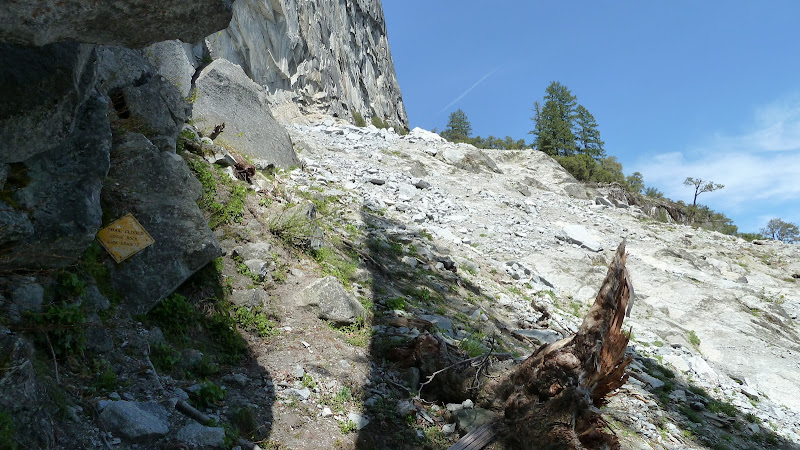
You should only be in that area maybe 10 minutes. beyond there there is little danger.
If you are really unlucky... then you won't know what hit you.
Sure there is danger... but ... I look up every time I go past Liberty Cap and say "please don't anything fall now" too.
Haven't done Indian Canyon yet. It's on my list... it just looks ungodly overgrown.
Done those babies before (such as old trail from Poopenaut towards North Mountain)... and they are delicious.
yeah, there's a lot of recent rockfall ...
here's the sign... and right next to it is a wacked tree from very very recent.
You should only be in that area maybe 10 minutes. beyond there there is little danger.
If you are really unlucky... then you won't know what hit you.
Sure there is danger... but ... I look up every time I go past Liberty Cap and say "please don't anything fall now" too.
Haven't done Indian Canyon yet. It's on my list... it just looks ungodly overgrown.
Done those babies before (such as old trail from Poopenaut towards North Mountain)... and they are delicious.
June 14, 2010 10:38PM | Admin Registered: 15 years ago Posts: 17,050 |
|
Re: Ledge Trail June 15, 2010 07:40PM | Registered: 14 years ago Posts: 755 |
No, it's not the least bit wet. As late as the 1950's the Indian Canyon Trail was on a park list as a possible "all-weather" trail up out of the Valley. Back then, horses were still a big item, and that trail, built on the original Indian route to the high country, has the virtue that it crosses no streams whatsoever. It was originally built as a toll mule route, but was put out of business by the Falls Trail when that opened.
Most of the trail is high above the creek that you can see in the photo. For example, in your photo there is a section of creek shaded by a cloud. There is an open-book gully to the left of that which the trail runs up. The trail had the usual stone wall switchbacks there, almost all gone now. It's just critical-angle dirt and rocks in that section. Not too bad coming down, but a pain going up. Above that point the trail hooks around to the right and finds one of the "thank god" ledges that Yosemite is famous for, which takes you gradually back towards the stream. It hits the Yosemite Point to North Dome trail near that trail's stream crossing of Indian Creek.
FYI, going downhill the trail exits your photo above its lower left corner. It hooks way around to the west, just under the cliffs, then does a series of switchbacks to come out near the back of the NPS work yard in Yosemite Village. Quite a bit west of the creek. It must have had many, many stone switchbacks, but only a handful still survive. I could offer some GPS coords, if anyone wanted. I'll be in the Valley starting tomorrow, and may do the Indian Canyon Trail on Thursday (Downhill, after going up the Falls Trail. I've done it going uphill often enough, but it's a lot of work crossing the talus sections going uphill).
Quote
eeek
Quote
bill-e-g
Haven't done Indian Canyon yet. It's on my list... it just looks ungodly overgrown.
A bit wet right now too:
June 15, 2010 08:17PM | Moderator Registered: 15 years ago Posts: 1,918 |
Heck ya.. I want GPS coords!
For the Cathedral Rocks... are you talking thru the Gunsight? or some other route?
Anything else you have... purty please... Best way up Sunnyside?
Have you been up Grizzly? via the Gulch? Which one is LeConte btw.?
Getting up to top o Grizz was def. class 3 movie near the top. Bird stayed below..
I'll PM my email adx. Thanks in advance!
June 15, 2010 09:44PM | Registered: 15 years ago Posts: 670 |
Quote
bill-e-g
Heck ya.. I want GPS coords!
For the Cathedral Rocks... are you talking thru the Gunsight? or some other route?
Anything else you have... purty please... Best way up Sunnyside?
Have you been up Grizzly? via the Gulch? Which one is LeConte btw.?
Getting up to top o Grizz was def. class 3 movie near the top. Bird stayed below..
I'll PM my email adx. Thanks in advance!
I'd love to see that picture redone with a line of the old trail in color! With another line in a different color that is what you think is the easiest route. I've been up there to the base of Lehamite Falls and it was quite difficult. However that's on the opposite side of the canyon as you're saying the trail is on. ( BTW I ran across a big monster thick phone or power cable running up the canyon? What would it be doing up there? )
Getting to the top of Higher Cathedral is actually pretty easy. You go up the Climbers trail. There's lots of trails up there since there's lots of climbing routes in the area. As you're driving into the valley park at the last pullout before you get to El Cap crossover. Head up the gully to the south. You might be able to find the trail early on if you head SE ( stand in the road looking E into the valley, head 45deg to 60deg to the right ) from the pullout. If you don't find a trail within a 200 feet then just head up the middle of the gully. You'll find a multitude of trails eventually. Don't follow all the offshoots, they're going to climbing routes such as the Spires. If it's a busy climbing day you'll start hearing climbers yelling on the cliffs around you. The gully narrows and you get to the cutest pass that's only about 25' wide. Straight ahead looking up the canyon that Bridalveil creek is coming down you'll see a cascade. Scramble up the ridge to the N ( hairpin turn to the right ) to the top of Higher Cathedral. It's one of those hikes you look at from the valley and say "That's impossible!" but is actually pretty easy.
Gunsight I think is quite a bit harder. I've been up there and turned back when I got to a point where there didn't seem to be a safe route to go farther. It was all friction on the rock, no foot holds. I'd like to try again.
Sunnyside is my next trip. http://yosemiteexplorer.com/trails/fern-ledge has some good pictures and description.
Edited 4 time(s). Last edit at 06/15/2010 10:22PM by qumqats.
|
Re: Ledge Trail June 15, 2010 11:47PM | Registered: 14 years ago Posts: 755 |
Not the Gunsight. That's roped scrambling for most people, and a rappel down.
As I understand it, Leconte's Gully is accessed by starting up the Sierra Pt trail, but going left when you hit the cliff. Just follow the base of the cliff until you end up in the gully. It comes out on the west side of the saddle between Grizzly Peak and the ridge that runs up to the Diving Board. I prefer to access that saddle from the other side (up from the Emerald Pool), which avoids the exposure of bushy class 3 or class 4 stuff in LeConte gully. By the way, the Diving Board is a vastly neater place than Grizzly Peak, in my opinion.
Sunnyside is a walk-on from the east end. I haven't tried to scramble up after reaching the west end of it, but it could be awfully slippery right now.
I have to stop. Of to Yosemite in the morning. But maybe I'll start a thread on the old trails when I get back.
Quote
bill-e-g
Heck ya.. I want GPS coords!
For the Cathedral Rocks... are you talking thru the Gunsight? or some other route?
Anything else you have... purty please... Best way up Sunnyside?
Have you been up Grizzly? via the Gulch? Which one is LeConte btw.?
Getting up to top o Grizz was def. class 3 movie near the top. Bird stayed below..
I'll PM my email adx. Thanks in advance!
June 16, 2010 07:19AM | Moderator Registered: 15 years ago Posts: 1,918 |
Quote
wherever
By the way, the Diving Board is a vastly neater place than Grizzly Peak, in my opinion.
Grizz Peak is just something you do b/c it's there. The same great views can be
seen from a short distance below the board... and thus avoiding the bush wack a doodle
to get down to Grizz from the board.
Additionally, you get to see Turlock from the board:
http://yosemitenews.info/forum/read.php?3,24912,24912#msg-24912
http://yosemitenews.info/forum/read.php?3,24825,24825#msg-24825
Lastly... Bob Burb is an animal.
His site is great. His feats are amazing (I'll do maybe 1/4-1/2 of what he does in a day
and stay overnight though... thank you very much). I'd put up a site like his
but it'd be like childsplay in comparison... (and I'm too lazy... ) (and don't really
wanna go back over 200 trips)
PLEASE start a old trail thread!
June 14, 2010 10:40PM | Registered: 15 years ago Posts: 670 |
Quote
bill-e-g
. . . snip . . .
You should only be in that area maybe 10 minutes. beyond there there is little danger.
If you are really unlucky... then you won't know what hit you.
Sure there is danger... but ... I look up every time I go past Liberty Cap and say "please don't anything fall now" too.
. . . snip . . .
Have you ever looked up at the vast expanse of cliff towering above you while you're going up the switchbacks in the gully part of Upper Yosemite Falls Trail?
You know . . . that part of the trail that killed hikers the last time it had a good fall!... ( ok, yes, that was a long time ago )
But none the less, that's the trail where I'm saying to myself "please don't anything fall now".
June 14, 2010 10:46PM | Admin Registered: 15 years ago Posts: 17,050 |
Quote
qumqats
Have you ever looked up at the vast expanse of cliff towering above you while you're going up the switchbacks in the gully part of Upper Yosemite Falls Trail?
You know . . . that part of the trail that killed hikers the last time it had a good fall!... ( ok, yes, that was a long time ago )
But none the less, that's the trail where I'm saying to myself "please don't anything fall now".
I was thinking the same.
|
Re: Ledge Trail June 15, 2010 09:04PM | Registered: 14 years ago Posts: 755 |
"...beyond that there is little danger...." Actually, when the trail was still in official use, this was not considered the dangerous part. People would stick to the trail and use the chains where necessary. The stuff you kicked loose would just go over the side, and there wasn't that much coming off the cliff face above you.
What hurt so many people was the upper half. It's a very steep gully, and you were right in it the whole way. When someone kicked a rock loose, it went through the crowd below like a ball in a bowling alley. That's why it was one-way up only during the last half of this trail's life. People kick fewer rocks going uphill....
Today, with all the brush in there, it's not as bad. But I've seen rocks go some distance there, even so. The saving grace nowadays is that there is likely to be no one above you on the trail except members of your own party.
Quote
bill-e-g
whatever,
yeah, there's a lot of recent rockfall ...
here's the sign... and right next to it is a wacked tree from very very recent.
You should only be in that area maybe 10 minutes. beyond there there is little danger.
If you are really unlucky... then you won't know what hit you.
Sure there is danger... but ... I look up every time I go past Liberty Cap and say "please don't anything fall now" too.
Haven't done Indian Canyon yet. It's on my list... it just looks ungodly overgrown.
Done those babies before (such as old trail from Poopenaut towards North Mountain)... and they are delicious.
June 15, 2010 10:20PM | Moderator Registered: 15 years ago Posts: 1,918 |
June 15, 2010 10:28PM | Registered: 15 years ago Posts: 670 |
Even if you already know about it, it's well worth mentioning Bob Burd's great collection of TRs at http://www.snwburd.com/bob/ Many of the climbs mentioned in this thread are there, as well as many, many more.
May 26, 2010 10:29AM | Moderator Registered: 15 years ago Posts: 1,876 |
Quote
Bee
Yury,
As someone who has spent time outside of the US, I can say that for the most part, it takes a certain amount of effort to put one's self at unreasonable risk while at American parks. There are rails & ramps, steps & stops, fluffed & folded trails, and more signs than one can ever read, all designed keep you out of harm's way. Occasionally, the American system determines that in spite of all these precautions, folks STILL might get hurt, and being the litigious society that the US is, such risk to life & dollar are not acceptable. Americans like this security blanket, and for the most part, the citizens have lost the thirst for measurable risk and challenge, thus, "dangerous" is defined on almost a ridiculous scale**. If you have climbed/hiked in the Dolomites/Alps...or even Eastern Sierra Peaks, many of the routes deemed "dangerous" in the US would be laughable to you. So it must be said, Americans are a spoiled lot for all of the above mentioned reasons, thus, it is the policy to create more policy to further eliminate the possiblity of pushing one's limits, because when the intrepid adventurer gets hurt, the second person he calls is his lawyer (the first person is the helicopter service)
**THe Ledge Trail being one of those places that does NOT have all of the steps, stops, rails etc., thus, one can actully pitch forth into the abyss....should he be foolish enough to venture forth unprepared on the way down. THe rock falls can be untimely, too. In days past, such risks were acceptable, by todays standards, they are not.
All the caution signs, rails, etc. are really geared toward attempting to protect, from themselves, what is (erroneously) perceived as the lowest common denominator in the mentality of park visitors.
Incredibly enough, evidence indicates that this bar seems to be still too high for some idiots. Case in point:
http://yosemitenews.info/forum/read.php?1,24686,24748#msg-24748
One of my favorite expositions of Murphy's Law is:
Nothing is foolproof... because fools are so ingenious.
Edited 1 time(s). Last edit at 05/26/2010 10:30AM by szalkowski.
May 27, 2010 06:03AM | Moderator Registered: 15 years ago Posts: 1,918 |
Up this. Down the 4 Mile.
Know what's in the Gully. The Death book calls it LeConte Gully.
Someone else said the gully by Grizzly Pt. (more dangerous just to get to the top of that than this trail),
was LeConte. I'd like to know the real answer.
Start from the Happy Isle Trailhead Parking NOT NOT NOT Curry Village. Stay next to wall.
There is no Class 3 is this "climb".
If you can't make it up... don't start. 3000ft. climb in about 1.5 miles.
May 26, 2010 05:56AM | Registered: 15 years ago Posts: 670 |
Going up isn't very bad. You just keep going up. The only thing you have in mind is while you're on the Ledge part is to keep to the left away from cliffs on the right, Simple, little or no danger. Once you do the left turn and start up the Gully you're past the dangerous part.
The problem is people going down who have never been up it. As you're coming down the gully if you don't know where to cross the creek and start down the Ledge ( staying close to the cliff face) you end up getting ledged. That's what's killed most of the people.
Up - little danger
Down - much danger if you don't know what you're doing and make the classic mistake of passing the creek crossing.
|
Re: Ledge Trail May 26, 2010 09:47PM | Registered: 13 years ago Posts: 931 |
Quote
qumqats
Gigapan of view from Eyehook Point along Ledge Trail
Spherical Panorama WWP entry for Elevation Event - view from Eyehook Point along Ledge Trail - Best view is Fullscreen
One of my favorite hike/views in the valley area.
Another one is Sierra Point. I'd consider that trail much more dangerous for the novice than ledge trail, at least going up hill.
Ledge trail IS A DEATH TRIP for the first-timer going downhill. A number of the deaths on Ledge Trail are in this catagory.
It'd be interesting to know about the number of successes, in either direction. 14 deaths, while tragic, isn't that big a number. Hundreds, reportedly, die annually on China's "Hua Shan" trail. Perhaps some of you have heard about that infamous hike.
|
Re: Ledge Trail June 14, 2010 12:15AM | Registered: 13 years ago Posts: 16 |
Quote
Ohnivy-Drak
Quote
qumqats
Gigapan of view from Eyehook Point along Ledge Trail
Spherical Panorama WWP entry for Elevation Event - view from Eyehook Point along Ledge Trail - Best view is Fullscreen
One of my favorite hike/views in the valley area.
Another one is Sierra Point. I'd consider that trail much more dangerous for the novice than ledge trail, at least going up hill.
Ledge trail IS A DEATH TRIP for the first-timer going downhill. A number of the deaths on Ledge Trail are in this catagory.
It'd be interesting to know about the number of successes, in either direction. 14 deaths, while tragic, isn't that big a number. Hundreds, reportedly, die annually on China's "Hua Shan" trail. Perhaps some of you have heard about that infamous hike.
Mt HuaShan
http://www.youtube.com/watch?v=Ke4-cwNvDuE
I did this Hike in 2007 I suspect It might be more dangerous then anything in yosemite. I wore a harness so wasent too bad, but you will see some Chinese people doing the hike to the temple with out anything. Harness or not, its Chinese engineering so its always a bit iffy. Ill load my pics up and post them.
Edited 1 time(s). Last edit at 06/14/2010 12:17AM by wookie.
|
Re: Ledge Trail June 27, 2010 11:00PM | Registered: 13 years ago Posts: 931 |
Quote
wookie
Quote
Ohnivy-Drak
Quote
qumqats
Gigapan of view from Eyehook Point along Ledge Trail
Spherical Panorama WWP entry for Elevation Event - view from Eyehook Point along Ledge Trail - Best view is Fullscreen
One of my favorite hike/views in the valley area.
Another one is Sierra Point. I'd consider that trail much more dangerous for the novice than ledge trail, at least going up hill.
Ledge trail IS A DEATH TRIP for the first-timer going downhill. A number of the deaths on Ledge Trail are in this catagory.
It'd be interesting to know about the number of successes, in either direction. 14 deaths, while tragic, isn't that big a number. Hundreds, reportedly, die annually on China's "Hua Shan" trail. Perhaps some of you have heard about that infamous hike.
Mt HuaShan
http://www.youtube.com/watch?v=Ke4-cwNvDuE
I did this Hike in 2007 I suspect It might be more dangerous then anything in yosemite. I wore a harness so wasent too bad, but you will see some Chinese people doing the hike to the temple with out anything. Harness or not, its Chinese engineering so its always a bit iffy. Ill load my pics up and post them.
Looking forward to your pics, thanks. I believe harnesses are mandatory nowadays for this "hike." Another notorious trail is the "El Camino (or Caminito) Del Rey", located in Southern Spain.
|
Re: Ledge Trail May 26, 2010 09:30PM | Registered: 13 years ago Posts: 931 |
May 26, 2010 10:59PM | Moderator Registered: 15 years ago Posts: 1,347 |
Quote
Ohnivy-Drak
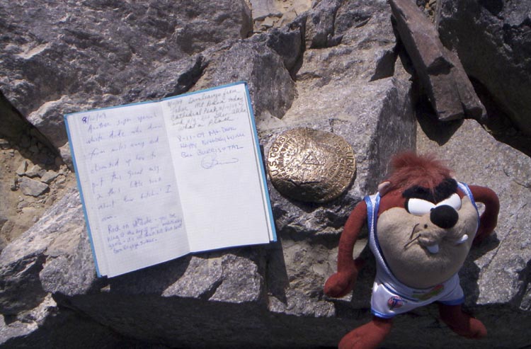
Nice video. I've always wanted to go up this trail. You might have just inspired me to do so, and take along my own little good luck charm.
A fuzzy good luck charm will almost always guarantee a good day in the hills!
The body betrays and the weather conspires, hopefully, not on the same day.
|
Re: Ledge Trail June 12, 2010 01:08PM | Registered: 13 years ago Posts: 931 |
Quote
Bee
Quote
Ohnivy-Drak
Nice video. I've always wanted to go up this trail. You might have just inspired me to do so, and take along my own little good luck charm.
A fuzzy good luck charm will almost always guarantee a good day in the hills!
I'm actually not familiar with this fuzzy guy. Tasmanian Devil maybe? Just a guess...
For me, pandas are good luck.
Edited 1 time(s). Last edit at 06/12/2010 01:15PM by Ohnivy-Drak.
June 12, 2010 07:04PM | Admin Registered: 15 years ago Posts: 17,050 |
Quote
Ohnivy-Drak
Quote
Bee
Quote
Ohnivy-Drak
Nice video. I've always wanted to go up this trail. You might have just inspired me to do so, and take along my own little good luck charm.
A fuzzy good luck charm will almost always guarantee a good day in the hills!
I'm actually not familiar with this fuzzy guy. Tasmanian Devil maybe? Just a guess...
For me, pandas are good luck.
|
Re: Ledge Trail June 13, 2010 05:22PM | Registered: 14 years ago Posts: 755 |
Some comments about the Ledge Trail from an old-timer: This trail was very popular about a hundred years ago. It was the quickest way to Glacier Point from Curry Village, and was the route used by the guy who lit the firefall every night.
It was never difficult, if you had good footwear. The first half goes up to the right on a sloping ledge from Curry Village, all the way to the top of Staircase Falls. Then it makes a right angle bend to the left, and goes up the gully that the the stream comes down. The top half is easy, though it can be very bushy if the winter snow avalanches haven't cleaned out the brush recently. That's the gully in your photo.
The bottom half is very straightforward. You just go up the one long ledge and stay close to the cliff face. It's fairly steep, and has a few friction steps to get up, but the ledge is very wide in most places. People get in trouble when they move away from the cliff face looking for better footing. It gets better for a few feet, but then you get sucked in to increasingly worse stuff.
The "cables" were, in fact, chains hung along the cliff face to grasp at a couple of slippery places. Like Sierra Point Trail used to have. Any other cables that you see are left over from old power and phone lines to Glacier Point. There are no real difficulties, but the lack of handholds and the existence of occasional sand and loose pebbles can be disconcerting. It is certainly true that if you slip and start sliding where the chains used to be, you will go over the edge.
I used to do this trail every year, but no longer. The last two times I went to the Valley intending to do this trail, I observed serious rockfalls coming down across the ledge. The kind that leave a large cloud of granite dust hanging, and which produce shrapnel around the cabins below. We seem to be in a more active rockfall cycle this last decade or so.
I like to follow the old trails, including Indian Canyon Trail (abandoned around 1870) and Sierra Point Trail. The climbers access trail from the Valley to the top of Upper Cathedral Rock is also very nice. The Ledge Trail is in that league. It is not truly out of bounds (it's a rock climbers access route), but why play Russian Roulette? If anyone had been on the trail during the rock falls that I have seen, they'd be dead.
|
Re: Ledge Trail June 13, 2010 11:16PM | Registered: 14 years ago Posts: 755 |
Here is an old photo, taken from near Eagle Peak, that shows what is going on.

From the top of Glacier Point, you can see the avalanche gully which is the upper part of the trail. About halfway down, it reaches the face of the mountain, and three things happen: Staircase Falls begins cascading down a series of ledges to Curry Village. Behind that in the photo is the main trail ledge, which runs directly under the cliff face. In the foreground coming toward you is another gully, which appears to be an extension of the upper gully. It's not....it is much steeper in its upper part, beyond the critical angle at which everything you touch slides away. It is impassable.
From the top of Glacier Point, you can see the avalanche gully which is the upper part of the trail. About halfway down, it reaches the face of the mountain, and three things happen: Staircase Falls begins cascading down a series of ledges to Curry Village. Behind that in the photo is the main trail ledge, which runs directly under the cliff face. In the foreground coming toward you is another gully, which appears to be an extension of the upper gully. It's not....it is much steeper in its upper part, beyond the critical angle at which everything you touch slides away. It is impassable.
|
Re: Ledge Trail June 13, 2010 11:20PM | Registered: 14 years ago Posts: 755 |
I don't know why the photo didn't work. Try this:
http://picasaweb.google.com/lh/photo/XPPUrJOu2TL3Fs_b9QN4Ww?feat=directlink
http://picasaweb.google.com/lh/photo/XPPUrJOu2TL3Fs_b9QN4Ww?feat=directlink
May 20, 2012 10:52PM | Registered: 15 years ago Posts: 4,173 |

June 14, 2010 01:00AM | Registered: 15 years ago Posts: 670 |
Another photo with a good view of Ledge Trail. This one looking down from North Dome.
Click on the link/photo to go to Gigapan.
Double click or use your mouse wheel to zoom in.
Mouse drag to pan around.
Gigapan of Yosemite Valley from North Dome

Edited 1 time(s). Last edit at 06/14/2010 01:06AM by qumqats.
Click on the link/photo to go to Gigapan.
Double click or use your mouse wheel to zoom in.
Mouse drag to pan around.
Gigapan of Yosemite Valley from North Dome
Edited 1 time(s). Last edit at 06/14/2010 01:06AM by qumqats.
|
Re: Ledge Trail May 06, 2013 04:07PM | Registered: 13 years ago Posts: 1,697 |

May 07, 2013 07:04AM | Moderator Registered: 14 years ago Posts: 7,421 |
|
Re: Ledge Trail August 16, 2015 03:58PM | Registered: 8 years ago Posts: 21 |
Most recent info I have been able to find on this route is from a couple in their 50s dated 2014.
However an old timer in the park who did it often as a kid said it is best avoided.
Once you have seen it however the pull try it is huge.
The 2014 article mentioned that the gully is getting pretty overgown and could be impossible to pass through in a few years.
As for approching from the apron at HI not sure if that is any better than from behind CV due to rock falls.
So many of us have a need to know.
August 17, 2015 07:59AM | Registered: 14 years ago Posts: 675 |
We did the Ledge a year ago, TR here....my buddy had thought he had found the start of the trail on a previous trip at the back of Curry Village...in fact out the back door of the remains of the old Curry Cabin, so we started up thataway. Turns our "trail" led up to somebody's little cowboy camp under a rock. He or she wasn't living there at the time but it looked like the location made a good sleeping spot for a while. Anyway, from there we had to thrash up through brush and scrub oaks to the base of the cliff.
I would think that the start by the backpackers parking lot would be easier. But at any rate, you can probably start anywhere between the backpacker's parking lot and Curry Village. Just head up, and when you hit the base of the cliff and can't go any higher, go right.
I would think that the start by the backpackers parking lot would be easier. But at any rate, you can probably start anywhere between the backpacker's parking lot and Curry Village. Just head up, and when you hit the base of the cliff and can't go any higher, go right.
|
Re: Ledge Trail August 25, 2015 09:37PM | Registered: 8 years ago Posts: 21 |
For the record, as far as I can tell, the same number of people have died on the Ledge Trail as have died going over Nevada Falls.
More people have gone over Vernal Falls than have died on the Ledge Trail.
Should you want to do the Ledge Trail and give yourself the best odds do the following.....
1. Go up it not down it.
2. Do not go off the trail or attempt a shortcut.
3. Bring enough water with you so you do not EVER have to go off trail to get water.
4. If you wear a hat make sure it is tight. If it blows off your head do NOT go after it.
For all those who have followed these rules only 1 has died and that was because he missed the upper section turning point where the ledge meets the falls and continued till he slipped on wet rock.
PS....I did see a web entry from a couple who did the trail dated mid-2015 so people seem to still be going up.
PPS....the problem with the statistic of the Merced River claiming the most lives is that most would think that means drowning the in Valley however Vernal Falls and Nevada Falls deaths are considered in the total of Merced River deaths even though those are falling deaths not drownings.
|
Re: Ledge Trail August 16, 2015 05:02PM | Registered: 11 years ago Posts: 324 |
Curious,
You sound a lot like me. I looked up at the Ledge Trail so many times,
weighing the dos and don'ts of trying it. I had read everything I could
get ahold of; almost all of it originating from this forum.
On Sept. 4 of last year, I went up the trail, starting from behind the
parking lot. I can provide info from that hike, if you like.
If there has been a change to the trail since that date (rock slide, etc.),
somebody else will have to chime in.
|
Re: Ledge Trail August 16, 2015 06:46PM | Registered: 12 years ago Posts: 220 |
|
Re: Ledge Trail August 25, 2015 09:51PM | Registered: 8 years ago Posts: 21 |
It seems there are two things everyone wants to know about the Ledge Trail.....is it possible to get across the rock fall areas and how bad is the bush wacking. I think many people are more concerned with the bushwacking than the rock slides.
I predict that if John Muir were alive today the Ledge Trail would still be in use (the Fern Ledge would be on the map as well). I think he would have installed a hiking system similar to the skiing system where trails are rated. The Ledge Trail might be a double black diamond but it would still be a trail.
Official trails in the Valley area are rather silly things. Even the so called "Use Trails" are more or less a joke. The so called "Use Trail" that goes to Lost Lake and the Snake Dike is in no way shape or form a "Use Trail" unless it is covered in snow. That is as well worn as the official Gaylor Lakes trail or many others in the backcountry to the point of being fully boring. Even the "Use Trail" up Mt. Hoffman is a snooze fest. In the Valley you seem to either have to be on a freeway or you are considered "off trail".
|
Re: Ledge Trail September 04, 2015 11:31AM | Registered: 8 years ago Posts: 4 |
I did it in June and the brush was thick in some places but certainly passable. The rock slide area was easily passed but I admit it was spooky. I kept looking up from time to time. Following are some pictures...

https://scontent-lax3-1.xx.fbcdn.net/hphotos-xfp1/v/t1.0-9/10477049_10204867011060330_2038035794455709830_n.jpg?oh=e16860fe66b37caeff61abde13cc67bd&oe=5676A44F
https://scontent-lax3-1.xx.fbcdn.net/hphotos-xta1/v/t1.0-9/11536147_10204867012620369_7390542183447996510_n.jpg?oh=0b9e7beb796f3de0ab1e71890816c147&oe=5677B807
https://scontent-lax3-1.xx.fbcdn.net/hphotos-xap1/v/t1.0-9/10360954_10204867013220384_2419339200427226917_n.jpg?oh=711e73de56a0e69a1053076113b4bc32&oe=5680094C

https://scontent-lax3-1.xx.fbcdn.net/hphotos-xpf1/v/t1.0-9/9279_10204864796204960_3398505567868715646_n.jpg?oh=142299c5d3222d7592fc1f1736415abe&oe=567B73EE
Edited 1 time(s). Last edit at 09/04/2015 11:45AM by blondguy.
https://scontent-lax3-1.xx.fbcdn.net/hphotos-xfp1/v/t1.0-9/10477049_10204867011060330_2038035794455709830_n.jpg?oh=e16860fe66b37caeff61abde13cc67bd&oe=5676A44F
https://scontent-lax3-1.xx.fbcdn.net/hphotos-xta1/v/t1.0-9/11536147_10204867012620369_7390542183447996510_n.jpg?oh=0b9e7beb796f3de0ab1e71890816c147&oe=5677B807
https://scontent-lax3-1.xx.fbcdn.net/hphotos-xap1/v/t1.0-9/10360954_10204867013220384_2419339200427226917_n.jpg?oh=711e73de56a0e69a1053076113b4bc32&oe=5680094C
https://scontent-lax3-1.xx.fbcdn.net/hphotos-xpf1/v/t1.0-9/9279_10204864796204960_3398505567868715646_n.jpg?oh=142299c5d3222d7592fc1f1736415abe&oe=567B73EE
Edited 1 time(s). Last edit at 09/04/2015 11:45AM by blondguy.
|
Re: Ledge Trail September 04, 2015 11:42AM | Registered: 12 years ago Posts: 220 |
September 04, 2015 05:14PM | Registered: 15 years ago Posts: 4,173 |


Sorry, only registered users may post in this forum.

