The Devils Dance Floor is a flat-topped granite dome located just south of Tamarack Flat Campground. It has good views to the east, south, and west. Although it is not on an official trail, when the campground is open you will see people wandering between the summit and the campground. But I have never seen anyone beyond that point. Excellent off-trail hikes can be found south of the dome.
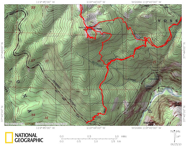
Here is a map of the area:

As a pdf: https://docs.google.com/leaf?id=0B9ZDeFswongBOWRiYmJhYTktMjg0OC00YjkyLWE1MmItOTkzMjlkMTMzYjIz&hl=en
The map shows four different routes to the Dance Floor, plus a GPS trace of my hike there last Friday. Because the campground was still closed for the winter, and because I had no one to bring the car around, I parked at the Foresta trailhead and did a loop. The loop is about seven miles, and has a 2000 foot climb.
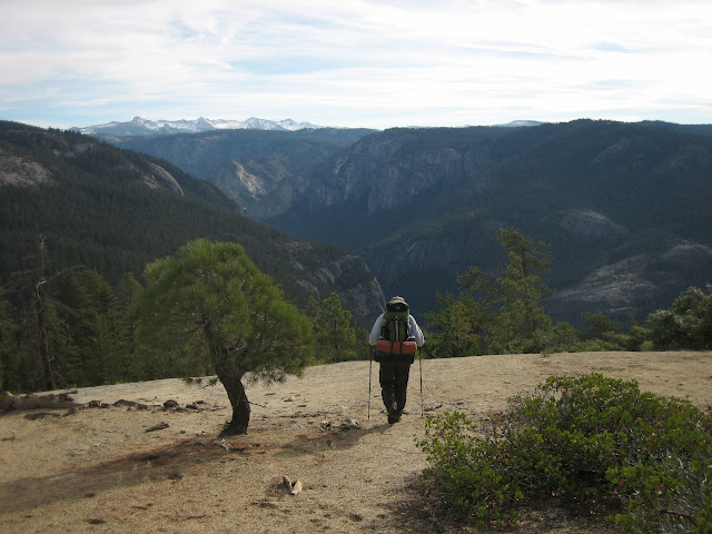
Route A is the easy one that you take your novices and in-laws on. The majority of it is on good easy granite. Park at the far west end of the campground, being careful not to block anyone's campsite. Head straight south, and climb onto the Dance Floor at the northwest corner. Route A is about a 400 foot climb. Enjoy the views, and have some lunch in the shade at the edge of the cliff. Send the in-laws back to bring the car around to the Foresta trailhead, while you do one of the bushwhacks. Here is a view of Silver Strand Falls, Old Inspiration Point, and Stanford Point from the summit:

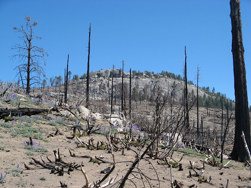
Route E is temporarily an excellent route. Until last year, it was impenetrable. Before 1990 this was a great old-growth forest. But a hundred years of fire suppression had left too much fuel on the ground, and the resulting Arch Rock fire burned 18,000 acres. In some places it was a ground fire that allowed the large trees to survive, but on the Foresta Ridge it killed almost everything. Twenty years later, the ridge supported giant clusters of manzanitas, oak and alder thickets ten feet tall, that required you to climb four feet into the branches to move at all, and below the few mother evergreens that survived it had stands of new trees a foot apart. This was the worst bushwhacking that I have seen in the Sierras, and that is saying a lot.
Then in August of 2009 the park service authorized a controlled burn in Big Meadow, which is the flat area adjacent to Foresta. In August? What were they thinking?
See http://latimesblogs.latimes.com/outposts/2009/09/yosemite-fire-2.html
This fire burned the ridge again. It killed all the brush. The manzanita thickets appear to be still there, without their leaves, but that is deceptive. What you see are the small bushes. The big ones burned to the ground, leaving open spaces between. I was able to hike the ridge without touching anything bigger than a fern. Which is good, because all those manzanita skeletons are covered with soot.
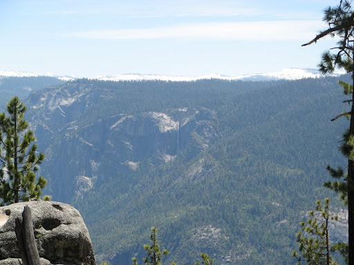
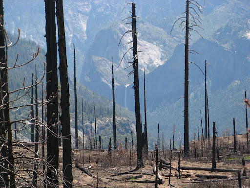
Unfortunately, last year's fire also killed the few surviving trees on the ridge. So the bushes will come back without any competition from young trees. This will soon be a thicket again. Enjoy it while you can. In order from the top, here are some photos. Looking back at the west edge of the dome:

Looking towards Bridalveil Falls from the burn:

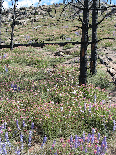
Near the Foresta trailhead we have a lot of flowers this Spring:

Routes B and C are off the southeast corner of the dome. The very upper part has also burned, but here it was a ground fire that didn't kill the big trees. You soon get below that to stuff that hasn't burned recently, and is well forested. Route B cuts back under the dome and descends a steep game trail. Route C is a perfect route finding exercise for beginners. It lacks the steep dirt of C, and has some little ravines to cross, outcrops to detour around etc. Nice and easy going.
The continuation Route D down to the highway is still a work in progress. I didn't like the bushes and branches on the route shown. There must be a better way....
Try A and C the first time, but they are all good.