The previous note was about biking in Aspen Valley, on the Old Tioga Road. From Aspen Valley to Harden Lake the road is now a wilderness trail, but starting near Harden Lake the old road is still maintained as a road for 8.7 miles, past White Wolf and across the New Tioga Road (1940) to the Yosemite Creek Campground. Beyond the campground, the old road continues as an abandoned trail for 2.5 miles with a thousand foot climb, to merge with the new road near Porcupine Flat.
By the way, the Harden Lake Fire has been burning for a couple of weeks. I wouldn't go north of White Wolf today.
#3 Biking at White Wolf. 3.25 miles, 800 vertical feet
Actually, you probably wouldn't do this ride unless you were staying at White Wolf, or as an adder to the Yosemite Campground ride. From White Wolf you can bike up to the highway, or you can bike down almost to Harden Lake. Just like at Aspen Valley, the dirt road down to Harden Lake is a little corridor of non-wilderness embedded in the wilderness area. Why is it there? I don't know of any private cabins down there. But the White Wolf Lodge and White Wolf Campground and ranger cabins and ranger corral must all need water and generate sewage. I'm guessing that there is a treatment facility down there somewhere.
The part of the road below White Wolf is gated. But unlike at Aspen Valley, there is a "no biking" sign at the gate. Why? It's a maintained road and it's open for public hiking. The "no biking" sign ought to be at the trailhead at the far end. Anyway, there are plenty of bike tracks made by the employees and off-duty rangers, and they just smiled at my wife when she biked down there last year.
#4 Tioga Pass Road to Yosemite Creek Campground 5 miles 1000 vertical feet
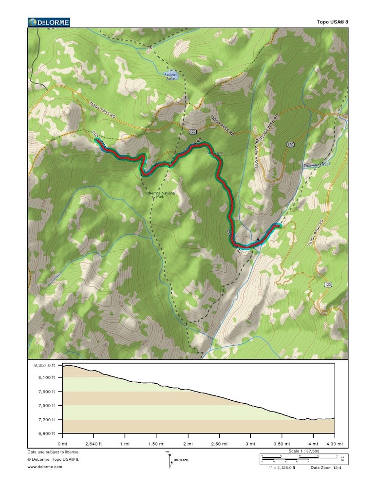
We did this in the afternoon while driving from San Jose to Tuolumne last week. We shortened it a bit by driving in the campground access road a half mile or so before parking. From there it is a short distance to the high point (county line, divide between Yosemite and Tuolumne drainages). The ride down to the campground is about 4 miles and about a thousand feet, so it's 5% grade. The big difference between this ride and the others that I have mentioned is the terrible state of the pavement. It's newer than the Aspen Valley pavement, but is a mass of patches, bumps and potholes. Of course, a bike has a lot of options for steering a smooth path through this stuff that a car lacks, and even my wife's recumbent had no problems negotiating it. Still, it's no bike path.
Perhaps the park service keeps the road that way to slow down the traffic. I saw two cars with low clearance begin bottoming out, and they just turned around and gave up.
Shortly after starting down the hill you get a good vista of Yosemite Creek's valley, and a clear view of Sentinal Dome and the cell phone tower on Glacier Point Ridge. A good place for any White Wolfer to get his telephone fix.
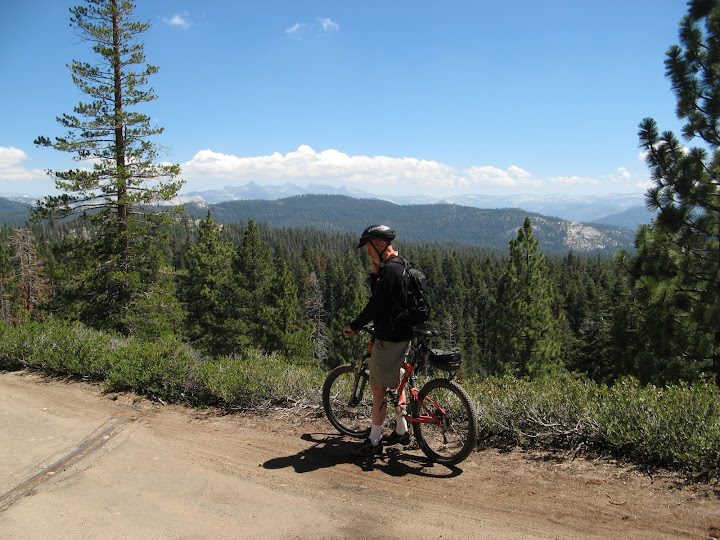
The plan was for all of us to bike down the hill and across the bridge to road's end. Then I would bike back up to fetch the car while my buddy explored the abandoned extension of the road. It's amazing how much smoother the road is going uphill at 4mph than it was bouncing down at over 12 mph.
I got to the top, and mounted the bike on its rack, then opened the driver's door to get my driving shoes out of a Safeway plastic bag on the floor. As I fiddled with them, I noticed someone staring intently between my legs at the bag, from about five feet away. A bear cub! "Where's your mama? Go away!", was my response. The cub was unimpressed, but ambled over to poke at a rotten log while I jumped into the car and then grabbed my camera.
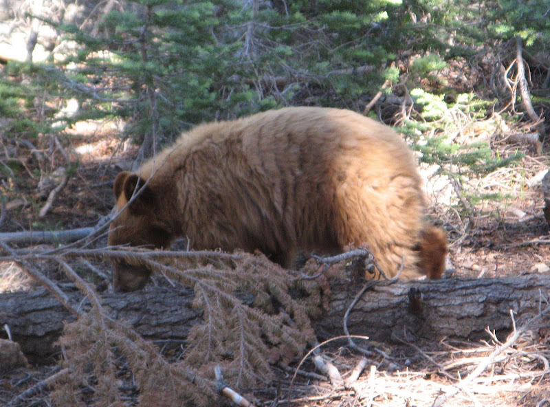
I had heard that there were bear problems at the campground after it recently re-opened. This kid was already a pro at spotting a grocery bag in a car. Who would expect to be sniffed at by a bear at 3pm in the afternoon, four miles from the campground?...
A real mountain biker had followed me up the hill from his campsite, and went on to turn around at the highway junction. As I was driving down the hill, he passed me going much faster than my car was going, confirming my suspicion that the rough state of the pavement may be there for "calming" traffic on this (essentially one lane) road.
#5 Tioga Road to Tamarack Campground 3 miles, 700 foot vertical
As mentioned in the comments to my last post, the Old Big Oak Flat Road ran through Tuolumne Grove and Crane Flat The ride downhill from the grove to the campground at the Route 120 entrance station would be great to do, but it seems to be off limits to bikes. Going towards the Valley from Crane Flat, the old road passed through Tamarack Flat Campground. That leg is still open as the entrance to the campground, but the road is closed to bikes beyond that point.
This ride is similar to the previous one, but shorter and easier. It would be a good addendum to a hike from the campground to the Devils Dance Floor, mentioned in previous posts.

