Welcome! Log In Create A New Profile Recent Posts
Yosemite Valley

The Moon is Waxing Gibbous (56% of Full)

Rocketlawyer.com


Advanced

wherever

All posts are those of the individual authors and the owner of this site does not endorse them. Content should be considered opinion and not fact until verified independently.

avatar wherever
October 10, 2010 05:33PM
Super duper thanks to wherever:


(and to qumqats for the Oh-My-Gash)

Lightning not so great since looking into the sun... but sun didn't affect one of my favorites:


Yose Falls is indeed flowing... a little... gorgeous day yesterday... and hit up the Loft Pizza again...
WAY better than Pizza Factory!
avatar Re: wherever
October 10, 2010 06:10PM
I mean Oh-My-Gosh.

Old Priest is open again (was open last weekend). Some guard rails and new surface.
Other than that... Same Old Priest Grade. (which is good imo)

She did continue... somewhat reluctantly... (I have a penchant for going too high too quickly)

Re: wherever
October 10, 2010 11:32PM
Am I the only one who knows what Bill-e-q is talking about? Those pictures are clearly taken while ascending the Indian Canyon Trail.

Unfortunately, all maintenance on that trail ceased in the 1870s. It was a toll trail, like many of the early ones, and went out of business when the Yosemite Falls Trail opened. Indian Canyon got its name for having the only Indian route to the high country on the north side of the Valley. The Indian Canyon Trail roughly followed the aboriginal route. While there are still a few dozen switchbacks to be found, the section shown in the photos was swept clean of them by snow and rock avalanches years ago. The trail runs high on the west side of Indian Canyon...

It is a great bushwhack. Though you will recall, Bill-e-q, that I told you that it would be a lot more work doing it in the uphill direction than it is to do it in the downhill direction with only a light day pack.

I trust that you found the route as described, and that the brush wasn't too bad in the couple of spots where it can grow up. It looks like you had nice weather.
Re: wherever
October 11, 2010 12:01AM
What we are talking about:


This is Indian Canyon as seen from the Four Mile Trail. Yosemite Point is the left outcrop. Yosemite Village is behind the trees at the lower left. The Indian Canyon Trail followed the route of the white numbers.

If you choose to go up there, remember that this is serious bushwhacking. Don't fall off anything, and don't complain to me if you can't find the trail.


Edited 2 time(s). Last edit at 06/20/2012 10:13PM by wherever.
avatar Re: wherever
October 11, 2010 07:54AM
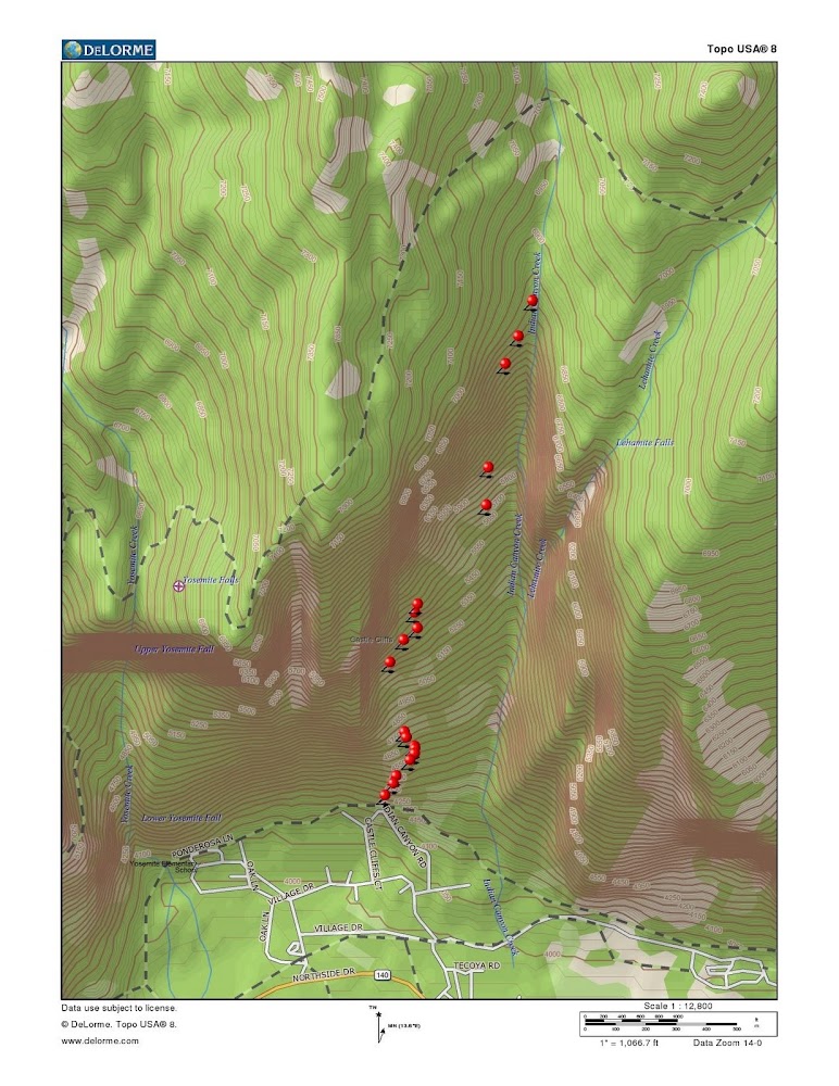
Here's some more with annotations of what we did:

http://picasaweb.google.com/yosemite.chick.on/Indian
(I put whever's pix with numbers in that set... and referred to it)

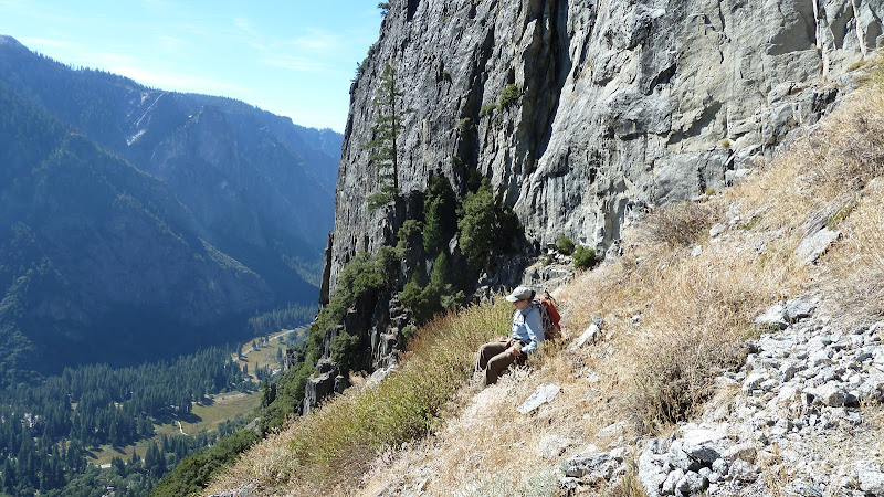
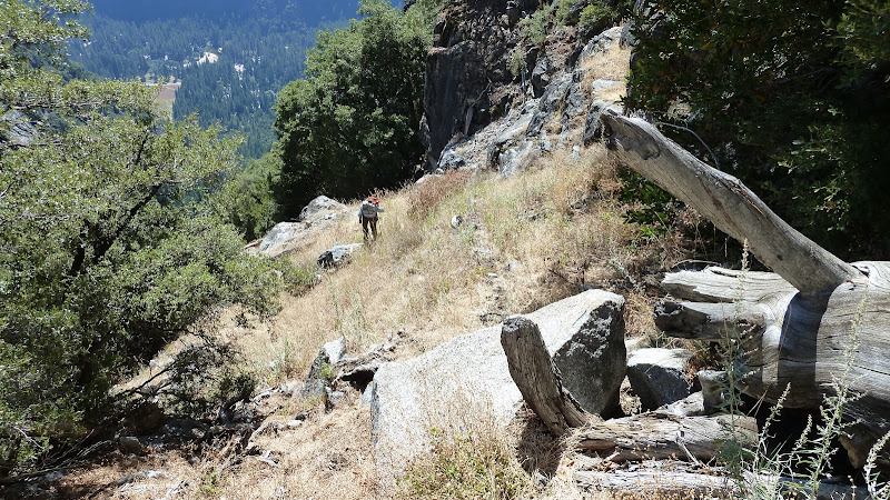
I thoroughly enjoyed it. The trail is definitely well defined from the start (#13)
to about #9. From #9 to #3 you are on your own. After #3 you should
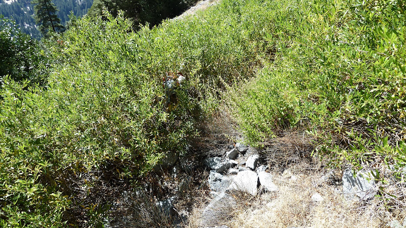
be able to find the trail again. It gets brushier up there and the trail is cut back.
All the hiking is pretty much in Black Oaks and boulder hopping until the
top. So.. imo the bushwhacking isn't too much.
Biggest issue is that it is very steep. Wife said that she her legs were
wobbly at times. Need to be careful not to dislodge a rock onto the
person below.

I went too high twice-ish. The first was just following the trail all the way to
what looks like the climbers way to the Cliffs (saw gear in trees above).
Had to drop back down and then work our way around.
Second time was the nice open area... this was where the wife whined
and said she didn't want to drop back down 500 ft. and then have to
climb back up... "let's go back down" (and then I whined)
Next time I will cut over quicker... it was just so nice and open there...

Of course going down it may be easier... but I prefer going up. smiling smiley

I enjoy this stuff... I'll definitely do it again... especially since we didn't go to
North Dome on account every time I stopped and looked back someone
was 100ft. below me.

Figure it will take you about 4 hrs going up (that's what we ended up taking).

Have fun. And if you can't find the trail... hate it... or whatnot...
Talk to the bird. It's not easy...
Re: wherever
October 11, 2010 02:46PM
Another view.
Re: wherever
September 04, 2015 12:09PM
I did Indian Canyon June 2015 to North Dome and down Snow Creek. Awesome day. Got caught in the rainstorms but made the views beautiful with the clouds moving over the valley. Pics:


going back down-


Edited 1 time(s). Last edit at 09/04/2015 12:13PM by blondguy.
Sorry, only registered users may post in this forum.

Click here to login