link: Christmas on Inspiration Ridge
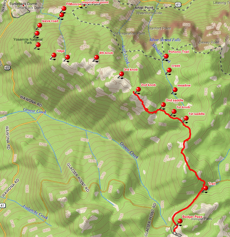
The goal was to find a bit easier hike than El Cap Ridge, and one which would go from Glacier Point Road to the parking lots at Tunnel View or the base of Bridalveil Falls. The Christmas ski trip established the top part of the route, and last month's kiddie hike from Tunnel View to Bridalveil Falls (link) scoped out the condition of the lower part of the Old Wawona Road. This trip was to check out the two likely routes in the middle portion. Basically, we went up the old road to where it crosses the ridge, up the ridge to its high points, then down along the Meadow Brook meadows to the Pohono Trail and back down.
The situation was this: It was Monday, June 13, at the peak of the waterfall season. Swinging Bridge was about to be closed for high water, and campsites was getting wet. Everybody and his brother was in the Valley....you could hardly move with your car. Elbow to elbow tourists everywhere. Unless, of course, you simply went a few feet off-trail. My hiking buddy had just shown up, and was ready to try anything. Our original plan was to start up the Pohono Trail at Tunnel View, and come back down via the old road to Bridalveil Falls. Our car spot didn't materialize, so we ended up back at the tunnel, but otherwise all went as planned.
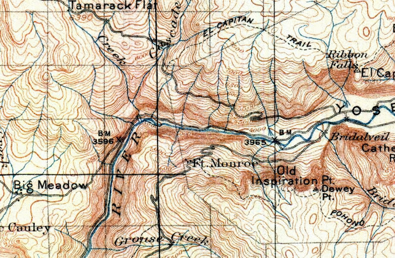
Here is a 1990 ISGS Valley map showing the bottom section of the hike:
You can see the new road to the tunnel coming in from the right and the old road as a trail above it. The old road crosses the new Pohono Trail below Inspiration Point, then comes around and meets the trail again at Inspiration Point. You can see the asphalt from the trail. The old road then heads west and the trail heads uphill. Fort Monroe was located where the old road road touches the white area on the map above Turtleback Dome. Originally, that was also the park entrance station and the starting point of the Pohono Trail, but the trail has since been moved to cut that corner.
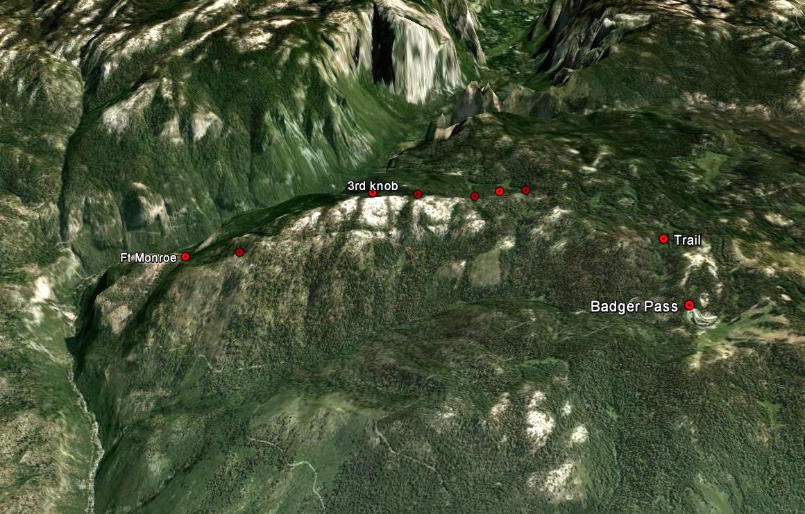
We followed the Pohono Trail from the tunnel to the old road, then up the old road past Inspiration Point and Fort Monroe (nothing left there) past where the line shown on the map peters out, to near the sharp ridge line. This is the high point on the old road....after it turns the corner it slants back down to where the new road is located at Grouse Creek. The Old Wawona Road is well discussed in recent threads.
The west side of the ridge has seen numerous fires. Giant burned-out stumps suggest that this was primeval forest before the great Arch Rock fire of 1990. It must have later grown over with thick brush along the ridge crest and everywhere west of it. But there has been a recent fire that mostly cleaned out the brush. That fire also spread as a ground fire into the groves on the west side of the ridge, sparing the large trees and leaving them easy to walk through. But very steep. At the moment, it's easiest to pick your way up the ridge, but as the brush grows back it might be better to head into the trees.
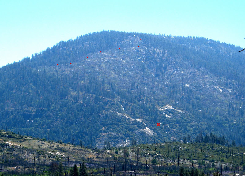
Here is a view from Foresta that shows the route after you leave the road, and before you crest the ridge. Dots show where you leave the old road to head up the hill. The X is in on the new road, west of the tunnel. Turtle Dome is just out of sight to the left. The low ridge in the foreground is the south boundary of Foresta.
As you climb on our hike, you will see the Devils Dance Floor across the valley, near Tamarack Campground. It is named for its large flat granite top. It marks the east edge of the Big Meadow fire two years ago. I believe that was at the same time as the fire on Inspiration Ridge.
To the northwest from the hike, you can see Foresta, Big Meadow, and the (under the trees) the location of Little Nellie Falls.

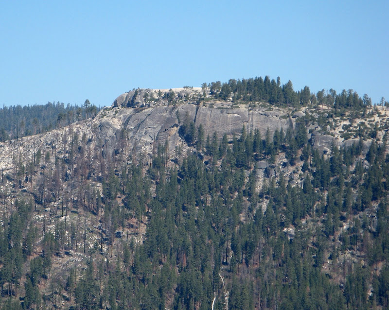
Once you get up onto the lowest knob on the ridge, things ease up a lot. As you walk from knob to knob, there is much more exposed granite and there are huge boulders to admire everywhere. Here is one boulder:

At the second saddle (as named on my December romp) we headed down the hill to the meadows of Meadow Brook. They were flooded.

The meadows were open, but the woods still had several feet of snow. Mr. Bear had been to visit:

Of course, we didn't walk at all in the meadows. We stayed in the snow in the woods (including some giant old sugar pine, red cedar, and ponderosa pine), until we got to where the creek exits into a steeper gorge. Then we could cross the creek on numerous snow bridges. A short distance below this area, the now enlarged creek tumbles over Silver Strand Falls. Also known as Inspiration Falls and Widow's Tears Falls. It's 1170 feet high according to the Yosemite Waterfall booklet. That makes it one of the tallest falls in the park. It doesn't look that tall in this photo taken from near Fireplace Bluff, but the topo map shows that it's true.

We really didn't want to go over the falls, so we were careful to watch for the Pohono Trail. Even so, my buddy walked past it, and I only found it because the GPS said to look right there. Then it was possible to see the faint impression of some snowshoes. The problem was that the snow melt was proceeding at a great rate; the automated snow gauge at White Wolf was dropping five inches per day. I expect that it was doing the same here. The snow was firm and easy to walk on going downhill, but any surface marks weren't lasting very long.
We passed by Old Inspiration Point, which has a fabulous view of the falls. It is a couple hundred feet below the Pohono Trail. Coming back up in the wet snow didn't look like much fun. The rest of the hike down was uneventful. We met the first oncoming hikers just below snow line. Except for evidence of fire fighting, we saw no sign that anyone does this hike. My recommendation for the future, if you can get someone to drop you off, is to do it one way down from the Glacier Point Road. Just leave the road at the cross country ridge trail to Dewey Point, and be sure to take the left fork in the ridge. Once you make that turn, I don't see how you could get lost.
The red GPS trace is from the December trip.
Driving home two days later, it was 99 degrees in the Central Valley, and 93 at our home near San Jose. The Valley was getting fantastic spring runoff.
Edited 2 time(s). Last edit at 06/10/2014 05:52PM by wherever.