My wife and I have a permit for Porcupine Creek to Yosemite valley via the Upper Falls Trail for entry on 6/26. We intended on checking out Indian Rock and North Dome before heading for the Falls. I've been lurking in the forums for the last few weeks trying to filter through all the great information. After reading the recent posts on the North Rim and looking at NPS current conditions it would seem that our plans need some revision.
I received priceless information from several people on the forums last year, almost to the day, when my Brother and I entered at Cathedral Lakes for the Valley via JMT. I did get a lot of good practice traveling in snow conditions, sun cups included (long meadow was full of 'em) but I'm hesitant to go forward with our plans based on what I've been reading. I'm not so much worried about snow coverage or trail visibility, as I am worried about creek crossings. I believe there are at least 2 creeks that will require crossing, Indian and Snow are coming to mind, but my maps is not handy at the moment.
I would be forever grateful for any useful input or opinions on the current conditions out in that neck of the woods. Any alternate routes or even entirely different ones that will give my wife and I a chance to escape into the forest wilderness would be incredible. I have slept on the permit station porch before and am more than willing to do it again if necessary. I'll be sure to post a trip report, pics included, when we return. Let me know if y'all need more info. Thanks!

The Moon is Waxing Gibbous (79% of Full)
Re: Porcupine Creek to Yosemite Valley 6/26??
All posts are those of the individual authors and the owner
of this site does not endorse them. Content should be considered opinion
and not fact until verified independently.
|
Porcupine Creek to Yosemite Valley 6/26?? June 22, 2011 06:04PM | Registered: 13 years ago Posts: 22 |
June 22, 2011 07:15PM | Registered: 14 years ago Posts: 7,421 |
Sounds like you are starting at "North Dome/Porcupine Creek" TH.
Heading to Indian Rock, then North Dome, along the rim, and down Yosemite Falls trail to valley.
Go.
I mentioned on another thread that Indian and Lehemite are a non-issue.
The only one of any concern would be Porcupine... and you should be able to cross that via logs or
whatnot. Or get your feet wet. I think you're worrying too much.
You won't be going near Snow Creek.
If Porcupine really gives you an issue crossing... what you can do is head back to Porc. CG
and park across from it and then not have to cross it. It involves plenty of non-trail and you
may not like it though in order to get to the ND trail.
June 22, 2011 08:57PM | Registered: 12 years ago Posts: 343 |
June 22, 2011 09:00PM | Registered: 14 years ago Posts: 7,421 |
June 22, 2011 09:02PM | Admin Registered: 15 years ago Posts: 17,051 |
|
Re: Porcupine Creek to Yosemite Valley 6/26?? June 22, 2011 09:24PM | Registered: 13 years ago Posts: 22 |
"What, me worry?" that's the story of my life. I'll try to swallow a chill pill.
My wife and I are hoping to take the Yarts bus from YV to the Porcupine Creek TH. The Yarts policy seems to be that they will stop on demand anywhere the driver deems safe enough if you request it ahead of time. Anyone with experience with this, please feel free to chime in.
Thanks for replies everyone.
June 23, 2011 07:59AM | Registered: 13 years ago Posts: 426 |
We did the Porcupine Creek to North Dome, by way of Indian Rock, last July 4, and it was wonderful. We were staying in TM, so we did is as an out and back, but met enough people going down the Yosemite Falls trail that we made a note to try it that way some day as well. But then we saw the zig zag going down into Little Yosemite Valley, and we have to do that one too.
After hiking through the Tuolumne River valley in the days before this hike, we were prepared for a full mosquito assault, but looking back on it now, I don't recall getting attacked at all on this side of the road. I assume it's because there's less standing water on the rim.
After hiking through the Tuolumne River valley in the days before this hike, we were prepared for a full mosquito assault, but looking back on it now, I don't recall getting attacked at all on this side of the road. I assume it's because there's less standing water on the rim.
June 23, 2011 08:03AM | Registered: 14 years ago Posts: 7,421 |
June 23, 2011 11:26AM | Registered: 15 years ago Posts: 4,173 |

|
Re: Porcupine Creek to Yosemite Valley 6/26?? June 29, 2011 09:17PM | Registered: 13 years ago Posts: 22 |
Pano shot from top of North Dome on Sunday 6/27/11. I get a lil trip report together soon, all went very well. Snow and creeks were non-issues.
http://www.flickr.com/photos/30075804@N08/5886269679/in/photostream
Edited 1 time(s). Last edit at 06/30/2011 07:28PM by sewolpe.
http://www.flickr.com/photos/30075804@N08/5886269679/in/photostream
Edited 1 time(s). Last edit at 06/30/2011 07:28PM by sewolpe.
|
Re: Porcupine Creek to Yosemite Valley 6/26 : Updated w/ Trip Report June 30, 2011 09:46PM | Registered: 13 years ago Posts: 22 |
Porcupine Creek to Yosemite Valley via Yosemite Falls Trail
On Sunday, 6/26/11, my wife and I drove 6 hours from our home in So. Cal. to Yosemite Valley. We came out Wawona tunnel at approx. 1:30pm. We then spent the next 2 hours crawling through the valley floor to the parking area. Upon parking we then waited at the shuttle stop for 45 mins with no signs of a bus. All the while the stop across the street saw 8 buses go through. Eventually the buses made it. Lesson here, do not arrive late to YV on the weekend.
We then proceeded to the Wilderness station, and quickly got out permit, bear canister and wilderness lecture; the Ranger immediately began the scare routine when we told him our entry point. He then showed us the most recent conditions report, which were fairly accurate based on what we saw. After convincing him that we were well prepared and did not need 2 bear canisters we went out to wait for the Hwy. 120 Yarts bus. We only waited about 5 minutes before the bus showed up, almost 5pm on the dot. By 5:05pm we were on our way, headed for the Porcupine Creek/North Dome TH.
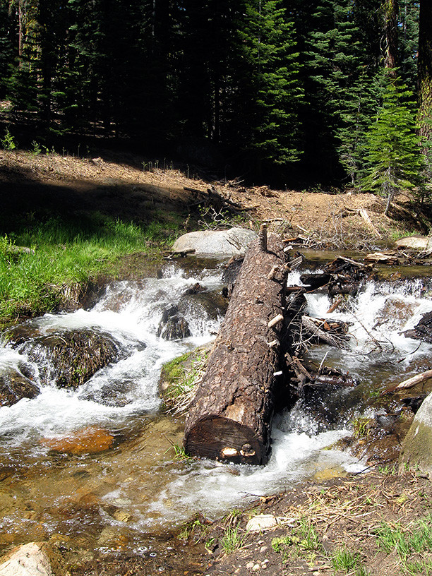
We arrived at the TH at approx. 6:15pm and were on the trail within minutes. While the TH itself is clear of snow, we met 1-3' deep conditions almost immediately, no post-holing though. There were several foot prints which made staying on the trail much easier than I had anticipated. We reached Porcupine Creek and as the conditions report indicated we found a safe log crossing 100 yards or so upstream. The log was pretty wet but large enough in diameter to comfortably walk across and had several large branches that provided good hand holds. The mid section of the log was submerged about 6"-8" in the stream, this was not a problem though. It was relatively late in the day and I imagine the water level would have been a bit lower had we not been dependent on the Yarts bus for a ride.
Here is the trail head.
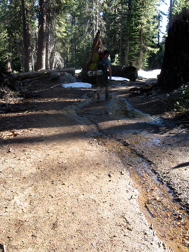
And here is just after the trail head.
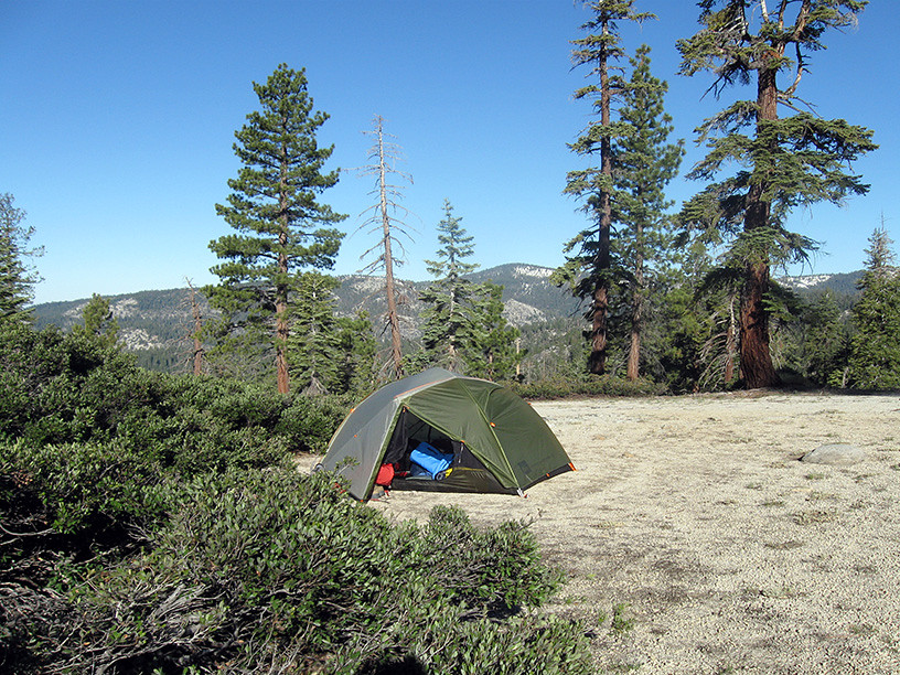
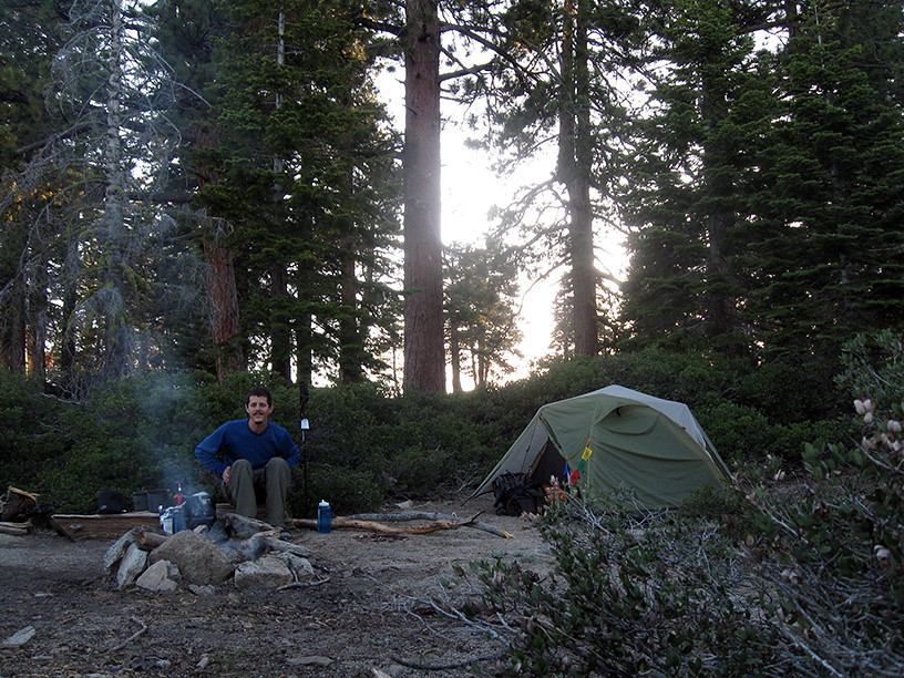
The trail remained covered in 60-80% snow up until the junction where you can go right and continue to Lehamite Creek or go straight towards Indian Rock and North Dome (our route). At that point and beyond we only encountered minimal patches of snow. We passed by one campsite shortly after the junction, about 100 yards from the trail West of Indian Rock. It appeared to have some great views and a nice established fire ring; it also already had a group of campers. We continued on and right before the trail up to Indian rock found a camp site with shrouded views of the formation. It wasn't until the following morning that we discovered the fire ring, oh well.
Our humble camp.
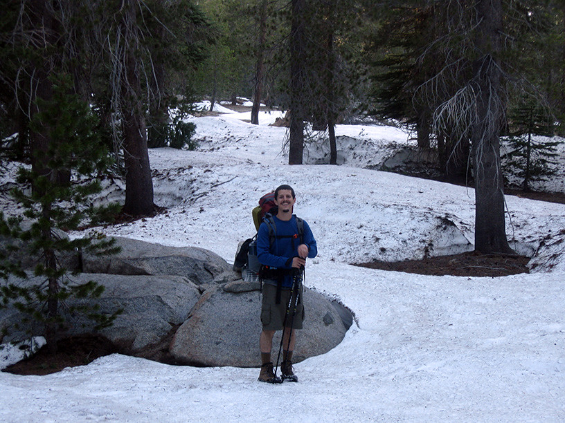
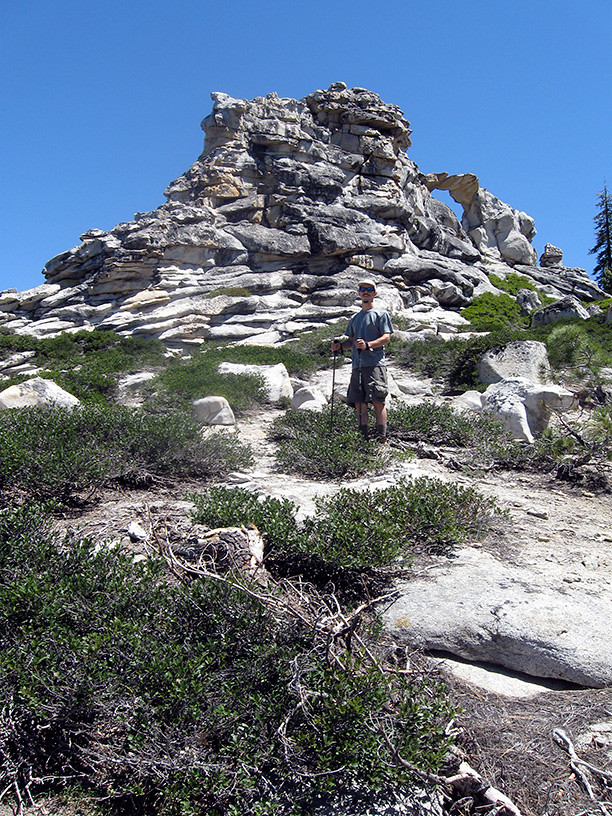
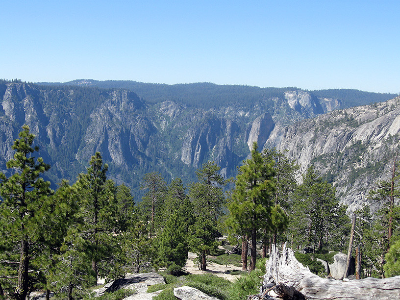
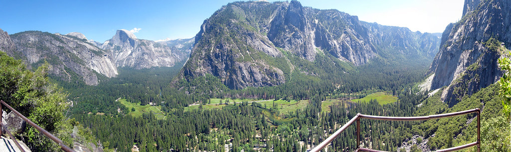
We did our morning thing, packed up the tent, found water nearby and headed out to Indian Rock. After a few photo op's with the arch we headed back down and went on towards North Dome. We dropped our packs at the North Dome trail marker and headed up the dome. We arrived at the top of North Dome a little after noon and enjoyed the views for 30-45 minutes. It was great to see the park from that perspective, what a great view. I am surprised, yet thankful we saw as few day hikers as we did given such easy accessibility to a view that IMO easily rivals Half Dome at much less mileage. We then returned to our packs, pulled out a few snacks to fill our pockets and continued on the trail towards Lehamite Creek.
Going out for some water.
Heading back to the trail on day 2.
Me and Indian Rock, or Indian Rock and I.
See pano of North Dome above.
The trail after North Dome towards Lehamite Creek.
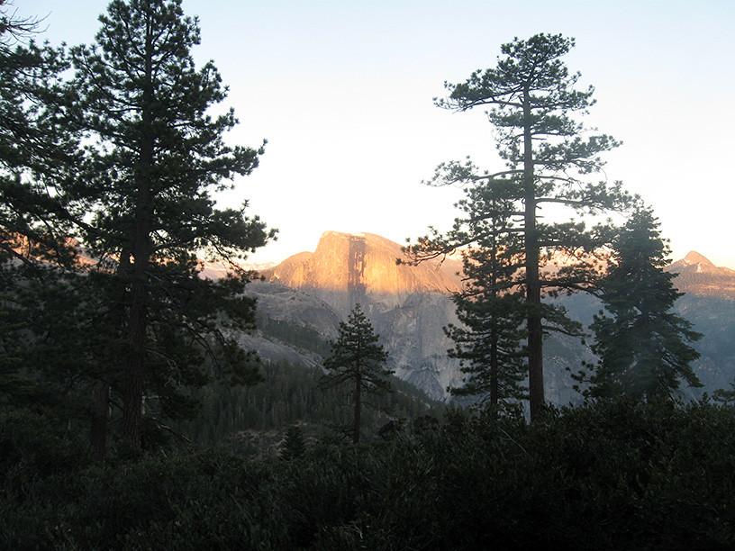
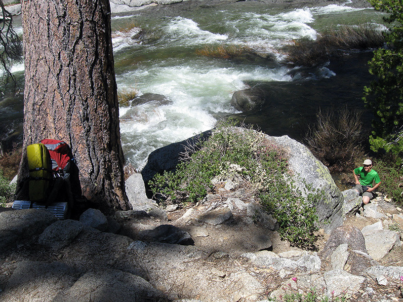
After several creek crossings that all required a short hike upstream we found an established camp site right before the descent towards Yosemite Valley Upper Falls. It seemed to lay directly across the valley from the NW face of Half Dome. I completely forgot to fill our reservoir up at the last marked creek and found myself hiking back about half a mile to a mosquito infested spring where I experienced hell on earth. So many skeeters, I was at a loss. As I filtered our water I received no less than 30 bites in 5 minutes time. It was the only time I got bit on the whole trip, as far as I know.
One of the many small creek crossings. This may be Royal Arches Creek, but I am not certain.
Our humble camp take 2.
The view from camp.
A snow flower near camp.

I have spent about a dozen or so evening in the parks wilderness but this evening the light show was more utterly amazing than usual. The horizon glowed with pink and purple highlights that slowly faded to blue as the night continued. At one point it seemed that dusk had turned right into dawn, skipping all of the night, it was very beautiful. We had a few deers visit us and several lizards hang out during dinner. We also saw some Jays, Wood Peckers and some sort of Raptor but not sure exactly what kind.
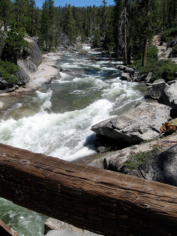
The next day we slept in but made quick work of packing up camp and eating some breakfast. We headed out towards Yosemite Upper Falls at about 10:30am. Once we reached Yosemite Point, the number of people we encountered rose exponentially. We snapped some pics at the Point, there was a great rainbow in the mist of the Falls, and crossed by a couple arguing so loud we swore we could still hear them as we neared the bridge at the top of the Falls. We reached the top of the Falls and found a safe place to access the water for filtering. After filling up we hung out at the bridge and overlook and ate some snacks. We gave some water to a random kid who had nothing but the shirt on his back and continued down the trail. Several times down the trail we encountered the kid from earlier as he went up and down short cutting portions of the trail looking for family members and talking to the teenage girls. While descending the trail we crossed by 3 or 4 2-man crews working on the trail steps and retaining walls.
The descent towards Yosemite Upper Falls.
The view from Yosemite Point.
Getting some water at the Falls.
Looking upstream from the bridge.
The Falls from trail.

Just after Colombia Point we crossed by the kid's mother (he had introduced us earlier in the day), she was very dehydrated and being cared for by some kind strangers, we split the remainder of our water with them. They had already called for rescue. On the way down just before reaching Camp 4 we crossed by the emergency responder and then the kid again, we told him what was going on and he took off up the trail. At approx. 3:30pm we reached the valley floor. Minutes later we were sitting at the shuttle stop across from Camp 4 when the strangers who had been with the kid's mother walked up. They said she was okay.
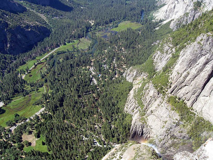
Pano from Colombia Point.
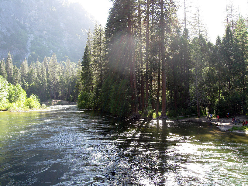
Water level in the Valley.
We had evidently not learned our lesson as we sat at the the shuttle stop for another 45 mins without seeing any buses. We then made the decision to circumvent the shuttle system altogether. This was less convenient, but much less stressful.
We spent that night camping in the valley, woke up the next morning, had some breakfast and tea, then took Hwy 140 out of the park and Hwy 1 home. It was an incredibly good ending to a great trip. We usually enter/exit the park via Hwy 41 through Fresno, not so scenic. I'll post some pics if anyone is interested.
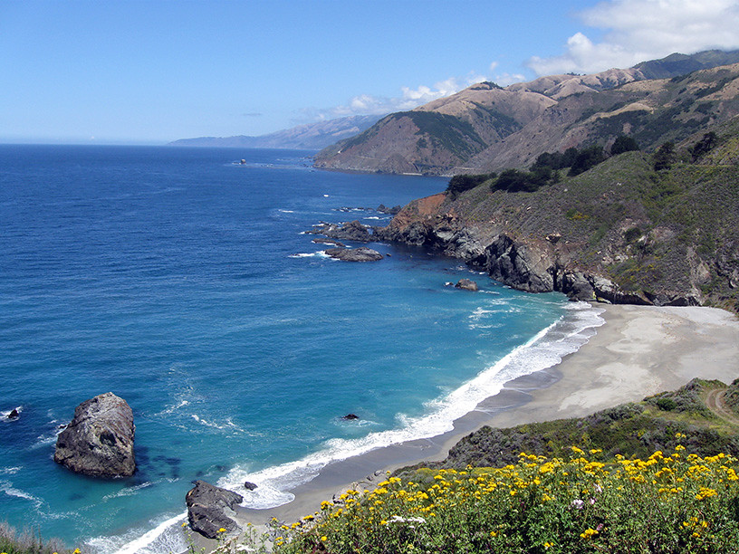
California Coast Line from Hwy 1. Bixby Bridge in the distance.
Edited 2 time(s). Last edit at 07/01/2011 10:09AM by sewolpe.
On Sunday, 6/26/11, my wife and I drove 6 hours from our home in So. Cal. to Yosemite Valley. We came out Wawona tunnel at approx. 1:30pm. We then spent the next 2 hours crawling through the valley floor to the parking area. Upon parking we then waited at the shuttle stop for 45 mins with no signs of a bus. All the while the stop across the street saw 8 buses go through. Eventually the buses made it. Lesson here, do not arrive late to YV on the weekend.
We then proceeded to the Wilderness station, and quickly got out permit, bear canister and wilderness lecture; the Ranger immediately began the scare routine when we told him our entry point. He then showed us the most recent conditions report, which were fairly accurate based on what we saw. After convincing him that we were well prepared and did not need 2 bear canisters we went out to wait for the Hwy. 120 Yarts bus. We only waited about 5 minutes before the bus showed up, almost 5pm on the dot. By 5:05pm we were on our way, headed for the Porcupine Creek/North Dome TH.
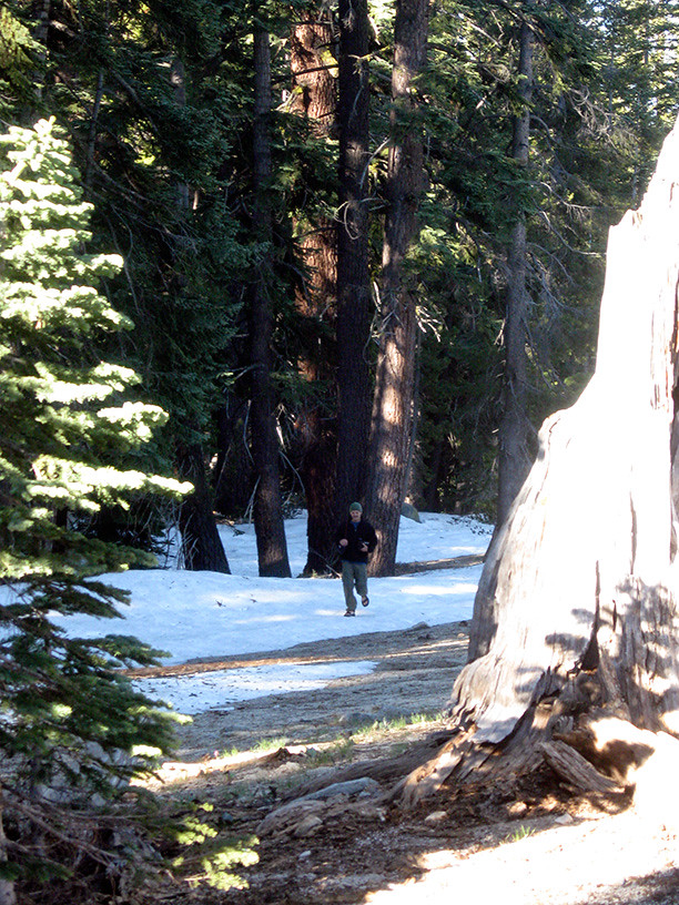
We arrived at the TH at approx. 6:15pm and were on the trail within minutes. While the TH itself is clear of snow, we met 1-3' deep conditions almost immediately, no post-holing though. There were several foot prints which made staying on the trail much easier than I had anticipated. We reached Porcupine Creek and as the conditions report indicated we found a safe log crossing 100 yards or so upstream. The log was pretty wet but large enough in diameter to comfortably walk across and had several large branches that provided good hand holds. The mid section of the log was submerged about 6"-8" in the stream, this was not a problem though. It was relatively late in the day and I imagine the water level would have been a bit lower had we not been dependent on the Yarts bus for a ride.
Here is the trail head.
And here is just after the trail head.
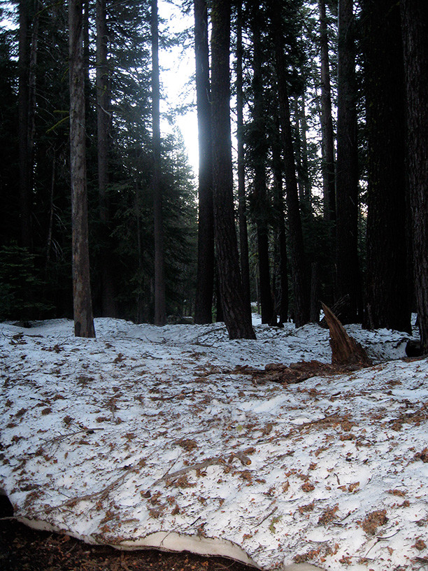
The trail remained covered in 60-80% snow up until the junction where you can go right and continue to Lehamite Creek or go straight towards Indian Rock and North Dome (our route). At that point and beyond we only encountered minimal patches of snow. We passed by one campsite shortly after the junction, about 100 yards from the trail West of Indian Rock. It appeared to have some great views and a nice established fire ring; it also already had a group of campers. We continued on and right before the trail up to Indian rock found a camp site with shrouded views of the formation. It wasn't until the following morning that we discovered the fire ring, oh well.
Our humble camp.
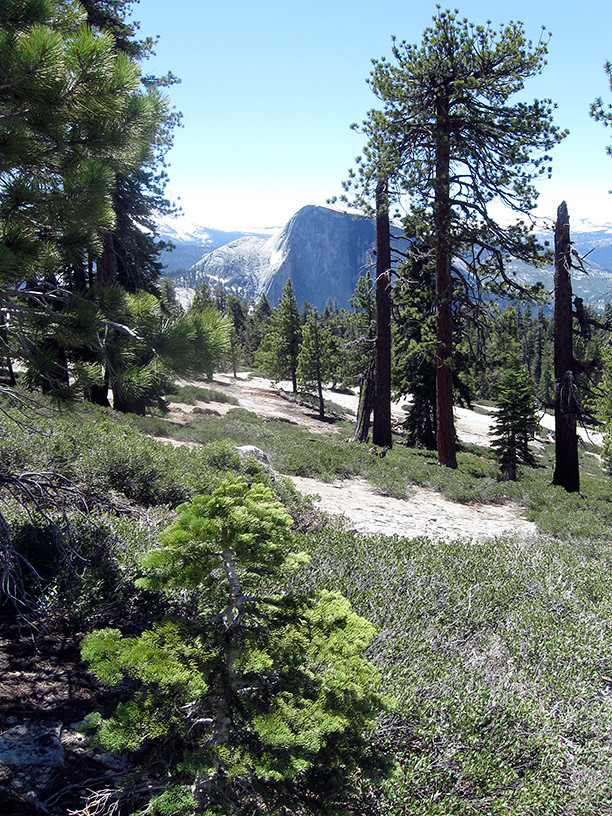
We did our morning thing, packed up the tent, found water nearby and headed out to Indian Rock. After a few photo op's with the arch we headed back down and went on towards North Dome. We dropped our packs at the North Dome trail marker and headed up the dome. We arrived at the top of North Dome a little after noon and enjoyed the views for 30-45 minutes. It was great to see the park from that perspective, what a great view. I am surprised, yet thankful we saw as few day hikers as we did given such easy accessibility to a view that IMO easily rivals Half Dome at much less mileage. We then returned to our packs, pulled out a few snacks to fill our pockets and continued on the trail towards Lehamite Creek.
Going out for some water.
Heading back to the trail on day 2.
Me and Indian Rock, or Indian Rock and I.
See pano of North Dome above.
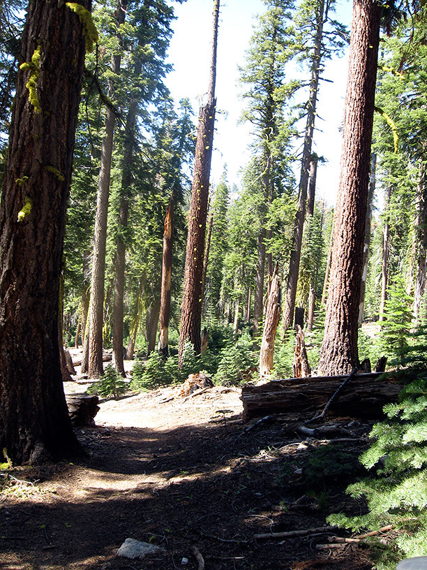
The trail after North Dome towards Lehamite Creek.
After several creek crossings that all required a short hike upstream we found an established camp site right before the descent towards Yosemite Valley Upper Falls. It seemed to lay directly across the valley from the NW face of Half Dome. I completely forgot to fill our reservoir up at the last marked creek and found myself hiking back about half a mile to a mosquito infested spring where I experienced hell on earth. So many skeeters, I was at a loss. As I filtered our water I received no less than 30 bites in 5 minutes time. It was the only time I got bit on the whole trip, as far as I know.
One of the many small creek crossings. This may be Royal Arches Creek, but I am not certain.
Our humble camp take 2.
The view from camp.
A snow flower near camp.
I have spent about a dozen or so evening in the parks wilderness but this evening the light show was more utterly amazing than usual. The horizon glowed with pink and purple highlights that slowly faded to blue as the night continued. At one point it seemed that dusk had turned right into dawn, skipping all of the night, it was very beautiful. We had a few deers visit us and several lizards hang out during dinner. We also saw some Jays, Wood Peckers and some sort of Raptor but not sure exactly what kind.
The next day we slept in but made quick work of packing up camp and eating some breakfast. We headed out towards Yosemite Upper Falls at about 10:30am. Once we reached Yosemite Point, the number of people we encountered rose exponentially. We snapped some pics at the Point, there was a great rainbow in the mist of the Falls, and crossed by a couple arguing so loud we swore we could still hear them as we neared the bridge at the top of the Falls. We reached the top of the Falls and found a safe place to access the water for filtering. After filling up we hung out at the bridge and overlook and ate some snacks. We gave some water to a random kid who had nothing but the shirt on his back and continued down the trail. Several times down the trail we encountered the kid from earlier as he went up and down short cutting portions of the trail looking for family members and talking to the teenage girls. While descending the trail we crossed by 3 or 4 2-man crews working on the trail steps and retaining walls.
The descent towards Yosemite Upper Falls.
The view from Yosemite Point.
Getting some water at the Falls.
Looking upstream from the bridge.
The Falls from trail.
Just after Colombia Point we crossed by the kid's mother (he had introduced us earlier in the day), she was very dehydrated and being cared for by some kind strangers, we split the remainder of our water with them. They had already called for rescue. On the way down just before reaching Camp 4 we crossed by the emergency responder and then the kid again, we told him what was going on and he took off up the trail. At approx. 3:30pm we reached the valley floor. Minutes later we were sitting at the shuttle stop across from Camp 4 when the strangers who had been with the kid's mother walked up. They said she was okay.
Pano from Colombia Point.
Water level in the Valley.
We had evidently not learned our lesson as we sat at the the shuttle stop for another 45 mins without seeing any buses. We then made the decision to circumvent the shuttle system altogether. This was less convenient, but much less stressful.
We spent that night camping in the valley, woke up the next morning, had some breakfast and tea, then took Hwy 140 out of the park and Hwy 1 home. It was an incredibly good ending to a great trip. We usually enter/exit the park via Hwy 41 through Fresno, not so scenic. I'll post some pics if anyone is interested.
California Coast Line from Hwy 1. Bixby Bridge in the distance.
Edited 2 time(s). Last edit at 07/01/2011 10:09AM by sewolpe.
July 01, 2011 08:19AM | Registered: 12 years ago Posts: 254 |

Sorry, only registered users may post in this forum.

