Welcome! Log In Create A New Profile Recent Posts
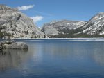
Tenaya Lake, Yosemite National Park

The Moon is Waxing Gibbous (59% of Full)


Advanced

Upper Pines to Nevada and back, 8.5 miles?

All posts are those of the individual authors and the owner of this site does not endorse them. Content should be considered opinion and not fact until verified independently.

Upper Pines to Nevada and back, 8.5 miles?
June 24, 2011 08:31PM
My garmin 60csx (whatever the letters are) said it was 8.5 miles from our site in the last loop of UP CG up the mist trail to Nevada then down the JMT (with an accidental eye rolling smiley decent via the stock trail) and back to the site. But the signs, etc, told me that reading was at least a mile too much, if not 2 miles.

Which is right? Signs that tell me that was closer to 6.5 or my GPS?
avatar Re: Upper Pines to Nevada and back, 8.5 miles?
June 25, 2011 08:14AM
I don't have a GPS track of that particular hike, but my experience is that more often than not the distance on the signs in Yosemite are inaccurate. They never add up or make much sense. For example, you'll be standing at Point A where a sign will say "Point B 4.1 miles" and when you get to Point B the sign will say something like "Point A 3.9 miles". And when you get to point C it gets even more confusing since nothing adds up in either direction. Also, <random fact> the sign in Tiltill valley showing its elevation is off by 1000 feet. </random fact> So yeah, I don't trust the signs.

Another thing you can do is drop the track on a map (if you don't have an application that does this use something like everytrail.com) and see if there are any obvious anomalies on your track (if your signal was lost even for a second, which is pretty easy in the valley, your track might show it with some strange spikes or variations). If you're GPS-track savvy you can go in and edit those points out to get a more accurate number.
avatar Re: Upper Pines to Nevada and back, 8.5 miles?
June 25, 2011 12:48PM
Quote
calipidder
(if your signal was lost even for a second, which is pretty easy in the valley, your track might show it with some strange spikes or variations).

A GPS can also get off quite a bit by receiving reflections of a signal. Quite possible in the valley area.
avatar Re: Upper Pines to Nevada and back, 8.5 miles?
June 25, 2011 08:36AM
Quote
hotrod4x5
My garmin 60csx (whatever the letters are) said it was 8.5 miles from our site in the last loop of UP CG up the mist trail to Nevada then down the JMT (with an accidental eye rolling smiley decent via the stock trail) and back to the site. But the signs, etc, told me that reading was at least a mile too much, if not 2 miles.

Which is right? Signs that tell me that was closer to 6.5 or my GPS?


A rough TOPO! software mapping of that route claims it to be in the 6.0-6.5 mile range.

Also, see:
http://www.nps.gov/yose/planyourvisit/loader.cfm?csModule=security/getfile&PageID=200006


Edited 1 time(s). Last edit at 06/25/2011 08:41AM by szalkowski.
avatar Re: Upper Pines to Nevada and back, 8.5 miles?
June 25, 2011 01:23PM
Quote
hotrod4x5
My garmin 60csx (whatever the letters are) said it was 8.5 miles from our site in the last loop of UP CG up the mist trail to Nevada then down the JMT (with an accidental eye rolling smiley decent via the stock trail) and back to the site. But the signs, etc, told me that reading was at least a mile too much, if not 2 miles.

Which is right? Signs that tell me that was closer to 6.5 or my GPS?

I ran a route using BaseCamp and it showed 6.7 miles. I'm not sure where you started exactly but I guessed at Clark's Bridge. If closer than that then the round trip would be a bit shorter.


Old Dude
Sorry, only registered users may post in this forum.

Click here to login