All posts are those of the individual authors and the owner of this site does not endorse them. Content should be considered opinion and not fact until verified independently.

Return to Cherry Creek Canyon
July 05, 2011 08:32PM
My wife still recovering from a back injury, this weekend I returned to Cherry Creek Canyon with some friends, one of whom had never been there. (For previous trips and pictures, see here:

http://yosemitenews.info/forum/read.php?3,27875,37777)

We went up-canyon on the way out, then returned by ascending the gully to Lookout Point.
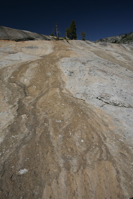
Pictures

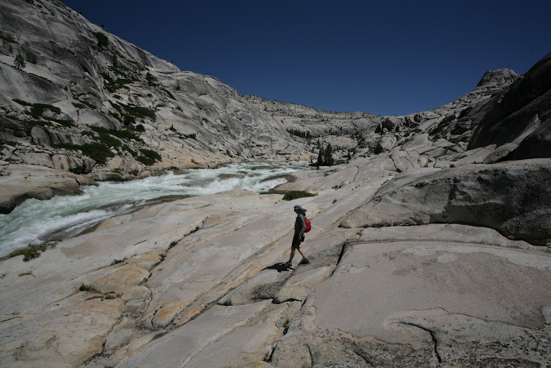
Unlike my trip a month ago, summer was in full-force, and the sun was especially blazing in the open granite areas. Snow was all but gone from the canyon, and we made it to the Big Lake outlet confluence on our layover day. Cherry Creek was cold, but the small creek that flows into the Flintstone area from below Sachse Spring, passing over almost hot granite, formed a warm swimming pool at its base.


The canyon between Cherry Bomb Gorge and Lord Meadow is special--a long granite canyon unbroken by valleys, meadows, or lakes created behind the bedrock "dams" that give the Tuolumne or Merced rivers their characteristic form.


We caught up with one couple just below the "Chockstone" crux--they had decided to turn back, but we led them up the crack. They continued on past Flintstone, where we decided to camp. A second couple who had descended from Lookout Point arrived at Flintstone late that night. The next day, we passed a third couple descending the canyon just north of where the Schiffrin route leaves the creek (heading south). These were the only people we encountered until we were on the Kibbie Ridge trail.
avatar Re: Return to Cherry Creek Canyon
July 05, 2011 08:35PM
Great pics, thanks for sharing. I've always loved that canyon. Its nice that you basically had it to yourself, some times its crazy crowded....
Re: Return to Cherry Creek Canyon
July 05, 2011 08:49PM
For those who want some "beta" on the Lookout Point route, here is a description and GPS track of the route:

Lookout Point Route

The route we took rougly followed the small creek that flows from north of Lookout Point to a wooded area just below Camp Flintsone. The route was relatively straightforward, although I imagine it would be easier to follow up than down, since there are several places where one could get hung up by cliff bands not visible from above, especially between 6400' and 6600'. We also managed to avoid significant brushy sections, but I suspect that luck played some role in that.

Here's a brief route description: from Flintstone, ascend open granite just east of the stream to about 6000', where cliffs force you southwest across the creek to easy, open granite on dome 6202'. Continue south/southwest across a series of granite ridges until the final one, where you can scout for a route up the wooded hillside that avoids cliff bands. The next 400' is a steep ascent of this heavily wooded hillside. Around 6800' the gradient eases a bit--continue climbing until you meet the Kibbie Ridge trail, which is fairly obvious in this area (it was much less conspicuous closer to now-unsigned Lookout Point itself...)

Based on GPS, the Lookout Point route was about the same distance as the creek route (approx. 7 miles), but took us a few hours less time.

While climbing the route, we scouted for an alternative to climbing the wooded hillside between 6400' and 6800'. It appears that it might be possible to descend one of the gullies southwest for a few hundred feet to a point immediately below Lookout Point, then continue southwest climbing open granite to what is hopefully open forest (see black and blue routes on map above).

For completeness, here's another writeup that includes the Lookout Point route: http://www.snwburd.com/matthew/cherry_creek_02/index.html. I can't say we had nearly as much difficulty as the writer indicates he did, but given his experience, it's safe to say that this route is not a cakewalk...


Edited 1 time(s). Last edit at 07/07/2011 07:08PM by basilbop.
avatar Re: Return to Cherry Creek Canyon
July 05, 2011 09:03PM
Protest! You beat me to it! smiling smiley

I'll repeat what we've both said... that canyon kicks booty!

Thanks for the report
Re: Return to Cherry Creek Canyon
July 06, 2011 06:42AM
It's only fair, you scooped me on (re)locating Moran Point!
avatar Re: Return to Cherry Creek Canyon
July 06, 2011 10:55AM
Quote
basilbop
It's only fair, you scooped me on (re)locating Moran Point!


Bill-e-g was being continually harrassed by the chikin to make that trip.
As you have undoubtedly noticed, Chick-on's command of English is borderline at best and he thought that the location was something else entirely.
(NotPhonetically Yours)
The Marmots
avatar Re: Return to Cherry Creek Canyon
July 06, 2011 04:18PM
Yeah... I only found some really intelligent people there.


Chick-on is looking at you!
avatar Re: Return to Cherry Creek Canyon
July 06, 2011 04:37PM
Quote
chick-on
Yeah... I only found some really intelligent people there.


See? That's what we told you.
(Affirmationly Yours)
The Marmots
avatar Re: Return to Cherry Creek Canyon
July 06, 2011 07:43PM
I guess I wasn't there! Hah

Anyways, yeah, Cherry Canyon is awesome. I've enjoyed every trip I've made into it. Its beautiful from above and while you're in it. Something is definitely special about it...
Re: Return to Cherry Creek Canyon
July 07, 2011 12:00PM
Awesome. I've never been there, but the latest Outside Magazine (or is it Backpacker?) lists that hike as one of the 50 best in the country and the best weekend hike in CA
avatar Re: Return to Cherry Creek Canyon
July 07, 2011 12:56PM
That sucks. Guess I know where I'm not going until the road closes now.


Chick-on is looking at you!
Re: Return to Cherry Creek Canyon
July 07, 2011 02:33PM
Hate it when a favorite place is (re)discovered by the popular press... fortunately, these things tend to result in only temporarly blips in visitation. On the other hand, a few years ago wasn't there an article about the old cavalry trail to Obelisk Lake as part of a series on "lost" trails? I can't imagine that this resulted in hordes of people wading across the Merced then clawing their way up Grey Peak fork looking for a "trail" that was probably at best a few blazed trees and some broken branches well over 100 years ago. (Oh, and the trail most likely didn't even go to Obelisk Lake...) What's disappointing is that a lot of these "articles" seem to be rehashes of stuff gathered from elsewhere on the Internet written by people who probably never were there.


Edited 1 time(s). Last edit at 07/07/2011 03:16PM by basilbop.
avatar Re: Return to Cherry Creek Canyon
July 07, 2011 02:51PM
Exactly. That is exactly what occurred. Backpacker magazine.

What has happened very recently is everyone and their mother wants to go up Rockslides now.
Had a lovely conversation with a ranger last year about this. Suffice it to say he was just
slightly pissed. Said that pretty much if it gets bad they are just going to a) tell Backpacker
to not publish articles... and b) quit giving out permits. For the first time in MANY MANY years
that trail was booked solid...
w/r to Obelisk... I've mentioned this before but what they actually do is plan for S&R by
looking at Backpacker magazine. At least that is what I was told by a wilderness ranger.
That summer from what he told me they had to patrol the area and extract a number of
ill prepared folks.

Here's my personal Obelisk jaunt from a couple years ago:
https://picasaweb.google.com/yosemite.chick.on/Obelisk

I've yet to do the Cavalry route...


Chick-on is looking at you!
avatar Re: Return to Cherry Creek Canyon
July 07, 2011 03:33PM
Hey Bill-e, you'll probably be alright, I just read that article. It was listed as the Kibbie Ridge Trail and it just says to look into the canyon, not go into it. Their route was go out the ridge and drop into Many Island Lake for the first night, then go back on the trail and go the rest of the way to Boundary the next day. Damn.

The one thing I loved about that trailhead is that 90% of the people go to Kibbie only, and don't venture out Styx Pass. At least the vast majority of people never go crosscountry, so that's one thing to be happy about...

As for the cavalry trail, I can't speak for the one going to Obelisk, but whats left of the one going to Mercur is superb. Those guys didn't mess around. When you use dynamite to blast a trail, it stays there for over a century...

Speaking of the canyon this weekend I'm going out the Box Spring Trailhead near Bourland Mdws and then going to into Chain Lakes toward Studhorse Meadows along West Cherry Creek. Should be interesting...
avatar Re: Return to Cherry Creek Canyon
July 07, 2011 03:51PM
Ok, that's just funny. Kibbie Ridge Trail. I've only heard people whine about that trail.
Lately they have been sweeping the trail to Kibbie it seems... and then doing absolutely nothing about KR trail.
So a plenty will be a bit surprised... not to mention the fire damage... (gives it character imo)

I thought you were heading south to Chain Lakes out of Quartz... S. Yosemite. Figures there's another Chain Lakes.
Have fun


Chick-on is looking at you!
avatar Re: Return to Cherry Creek Canyon
July 07, 2011 04:05PM
Quote
chick-on
Ok, that's just funny. Kibbie Ridge Trail. I've only heard people whine about that trail.
Lately they have been sweeping the trail to Kibbie it seems... and then doing absolutely nothing about KR trail.
So a plenty will be a bit surprised... not to mention the fire damage... (gives it character imo)

I thought you were heading south to Chain Lakes out of Quartz... S. Yosemite. Figures there's another Chain Lakes.
Have fun

The brush/downed trees is kind of rough before lookout point...

Yeah, I figured I'd give the Emigrant a shot this weekend. Being that its a weekend, I'm hoping there'll be less people in the Emigrant than the park...
Re: Return to Cherry Creek Canyon
July 07, 2011 05:12PM
There are another set of Chain Lakes in the western Emigrant. Fortunately, this isn't as confusing as the two Kennedy Meadows, Junction Meadows, or Mono Passes.
Re: Return to Cherry Creek Canyon
July 07, 2011 03:55PM
First time post, but long time backpacker/explorer.

Speaking of Cherry Creek, has anyone accessed the West Fork Cherry Creek canyon/drainage from the logging roads around Hells Mountain (just north of Cherry Lake)? Am looking for a unique way to enter into the Emigrant Wilderness and Hyatt Lake in particular. I could call the ranger station and ask about those logging roads.

See http://www.mappingsupport.com/p/gmap4.php?ll=38.068193,-119.913147&t=t2&z=14&label=off&coord=latlng.

But I thought I'd ask here first. Also, I've never heard any first hand accounts of the lower part of the West Fork of Cherry Creek.

BigD
avatar Re: Return to Cherry Creek Canyon
July 07, 2011 04:08PM
I liked Hyatt, even if it was overgrown...but Big Lake was much nicer. There was an interesting surprise at Yellowhammer lake...

Most of the logging roads are pretty decent, as long as you have a truck with good clearance you'll be fine. Even cars are usually okay, you just have to be a little more careful. Noone wants to have to call Hwy 120 towing because they lost an oil pan....
Re: Return to Cherry Creek Canyon
July 07, 2011 05:27PM
I remember reading something about dropping into Cherry Canyon (and thus the lower part of the West Fork) from this apporach on a website that had info on climbs in Cherry Creek Canyon. (googles...) Ah, yes, here:

http://www.stanford.edu/~clint/cherryck/index.htm

I'm quite partial to the name "Mastadome" (Dome 6202)... oddly, there's no discussion of getting to this dome from Lookout Point, which would seem to be an easy approach by climber standards.

This is an interesting page here: http://www.stanford.edu/~clint/cherryck/02trailmap.pdf. There's a note about a big log that crosses Cherry below what I've been calling the chockstone route crux area ("3rd class [area?]" on the topo) but I don't recall seeing it on recent trips....
avatar Re: Return to Cherry Creek Canyon
July 07, 2011 05:30PM
Are you sure Big Log means it crosses the stream?
Definitely there is a monster log near the crux location... by that "pond".

edit: here it is:
https://picasaweb.google.com/yosemite.chick.on/CherryCreekCanyon#5612637753949323874


Chick-on is looking at you!


Edited 1 time(s). Last edit at 07/07/2011 05:35PM by chick-on.
Re: Return to Cherry Creek Canyon
July 07, 2011 05:36PM
The topo does indicate that "this is the only possible river xing @ high water", but I guess it could mean that you can wade across the river here, and don't actually cross on the log.
avatar Re: Return to Cherry Creek Canyon
July 07, 2011 05:41PM
Yeah. Hard to tell. The map is not super recent. Logs get shoved around.
Quite possible there was a log all the way across when they made the map.
Not anymore...


Chick-on is looking at you!
Re: Return to Cherry Creek Canyon
July 07, 2011 07:12PM
According to this report, it appears there was a log that crossed the creek in 1995: http://www.climber.org/reports/1995/30.html.

"As we moved down canyon and came to a 40- or 50-foot chimney (class 3?) that we had to go down, we noticed a large tree across the creek which provided a very good bridge to the other side and explained the campers over there."
avatar Re: Return to Cherry Creek Canyon
July 07, 2011 08:35PM
This is also in that report: "the lower canyon being unappealing".
Yeah, the Hike up to Lookout Pt. is so much better than the Canyon below Flintstone.
Gimme a break. Yes, the upper portion is more spectacular... but you miss a LOT by skipping the lower.
I think we talked about this already in the other thread...


Chick-on is looking at you!
avatar Re: Return to Cherry Creek Canyon
July 07, 2011 05:33PM
This is 6202 for those interested:
https://picasaweb.google.com/yosemite.chick.on/Cherry#5498039311263000194

For the millionth time... just some spectacular granite..


Chick-on is looking at you!
avatar Re: Return to Cherry Creek Canyon
July 07, 2011 05:28PM
Sorry... just thought I'd say I've looked at the same thing... just haven't done it yet...
Do have a route planned that goes up the entire length of the WF... so I'll know more about WF eventually...
Have only gone up a little ways up the WF... but that way many many years ago... and took the usual way
in from Shingle area.
Nearly went up it a month ago by using a boat to cross the pond area... but wife nixed that
master plan when she said she would rather hike in the snow (I'm not joking).

If/when you call... please post. I'm very curious also.


Chick-on is looking at you!
Re: Return to Cherry Creek Canyon
July 07, 2011 11:12PM
Thanks for all the information everyone. I liked those home drawn maps at the stanford site....very old school and treasure island-ish (the book).

Will definitely post of TR if/when I do the trip, though lot's of other trips planned too and baby on the way.
Re: Return to Cherry Creek Canyon
July 21, 2014 12:20PM
A quick thanks to all the folks who have taken time to provide up-to-date information about this area. It was a great resource for trip planning. I'm not sure I have much new to add.

Finally got out to the area last week. Hit both the WF and EF up to just below lord meadow. The WF was the more populated (perhaps unsurprisingly this year). Bugs liked the WF better too, didn't run into many on the EF.

Really enjoyable creek travel at these water levels. There were none of the navigational hurdles that are discussed in other threads. Learned that the WF can come up quick after a rain. Saw bear poops along the EF, but no bears.
avatar Re: Return to Cherry Creek Canyon
July 21, 2014 01:47PM
Quote
caeiro
A quick thanks to all the folks who have taken time to provide up-to-date information about this area. It was a great resource for trip planning. I'm not sure I have much new to add.

Finally got out to the area last week. Hit both the WF and EF up to just below lord meadow. The WF was the more populated (perhaps unsurprisingly this year). Bugs liked the WF better too, didn't run into many on the EF.

Really enjoyable creek travel at these water levels. There were none of the navigational hurdles that are discussed in other threads. Learned that the WF can come up quick after a rain. Saw bear poops along the EF, but no bears.

The NF and EF converge at Lord Meadow to form "Cherry Creek". The WF converges with Cherry Creek a mere
(approx.) 2.5 miles from Cherry Lake.
So.. curious about your route. How much of the WF did you do and where did you start (on it) ?
Did you do all of Louse? Then go all the way down to where WF converges with Cherry Creek proper?
Then back up to Big Lake outlet and back up?

Anywho, just curious. It's all good. Def. gonna do what just typed there above someday.
All forks are great.

Both times this year didn't see a single person along WF/EF/NF/CK... technically though I guess we
did see some peeps by WF up near Gem/Piute Lakes.

Have fun


Chick-on is looking at you!
Re: Return to Cherry Creek Canyon
July 22, 2014 09:27AM
We didn't get a chance to explore louse canyon this trip. We saw the lower section of the WF from about where the 'mile 5' marker is (on the USGS 7.5 minute topos) down.

Then hiked upstream on CC proper (what I guess I have been mistakenly calling EF) from a little above the confluence with WF to just beyond where the outflow from yellowhammer comes in.

Stayed in the canyon most of time until the hike out but getting up the lakes is on the list for next time, as is going up the NF, perhaps when there is a bit more water.


Edited 1 time(s). Last edit at 07/24/2014 11:28AM by caeiro.
Re: Return to Cherry Creek Canyon
July 24, 2014 12:02PM
From down at the creek-level I definitely noticed the saddle you point out crossing cherry ridge north of 6656 and my impression is that trying to cross there would be not fun at all given the steepness of the slopes and how brush-y they were.

These people seem to have found a way down to the WF like what you are talking about but maybe without the steep post-Bear Meadow creek section? That section as you describe it might not be fun either (although I have no first hand experience of that route).

Path of least resistance for us was around to the south of cherry ridge rather than over. It felt like fairly open terrain to get to CC proper, as long as you don't mind hopping on/around boulders for a little while. Not sure how where we intersected CC relates to the chockstone location, but CC was low enough to walk in (excepting deep pools) most of the time, so I didn't actually notice that feature on my way up the creek, and it was not an impediment.
Re: Return to Cherry Creek Canyon
July 24, 2014 05:39PM
Thanks for the link to the TR from Bourland Meadow. I wish there was more detail on how they got down to WF CC. They seem to have found a use trail all the way from the parking lot to WF CC (in 2012). If I can find that it would be easy, but I'm not counting on it.

I guess I can poke around for the best place over Cherry Ridge. If it doesn't look feasible then I can continue heading south, rounding the shoulder if necessary and not actually crossing the ridge.
Re: Return to Cherry Creek Canyon
July 25, 2014 09:25AM
@caeiro: Where did you enter?


Edited 1 time(s). Last edit at 07/25/2014 09:26AM by ags.
Re: Return to Cherry Creek Canyon
July 23, 2014 09:51PM
After a fun (but challenging) trip up Cherry Creek in 2013, I'm doing final planning of the 2014 version. Last year I went in at Shingle Springs, which is not an option this year due to Rim Fire closures. My current plans are to enter at the parking lot Southwest of Bourland Meadow. I'm looking for experience/advice on how to get from there to CC above chockstone. (getting past Flintstone above Cherry Bomb is another story, long in the making. I'll keep that separate for now).

Looking at the Cherry Lake North 7.5 minute topo map, it seems an easy trek to the NE to the (unnamed) creek that passes through Bear Meadow (could be a lot of brush?). Following that creek south looks easy, with the possible exception of the almost-due-east section after Bear Meadow to the junction with the WF of CC. That may be pretty steep. Anyone been there who could offer an opinion?

From the junction of unnamed (Bear Meadow) creek and the WF of CC, attempting to pop over Cherry Ridge to CC proper doesn't look easy. Seems that others have followed the WF of CC south to the confluence with CC proper - any challenges there?

Alternatively, last year when hiking up CC, the only other humans we saw (before Kibbie Ridge Trail) were at a chance meeting on CC at a point between chockstone and Flintstone. We met a group of people that claimed to have been hiking the area annually for the past 20+ years. I was heading north, they were heading west, and we met right at CC. If I understood correctly, they were going to pop over Cherry Ridge (perhaps the southernmost portion?) and continue to a forest road/trailhead. Looking at the topo map, I'm wondering if they went through the saddle on Cherry Ridge north of 6656, which is just east of due north of the confluence of the WF and CC. Otherwise, they'd have to follow CC south to the WF of CC, and that doesn't make sense based on where we met and the direction they headed off.

Can anyone comment on this route? After joining CC proper, I plan to head north, eventually climbing up the drainage from Big Lake, east to Yellowhammer, then wandering back west to get back to the parking lot near Bourland Meadow. I will be going in in two weeks, any help much appreciated.


Edited 1 time(s). Last edit at 07/24/2014 05:36PM by ags.
Re: Return to Cherry Creek Canyon
July 24, 2014 12:03PM
sorry, newbie mistake, see my reply just above your post...
Re: Return to Cherry Creek Canyon
July 25, 2014 05:37PM
When we did Cherry Creek Canyon, we went in through Bourland Meadow and headed towards Hyatt L. From Hyatt we walked the granite highway over to Big L, climbed Gillete Mountain, and then descended into CCC. We then hiked down the Canyon which is one of the most spectacular hikes in the Sierra. At the confluence of West Fork of Cherry Cr/ we turned right and headed up West Fork to a point where we could head back to Bourland Meadow.
Re: Return to Cherry Creek Canyon
July 30, 2014 11:12AM
So when you left West Fork of CC heading up to Bourland Meadow, did you follow the stream (outflow) from Bear Meadow, or were you further north? It seems the route from Bourland Meadow down to the first creek is straightforward, with no challenges or excessively steep terrain. The route from that unnamed creek to WF is the one where it's hard to tell from the topo map what the best route would be to avoid the steep terrain.

Agreed on the hike along CC from Big Lake to confluence with the West Fort - it is spectacular. Is the WF hike less-great, and if so, why?

Thanks.


Edited 1 time(s). Last edit at 07/30/2014 12:00PM by ags.
Sorry, only registered users may post in this forum.

Click here to login