I rolled into the Lee Vining area around midnight, threw down the sleeping bag (on the lumpiest spot available argh), saw a shooting star and it was lights out.
8/8/11
Awoke and went and stared at the Dana area for awhile. People watching ...a french family faire du picnic en plein air,
climbers and other assorted sierra vagabonds posing and scoping the area, each other and me out.
Decided to move on to something more mellow ( cut me some slack, midnight remember) ...
breakfast at Tenaya Lake: a slab of naan with about an inch of PB and a schmear of nutella. I have a full day of river sitting ahead better eat up!
So, with an alpine start of 10:something a.m. I set off up the Murphy Creek trail.
I sauntered along enjoying the wildflower display and the inviting pools in the slabby watercourse. So good to be back in the mountains!
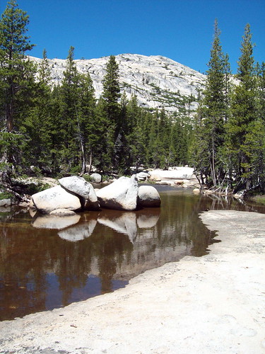
Murphy Creek by MangosteenKate, on Flickr
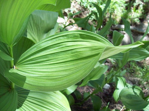
corn lily by MangosteenKate, on Flickr
Didn't see another person after crossing the creek in the Polly Dome Lakes area.
With my curiosity pulling me further and further, I never really did stop to river-lounge. Maybe I'll go up Tuolumne Pk.... maybe Polly Dome...
... maybe up this enticing ridge will satisfy and I'll head back to the car.
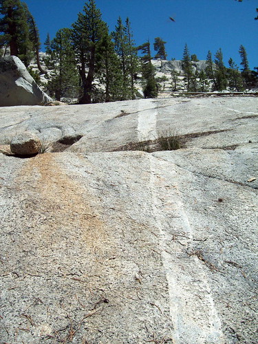
Line w/ ufo by MangosteenKate, on Flickr
Cool erratics:
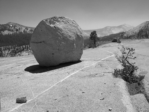
Puffer fish totally ignoring me. by MangosteenKate, on Flickr
I kept harking back to this post and Chick-on's line drawn on "an interesting ridge."
Chick-on's ridge talk
(not a stalker, I swear)
Could I do it? Should I do it? I can always retreat to marked trails, back the way I came. Just go up and have a look around, reassess things.
Loverly trail:
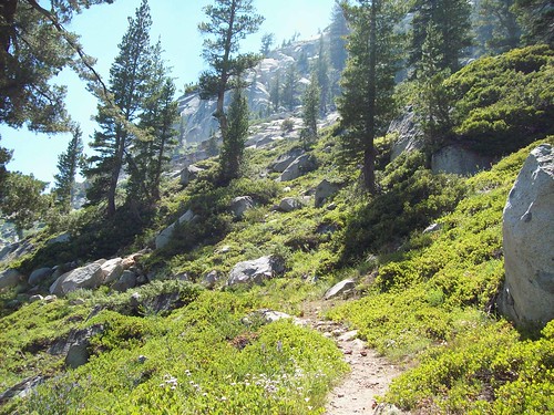
I'm likin' this trail by MangosteenKate, on Flickr
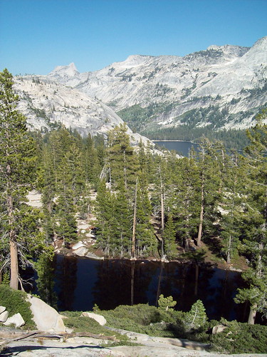
Conness & Lupine:
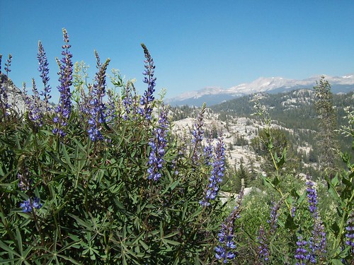
Lupine Conness by MangosteenKate, on Flickr
What'sup thar?
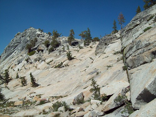
wuts up thar? by MangosteenKate, on Flickr
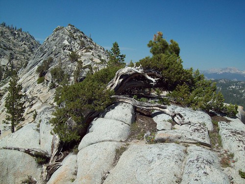
Beckoning, gotta go.
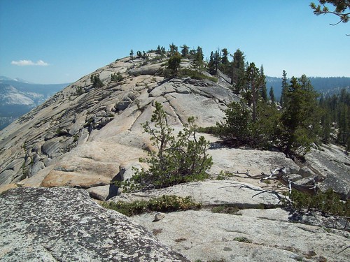
beckoning by MangosteenKate, on Flickr
Basically followed this ridge from the saddle between Murphy Creek drainage and Raisin Lake.
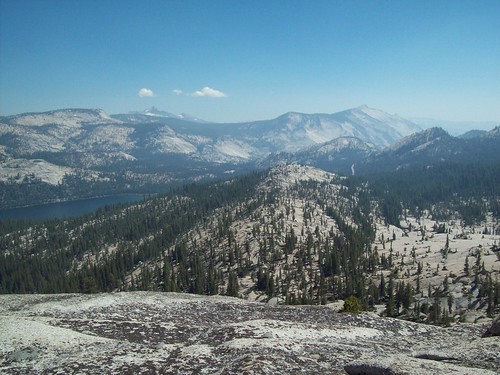
Looking at Tenaya Lake, Mt Clark, Clouds Rest. You can see Tioga rd (vertical stripe to right of dome.)
popped out near there in the flats ~1/4 mi. west of Sunrise parking. west end of Tenaya Lake.
beckoning/what have i gotten myself into by MangosteenKate, on Flickr
Looking back at the dome:
Untitled by MangosteenKate, on Flickr
Somewhere between these two photos a fatigue set in and my confidence in myself was starting to wane.
The crazy inner dialog starts.... am I dehydrated? I'm a fool for not bringing more water. I have no appetite. beer. a beer sounds good.
why does it feel like someone is standing on my chest? I don't even like beer all that much
I have a good sense of direction,but no formal routefinding skills. what was I thinking? my feet feel like sandbags.
They're going to find me under a rock in my dirty underwear, clutching some gummy bears, amateur! I'm out of condition...
altitude is getting to me. why is my throat so scratchy? I just want to beeline for the car, but all the trees, bushwhacking.
Go up, girl, stick to granite and, yes, walk a mile or whatever out of your way for an easier road walk back.
Onward!
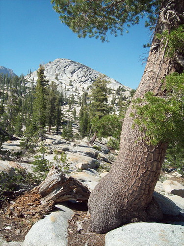
Surprise tarn:
Cathedral Pk, Stately Pleasure Dome by MangosteenKate, on Flickr
Time for gummy power!
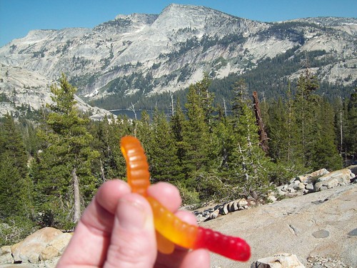
Gummy power by MangosteenKate, on Flickr
orange points to where I need to go....
Got back to Mono Lake in time for dinner at the Mobil. Woke up with a spliting headache. Thought I was going to be the first person ever
to die of cerebral edema in Lee Vining, but no turns out I'm just a bit of a hypochondriac when on my own in "the wilds".
The feeling off, scratchy throat etc of the previous day was just a cold that has lasted all week.
Really? I'm ending on a gummy worm photo? More photos here:
Mo' betta photos
Didn't see any footprints on the ridge walk(and tried not to leave any to nurture that sense of discovery in the next person who follows).
Highly recommended hike. I think I would have liked it more as an overnighter just to have had more time to wander around.
THANK YOU CHICK-ON!! for the inspiration!
Thoughts of you all kinda kept me goin' in the rough spots.
By the way, what does one call this ridge?? I just wrote Raisin Ridge for lack of better ideas/ info.
Edited 1 time(s). Last edit at 08/15/2011 05:15PM by nomenclature.