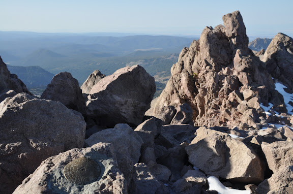
Clouds Rest
Edited 7 time(s). Last edit at 08/18/2011 03:34PM by Ohnivy-Drak.
|
Official USGS Benchmark Thread August 17, 2011 08:21PM | Registered: 13 years ago Posts: 931 |
August 17, 2011 10:33PM | Registered: 14 years ago Posts: 7,421 |

|
Re: Official USGS Benchmark Thread August 18, 2011 12:18AM | Registered: 13 years ago Posts: 931 |
Quote
chick-on
Um... you realize there is another one up there, no?
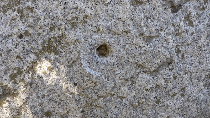
#1 is still intact. The triangle one .. only the nub is there.
Do you really want these? I have prob. close to 50 if you include the boundary markers.
(I had this crazy idea to find all the boundary markers some day... but have yet to pursue it)
Have never found the Eagle Peak one.. looked a few times now to no avail...

|
Re: Official USGS Benchmark Thread August 18, 2011 12:35AM | Registered: 13 years ago Posts: 931 |
August 18, 2011 01:03AM | Registered: 15 years ago Posts: 4,173 |
|
Re: Official USGS Benchmark Thread August 18, 2011 01:27PM | Registered: 13 years ago Posts: 931 |
Quote
plawrence
If this is supposed to be a thread about USGS Bench Marks photos, I would suggest it would be a more attractive thread that if instead of just providing a link to your USGS bench mark photos, that you link the actual photos to your post so the bench mark photo appears in the post itself. Just a thought...
August 18, 2011 02:16PM | Registered: 15 years ago Posts: 4,173 |
Quote
Ohnivy-Drak
Quote
plawrence
If this is supposed to be a thread about USGS Bench Marks photos, I would suggest it would be a more attractive thread that if instead of just providing a link to your USGS bench mark photos, that you link the actual photos to your post so the bench mark photo appears in the post itself. Just a thought...
Very good idea. But I can't get the "Insert image URL" feature to work.
|
Re: Official USGS Benchmark Thread August 18, 2011 03:34PM | Registered: 13 years ago Posts: 931 |
August 18, 2011 08:10AM | Registered: 14 years ago Posts: 7,421 |
September 06, 2011 09:15PM | Registered: 14 years ago Posts: 7,421 |
|
Re: Official USGS Benchmark Thread November 03, 2011 10:06AM | Registered: 13 years ago Posts: 931 |
November 08, 2011 07:44AM | Registered: 14 years ago Posts: 7,421 |
Short answer is yes. With road and trailhead improvements... YMMVQuote
Ohnivy-Drak
Sorry, I had forgotten that I asked that question about bench markers before. Thanks for the tip on the triangles. Although not all of them are provided/seen on the USGS maps, ie Nevada Falls & Watkins. The "X's" mark the high points, but that's not necessarily where the markers are (i.e. Watkins again).
When the map shows "BM 8161" near Murphy Creek TH along Tioga, does it mean we should find some type of marker there?
|
Re: Official USGS Benchmark Thread June 13, 2012 10:00PM | Registered: 13 years ago Posts: 931 |
June 14, 2012 07:40AM | Moderator Registered: 14 years ago Posts: 7,421 |
Quote
Ohnivy-Drak
Just clicked on the second link (NGS) that you provided, lol. First search filter: Mariposa County, then Tuolumne. The last column, "Description," could use some improvement. No listing for North or Basket, for instance. But in all its glory, I see a listing for "EAGLE." I'll punch those coordinates in and give it a go sometime. There are quite a few groups of rocks up there, so who knows which one. It doesn't have to be the highest point.
|
Re: Official USGS Benchmark Thread June 14, 2012 09:42PM | Registered: 13 years ago Posts: 931 |
June 14, 2012 09:58PM | Moderator Registered: 14 years ago Posts: 7,421 |
|
Re: Official USGS Benchmark Thread June 14, 2012 10:08PM | Registered: 13 years ago Posts: 931 |
|
Re: Official USGS Benchmark Thread June 15, 2012 07:50AM | Registered: 13 years ago Posts: 864 |
Quote
Ohnivy-Drak
btw, what are the odds the Eagle marker is somewhere in the meadow? Or somewhere along Eagle Creek?
|
Re: Official USGS Benchmark Thread June 15, 2012 10:30AM | Registered: 13 years ago Posts: 931 |
Quote
basilbop
Quote
Ohnivy-Drak
btw, what are the odds the Eagle marker is somewhere in the meadow? Or somewhere along Eagle Creek?
The marker would most likely be in a location where it has line-of-sight visibility to other markers so that its location relative to these markers could be determined using traditional (non-GPS) survey methods. (Perhaps this is why there is no marker on HD--its relatively flat top would render the marker invisible to other lower surrounding markers...)
|
Re: Official USGS Benchmark Thread February 19, 2013 10:16AM | Registered: 13 years ago Posts: 931 |
February 20, 2013 06:50AM | Moderator Registered: 14 years ago Posts: 7,421 |
|
Re: Official USGS Benchmark Thread December 29, 2017 11:23AM | Registered: 6 years ago Posts: 5 |
Quote
chick-on
Here are two links to bench mark stuff.
First the viewer:
http://benchmarks.scaredycatfilms.com/CA.html
And NGS:
http://www.ngs.noaa.gov/cgi-bin/ds_county.prl
The second one has datasheets which tell you location and a lot of info.
For a few they even have pictures.
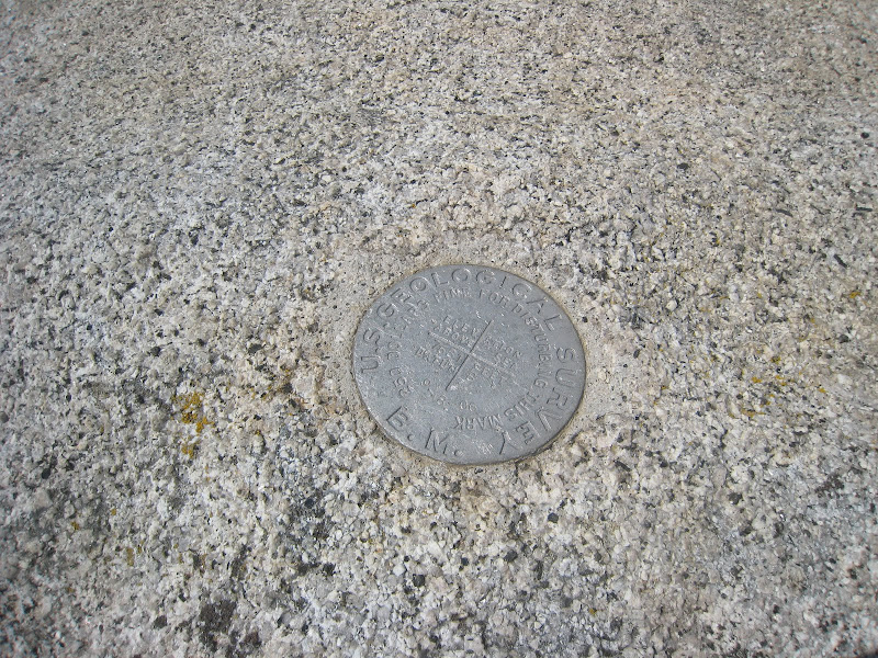
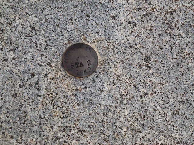
On USGS maps you can see the bench markers. If there is a triangle then there should be a bench marker.
The links above may help to determine if you can find it or not.
In more than a couple of places I have searched to no avail (Forsyth, Piute, ... )
Many peaks do not have bench markers.
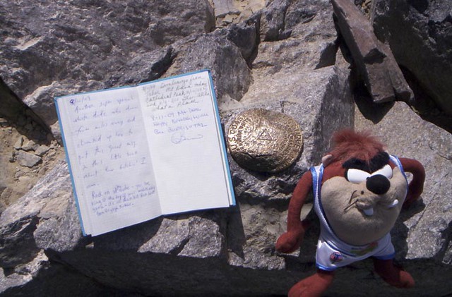
What I have is listed below. If you want to see any or all of these just let me know.
Reg = Registry (the registry book)
Box = Sierra Club Registry Box
Boundary = Yosemite Boundary Marker
1/2/3/T = Stamp Type
Good luck hunting... I'm missing a few myself..
Here is more or less what I have for Yosemite:
Andrews Peak Reg
Bigelow Peak Boundary
Buena Vista
Clouds Rest 1
Clouds Rest 2
Clouds Rest T
Condon 1
Condon 2
Condon T
Condon HHWS
Crown Pt
Dance Hall 1
Dance Hall 2
Dance Hall T
Dewey Pt
Dorothy Lake Boundary
Double Rock 1
Double Rock 2
Double Rock T
El Capitan
Falls Creek Gauge
Fernandez Pass Boundary
Flat 1
Flat 2
Flat T
Foerster Peak Boundary
Foresta Boundary
Forsyth Peak Reg
Frog Creek Boundary
Gale Peak Boundary
Glacier Pt
Hetch Hetchy Dam
Inspiration Pt
Keyes Peak Reg
Kibbie 1
Kibbie 2
Kibbie T
Kibbie Boundary
Kibbie Ridge Boundary
Mahan Peak Reg
Many Island Boundary
Merced Peak Reg
Mt Clark Box
Mt Clark USGS
Mt Conness 1
Mt Conness 3
Mt Dana 1
Mt Dana T
Mt Hoffmann 1
Mt Hoffmann 2
Mt Hoffmann Gendarme
Mt Hoffmann T
Mt Lyell Box
Mt Lyell Marker
Mt Lyell USGS
Mt Maclure Box
Nevada Falls
Panarama Pt
Peeler Lake Boundary
Piute Mtn Reg
Poopenaut 1
Poopenaut 2
Poopenaut T
Post Peak Boundary
Red Peak
Richardson Peak
Schofield Peak Reg
Sentinel Dome
Sing Peak Boundary
Smith Peak T
Taft Pt
Tower Peak Box
Tuolumne Meadows
Vernal Fall
Virginia Reg
Volunteer Peak Reg
Mt Watkins
Yose Creek Road
Yosemite Pt
December 30, 2017 08:38AM | Moderator Registered: 14 years ago Posts: 7,421 |
Quote
amygdaloid
I realize this thread has been inactive for many years, but I'm hoping I can get some information from someone on the benchmark that is listed below as being on El Capitan. Does anyone have a photo and an approximate location on the quad map for it?
Thanks
Tom

December 30, 2017 08:44AM | Moderator Registered: 14 years ago Posts: 7,421 |
|
Re: Official USGS Benchmark Thread December 31, 2017 02:35PM | Registered: 6 years ago Posts: 5 |
February 12, 2018 02:21PM | Moderator Registered: 14 years ago Posts: 7,421 |
Quote
amygdaloid
Thanks! Not sure if I’ll ever get to see
this one for myself, but hopefully I’ll get back to Yosemite some day. It’s been around 20 years since I’ve been. I’m going to make a replica of the El Cap BM as a keychain. I just finished a 3D model of Glacier Point BM today and ordered a bronze print from Shapeways.com. Here is what that one looks like. Glacier Point BM model
|
Re: Official USGS Benchmark Thread June 29, 2018 11:52AM | Registered: 13 years ago Posts: 931 |

|
Re: Official USGS Benchmark Thread February 26, 2018 07:04PM | Registered: 6 years ago Posts: 5 |

February 26, 2018 08:25PM | Moderator Registered: 14 years ago Posts: 7,421 |

|
Re: Official USGS Benchmark Thread February 27, 2018 09:26PM | Registered: 6 years ago Posts: 5 |
Quote
chick-on
Yes
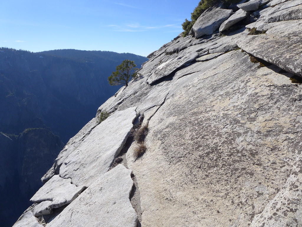
I mentioned the one at the "summit" ... have never seen it... have looked ... (doesn't mean it's not up there)
(but I have looked > 3 times so... )
Anywho... yes, the other one up there (one still there... is close to the edge)
(you no clicky on gmap4 link I put in post above? )
Without futher adoo:
It's more or less safe... just don't take like 3 more steps unless ...
The rock there to the right... that kinda overhangs... and you can see it from 3000 ft below ...
if you have Chick-on eyez... (or a zoom) (or just good eyes) (I think)
Have fun
edit: oops... sorry... THANK YOU FOR THE LINKS Love it!
February 28, 2018 02:01PM | Moderator Registered: 14 years ago Posts: 7,421 |


|
Re: Official USGS Benchmark Thread April 26, 2020 08:02AM | Registered: 6 years ago Posts: 5 |
April 26, 2020 01:26PM | Moderator Registered: 14 years ago Posts: 7,421 |
|
Re: Official USGS Benchmark Thread April 27, 2020 04:43AM | Registered: 15 years ago Posts: 619 |
|
Re: Official USGS Benchmark Thread August 18, 2011 08:45AM | Registered: 13 years ago Posts: 688 |
August 18, 2011 06:54PM | Registered: 14 years ago Posts: 7,421 |
August 18, 2011 02:04PM | Registered: 13 years ago Posts: 424 |
August 18, 2011 07:03PM | Registered: 14 years ago Posts: 7,421 |
September 20, 2011 07:21AM | Registered: 14 years ago Posts: 7,421 |
September 23, 2011 11:17AM | Registered: 15 years ago Posts: 4,173 |
November 08, 2011 09:27PM | Registered: 15 years ago Posts: 4,173 |
Quote
chick-on
I just called it that... I presume that there are over 140 markers similar to bench markers around the park.
They are marked with "Yosemite National Park" "Boundary" and then either "Post No. #" or "Mark No. #".
The Number I have:
Foresta: 8
Frog Creek: 54
Kibbie: 56
Kibbie Ridge: 61 (this is the one b4 Sachse)
Many Island: 64
Bigelow Peak: 76
Dorothy Lake: 80
Peeler Lake: 89
Foerster: 129
Post Peak Pass: 135
Fernandez Pass: 140
Gale Peak: 141
November 08, 2011 09:32PM | Moderator Registered: 15 years ago Posts: 1,918 |
November 08, 2011 10:11PM | Registered: 15 years ago Posts: 4,173 |
Quote
bill-e-g
Read this:
http://yosemitenews.info/forum/read.php?3,44982,46216#msg-46216
Many of those Old Topos were/are available at the berkeley site.
http://yosemitenews.info/forum/read.php?1,5185
But many also are not. Awesome they are doing this. Hopefully they put up various Mt. Lyell Quads too.
November 08, 2011 10:24PM | Moderator Registered: 15 years ago Posts: 1,918 |
November 08, 2011 11:33PM | Registered: 15 years ago Posts: 4,173 |

November 09, 2011 06:46AM | Moderator Registered: 15 years ago Posts: 1,918 |
May 01, 2015 04:01PM | Registered: 14 years ago Posts: 675 |
|
Re: Official USGS Benchmark Thread May 07, 2015 11:01PM | Registered: 13 years ago Posts: 931 |
August 18, 2011 04:10PM | Registered: 14 years ago Posts: 675 |
August 18, 2011 07:04PM | Registered: 14 years ago Posts: 7,421 |
August 18, 2011 08:35PM | Registered: 14 years ago Posts: 675 |
Quote
Chick-on
The Clouds Rest Triangle one... that one is not there. Just a nub.
August 22, 2011 05:14PM | Registered: 14 years ago Posts: 7,421 |
November 08, 2011 08:24PM | Registered: 13 years ago Posts: 424 |
Quote
chick-on
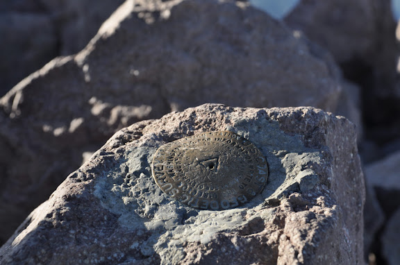
I'm actually quite surprised so many are in decent shape.
An example:
I actually have al the ones I have in a set if there is any desire.
Kinda figured this would go over as well as the Roadside Makers..
November 08, 2011 09:34PM | Moderator Registered: 15 years ago Posts: 1,918 |
November 15, 2011 11:31PM | Registered: 13 years ago Posts: 424 |
Quote
bill-e-g
It's EAST of Kibbie Lake up on the ridge (take a lookie at a USGS map).
All 3 are up there. In great shape. You can find them here:
https://picasaweb.google.com/103089501068510688008/BenchMarkers?authkey=Gv1sRgCMfQ4IvD8NO9SQ
(we explicitly put Kibbie here to elicit a response from you) (it eventually worked)
|
Re: Official USGS Benchmark Thread June 15, 2012 10:55AM | Registered: 13 years ago Posts: 931 |
Quote
Bearproof
Quote
Chick-on
The Clouds Rest Triangle one... that one is not there. Just a nub.
That's the problem..I think that some people are willing to risk the $250 fine to take a mountaintop souvenir. A $250 fine...have you ever seen the Geodetic Survey police hanging around summits waiting for benchmark thieves?
And nubs don't make for very cool pictures!
|
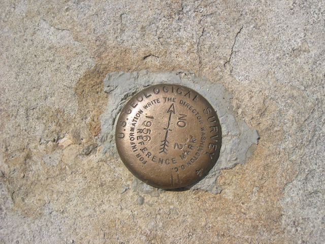
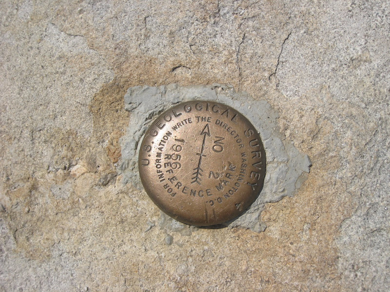
Re: Official USGS Benchmark Thread May 04, 2015 12:48PM | Registered: 12 years ago Posts: 23 |
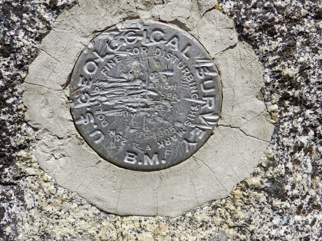
 but they mentioned the main station appeared to be aluminum (rather than brass or copper) and that the stamping was obliterated. It was originally monumented in 1905.
|
Re: Official USGS Benchmark Thread September 06, 2011 09:20PM | Registered: 13 years ago Posts: 688 |
September 06, 2011 09:37PM | Registered: 14 years ago Posts: 7,421 |
|
Re: Official USGS Benchmark Thread September 07, 2011 08:39AM | Registered: 13 years ago Posts: 688 |
September 07, 2011 09:10AM | Moderator Registered: 15 years ago Posts: 1,876 |
|
Re: Official USGS Benchmark Thread September 07, 2011 09:29AM | Registered: 13 years ago Posts: 688 |
Quote
szalkowski
Quote
chicagocwright
Is there a story on why there isn't one on Half Dome?
Is there a story about why there should be one on Half Dome?
(NoParticularReasonFromOurViewpointly Yours)
The Marmots
September 20, 2011 08:32AM | Registered: 15 years ago Posts: 1,876 |
Quote
chicagocwright
Quote
szalkowski
Quote
chicagocwright
Is there a story on why there isn't one on Half Dome?
Is there a story about why there should be one on Half Dome?
(NoParticularReasonFromOurViewpointly Yours)
The Marmots
I don't know. Every REI I go to has one so I figured Half Dome deserves one also.
But seriously, I naively assumed any prominent peak has one. Does Mt. Washington in New Hampshire have one? (just trying to think of peaks where I have been)
|
Re: Official USGS Benchmark Thread September 22, 2011 06:11PM | Registered: 13 years ago Posts: 931 |
Quote
tomdisco
Quote
chicagocwright
Quote
szalkowski
Quote
chicagocwright
Is there a story on why there isn't one on Half Dome?
Is there a story about why there should be one on Half Dome?
(NoParticularReasonFromOurViewpointly Yours)
The Marmots
I don't know. Every REI I go to has one so I figured Half Dome deserves one also.
But seriously, I naively assumed any prominent peak has one. Does Mt. Washington in New Hampshire have one? (just trying to think of peaks where I have been)
Yes, Mt. Washington has one labled 6288.176'. Makes one curious what standard is used for sea level where they measure in increments to 3 decimals.
|
Re: Official USGS Benchmark Thread September 24, 2011 11:33AM | Registered: 15 years ago Posts: 72 |
Quote
Ohnivy-Drak
Quote
tomdisco
Quote
chicagocwright
Quote
szalkowski
Quote
chicagocwright
Is there a story on why there isn't one on Half Dome?
Is there a story about why there should be one on Half Dome?
(NoParticularReasonFromOurViewpointly Yours)
The Marmots
I don't know. Every REI I go to has one so I figured Half Dome deserves one also.
But seriously, I naively assumed any prominent peak has one. Does Mt. Washington in New Hampshire have one? (just trying to think of peaks where I have been)
Yes, Mt. Washington has one labled 6288.176'. Makes one curious what standard is used for sea level where they measure in increments to 3 decimals.
Out of state markers are more than welcome. FYI, I recently read an article in "Backpacker" magazine about a rescue from this very mountain. Two unprepared hikers almost froze to death.
|
Re: Official USGS Benchmark Thread May 04, 2015 12:54PM | Registered: 12 years ago Posts: 23 |
|
Re: Official USGS Benchmark Thread September 07, 2011 09:13AM | Registered: 13 years ago Posts: 15 |
September 07, 2011 10:17AM | Registered: 14 years ago Posts: 7,421 |
September 07, 2011 10:19AM | Registered: 14 years ago Posts: 7,421 |
|
Re: Official USGS Benchmark Thread September 07, 2011 10:29AM | Registered: 13 years ago Posts: 15 |
September 07, 2011 10:38AM | Registered: 14 years ago Posts: 7,421 |
|
Re: Official USGS Benchmark Thread September 10, 2011 11:50AM | Registered: 13 years ago Posts: 931 |
September 10, 2011 11:59AM | Registered: 14 years ago Posts: 7,421 |
Quote
Ohnivy-Drak
Quote
chick-on
Okie. The album is now accessible with authkey above. Sorry
Thanks for contributing. I'll try to add a few of my own, and hopefully others will find it interesting enough to add some from their journeys.
|
Re: Official USGS Benchmark Thread September 22, 2011 06:09PM | Registered: 13 years ago Posts: 931 |
Quote
chick-on
Quote
Ohnivy-Drak
Quote
chick-on
Okie. The album is now accessible with authkey above. Sorry
Thanks for contributing. I'll try to add a few of my own, and hopefully others will find it interesting enough to add some from their journeys.
You're welcome
I keep finding a couple here and there in albums... there's 110 photos in that set now. Prolly too many to paste here.
|
Re: Official USGS Benchmark Thread September 07, 2011 10:28AM | Registered: 13 years ago Posts: 15 |
September 08, 2011 07:19AM | Registered: 14 years ago Posts: 7,421 |
Quote
YosemiteSteve
Another fun one is up at the Great Sierra Mine near Gaylor Lakes. There's a cool old Iron Cross looking marker, with an "M M" stamped on it. I believe this stood for Minerals Management, and it was used to survey to your mining claim.
|
Re: Official USGS Benchmark Thread September 24, 2011 11:47AM | Registered: 15 years ago Posts: 72 |
Quote
YosemiteSteve
Supposedly, the Yosemite Grant corners that weren't peaks were marked with rock cairns.

|
Re: Official USGS Benchmark Thread September 24, 2011 12:49PM | Registered: 13 years ago Posts: 931 |
Quote
SierraGold
Quote
YosemiteSteve
Supposedly, the Yosemite Grant corners that weren't peaks were marked with rock cairns.
The way people are tearing down cairns nowadays, I wouldn't be surprised if they were destroyed by someone who didn't know what they were looking at
|
Re: Official USGS Benchmark Thread June 01, 2017 03:26PM | Registered: 15 years ago Posts: 72 |
Quote
Ohnivy-Drak
Quote
SierraGold
Quote
YosemiteSteve
Supposedly, the Yosemite Grant corners that weren't peaks were marked with rock cairns.
The way people are tearing down cairns nowadays, I wouldn't be surprised if they were destroyed by someone who didn't know what they were looking at
OTOH, what do you think of the possibility that a few people are putting them up with the intent on leading people the wrong way?
November 13, 2011 07:40PM | Moderator Registered: 15 years ago Posts: 1,918 |
October 03, 2011 05:36AM | Moderator Registered: 15 years ago Posts: 1,876 |
October 03, 2011 08:34PM | Moderator Registered: 15 years ago Posts: 1,876 |
|
Re: Official USGS Benchmark Thread November 13, 2011 08:06PM | Registered: 13 years ago Posts: 931 |
November 13, 2011 09:37PM | Moderator Registered: 15 years ago Posts: 1,918 |
|
Re: Official USGS Benchmark Thread November 13, 2011 09:52PM | Registered: 13 years ago Posts: 688 |
|
Re: Official USGS Benchmark Thread November 13, 2011 10:46PM | Registered: 13 years ago Posts: 931 |
November 13, 2011 11:11PM | Registered: 15 years ago Posts: 4,173 |
December 19, 2011 04:54PM | Registered: 13 years ago Posts: 424 |
Quote
plawrence
Quote
Ohnivy-Drak
A group of people should buy one of those, then hammer it in where it's supposed to go.
I would think this is an activity that a Clamper might take on.
December 19, 2011 11:49PM | Registered: 15 years ago Posts: 4,173 |
Quote
oakroscoe
Quote
plawrence
Quote
Ohnivy-Drak
A group of people should buy one of those, then hammer it in where it's supposed to go.
I would think this is an activity that a Clamper might take on.
As a Clamper I don't know if I should be insulted or complimented. Oh well, I'll just have another whiskey...
November 14, 2011 07:16AM | Moderator Registered: 15 years ago Posts: 1,918 |
October 27, 2011 05:19AM | Registered: 15 years ago Posts: 4,173 |
|
Re: Official USGS Benchmark Thread October 27, 2011 10:54AM | Registered: 13 years ago Posts: 931 |
|
Re: Official USGS Benchmark Thread November 16, 2011 08:46AM | Registered: 13 years ago Posts: 693 |
November 16, 2011 07:27PM | Moderator Registered: 15 years ago Posts: 1,918 |
December 19, 2011 07:49AM | Registered: 14 years ago Posts: 7,421 |
December 23, 2011 09:47AM | Registered: 12 years ago Posts: 18 |
December 23, 2011 11:05AM | Registered: 14 years ago Posts: 7,421 |
Not many of the peaks around TM have markers... nothing really near Elizabeth.. You can find some markers along Tioga though.Quote
JRo27
I'm assuming there isn't one at North Dome or in the Elizabeth Lake area? If the weather remains decent,.
|
Re: Official USGS Benchmark Thread February 19, 2013 09:27PM | Registered: 13 years ago Posts: 931 |
Quote
JRo27
I'm assuming there isn't one at North Dome or in the Elizabeth Lake area? If the weather remains decent, The hubby and I are planning on hiking both next week. I like the idea of trying to find as many of these as possible. Our uncle owns a land surveying business back in Ohio and loves when we send him pics of markers.


February 20, 2013 06:52AM | Moderator Registered: 14 years ago Posts: 7,421 |
July 23, 2012 08:25AM | Admin Registered: 15 years ago Posts: 17,050 |
Quote
Ohnivy-Drak
Clouds Rest
|
Re: Official USGS Benchmark Thread July 23, 2012 07:55PM | Registered: 13 years ago Posts: 931 |
|
Re: Official USGS Benchmark Thread September 13, 2012 08:42PM | Registered: 13 years ago Posts: 931 |
September 25, 2012 08:28AM | Moderator Registered: 14 years ago Posts: 7,421 |
|
Re: Official USGS Benchmark Thread September 25, 2012 11:37AM | Registered: 13 years ago Posts: 931 |
|
Re: Official USGS Benchmark Thread February 15, 2013 10:21PM | Registered: 13 years ago Posts: 931 |
February 25, 2013 11:43AM | Moderator Registered: 14 years ago Posts: 7,421 |
|
Re: Official USGS Benchmark Thread February 25, 2013 01:26PM | Registered: 13 years ago Posts: 864 |
February 25, 2013 01:28PM | Registered: 15 years ago Posts: 4,173 |
February 25, 2013 01:31PM | Registered: 15 years ago Posts: 4,173 |
February 25, 2013 01:36PM | Admin Registered: 15 years ago Posts: 17,050 |
February 25, 2013 02:22PM | Moderator Registered: 14 years ago Posts: 7,421 |
February 25, 2013 03:46PM | Admin Registered: 15 years ago Posts: 17,050 |
February 25, 2013 03:55PM | Moderator Registered: 14 years ago Posts: 7,421 |
October 29, 2012 08:41PM | Admin Registered: 15 years ago Posts: 17,050 |
October 30, 2012 06:52AM | Moderator Registered: 14 years ago Posts: 7,421 |
October 30, 2012 10:27AM | Registered: 15 years ago Posts: 4,173 |
October 30, 2012 02:59PM | Admin Registered: 15 years ago Posts: 17,050 |
February 19, 2013 10:29PM | Moderator Registered: 15 years ago Posts: 1,347 |
|
Re: Official USGS Benchmark Thread April 18, 2013 08:18PM | Registered: 13 years ago Posts: 864 |


April 22, 2013 01:43PM | Registered: 15 years ago Posts: 4,173 |
Quote
basilbop
Chick-on and I located the BM at former site of Gentry's Ranger Station:
The NGS data seems to be mostly correct:
HR0762'DESCRIBED BY COAST AND GEODETIC SURVEY 1958
HR0762'4.2 MI W FROM EL CAPITAN RANGER STATION.
HR0762'4.2 MILES WEST ALONG BIG OAK FLAT ROAD FROM EL CAPITAN RANGER
The telephone booth no longer exists...
|
Re: Official USGS Benchmark Thread April 22, 2013 11:13PM | Registered: 14 years ago Posts: 755 |
Quote
plawrence
Quote
basilbop
Chick-on and I located the BM at former site of Gentry's Ranger Station:
The NGS data seems to be mostly correct:
HR0762'DESCRIBED BY COAST AND GEODETIC SURVEY 1958
HR0762'4.2 MI W FROM EL CAPITAN RANGER STATION.
HR0762'4.2 MILES WEST ALONG BIG OAK FLAT ROAD FROM EL CAPITAN RANGER
The telephone booth no longer exists...
Nor does the old El Capitan Ranger Station....
|
Re: Official USGS Benchmark Thread April 22, 2013 09:29PM | Registered: 13 years ago Posts: 931 |
April 23, 2013 04:27PM | Moderator Registered: 14 years ago Posts: 7,421 |
|
Re: Official USGS Benchmark Thread April 23, 2013 04:44PM | Registered: 13 years ago Posts: 931 |
April 23, 2013 04:51PM | Moderator Registered: 14 years ago Posts: 7,421 |
April 25, 2013 01:15PM | Moderator Registered: 14 years ago Posts: 7,421 |
|
Re: Official USGS Benchmark Thread April 25, 2013 04:26PM | Registered: 13 years ago Posts: 931 |
Quote
chick-on
Albert, uploaded a bunch more to here:
https://picasaweb.google.com/yosemite.chick.on/BenchMarkers
Happy Hunting
|
Re: Official USGS Benchmark Thread May 01, 2013 11:06PM | Registered: 13 years ago Posts: 931 |
|
Re: Official USGS Benchmark Thread June 25, 2013 07:20PM | Registered: 13 years ago Posts: 864 |


June 25, 2013 10:14PM | Moderator Registered: 14 years ago Posts: 7,421 |
June 29, 2013 06:08PM | Registered: 12 years ago Posts: 229 |
June 29, 2013 07:59PM | Registered: 11 years ago Posts: 299 |
July 01, 2013 09:24AM | Registered: 11 years ago Posts: 299 |
|
Re: Official USGS Benchmark Thread May 04, 2015 12:30PM | Registered: 12 years ago Posts: 23 |
January 19, 2014 05:24PM | Admin Registered: 15 years ago Posts: 17,050 |
|
Re: Official USGS Benchmark Thread March 09, 2014 11:40PM | Registered: 13 years ago Posts: 931 |
|
Re: Official USGS Benchmark Thread March 09, 2014 11:37PM | Registered: 13 years ago Posts: 931 |