Hello --
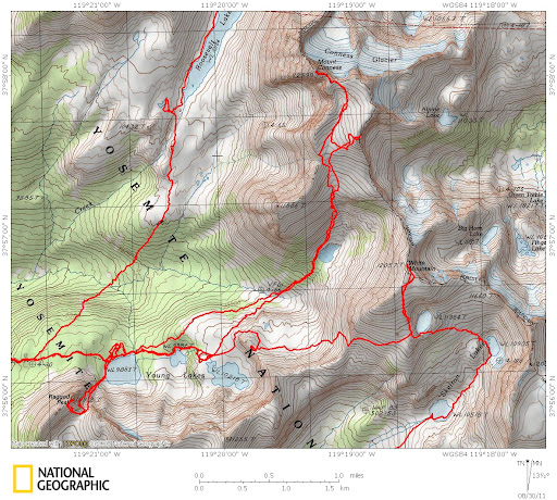
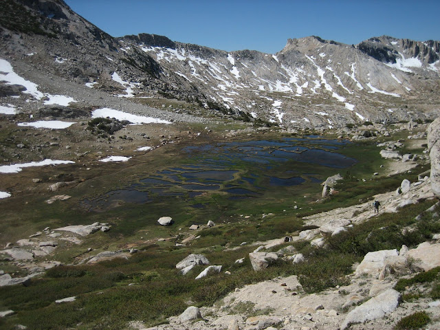
So I read with great interest about the hike to Mount Conness (as many of you did) in Backpacker magazine. A group of my friends (one who summitted Shasta in July) are planning to try to summit via Young Lakes on the Route which is basically a hike...at most some class 2 with a bit of exposure.
What I don't have, despite countless webpages with info, is a GPS trail track or more info on the important notices, pitfalls of the trip up Conness. I'm hoping someone on this forum can help. We are planning to hike out on September 10th, and come down late in the day on the 11th.
Feel free to post here with links or information, or if you'd prefer to contact me directly you can on by work email at bgregory@kovr.com. Any and all advice would be greatly appreciated.
Thanks for your time,
Brian

The Moon is Full
Re: Hiking Mount Conness Advice
All posts are those of the individual authors and the owner
of this site does not endorse them. Content should be considered opinion
and not fact until verified independently.


Sorry, only registered users may post in this forum.

