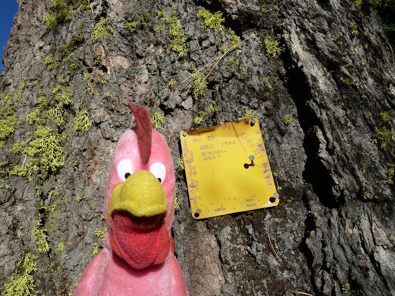
What came to be called the Mariposa Trail was a piece of the Indian trail that ran in the heights to the south of the valley. Coming down from the east side of Tenaya Lake and passing east of Glacier Point, it reached Bridalveil Creek near the current campground. There it split. Branches ran southwest towards Wawona via Alder Creek or west to Chinquapin via Indian Creek. The branch which was used as the south entrance to Yosemite Valley ran towards Badger Pass, and then more or less where our hike went as far as !st Saddle, then down Meadow Brook to the top of Silver Strand Falls, where it turned west. Below that point, it is now called "The Pohono Trail".
As Bunnell recalls it, 29 years later (see book: Discovery of the Yosemite)
"To obtain a more distinct and quiet view, I had left the
trail and my horse and wallowed through the snow alone to
a projecting granite rock. So interested was I in the scene
before me, that I did not observe that my comrades had all
moved on, and that I would soon be left indeed alone. My
situation attracted the attention of Major Savage, who
was riding in rear of column, who hailed me from the
trail below with, "you had better wake up from that dream
up there, or you may lose your hair; I have no faith in
Ten-ie-ya's statement that there are no Indians about here."
In later years he always stated that the first full view of the valley was from Old Inspiration Point, but I can assure you that nobody "wallows" down to Old Inspiration Point (It's too far below the trail), and nobody calls up to there from any trail. And there are no actual lookout spots up the hill on the south side of the trail.
On the map below I have placed an X where the real Mt. Beatitude must be. It is very close to the current trail, and could have been right next to the Indian foot trail. Moreover, the trail is descending rapidly at that point, so Major Savage could have been below that point on the trail and still have seen it and called up to it.
I have also placed a circle on the map where Hill's Point must be.
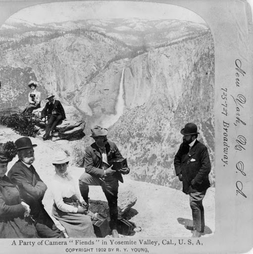
When you get there, Mount Beatitude has a great, unobstructed view of the valley and a superb view of Silver Strand Falls. It's not bushy, at least not at the point. But the reason that the guides didn't take people there is that the view of Bridalveil Falls is obstructed by the flank of Stanford Point. That's a deal breaker for tourists with cameras (See typical group with cameras, below). So the guides didn't take people there and the name didn't stick.
When you get to Mount Beatitude, there is a fine, unobstructed place to sit and take in the view.
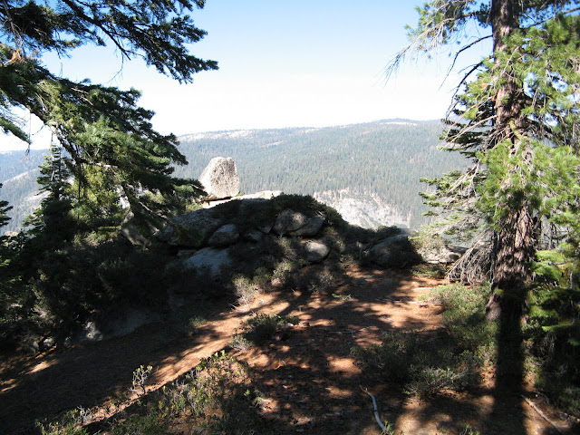
And this is the view:
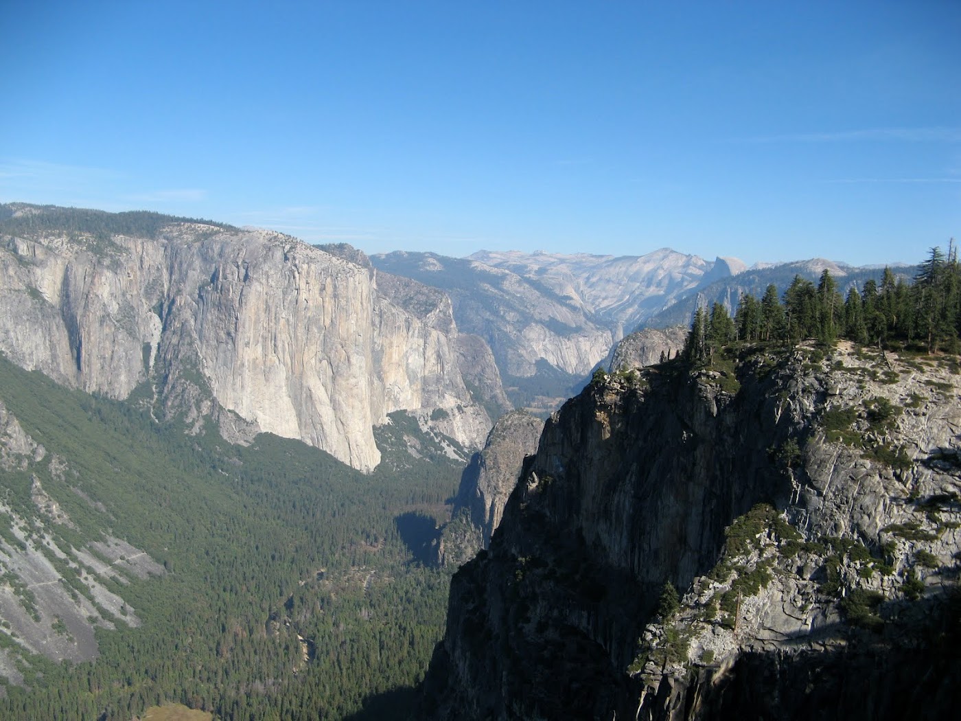
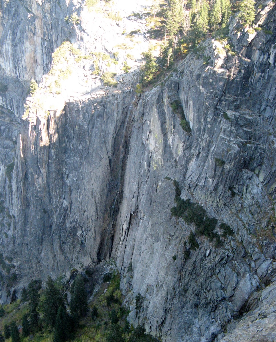
The lighting isn't very good on an October afternoon, but you can see how this first view of the valley would have impressed Bunnell. It also explains why his memoir is ecstatic about the view of El Capitan, but doesn't mention the waterfalls. He couldn't see Bridaveil. He could, however, have had a great view of Silver Strand Falls, since he was there during the snow melt....if he had been willing to go right to the edge on snow and ice.
Mount Beatitude is worth a visit, if you are going by on the Pohono Trail. You can hike down directly from above it on the trail, but it's also easy to traverse in from the west, where the trail is more at that level. It's a lot easier to get to than Old Inspiration Point, now that the trail to the latter is gone.
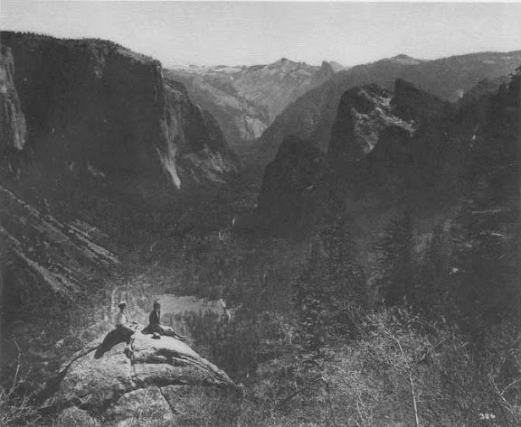
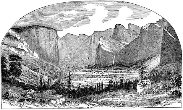
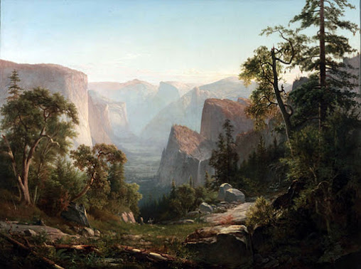
Now to Hill's Point. In 1865, there was no Wawona Road, so this section was still called the Mariposa Trail. An artist or photographer would have needed his horse and a mule or pack horse to carry all the gear. This is not a small painting, and the almost photographic accuracy suggests that he could have used a wet plate camera to capture the scene. That's what landscape painters do today. On the other hand the magnitude of effort needed for photography in 1865 was enormous (you actually had to make the emulsion on-site), and there is no record of him selling any photos from this era. Plus, that's not what Hudson River School painters did. I think that he camped at Hill's Point for a few days while he roughed in the painting, then took it to a studio somewhere to finish up. At that time he would have put in the fake foreground. Don't be upset by that. They all did it. Especially when the scene is from a promontory, and there isn't any foreground. Thomas Ayres made the first image of Yosemite Valley on June 27, 1855. Here is his sketch, made somewhere near New Inspiration Point. Note the fake foreground:
Here is Thomas Hills's famous painting from ten years later:
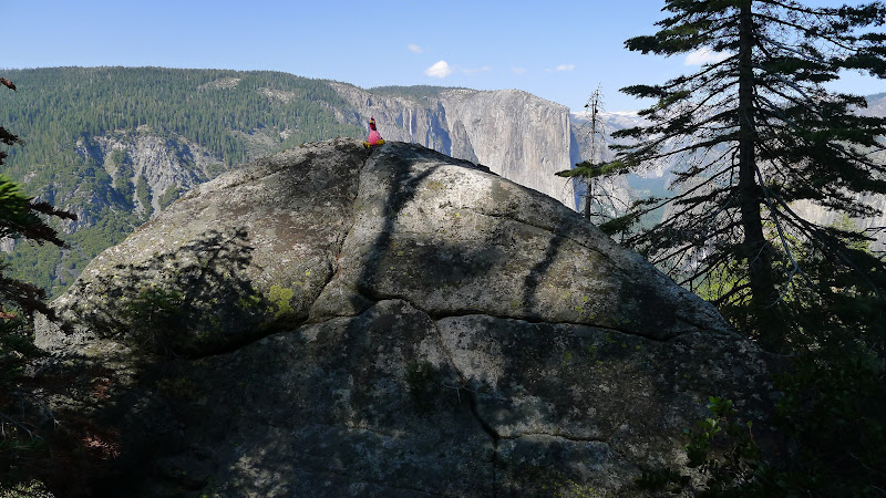
So we hiked on the trail to the west side of Artist Creek, then cut downhill until we got to the computed place. Amazingly, there was another fantastic promontory. Not only does it have unobstructed views, but it has a modest dip on its uphill side, with a sandy flat spot for a tent and another one for the horses. And no hint that anyone has been there for generations. The lead-in from the trail above isn't too steep for horses to traverse, especially if you come in from the west side, where the trail is only two hundred vertical feet above it. Or you could just walk in from the trail on the 6000 foot contour.
I'll call it Hill's Point.
Actually, if you want to be picky, a close comparison with the painting suggests that it was painted two hundred feet to the east and a hundred feet lower. But this certainly is the place to camp or to take photographs. We did hike east and down to take a look for the precise spot, but we were seduced by a class A deer trail and went a hundred feet too far east and too far down (You can't always see out through the trees). It was now bushy between us and the magic spot. Maybe another time. I recommend just visiting the promontory. The view from there is just as good, and you won't ever have anyone saying, "Oh I have a photo from that spot".
Now it was time to go back up to the trail. But my buddy began whining about too much uphill (after his run up the Four Mile Trail. The kid is only 60...he should be able to do that sort of thing!). He insisted that we just go down alongside Artist Creek. OK. We hadn't scouted that out beforehand, but I didn't care, so long as he was willing to come back up if it gets cliff-like down below. Well, of course it soon did.
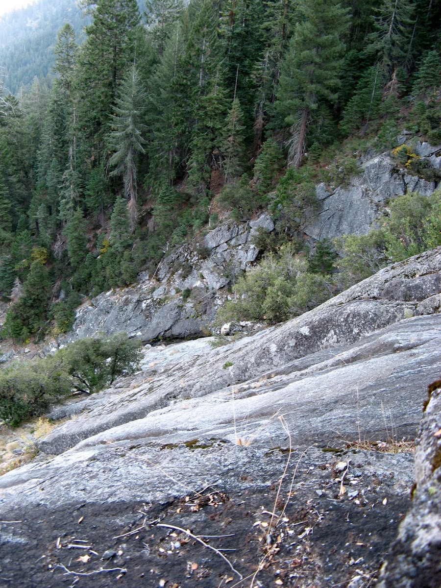
It looked just as bad to the left. That's Artist Creek over there, and the buttress beyond it has an adequate veneer of dirt and trees. But how to get there? Mr. Grumpy had to lead us back up to where the creek could be crossed, and we then went down the east bank without any trouble.
Hill's Point. N37.7090, W119.6815 elev 6020.
Mount Beatitude. N37.7029, W119.6301 elev 6840. Remember that with cliffs around, GPS readings will wander.
Here is Google Earth's take on things:
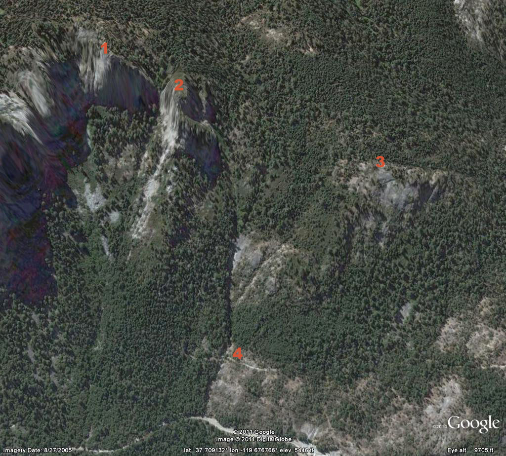
1 is Mount Beatitude. 2 is Old Inspiration Point. 3 is Hill's Point. 4 is Artist Point on the Old Wawona Road. The current highway is visible below.
It would have been helpful to have looked at this view before heading down the hill towards the creek...
Edited 4 time(s). Last edit at 04/16/2013 07:50PM by wherever.


 )
) It looks like my relocation to the west coast will still be another year or so out but, once I'm living within driving distance of Yosemite, I've got some serious catching up to do!