All posts are those of the individual authors and the owner of this site does not endorse them. Content should be considered opinion and not fact until verified independently.

The Big Oak Flat horse trail from Gentry's to the valley
November 01, 2011 01:01AM
For our second full day of hiking in Yosemite this October, we elected to scout out the old Big Oak Trail from Gentry's to the Valley. I am much obliged to Chick-On, who posted a topo map with the old trails overlay that was prepared circa 1964 by William and Mary Hood for the park service. It is posted on the park web site in the form of an overlay and a separate legend. There was, however, no posting of the map this is an overlay to. The portion of Chick-On's map that is relevant is this:


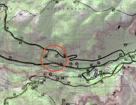
What you see in the red circle, and then proceeding west as a dashed line alongside the Old Big Oak Flat Road, is identified in the legend as the Big Oak Flat Trail.

In the book, "The Big Oak Flat Road" (see link: book), the authors report out the following:

Beyond Crane Flat, and from 1856 to 1874, the rival communities of Tuolumne County and Mariposa County used a common terminus to their thoroughfares to Yosemite Valley. It followed more or less along the old Mono Trail and led through Gin and Tamarack Flats, Gentry’s (in later years) and down the cliff to the floor of Yosemite Valley. A peculiarity which did not interfere with practical usage was that one contingent called the entire length the “Big Oak Flat Trail,” while the other group spoke of it as the “Coulterville Free Trail.”

When the later road-building competition began, the Coulterville contingent rerouted their road to pass through Foresta, since the horse trail seemed too steep for wagons, and the great talus piles ahead made road building at a lesser grade too difficult. When they had money difficulties, a second company began building the Big Oak Flat Road through the talus piles anyway. But that's another story. A whole book, in fact. What caught my eye in Chick-On's overlay was a hint of where the old horse trail met the valley. The overlay sometimes has routes that are quite inaccurate, being drawn in with a coarse pen. But it usually accurate about junctions.

To quote further from the book:
The last station on the road was Gentry’s, down the mountain from Tamarack Flat at an elevation of 5627 feet. It was on the brink of the tremendous cliffs overhanging the canyon of the Merced just below Yosemite Valley but was so hemmed in by timber that the precipice was invisible.

Colonel E. S. Gentry settled there while the travelers over the high ridge where his stopping place was located were still riding a rough trail on horse and mule back. The wagon road with its appropriate concomitant of stages and freighters was so slow in arriving at his door that he was but little known to the dwellers on the lower [central valley] portions of the turnpike. Tamarack Flat was the last destination to be discussed with familiarity by the cattlemen and, until 1872 when the final miles of the road were under construction, only the determined sightseers headed for the wonders of fabled Yosemite or owners of supply trains plodded into Gentry’s on tired horses or mules.


There were two things called Gentry's. On the map, they are shown to the west of the circle. The less westerly one was not his main site, which was too small for Gentry's purpose but which later became a toll both and the entry station to the park. The original boundary of the Yosemite Grant runs through that spot. The other group of buildings to the west was Genty's Hotel and horse changing station, and later a sawmill. It was also the western junction of the trail that runs to El Capitan and beyond.

For almost twenty years, hardy tourists passed Gentry's on pack trains on their way to the valley. They were, of course, happy to relate how difficult the journey had been.


Well, we didn't have any hysterical women on side saddles, and we now knew where to look for the trail head. One other bit of historical interest. The pack trail was abandoned in 1874 when the road was finished. However, an engineering historian has reported the following: (see link: report)

The $56,000 turnpike had a maximum grade of 16 percent and averaged 13' in width. The road was open year round from Big Oak Flat as far as Crockers' Station, just outside the park's present northwest boundary, and for seven months from Crackers' to the Valley floor. The tollgate on the Yosemite end was located at the covered bridge over the South Fork of the Tuolumne River. In 1875, Harlow Stuart of Sonora ran a telegraph line along the road.

The trail is steeper than the road, but the relevant part for us was that the telegraph came through the year after they abandoned the trail, and it follows the old trail not the road. It turns out that the wire was almost pure iron (for low resistivity) instead of steel, so it doesn't rust. The wire is still just fine, and in many places is the best way to confirm which way to go when it is unclear which path is the horse trail and which an intersecting game trail.

Actually, the trail is quite clear in most places. There isn't a lot of stonework, though there is some where the trail crossed dips caused by rivulets. It is very modest and easy to overlook, unlike the heroic stonework on the old road. The main clues to following the trail are that the surface stones were moved to either side of the path, and twenty years of traffic has produced a slight groove in the ground.

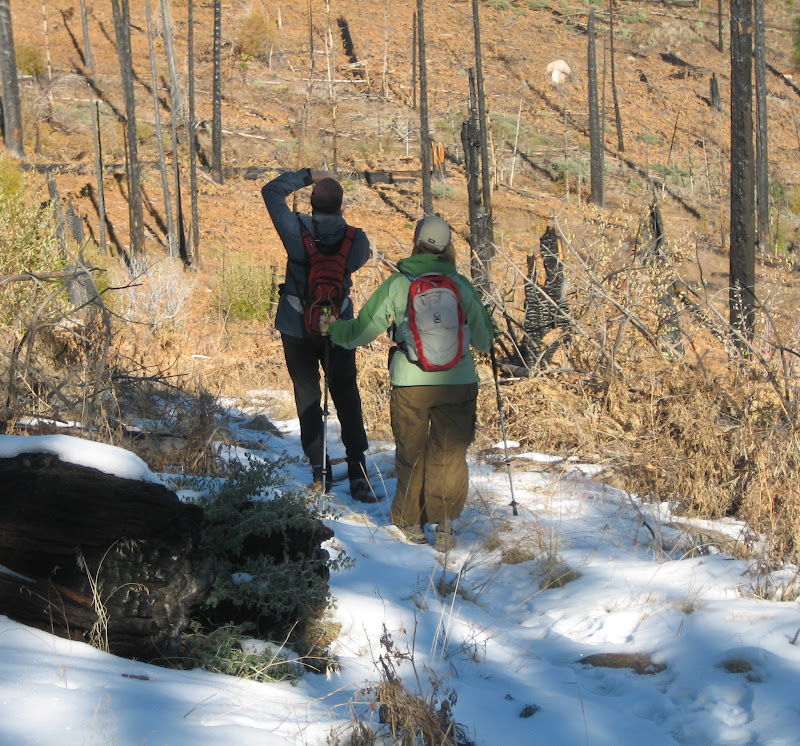
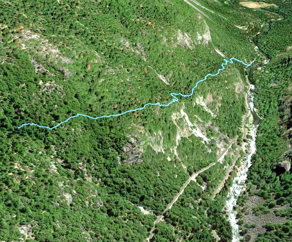
Because of a lot of sewer work along the highway, we chose to park at the turnout called Valley View, east of the Pohono Bridge. That left us about a half mile to walk to the actual trail terminus, but we amused ourselves with various ruins and construction equipment tucked into the woods. Until, that is, we found a strip of poison oak that put us back on the highway.

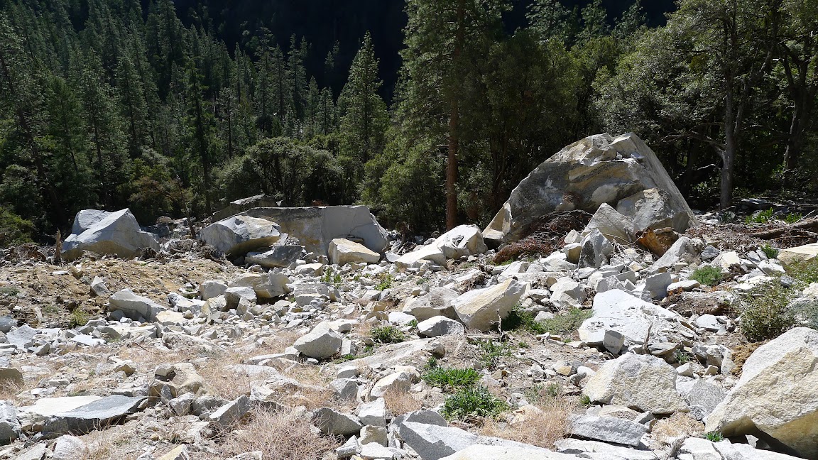
The main thing to look for at the start is a huge scar on the face of the cliff below Rainbow View pipe rail, with a corresponding fresh talus pile underneath. Leave the highway and hike cross country to the base of the talus. Near the lower end of it is a cabin-sized boulder, and the trail can found where it crosses at the uphill side of it.
There is some fresh rockfall at this point, so you have to scramble over a couple of stone blocks right there. You will then find the trail going uphill to the west, and there are cairns.

That was a shock. We thought perhaps that someone else had read this forum and beat us to it. But most of the cairns look older than that. We finally concluded that they might belong to insulator thieves. The reason being that where the cairns stopped at the lip of the Fireplace Creek Cascade, the telegraph insulators began. Before that it was only scraps of wire on the ground. I had mentioned in an earlier post the insulator collectors' convention recently here in San Jose. One of the things that these guys do is collect them in the field and then swap among themselves.

Which raises an interesting question. The insulators are 136 years old. And they are now litter. It wouldn't surprise me if the park service wanted to both protect them as artifacts and to haul them away as refuse. Like the wooden pipes at the Glacier Point water works...

Anyway, the trail isn't too hard to follow in most places, and is certainly a better trail than the rough trail up to Ribbon Falls Amphitheater that we did the next day. Except for one thing: Wherever the trees thinned out there were bushes. Not too bad and not too often, but it would be good to have some trail usage to keep them down.

The trail first climbs to a prominent bench, where it becomes indistinct for a brief while, but when the slope picks up again it becomes easily visible once more. The next interesting place is where the trail reaches Fireplace Creek, which flows year-round. At this point you change from having a big cliff above you to having a big cliff below you. It's another one of those neat Yosemite places. but not one that would suit builders of a wagon road.

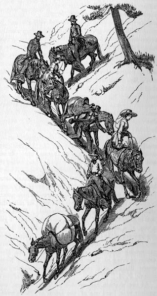
At this point we expected switchbacks going up. But there weren't any. After casting about for a bit, we found the trail continuing on the other side of the creek and up the bank. It continues as before, except more steeply at first. This is the only place where the old pack-train illustration above makes any sense. But it soon resumes its usual pitch.

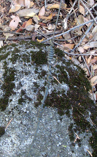
This went on for a long time. We soon discovered that the telegraph wire in this area was not nailed to tree trunks or cross boards. It was passed through doughnut insulators that were hung in the trees with wire.


This is what a typical bit of the trail looks like. Impossible to photograph well with the lighting as it is.


Not a technique that you would use on the valley floor, but along an abandoned trail it was OK. As an engineer, I was also interested in the splices. Here is one where the two spools of wire were of different diameter, so it is easy to see how the splice was done.


This continued on and on. Finally, at about the 5250 foot level we got into an area with thinner soil and therefore more brush. Manzanita. When we hit an area of low angle slick rock, my buddy went nuts. He had realized that this thing was not going up to the road, but was going to continue in the same fashion all the way to Gentry's. The road was only a couple of hundred feet above us, so up the hill he went. We reached the road at 5500 feet and at noon. It had taken two hours from the Valley View parking lot.

Our original plan had been to go up the switchbacks to the road and then just continue along the creek past the waterfall and up to the El Cap Trail. Then down the trail and back along the old road. We had left a bicycle at its terminus. However, we were now too far to the west, under the Fireplace Bluffs. The idea of going around the loop the other way wasn't as attractive, since there was a lot of slickrock to cross that I hadn't seen yet. I prefer to do that going uphill. Finally, my buddy was starting to worry about how he would get a prime seat in the Lodge bar for the seventh game of the world series.

We ate a leisurely lunch, then walked the old road to where the switchbacks should have been. We went down the hill at that point, to the east of the creek, but within hearing distance of it. We were sure that we wouldn't overshoot the trail going down, because it follows the edge of the cliff above the cascade, and that is a pretty hard landmark to miss. It took an hour and a quarter to get from the old road back to the highway.

My guess as to why there are no switchbacks is that they only existed for one season. That would be while the masons were working on the great switchbacks of the road. The reason for having this optional route was that Fireplace Creek would be very scary and troublesome to cross at the head of the cascade when the creek was running full. The road crew would have put in their culvert over the creek by that time, and from that point a good horse could make it down blazed switchbacks on steep dirt to the old trail. Better than being swept over the cascade. And much faster if there was any traffic going the other way. But no stonework was done, so it's all gone now. Who knows what description the Hoods used to come up with that route on their overlay?

When I went to print a map of the gps track, I found that it wandered all over the place. That happens often enough among trees and cliffs, but this was worse than usual. I finally just drew in some waypoints that averaged the wandering, and threw the gps track away.


In this map, the long red track is from my descent after reaching the top of the waterfall last June. (See link: Fireplace Falls Hike) You can see where I backed away from the creek, then descended to the road, then followed it home. The short red track is the actual track from when we left the horse trail to where we hit the old road. The yellow dots were waypoints put in before the hike, a sort of expected route. The blue dots are my rendering of the average route of the wandering gps track obtained while on the horse trail.

Finally, here are a couple of Google Earth views with those waypoints thrown in. It doesn't handle the waypoint characters very well.


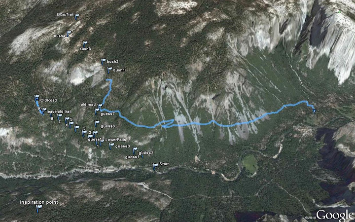
And a closeup rendering looking from the west. The red circle is the start point at the highway.


It's a nice bushwhack. Maybe some day I'll follow the trail all the way back to Gentry's.
Re: The Big Oak Flat horse trail from Gentry's to the valley
November 01, 2011 11:54PM
Wow! I've been aware of the Big Oak Flat horse trail for 40 years, but I never had the opportunity to travel it. Excellent work!
avatar Re: The Big Oak Flat horse trail from Gentry's to the valley
January 30, 2012 05:50PM
Well... I tried... but failed exceptionally... As is typical for me... went too high too fast... had to come back down...
then didn't see trail so went back up... and then back down... and then after crossing Fireplace Creek said
time to just go straight up and go back and read wherever post.
By failed excecptionally the route I took ended up being quite spectacular due to skirting around
almost entire Rainbow View cropping... Hitting about the only open areas in that area including
some gorgeous waterfalls and open grassy areas...

5.99 (in my book) route: (seriously, there are clips on this wall) (I looked for a number of minutes in amazement)


Incredible recent rockfalls, cliffs, and arch:


As wherever said, cabin-size boulders:


Gorgeous open area:


Creek East of Fireplace with excellent example of Porphyry Rock:


Nice Falls on Fireplace itself:


I followed game trails for quite some distance... but never saw any telegraph stuff... next time... I'll stay lower or just follow
some guy named wherever if he'll let me.


Chick-on is looking at you!
avatar Re: The Big Oak Flat horse trail from Gentry's to the valley
January 30, 2012 05:53PM
O, I had loaded into my GPS the old trail:


I must not have done a very good job of doing the original overlay because I know I got the elevation matched:


Chick-on is looking at you!
Re: The Big Oak Flat horse trail from Gentry's to the valley
January 31, 2012 03:39PM
Quote
chick-on
Well... I tried... but failed exceptionally... As is typical for me... went too high too fast... had to come back down...
then didn't see trail so went back up... and then back down... and then after crossing Fireplace Creek said
time to just go straight up and go back and read wherever post.
By failed excecptionally the route I took ended up being quite spectacular due to skirting around
almost entire Rainbow View cropping... Hitting about the only open areas in that area including
some gorgeous waterfalls and open grassy areas...

......

I followed game trails for quite some distance... but never saw any telegraph stuff... next time... I'll stay lower or just follow
some guy named wherever if he'll let me.

Hey, I'd be happy to show you the old horse trail some time. But I don't get to Yosemite very often. Right now I'm at Snowbird, as part of a 4 week ski trip in Utah, Colorado, and Wyoming. Then I have to reload the car for a drive to British Columbia to do some back country skiing there...

But here are some hints: You did start up too soon and stayed too high. The best way to get on the trail is to park on the road below the big rockfall that comes down from the outcrop that has Rainbow View at its top. Then walk up to the big boulders, and pick up the trail where it crosses right behind the big flat-topped one:


Your photo is taken from up near the cliff, looking down towards the road. As I recall, the trail passes just this side of the big rock, and within touching distance of it and the smaller one uphill of it. Then the trail follows a quite uniform grade below your track until you get to where Fireplace Creek goes over its cascade. At that point, your track is at most a few feet from it. Once you cross the creek, the trail has a switchback or two, but then continues westerly at the previous grade while your track veers up the hillside.

Try again a little lower. If you can't peer over the edge of the Fireplace Creek cascade, you are too high on the eastern side of the creek. At the creek crossing, the path ascends up the creek for a short distance, until the telegraph wire shows you where to head leftwards up the bank and start west again...

Have fun.
avatar Re: The Big Oak Flat horse trail from Gentry's to the valley
January 31, 2012 04:50PM
"There are clips on this wall" - bolts, you mean?

I'm not exactly sure where you were. There are bolted routes on Fireplace Bluff:
http://www.supertopo.com/climbing/thread.php?topic_id=870861

Perhaps Audubon Buttress?

avatar Re: The Big Oak Flat horse trail from Gentry's to the valley
January 31, 2012 08:46PM
Yes, bolts. With clippy thingies on them. wink
Awesome picture of that Buttress! Thanks!

Much lower. Below Rainbow view is where some routes were. East of that huge rockfall.
And that rockfall occurred within the last couple of years... (feel free to look it up)
and those boulders are much bigger than the one that JUST fell taking out Big Oak Flat Rd.

The map of where I went was posted here:
http://yosemitenews.info/forum/read.php?3,39010,50906#msg-50906
I slept up at about 7200 ft. And it got down to a bone chilling 27 degrees (never once even
put gloves on).

Anyway, if you would like me to draw a map of where everything is ... can do.

Thanks again for the photo. It's in photos I have taken... but nothing like that... nothing even close...

(I'll take one next time I'm at Tunnel View) (you should too)


Chick-on is looking at you!


Edited 1 time(s). Last edit at 01/31/2012 08:55PM by chick-on.
avatar Re: The Big Oak Flat horse trail from Gentry's to the valley
January 31, 2012 09:32PM
Very interesting. I can't find anything on Clint's list, which is fairly comprehensive:

http://www.stanford.edu/~clint/yos/YOS.HTM

Scroll down to the 700's. Audubon Buttress is the only feature listed between Fireplace Bluffs & Little Wing.

Perhaps you stumbled across an old obscurity or something under development. It might be a good question for supertaco.
avatar Re: The Big Oak Flat horse trail from Gentry's to the valley
February 01, 2012 11:19AM
Found a decent photo of Audubon I tooks from Old Inspiration:


and the lay of the land from Inspiration Pt:


The bolts looked brand spanking new. I took closeups of one at least if you want a look see.


Chick-on is looking at you!
Re: The Big Oak Flat horse trail from Gentry's to the valley
November 15, 2012 09:32PM
This thread was started at Halloween of last year, when a friend and I tried to trace out the old horse trail from the valley to Gentry's hotel and entry station. It was a good time of year for low elevation bushwhacking...the higher country was picking up enough snow to mess up hiking, but there wasn't enough to reliably ski on.

Last year, we lost the trail as it approached the Old Big Oak Flat Road.

This year, we spent Halloween visiting the grandkids near Boston, which allowed us to experience Hurricane Sandy first hand, followed a week later by six inches of snow. But we got back to California last weekend, in time for a brief trip to Yosemite before we have to head off to Vail. (It's hell being retired.)

On Tuesday we set off again on the same quest, but this time with a new GPS that would actually work among the trees. My companion was not my usual brush-crasher, so we proceeded more slowly and tried to verify every foot of the old trail that we could. The sure indicator of correctness was the old telegraph wire, which would rise up out of the detritus on the floor of the woods every tenth mile or so. It's usually difficult to see...we tripped over it half a dozen times (once excitingly near the lip of the lower Furnace Creek waterfall). At another spot, the wire came down out of the trees to head level because one insulator was still attached to a downed tree limb and another was up in the trees somewhere. My buddy declared it to be a hazard, and gave it a yank....which brought a different large dead tree limb down on my head. We finally agreed to snip and roll up the wire to one side of the trail wherever it posed a danger. But these spots were few and far between. Most places the wire has long been buried under fallen tree parts.


I now have a good GPS track and some waypoints that indicate a route to where we lost the wire for good. We then tried a number of forward-going game trails without success.


As it turns out, we didn't get any farther than we did last time, but we had a fine hike and I am now in a much better position to go back and finish up the route. Here is what I think the problem is: Up until we lost it, the trail was still being used as a major game trail. Minor game trails would branch in and out, but the main trail was straight and full of bear and deer tracks. If we had to leave the trail due to a deadfall or manzanita tangle, we could easily pick it up again on the other side. Based on topography, where we lost the main trail is probably where it did a switchback to avoid an upcoming rib of rock. Guess what? Game don't do switchbacks. Worse, neither does the telegraph wire. The active game trails have led us past where we needed to turn uphill.

The loop that you see in the track near the waterfall is not instrument error. I chose to go up the west bank of the little ravine containing the creek by going straight up the rock outcrop at the edge. It has a most impressive drop on the south side. I wouldn't chose to go back down that way. The old trail goes up the creek for a bit, then angles back to the cliff edge on nice safe dirt. With wire to trip over..

My guess is that the original wire was strung with spools of heavy wire when the trail was still passable by mule. Later repairs seem to have been made with lighter gauge stuff. Here is another splice:


I'll bet that wires were being broken or knocked down all the time. I would hate to have been the linesman.

This time I have some gps coordinates to offer:

37.718604,-119.675625, Park Here
37.719364,-119.675209, On Trail
37.719686,-119.675711, Boulder
37.719953,-119.678151, On Trail 2
37.720114,-119.678808, On Trail 3
37.720495,-119.680013, On Trail 4
37.721265,-119.682510, Little Creek
37.721624,-119.683119, Waterfall
37.725420,-119.688221, Wire
37.725615,-119.689727, Lunch

Directions are as follows: After parking, head up the hill just to the east of the great boulder pile beneath Rainbow View. You will hit the old trail at "On Trail", then walk west on it to :Boulder", the great shiny new boulder marked X in Chick-On's photo


This boulder is just like Dorothy's House in the Wizard of Oz. It sits squarely on top of the trail, which goes under one side and comes out the other. "Wire" is the last place that we spotted a piece of wire.


To be continued. Hopefully, we can finish tracing out this old trail before Halloween comes around next year. Maybe Chick-On could check it out without immediately being sidetracked by the nearest cliff face. I could drop a trail of twinkies...
avatar Re: The Big Oak Flat horse trail from Gentry's to the valley
November 15, 2012 10:14PM
smiling smiley

I dunno I said anything before or not. But I did go up it again early this year.
For fun I just plugged in your waypoints into my GPS track. See... I didn't get tooo sidetracked.
wink

Click Here for GPS Track
Click on "t4 topo high" and zoom in

Actually I'm pretty sure I did some daring doo around where your lunch spot was.

If wondering what the heck I was doing on the one track... I went up that-a-way on way up Fireplace Bluffs..

Have fun

EDIT: We must have talked some about this. Since found this capture of the route taken along with black dots of where trail may be.


Chick-on is looking at you!


Edited 1 time(s). Last edit at 11/16/2012 06:20AM by chick-on.
Re: The Big Oak Flat horse trail from Gentry's to the valley
November 16, 2012 07:10AM
Quote
chick-on

Click Here for GPS Track
Click on "t4 topo high" and zoom in

Actually I'm pretty sure I did some daring doo around where your lunch spot was.

If wondering what the heck I was doing on the one track... I went up that-a-way on way up Fireplace Bluffs..

OK. Thanks. I remember the Fireplace Bluffs conversation, but don't recall this particular track. You must have tripped over a few ghost mules yourself...

On a completely different note, I have quit using gps waypoint symbols that look like pushpins, but where the location in question is actually under the center of the symbol instead of at the pin's point. As you can verify by zooming in.

Hence, the waypoints in your link's map that seem to be in the river or slightly over the edge of a cliff. I've changed to using small dots where the center of the symbol is unambiguously what you are trying to indicate. Of course, sometimes you have to struggle a bit to change the symbol. With a gmap4 it may not be possible


Edited 1 time(s). Last edit at 11/16/2012 07:14AM by wherever.
avatar Re: The Big Oak Flat horse trail from Gentry's to the valley
November 16, 2012 07:44AM
Gmap4 did that (I simply put in the waypoints on my file with the tracks in it.. saved it as gpx and threw it up on google sites).
Here's what it looks like on Garmin MapSource on my computer:


For those that have no desire... you may want to take 10 minutes and climb up to the rockfall area.
This is a recent rockfall (w/i last 5 yrs I believe) but I doubt you can find much about it.
Much larger than the recent fall that "took out" BOF road. And the boulders are incredibly large.
Of course, be careful if you decide to do so.


Chick-on is looking at you!
Re: The Big Oak Flat horse trail from Gentry's to the valley
December 01, 2014 07:16PM
On November 21, I had the chance to spend a few hours looking at the old horse trail, to make sure that there is no switchback that we missed which heads back up to the Old Big Oak Flat Road. I looked. There isn't one.

So it is clear that the old trail continues more as less as you would expect. Yes, there is a short section where all man-made traces of the trail have been wiped out by soft dirt coming down from above. Before this point, the trail has been on firm ground along the edge of a minor drop-off. Although there are a few spots where it is obscured by a windfall or manzanita thicket, the trail has been generally visible as a dip in the terrain with rocks pushed to either side. The footing is very easy to the point marked "last wire" on this map:


Beyond that point, where you cross a dry creek bed, is the obscured section. Of course, the deer and bears still use the trail, and where it disappears they split off along several trails of their own. On our first trip we followed a game trail to the red dot marked "left game trail", where the game trail entered some manzanita, so we left it and went straight up the hill to the abandoned Old Big Oak Flat Road. On a second trip we tried various other game trails, and turned around at places like the one marked "No Go". This time I cut up the hill to make sure that there was no switchback that we had missed. It was very steep dirt, leading to even steeper boulders and rock outcrops. I turned back at the point marked "No Switchback". I am confident that we had the right idea on the first trip. If my buddy hadn't been determined to get back in time to see a game on TV during our first trip, we would probably have prevailed and found the trail on the first try.

I am confident that we can find the missing leg from there to Gentry's settlement, and former park entrance. I wasn't trying to do that this trip. It was only a few hour hike, on a brisk but sunny day. I had a newer gps device than last time, and wanted to get a more reliable set of readings. Those little wiggles near the beginning are mostly artifacts, but the waypoints are consistent between both going up and coming down, and are consistent with previous trips. It was a pleasant short hike in beautiful weather.

The contours provided on this map are largely interpolated, and don't show the terrain very well. In particular, Fireplace Creek does not veer to the east just above the horse trail as shown on the topo map. The eastern tributary falls over the cliff in a cascade at the point marked "tributary", and the main creek does so at the point marked "creek". They merge far below. The trail at Fireplace Creek follows up the east bank for a ways, then crosses and cuts back up onto the west bank. The telegraph wire was a real tripping hazard going up the bank on our first trip, but after it got to my buddy twice he balled it up and threw it, so I didn't see it there this time.

In this Google Earth View you can get a better idea of the escarpment that the trail follows along. That kink in the middle is where the trail follows upstream a short distance before crossing Fireplace Creek. The white area below that is the vicinity of its cascade.


If we zoom back a bit, you can see that the terrain a bit uphill and to the west eases up in slope. It should be an easy trek from there to Gentry's establishment, once we find the trail again

.

Another purpose of the hike was to nail down the starting point. Parking along the shoulder of the road at
N37.7184, W119.6750
will easily hold more than a half dozen cars.


The old trail from there to the ford near Fern Spring is pretty overgrown. It is best to pick it up by going straight up the hill from the road, starting at the point N37.7181, W119.67562. You should aim to come up between the two blue dots at
N37.7183, W119.6753
which is on the trail just west of the first thicket, and
N37.71953, W119.67565
which is where the trail crosses behind the big boulder mentioned in the thread above.

If you tend to wander off the trail, here are some newly certified waypoints to get you back on it:

wire N37.72000, W119.67771
1 N37.72057, W119.68053
tributary N37.72171, W119.68306
creek N37.72206, W119.68368
2 N37.72319, W119.68615
3 N37.72470, W119.68769
last wire N37.72573, W119.68862


Edited 1 time(s). Last edit at 12/03/2014 09:09PM by wherever.
Re: The Big Oak Flat horse trail from Gentry's to the valley
November 16, 2015 06:56PM
Long update. We snagged a hiking day in Yosemite on Thursday, and found the snow line on the sunny side of the Valley to be around 5500 feet. Snow was all the way down to the ground on the shady side. Curry Village had a thin layer of snow and slush. The Glacier Point Road was closed, so our intended hike along Inspiration Ridge was too much of a nuisance to get to.

The hiking looked good over towards the old horse trail (see the beginning of this thread), so my buddy and I decided to finish exploring it. This time we would hike in from the Foresta trail head (Tamarack Flat and the Tioga Road were also closed), and hike down the horse trail from above. The hope was to find out where the old telegraph line joined up with the horse trail after its detour to the former ranger station and park entry on the Old Big Oak Flat Road.

Here is our gps track from the hike:


The total length is under 8 miles. We used the modern park trail that starts at the Foresta trail head at 4800 feet, climbs to the approximate location of the (abandoned) Spring pack trail to Gentry's Hotel (which ran beneath the Devils Dance Floor and was used when the main trail was still full of snow). Crossing Tamarack Creek, the trail then climbs above 6000 feet to catch the old road bridge over Cascade Creek. From there it follows the old road to the point marked "1", which is the former location of Gentry's Hotel, sawmill, and livery stables. At this point the modern trail to El Capitan branches off to the north, and the Old Big Oak Flat Road continues on as an abandoned trail (known as The Rockslides, if you need to designate it to the rangers as your wilderness entry point before entering from its terminus near the base of El Capitan).

But our intention was to leave the old road somewhere near the point marked 2, which is at the location of the old park entry station at benchmark 5729. This is the first reasonable flat spot on the road after it crosses the boundary of the original Yosemite Grant. That was the boundary of the park until 1890. The entry station still existed long after 1890 to help regulate traffic on the famously difficult road grade down to the valley. For a while the road was one way down or up depending on the hour.

Our decision to start searching for the wire at the old entry station was based on the idea that although the horse trail went from Gentrys to the Valley, the telegraph wire was strung much later, and would certainly have been continued along the road to the entry station, if not farther, before slanting down to intersect with and run along the horse trail. As it turns out, there is no sign of wire until the spot marked "3", which is where there is a fin of granite coming down from the direction of Fireplace Bluff (see link). This forces several clearly visible switchbacks on the descending trail, in order get below it, and is the first place that the wire appears. The road is still fairly close, and I believe that the wire came straight down from the road to this point. From there on, the downed wire provides many tripping hazards along the old trail. Be careful.

We poked around at the old entry station. No wire. We then followed the road to a place where an open forest leads down to a great lookout previously mention (see link). This is an obvious place to get a great view of The Cascades and Yosemite Valley, and sure enough the old horse trail appears. I believe that the horse trail above this point is mostly concurrent with the old road. On the map below, I have outlined in blue the places where I am certain that we were on the old horse trail. Those places provide no obstacles, except for the occasional thicket that you have to step around. However, shortly below the lookout you run into a maze of downed trees, followed by a bushy (dry) stream crossing and then some manzanita. It's not too hard to get through from point 4 to point 3, but there is no use in trying to follow the old path there. If you wish to walk through it, just set your gps and take the easiest path. Point 3 is at N37.72573, W119.68862. The lookout at point 4 is 37.72786, 119.69950.


And the Google Earth version:


In this view, the vertical exaggeration is turned off. It really is that steep, though the trail deftly sidesteps the cliffs. The first four points are as previously mentioned. Point 5 is where we left the road. 6 is the trail crossing of Tamarack Creek, and 7 is the old road bridge over Cascade Creek.

Enough maps. The weather was sunny and cold, perfect for a Fall hike. My buddy's wife hiked part way, then returned to re-position the car. The first item of interest was the appearance of a rare petrified mushroom below the Devils Dance Floor.


My buddy's wife turned back at the crossing of Tamarack, which really needs a bridge. The creek was flowing, and the rock hopping was enlivened by a thin coating of ice. Cascade Creek was scenic:


Beyond the bridge, the snow reached its maximum depth of about six inches. Then we turned the corner into the sun, and it was all gone. Here we are approaching the lookout:


A view to the west. The Devils Dance floor is off the top of the photo. Below on the right is the new road. In the center you can see it entering the long tunnel through the Upper Cookie Cliffs. At the lower left, the El Portal road makes a sharp to the left and the Old Coulterville Road slants upward to the left.


I will spare you the photos of us peering at wires and insulators. Our actual off-official-trail bushwhacking on the Old Horse Trail lasted only 2 and a half hours, and that's with various stops. It makes for a very satisfying sunny-day hike, if you enjoy route-finding.
Re: The Big Oak Flat horse trail from Gentry's to the valley
November 17, 2015 07:20AM
Thanks for posting this, wherever...I can't get enough of this stuff!

Quote
wherever
I will spare you the photos of us peering at wires and insulators. Our actual off-official-trail bushwhacking on the Old Horse Trail lasted only 2 and a half hours, and that's with various stops. It makes for a very satisfying sunny-day hike, if you enjoy route-finding.

I (and, I'm pretty sure, at least a few others on this board) have no interest in being spared! If you've got other pictures available online, I'm happy to look at them!
Re: The Big Oak Flat horse trail from Gentry's to the valley
November 17, 2015 01:31PM
Quote
DavidK42
Thanks for posting this, wherever...I can't get enough of this stuff!

I (and, I'm pretty sure, at least a few others on this board) have no interest in being spared! If you've got other pictures available online, I'm happy to look at them!

Well. The photos higher up in this thread show it best. We did get a nice photo on Friday of how a support wire was wrapped around a nail in a tree, but it somehow got erased during transfer to the computer. Bah. On the previous day, we got a photo of two support ties right alongside the Coulterville Road. Those two telephone/telegraph wires are of similar vintage to the ones on the horse trail.


Wire photos from the horse trail Friday tend to look like this:


That is a good example of an in-your-face and trip-you-underfoot spot on the trail. Where possible we push the wire off the trail, but in some places like this one the wire is caught up in downed limbs. We don't carry a wire cutter.

On a more modern note, the two buried phone cables alongside Foresta Road now have many more access posts than before. I'm guessing that is so that they could pull the old cable out of its sheath and snake in the new single smaller one. Whether it's fiber optic or higher frequency twisted pair cable is unclear, but it certainly is a lot smaller the the previous two cables:


Here's what is going on. In the above photo, one of the old trunk cables in its black plastic sheath has emerged from the singed metal conduit on the burned bridge. It was cut as shown and is hanging from the conduit. The new gray plastic cable is strung across the bridge using just cable ties, then goes into the other side of the sheath cut, out of the photo to the left. That sheath dives underground. That sheath entrance has a black plastic rain cover, but clearly the old twisted pairs must have been pulled from the sheath before the new cable could be put in. There is no new trenching, so the only disturbance along the road is the surprising number of new gray access posts.

You see? Too much information....
Re: The Big Oak Flat horse trail from Gentry's to the valley
November 18, 2015 12:16PM
Cool! I've seen old cabling on a number of my old-road explorations and, except for those that are obviously very old (like the telegraph wire/insulator in your 2nd picture) or very new (like the last picture), I'm always at a bit of a loss to know how much of an historical artifact I'm looking at (or stepping/tripping on/over/through/around) but I'm always fascinated to see them. Walking the old roads and trails is such a powerful "time-machine" experience for me (especially in the better-preserved sections) that I frequently imagine I'm hearing stage coaches coming around the next switchback...the old artifacts add all the more to that.
avatar Re: The Big Oak Flat horse trail from Gentry's to the valley
January 31, 2012 08:48PM
Thanks. That's what I figured. I may end up doing it sooner rather than later.
Enjoy your ski trips!


Chick-on is looking at you!
Re: The Big Oak Flat horse trail from Gentry's to the valley
November 16, 2012 12:32AM
I applaud the work being done on finding the Big Oak Flat horse trail and subsequent telegraph line. I wanted to do that work in 1971, but did not have the opportunity. By coincidence, I met a retired forest ranger several months ago who spoke of using that same type of insulator in his career because when a tree invariably fell, the wire would often slide through the insulator instead of break. I hope you share your findings with the Yosemite research museum.
Re: The Big Oak Flat horse trail from Gentry's to the valley
June 03, 2022 04:01PM
i was just on a very old trail between hwy 120 and the gentry trail. it is just down hwy 120 from cascade falls and is above the road. any one have info on it?

image of trail location, red line


trail in red

photo of rockwork


rock work


Edited 4 time(s). Last edit at 06/03/2022 04:15PM by pywiack.
Re: The Big Oak Flat horse trail from Gentry's to the valley
June 06, 2022 08:34AM
I'm not aware of any maps or such that have a trail in this location... My first guess was maybe it's a gutter/ditch to keep water off 120, but it looks like one of your pictures has a switchback in it, so that wouldn't make sense, and I suspect anything built for the current BOF would be more modern (concrete, etc., not just stacked rocks).

Maybe it was a "shortcut" trail from the residences that were near the base of Wildcat Falls/The Cascades to Gentry's--not unlike the Sunset Trail south of 140 that was a "shortcut" from Arch Rock to the Wawona Road (Chinquapin/Ft. Monroe)...?
Sorry, only registered users may post in this forum.

Click here to login