Welcome! Log In Create A New Profile Recent Posts
Dogwood bloom in Yosemite Valley

The Moon is Waxing Gibbous (56% of Full)


Advanced

Re: Identify this peak

All posts are those of the individual authors and the owner of this site does not endorse them. Content should be considered opinion and not fact until verified independently.

Identify this peak
March 07, 2012 08:35AM


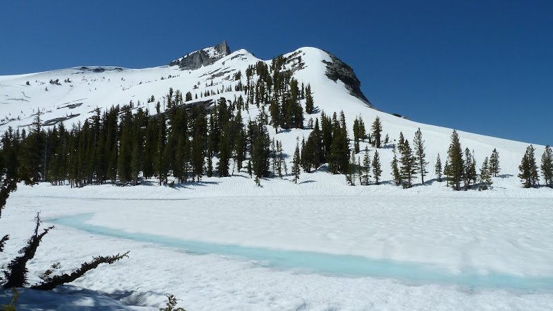
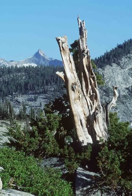
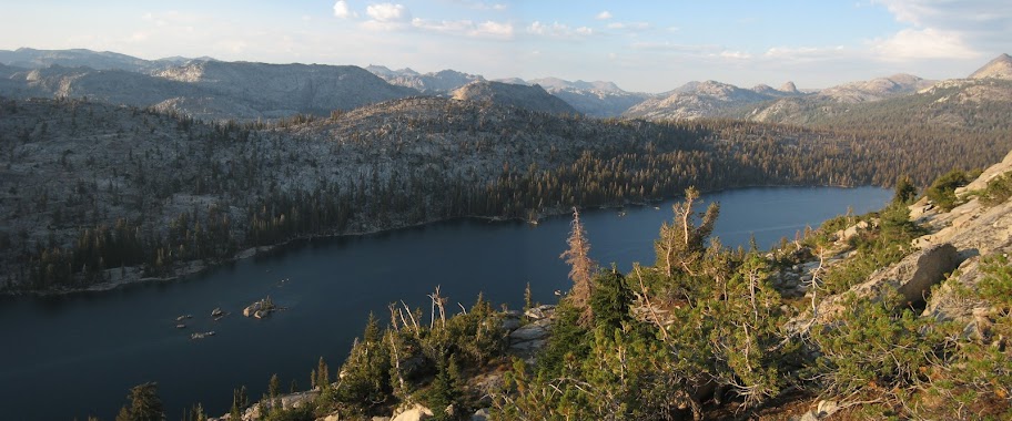
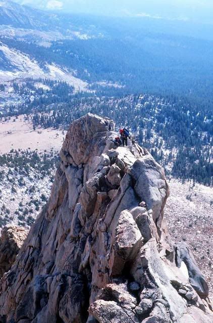
The Yosemite NP faceybook site is trying to identify this peak...
avatar Re: Identify this peak
March 07, 2012 09:19AM
Piece of Cake

Half Dome


Chick-on is looking at you!
avatar Re: Identify this peak
March 07, 2012 11:01AM
Quote
chick-on
Piece of Cake

Half Dome

Did Old Dude take that pic back before it was bisected?
avatar Re: Identify this peak
March 07, 2012 06:05PM
Quote
mbear
Quote
chick-on
Piece of Cake

Half Dome

Did Old Dude take that pic back before it was bisected?

Be kind to Old Dude.


Old Dude
avatar Re: Identify this peak
March 07, 2012 09:21AM
My initial thought right away was from Dozier.... looking across outlet of Lower Cathedral toward Tressider.
But I'm not sure. It's a tough one. Other thought was perhaps Vogelsang.

Need to poke around pix tonight. It's not an easy ID.


Chick-on is looking at you!
avatar Re: Identify this peak
March 07, 2012 09:47AM
Sorry if I ruin it... but it's def from Dozier.

Can't find my faux-toe of that spot in da snow... but here it is from Google Smurf:


Chick-on is looking at you!
avatar Re: Identify this peak
March 07, 2012 10:17AM
Here's one from with snow... not same angle of the dangle... but you should be able to see
that it's the same ridge, etc.


I'll post something better tonight when I'm off work... hahahaha


Chick-on is looking at you!
avatar Re: Identify this peak
March 07, 2012 11:02AM
Is that peak in the background officially named?

I don't think it's Tresidder Peak, or is it considered part of Tressider? Perhaps as one of its multiple summits – the northern one – with Tresidder's main (highest) summit further south along the unseen ridge (in that photo) obscured by this first, lower summit. Just wondering...


Edited 1 time(s). Last edit at 03/07/2012 11:04AM by plawrence.
avatar Re: Identify this peak
March 07, 2012 11:41AM
Nope. That peak is BM10450.. well, I have never heard a name for it

Here's a map:


Chick-on is looking at you!
avatar Re: Identify this peak
March 07, 2012 12:22PM
Looking at the topo map and seeing how it shares its southwestern face with Tresidder Peak, I was wondering if the USGS might consider it a part of Tresidder Peak itself, one mountain - two summits.
.
avatar Re: Identify this peak
March 07, 2012 07:43PM
I'd say that's a no. 10450 is along the same ridge as Tressider... but so is Columbia Finger.

Here's two faux toes of mine that will convince you if you no believe me:


On left is Echo Peaks


Way on right is Tenaya Peak


Chick-on is looking at you!
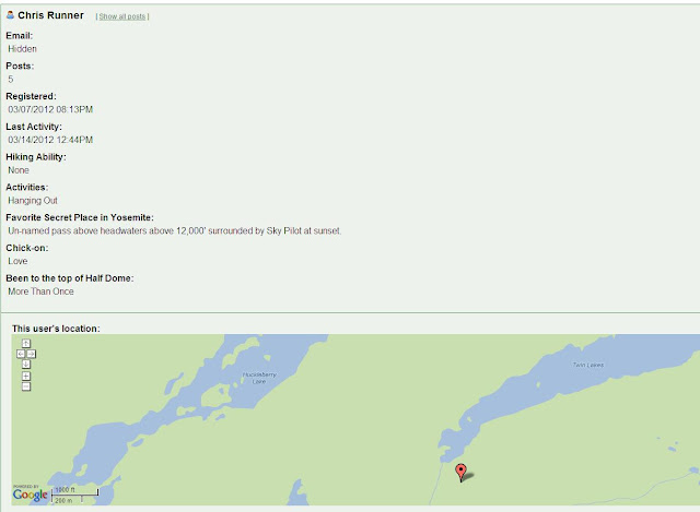
Re: Identify this peak
March 07, 2012 08:27PM
This peak looks amazingly similar to Mt. Clark from about the same angle. What's it called? How about "Mildred Peak." I doubt anyone would bother climbing it with that name!
avatar Re: Identify this peak
March 07, 2012 10:00PM
It's BM10450. It's just a small knoll... almost flat... til you hit the edge...
I'd bet anyone going to Tressider goes up there and enjoys the view too...
so it's probably visited quite a bit... I haven't been up there but have shots from
Tenaya, Echo, and Columbia Finger... it just looks supa flat...

IMO it looks nothing like Mt. Clark...

Here's some stuff on Clark:
http://yosemitenews.info/forum/read.php?3,44180

I think someone posted a pict from there ... but I can't find it...

Have fun


Chick-on is looking at you!


Edited 1 time(s). Last edit at 03/07/2012 10:08PM by chick-on.
avatar Re: Identify this peak
March 07, 2012 10:07PM
Found it:
http://yosemitenews.info/forum/read.php?3,43263

And to save you some time...here's a link directly to Chuck's photos from that peak.
http://panoramas.aa6g.org/TressidderRidge/tressidderridge.html


Chick-on is looking at you!
avatar Re: Identify this peak
March 08, 2012 02:08PM
Peter alerted me that I was spelling Tresidder wrong so I fixed the spellings and broke the link. New link:

http://panoramas.aa6g.org/TresidderRidge/tresidderridge.html

Chuck
Re: Identify this peak
March 08, 2012 08:51PM
Here's the photo that made me think that peak was Mt. Clark:

avatar Re: Identify this peak
March 08, 2012 10:07PM
Here's Clark from Clark Canyon:


Many of the Peaks in the park are very unique. And Clark is one of them. It's pretty hard IMO to mis-id Clark.
(athough it doesn't look fin-ish from the East)

Have fun


Chick-on is looking at you!
Re: Identify this peak
March 08, 2012 10:24PM
Well, I guess 18 years absence takes its toll. I'd probably score low on the old map test we used to do at the VC and the trout species test too. I even kinda got lost 2 years ago in Dana Meadows trying to find a favorite place, but at least I found the tower delphinium I was looking for below Gaylor lks.

Here's that fin on Clark:

avatar Re: Identify this peak
March 08, 2012 10:43PM
That's the SE Arete ... (not really visible in the 2 photos above)

Very kewl pix. Tanks for Sharon.
Ok, I leave it be now.

Chick-on is looking at you!


Chick-on is looking at you!
Re: Identify this peak
March 08, 2012 08:19AM
Good detective work chick-on!

I then had to figure out when I was on Tresidder Peak...OK found the year...got out the prints and looked through them. At first I thought I had a few, but it was Tenaya Peak. I only have the NE flank of 10450 in any of my pics. (I think)
Re: Identify this peak
March 08, 2012 08:35AM


17 Aug 2005 from Tressider Peak (scanned print)
Re: Identify this peak
March 08, 2012 08:54AM


here's another view from that batch of photos
avatar Re: Identify this peak
March 08, 2012 09:36AM
Nice... Long... Meadow... smiling smiley

In all honesty I immediately thought of Dozier and that view when I saw the photo.
I just couldn't remember that spire-like thing-a-ding in there... so I had to do the
investigatory work.

Did you go to the tip top of Tress?
Columbia?

When I went up Columbia I skipped Tress and headed to Tenaya Pk.. was doing a loop
from the Dolly Domes area and got lazy... Tress looked quite technical... and
Columbia was more difficult than what I thought it would be.
smiling smiley

Have fun


Chick-on is looking at you!
Re: Identify this peak
March 09, 2012 07:53AM


I found a WIDE photo of the area. Sep 2009


chick-on...I did not go to the tippy top of Tressider. I did have to drop my pack and got up close to both summits. I had to straddle a bit of a knife edge to be comfortable taking photos and video. I could've summited, but I questioned the "going down" part and since I was alone, I didn't.
avatar Re: Identify this peak
March 09, 2012 08:06AM
Nice.

Ears one of mine from 2007. Shows Columbia, Tressider, and 10450. (and a small Lake)


and for the Mt. Clark Guy: wink

May be ho hum... this photo of Clark... but look for The Old Guy in there.
And now I know where I want to spend a night... smiling smiley

Hik-errr-ladie395, when you gonna tell me when Teee-ohhh-ga Road gonna open for da year... so
we can get back to climbing all doz domes?


Chick-on is looking at you!
avatar Re: Identify this peak
March 09, 2012 12:42PM
Wow. No snow on the north side of Tresidder at all. Not so in 2011. Here's a 360 from a location not far from yours.

http://panoramas.aa6g.org/CathedralRidgeHike/Pan360.html

Maybe this year will have less snow..... and fewer mosquitos.

Chuck
avatar Re: Identify this peak
March 09, 2012 12:54PM
Quote
chick-on
Nice.

Ears one of mine from 2007. Shows Columbia, Tressider, and 10450. (and a small Lake)


. . . snip . . .

Upper Cathedral Lake?
avatar Re: Identify this peak
March 09, 2012 06:45PM
Quote
qumqats
Upper Cathedral Lake?

Yes

And ... related only in my chick-on bird brain....

here's one for C.Runner:


Chick-on is looking at you!
Re: Identify this peak
March 13, 2012 10:35PM
Nice


Edited 1 time(s). Last edit at 03/13/2012 10:40PM by Chris Runner.
Re: Identify this peak
March 13, 2012 10:44PM
Strangely but, I'll be darned if this lake doesn't look like Lower Twin Lake looking north from the northwest slopes of Michie Peak. Rainbows, anyone? Visited there just once on a day hike from Wilma in 1990 and had a great meeting SE of the outlet with a very colorful American kestrel who lives there. Not on the beaten path, if there is one nearby.


Edited 1 time(s). Last edit at 03/13/2012 11:04PM by Chris Runner.
avatar Re: Identify this peak
March 18, 2012 10:20AM
Quote
chick-on
Quote
qumqats
Upper Cathedral Lake?

Yes

And ... related only in my chick-on bird brain....

here's one for C.Runner:

bill-e-g,

This one is giving me fits. Everything I think it could be does not fit the surrounding topography.
avatar Re: Identify this peak
March 19, 2012 06:29PM
Jim, he answered it. But the reason I posted it was .. click on his name... and you'll see.

To be clear... it's a view of Lower Twin Lake taken from the SW flanks... (looking NE)
Lower Twin is just East of Huckleberry


Chick-on is looking at you!
avatar Re: Identify this peak
March 20, 2012 01:04PM
I'm completely lost. I'm not familiar w/ Huckleberry Lake and there are so many Twin Lakes it makes one head spin. Are we even talking Yosemite? Help out the handicapped.
avatar Re: Identify this peak
March 20, 2012 01:18PM
OK. No problem.

It was related in my chick-on brain because of this:


And Click Here for a Gmap4 of where photo was taken

Huckleberry is just outside the northern boundary of the park in the Emigrant Wilderness.


Chick-on is looking at you!
Sorry, only registered users may post in this forum.

Click here to login