Welcome! Log In Create A New Profile Recent Posts
Fern on the Four Mile Trail, Yosemite National Park

The Moon is Waxing Gibbous (71% of Full)


Advanced

Re: Searching for the lost Mono Trail (long)

All posts are those of the individual authors and the owner of this site does not endorse them. Content should be considered opinion and not fact until verified independently.

Searching for the lost Mono Trail (long)
July 27, 2012 01:33PM
Some of you know that I like to trace out the abandoned roads and trails around Yosemite Valley (see link). After previous good luck finding the Indian Canyon Trail and the Big Oak Flat Horse Trail, this week I went after the grandaddy of them all, the Mono Trail from Tamarack Flat campground to Porcupine Flat. It's been fading away since 1883, but has the longest history of them all.

First, some of that history. Before the white men showed up, the main Indian trail across the Sierras between Mono Lake and the western foothills was the Mono Trail. It came up Mono Pass (much nicer than Tioga Pass, even though it is slightly higher), across Tuolumne Meadows, and past Tenaya Lake. From there a branch went east of Half Dome to Bridalveil Creek and branched out from there (see link), but the main trail went southwest to Porcupine Flat, then to Tamarack Flat, Gin Flat, Crane Flat, and onward towards the foothills. Major branches went down to Yosemite Valley on either side of the Yosemite Creek crossing: In the east it was the Indian Canyon Trail (see link) and in the west it was the North Cliff Trail, which became the above mentioned horse trail (see link) that was eventually was replaced by the Old Big Oak Flat Road.

Perhaps Yosemite_Indian can add some comments about the significance of the old Mono Trail.

After the gold rush, there began to be a lot of miners' traffic over the Mono Trail to the high country and beyond, in addition to summer cattle and sheep outposts at all the above mentioned flats and in Tuolumne Meadows. In 1857, the Mono Trail was blazed as a horse trail, and in 1862 the original Yosemite Grant was carefully laid out such that the park did not infringe upon this route. See "Trail to Mono" in the 1869 map below. which I have highlighted with red dots, and the old park boundary, which I have outlined in red.


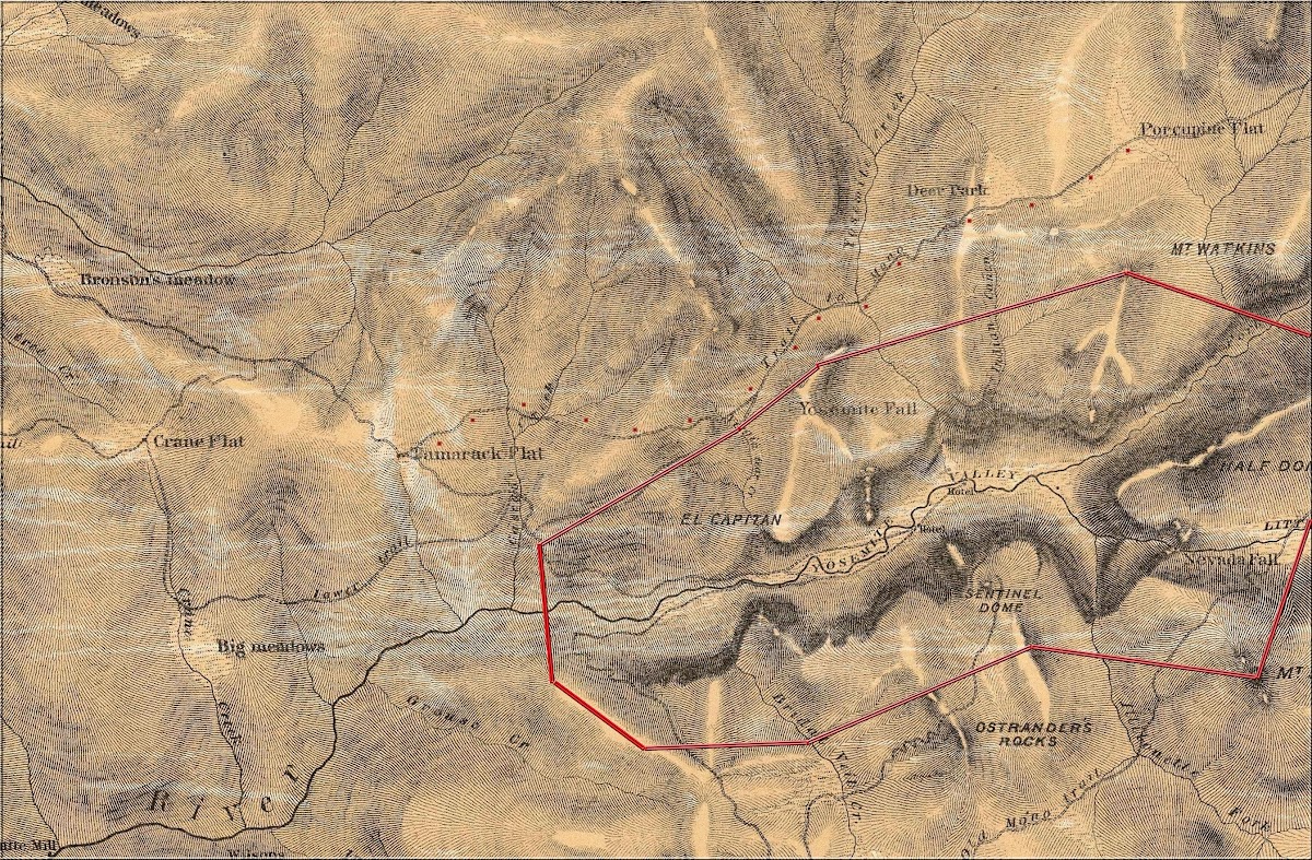
That map is too poorly drawn to allow someone to trace the route today, but the 1883 topo map is much more specific.


This map was made in the heyday of the Mono Trail. It has some interesting features. Unfortunately, it does not go any farther west, so you can't see Tamarack Flat. But it does show the main trail (my red dots added). It also shows a newer trail, called "old trail" coming up from Gentry's Station, which was the entry station and hostelry at the park boundary. It also shows the newest trail, called the Eagle Peak Trail, which took tourists to El Capitan, Eagle Peak, and the newly completed Yosemite Falls Trail. It is now called the El Capitan Trail.

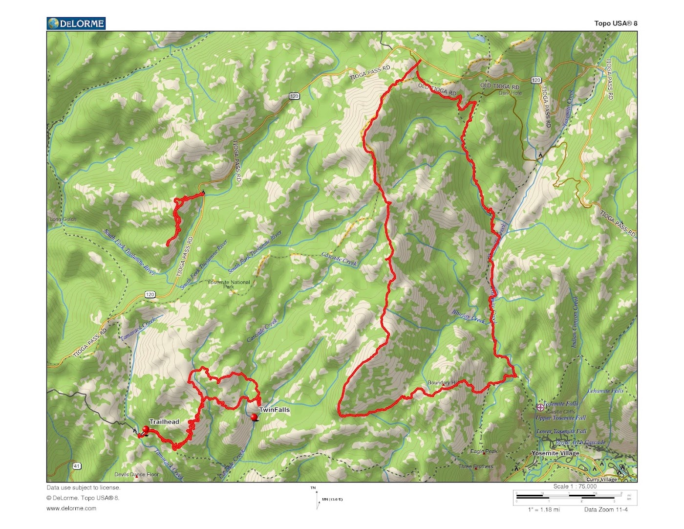
On the map, 5 is the top of Ribbon Falls, with El Capitan a bit to the right. 4 is Gentry's Station at the old park entrance. 1 is the junction of the upper branches of Cascade Creek. There is a twin waterfall at the junction, which has been the subject of recent postings (see link). Various of us have been toying with going for a close-up view of the falls, and Chick-on did it a week ago. I trust that he will post something about it on the Twin Falls thread. 3 is a very specific spot on the Mono Trail, where you can tell exactly where it went, since it is a narrow cleft and there is no other possible horse trail past that side of Boundary Hill.

The 1883 map is the last one to show this portion of the Mono Trail. That same year, miners put in the (old) Tioga Road, which effectively took over all the traffic from the lowlands to Porcupine Flat and on to Tioga Pass. Not only was it an actual wagon road, but it had a bridge over Yosemite Creek. Instead of coming up through Crane Flat and Tamarack Flat, it came through Aspen Valley and White Wolf, not joining the Mono Trail until Porcupine Flat. Travelers from Yosemite Valley towards Tuolumne could go up the improved Indian Canyon Trail (actually, the canyon is named after the indian trail, so it should be Indian Trail Canyon) until it was put out of business by the completion of the Yosemite Falls Trail. In any case, there was no need for anyone to go from Tamarack Flat to Tenaya Lake via the old trail. Fifty years ago the big Oak Flat book asserted that the trail was mostly gone, but some blazes remain. I figured, "How hard could it be to trace the old route?" since I knew where it went and there would surely be some 200 year old trees with 150 year old blazes. Plus, I had two very specific clues about the trail: The Split Rock and the notch next to Boundary Hill.

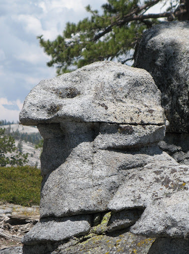
The Split Rock is mentioned in Schlichtmann's book: "A generous two-tenths of a mile past the present bridge over Tamarack Creek [traveling west from the saloon at Tamarack Flat] brings one to a well-marked gully leading up on the left. Along this small gulch went the Mono Trail joining Tamarack Flat with Yosemite Creek... ...It was exceedingly rough and steep even after being cleared out and blazed in 1857, but had the advantage of water and shade. Now it is impassable. [This was written in 1959.] Other portions of the Mono Trail have been maintained by the government for modern hikers, but this branch has been forgotten and is recognizable only by the blaze marks about six feet up on the large trees. Many of them have fallen and disintegrated but such marks as are left are always to be found on the right of the trail no matter in which direction one is traveling. [Meaning that they didn't blaze both sides of the same tree.] About a mile up the hill the trail goes through "Split Rock" which looks as if it had been divided for the purpose."

Looking at the satellite photos, here is a pretty good candidate for Split Rock:


But if that's not the right one, there are hundreds of other big rocks up there which might turn out to be Split Rock. Plus, Chick-on says that he saw it on his way to the twin falls last week. But somehow I missed finding Split Rock that day. I will go back...

Ha. So on Monday I set out to trace the old trail as far as Ribbon Meadow. I started at the 6338 benchmark. A trail junction is the only logical reason for the surveyors to have put the marker there a hundred years ago. I contoured east to the ridge, then straight up past the 7000 foot level. Looking for blazes. Looking for split rocks. Head spinning like a top.

I did find some things. I found the old 1875 telegraph line on its way to Gentry's Station. The insulators are still up in a tree near the road.


There was a later telephone line, which has been salvaged and carried away. But they broke one of the insulators and left it behind. It is the type that has an internal thread, and screws onto a threaded dowel, sort of the way that a push broom head goes on.


I met a bear, but he wouldn't pose for a photo. I passed an old skull. But the chief was not amused.

....

I met a chicken sphinx. Unlike many statues, this one is equally fowl on both sides....

.....

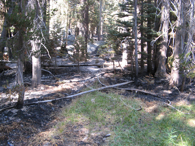
But what I didn't see is any blazes. Although there were some huge trees, easily two hundred years old, none showed blazes. Disturbingly, the great old giants, ponderosa and sugar pines, stood very far apart and there were no young pines. Almost the entire forest was made up of firs. Some were fairly large, but not 200 years old. All of the young trees were firs. They tended to form in isolated thickets of equal size...some thickets six feet tall and some half that size, probably based on particular fires. All the trees showed significant fire scars. The great sugar pine forest for which Yosemite was famous is gone here. Killed, perhaps, by horrible crown fires resulting from unwise forestry practice. I'm told that old tree rings show evidence of ground fires every decade or so, which wouldn't have killed the larger trees, but recent fires like the huge Arch Rock Fire can kill everything....

I had a chance the following day to see plenty of blazes along the Yosemite Creek Trail, but none were on very large trees and the oldest ones were healing over. Based on this hike, I would say that 150 years, along with fire damage, would be enough to obliterate any blazes at this altitude. However I'm told that blazes last longer on the slow growing trees up in Mono Pass.

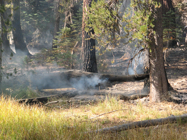
Speaking of beneficial ground fires, the current Cascade Creek fire has been burning for over a month and is still only about 30 acres in extent. This was of great interest to me, since it was just upstream of my bushwhack (see link).


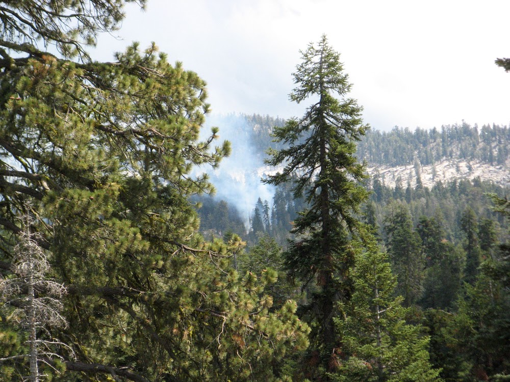
Even though the wind was constantly blowing the smoke to the northwest, away from me, one errant burst of smoke caught me on the knob just above the double falls. My eyes teared up so badly that I couldn't see to walk for the next five minutes. You don't have to warn me twice. I turned around and checked out a different route on the way home. Ribbon Meadow could wait until tomorrow.

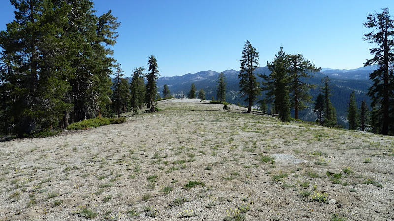
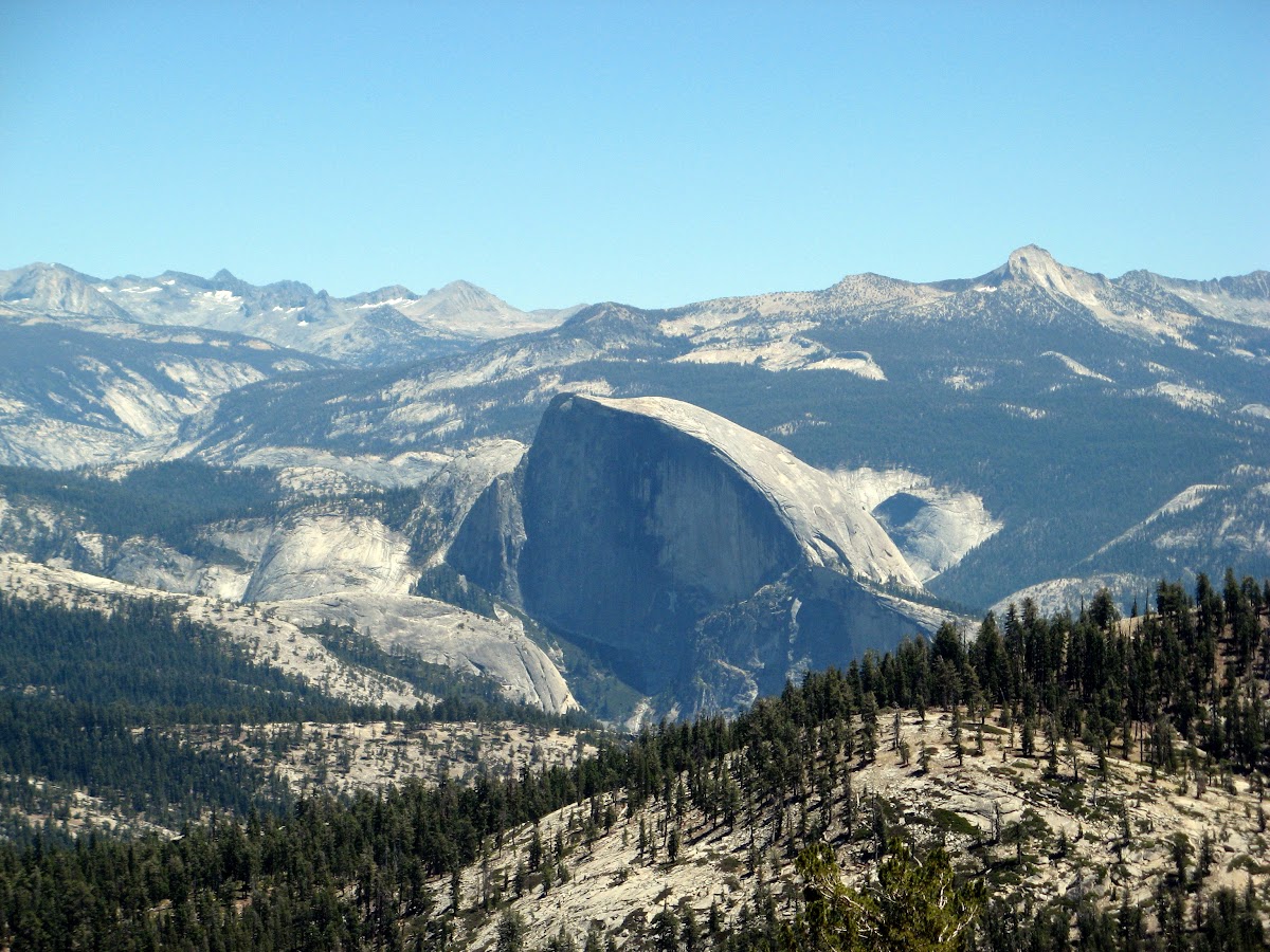
On Tuesday I decided to go to Ribbon Meadow via the El Capitan Ridge from White Wolf. Not the fastest route, about five hours to get to the meadow, but it's my favorite off-trail hike in Yosemite (see link). No brush, open ridge, great views, like a walk in the park. At the south end of the ridge stands a prominent knob, called Kaialauwa Hill on the old maps. Next to it is Boundary Hill, so named because one of the vertices of the original Yosemite Grant is on its summit. Between them is one of those perfectly straight fault-based gullies that you see in Yosemite, which the Mono Trail passes through. Kaialauwa Hill is by far the larger of the two. At 8971 feet it is slightly higher than Half Dome and 500 feet taller than Boundary Hill. Why its name has disappeared from modern maps is unclear, since it is a much better landmark than Boundary Hill, unless you are a surveyor...

Here is Half Dome seen from Kaialauwa Hill, with part of Boundary Hill in the foreground.


Descending to Ribbon Meadow in the usual place puts you right smack onto where the old trail used to run. From here to Yosemite Creek there is no need to hunt around for the old trail...your feet will keep you on it. (Still no blazes, though)


Note that the trail on the old maps was just sketched in, with only the main peaks surveyed by triangulation. The elevations shown along the old trail would be barometric ones obtained by some guy with a mule and a mercury barometer. Hence the unfamiliar look of the creeks and other stuff away from the trail. Here is a less fanciful modern map of Ribbon Meadow:


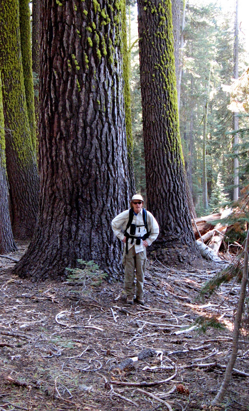
Even so, the modern map is misleading about the northern edge of the meadow. It turns out that a little creek flows east along the base of the hill. The ground slants steeply down the hill into the north side of the creek, but the south side of the creek is a grassy verge rising to a level bank before falling off again to the south. I remember thinking, "What a perfect place for a trail!", as I walked along it into a majestic grove of giant old pines....Ponderosas, Sugars, Whites, with no underbrush and a modest assortment of immature specimens to round out a healthy forest. This is what the great sugar pine forest must have been like 150 years ago.

Soon enough the creek turns to the south, but the land remains gentle until the desired cleft appears ahead. Then, suddenly, you get a taste of what a second-growth, badly burned forest is like:


Still, I was lucky. This is easy to walk through today, but in a few years it will be a labyrinth of fallen logs.

Then up the cleft. Perfect. Not burned, dirt floored, reasonable gradient. At one point the granite walls close in, and the path is about eight feet wide. I was standing right on the old trail. I listened for ghosts, but they were quiet.

Then I made a possible mistake. The other side of this little pass is called Bluejay Creek. I needed to take that down to the Yosemite Creek Trail, then head back to White Wolf. But Chick-on had done Boundary Hill last year, and reported that Bluejay Creek was almost impassable due to downed trees. So I went over Boundary Hill and down the other side instead.
The upper part of this trek was fine, the only problem being some strange blowdowns: Only the biggest live trees were knocked down, and all parallel to each other and across my path. Younger trees and dead tress remained standing. These windfalls were really big trees, so it meant detouring fifty feet one way and fifty feet back, repeat ad infinitum. Sometimes the detours were longer, where the trees had fallen like dominoes. Still, all was well until halfway down the far side when I hit another brushy burn area and was forced to the right and down through some bush-covered broken cliffs to the Eagle Creek Trail. It was two hours and 40 minutes from when I left the old trail to where I passed it again at the mouth of Bluejay Creek. If the old trail had still existed, it would have saved me two hours and some shin bruises. I haven't given up on there being a better route through there, but Chick-on and I have both missed it so far.

Then home in a hurry, in order to reach the car before sunset. Which I did, but only because the days are long right now. Eleven hours, 4600 vertical, and 22 miles make for a long hike.

On the other hand, including some hiking on the Smoky Jack Ridge next to route 120 on Sunday, I logged 22 hours of hiking in Yosemite, in July, in sight of the Valley, and never saw another hiker. Who says that the place is crowded in the summer?


Edited 2 time(s). Last edit at 07/30/2012 02:05PM by wherever.
avatar Re: Searching for the lost Mono Trail (long)
July 27, 2012 05:24PM
Love the skull rock.
Re: Searching for the lost Mono Trail (long)
July 27, 2012 08:56PM
Amazing! Thanks for sharing.
Re: Searching for the lost Mono Trail (long)
July 28, 2012 09:23AM
Awesome, thanks for sharing. Makes me want to explore it now, along with another old trail that I learned of recently but I'm sure has been covered on this forum before (too lazy to search for it now) that goes along the top of another great valley in Yosemite, Hetch Hetchy.
Re: Searching for the lost Mono Trail (long)
July 28, 2012 10:27AM
Thanks so much, wherever! These are my favorite kinds of hikes in Yosemite. Since I'm still on the east coast with my plans for a California relocation progressing slowly, I'm still limited to 1, occasionally 2 weeks a year for explorations in Yosemite (in addition to still having a number of the more established trails off the Tioga Road which I want to do, my current "old trail" project is tracing Wawona Road...next up is the stretch between Grouse Creek and Chinquapin). In the meantime, I don't just read but re-read, study the maps, do associated research and, in general, live vicariously through those of you who not only lovely searching for the old abandoned roads and trails but actually study the history associated with them. So for you and the others who take the time to do these very detailed write-ups, a great big Thank You. For my appetite, you can't post too much or get too detailed when writing about these topics!
Re: Searching for the lost Mono Trail (long)
July 29, 2012 09:10PM
Thanks. I have realized that I wasn't completely clear about why the original Mono Trail route was superior to the later "New Trail". One of the reasons for checking out this route was to find an easier route to get to a car at Tamarack after reaching Ribbon Meadow, when coming down off the El Cap Ridge from White Wolf. In the past, I have exited by taking the El Cap Trail east to Yosemite Falls (exhausting) or by taking the El Cap Trail west to Gentrys and from there down the Old Big Oak Flat Road to the Valley floor (exhausting) or continuing west from there to Foresta or heading northwest up to Tamarack Flat. None of these would be as easy as taking the old Mono Trail, because Gentrys is an extra 550 feet below Tamarack Flat. In other words, if you are headed for a car at Tamarack Flat (the shortest way out), you have to descend an extra 550 feet on the steep El Cap Trail to get down to the trail junction at the old park entry station at Gentrys, and then gain that elevation back again on the trail to Tamarack Flat.

In contrast, the old Mono Trail has a much more gentle and monotonic descent to Tamarack. And it is shorter. If it currently passed through old growth forest, there would be no contest. As it is, one needs to use some route finding to avoid the various windfalls, bushes, dead branch piles, and fir thickets that the modern fires have created. Even so, I think that the route is a winner. You will note from the 1883 map that the route stays high above the gullies of Cascade Creek and Coyote Creek until it can descend straight down a mostly open rocky ridge to the old road.

Here is my idea of where the trail went, and where I will try to go some time when the Cascade Fire has burned itself out:


By the way, here is a photo from my crossing of the west branch of Cascade Creek on the way in. Not much flow right now. Coming back, I was higher up the hill and crossed the creek near an open meadow filled with flowers. Beautiful country to walk through.

Re: Searching for the lost Mono Trail (long)
October 01, 2012 06:34PM
We finally did the old trail on Thursday. Porcupine Flat to Tamarack Flat. It's an all-day hike.... 9 to 5....but there are no obstacles to get around, except (as Chick-On says) a few vegetative ones.

In many ways this is the perfect horse trail route. It is as direct as possible. It passes by great masses of granite, but always has dirt underfoot. And is mostly in the forest.

In the 1860's and 1870's, when many miners and sheep herders were passing through, this was the main drag. On the other hand, in 1870 when John Muir offered to guide Joseph LeConte and his nine UC Berkeley companions from the valley up to Mono Pass (book link), they didn't stay on the Mono Trail when it got to Ribbon Meadow. The lure of views of the valley (which the Mono Trail lacks) was too great, and they took the newer tourist route (marked Eagle Peak Trail on the second map at the top of this thread) and stayed on that until they got to Yosemite Creek. After which they followed along the creek until crossing it at the Mono Trail crossing. When the Tioga Road opened in 1883, it captured the miner and sheepherder traffic, and all the tourist traffic from the valley took the Eagle Peak option. So the middle section of our Thursday's hike immediately fell into disuse.

LeConte's was an interesting trip, and it's worth reading his account. They started in the valley at dawn, forded the river and went downstream to pick up the old horse trail. see link They continued past Gentry's almost to Tamarack Flat, and then picked up the Mono Trail there. Without John Muir, they would have never found the turnoff of the trail. Only the blazes distinguished it from the game trails and sheep trails and alternate branch paths. They took the Eagle Peak option and camped in the flat near the peak. And did what every tourist does up there: They built a huge bonfire on the summit of Eagle Peak and hooted and hollered and fired their guns. Whereupon numerous other fires appeared in the valley and on Glacier Point, etc, where other people did the same. It was great fun. I highly recommend that you try this the next time you are camping up there.

The next day they rejoined the Mono Trail at the conjunction of Yosemite Creek and Bluejay Creek, and followed it up to the great meadow at Porcupine Flat. Which was full of sheep, of course. (He reports that there were another 12,000 sheep in Tuolumne Meadows when they got there.) They continued on to Tenaya Lake, and camped the second night at the lake.

Our hike was in the other direction. We started at the pullout and pay phone opposite the Porcupine Campground entrance. We crossed the large meadow there and angled up to and along several small higher meadows. Here there was a spring, even at the end of this very dry summer. That was a recurring theme of this route: We found more meadows and reliable water sources than we would have guessed possible. For horses, of course, this was a big deal. But even the earlier Indan foot route would have benefited from the water and game along the route. We saw a mother bear and cub, and numerous deer. No sheep.

In the map below, the red line is the proposed route that I drew beforehand from the old map and loaded into the gps receiver. The green trace is our actual gps track from Thursday. The purple is the latest outline of the Cascade Fire from InciWeb.


You can see that we followed the map pretty well. We also hit the edge of the fire, and found that it is still smouldering there, even though the main activity is to the north and west.

The famous blazes are gone. We found two, but they are on dead trees. For example:


This one was located just below a spring and pool which are located in an unexpected a place...halfway down the hill from Porcupine Ridge to Yosemite Creek. The other blaze was up at one of the small meadows near the top. It appears that any tree old enough to have been fully mature in 1857 is dead now. At the summit of the pass by Boundary Hill there are some splendid, huge firs. One of them is six feet in diameter. You can be sure that there was once a blaze near there, since anyone would stop to rest his horse at that spot. But the blazes are gone, and the older, bigger trees that the blazes were on are gone, too.

Chick-On warned about a terrible thicket at the lower end of Bluejay Creek. We never saw it. If you look at the old map, it is clearly silly to follow the creek where it makes a right angle bend before heading to Yosemite Creek. This gets back to Bunnell's complaint (link) that the Indians purposely ran the Mono Trail over slick rock to keep it impassible to horses. Quite the opposite. Only nutty white men with their horses would follow a brushy creek bed the long way around, when a short walk over a low spur of open rock takes you right from the ford of Yosemite Creek to the straight part of Bluejay Creek.

Here is the spur of rock in question:


We left the car before 9:30, and were across Yosemite Creek by 11:30. After lunch, we hiked up Bluejay Creek and reached the saddle at 2:00. Except for the grunt up the canyon of BluejayCreek, the trail wanders from one meadow to the next. Sometimes the "meadow" is rather steep, but it still has tall grass. Here is one of the small ones along the base of Kaialauwa Hill. There are much larger ones just to the south of there.


After crossing a low saddle, we are in the drainage of Cascade Creek. The left bank of the left branch of that creek is another damp meadow, and it has stopped the Cascade Fire in that vicinity. This fire has burned for a hundred days, but has hardly moved at all in the last month in this part of its perimeter. The fire is burning along the ground, in pine needles and dead branches and fallen logs. It doesn't seem to be affecting the mature trees at all, which is very good. When the fire hits the green edge of the meadow and creek, it just dies:


Soon we were in known territory. I went on another hunt for the lost Split Rock, and my buddy took a more direct route to the main trail and Tamarack Flat.

If anyone is interested, I can post some more details about the route, but I expect that no one is interested. But I will add one comment about why it is locally easy, but very tiring as a full day hike. There are almost no places where the fallen logs and/or young fir thickets will make you break stride (There are two, totaling about 15 minutes). You just look far ahead, and veer around them. But because this trip is mostly in forest, there is a continual carpet of soft dirt under pine needle duff under dead twigs and branches. You are high-stepping all the time, and it gets tiresome. In the rare places where the path is constricted so that the deer trails come together, you can see how little traffic it takes to make an easy walking trail through this stuff. A couple of pack mule trips would do it. But right now, you have to watch your step most of the time. By the end of the day, you are just tired of doing so...

These old Fir trees can get pretty big, even if they aren't as impressive as the huge old Sugar Pines once were:


Edited 2 time(s). Last edit at 01/01/2013 05:14PM by wherever.
avatar Re: Searching for the lost Mono Trail (long)
October 01, 2012 09:26PM
Thanks for the detailed report. I for one appreciate them greatly.

So did you find the elusive ”Split Rock”?
Re: Searching for the lost Mono Trail (long)
October 01, 2012 09:56PM
Enjooyed this. I, too, live on the East Coast, and don't have nearly your energy. So enjoy living vicariously as well.
Re: Searching for the lost Mono Trail (long)
October 01, 2012 10:37PM
Quote
plawrence
Thanks for the detailed report. I for one appreciate them greatly.

So did you find the elusive ”Split Rock”?

No. I went in circles in a huge boulder field and didn't find it. But it's close to Tamarack Flat Campground, so I will try again some day...
avatar Re: Searching for the lost Mono Trail (long)
October 06, 2012 04:34PM
Kewl. I can't find the conversation we had about Bluejay and the routes down from
Boundary Hill. I don't recall saying about a thicket. But I know I'm pretty silly.
I do know the wife complained about the huge amount of twiglets and downfall
that you have to go thru if you stay close to Bluejay. At least that is what I recall.
We went that-a-way because I wanted to see the trail right where it
crosses Bluejay and compare it to what it was at high water.
It wouldn't surprise me if they cut down some of the big trees with marks on them.
Seems nearly every ridge that isn't WAY out there in the backcountry...
there's a whole lot of cut trees. Guess that is called forest management.

I presume you at least saw the monster balancing rock near what I said was Split Rock.
Regardless of Split... that baby is worth going and seeing.

I never did find anything on Boundary Hill w/r to Yosemite Grant or Blister Rust Control..
but it is still none the less ... worth visiting.


Have fun


Chick-on is looking at you!
Re: Searching for the lost Mono Trail (long)
October 06, 2012 05:56PM
Quote
chick-on
Kewl. I can't find the conversation we had about Bluejay and the routes down from
Boundary Hill. I don't recall saying about a thicket. But I know I'm pretty silly.
I do know the wife complained about the huge amount of twiglets and downfall
that you have to go thru if you stay close to Bluejay. At least that is what I recall.
We went that-a-way because I wanted to see the trail right where it
crosses Bluejay and compare it to what it was at high water.
It wouldn't surprise me if they cut down some of the big trees with marks on them.
Seems nearly every ridge that isn't WAY out there in the backcountry...
there's a whole lot of cut trees. Guess that is called forest management.

I presume you at least saw the monster balancing rock near what I said was Split Rock.
Regardless of Split... that baby is worth going and seeing.

I never did find anything on Boundary Hill w/r to Yosemite Grant or Blister Rust Control..
but it is still none the less ... worth visiting.


Have fun

Thanks. I can't find that quote. either, but I'm sure that you said it somewhere. It is also true that Bluejay Creek flows into Yosemite Creek by flowing out of an utter thicket...I've passed that spot while hiking on the trail up Yosemite Creek.

Thanks for the photo, but I'm not sure it was the one you intended to post. It sure looks like a portion of the El Cap Ridge, not part of Boundary Peak.

With respect to doing that whole section of the Mono Trail again, I probably won't. There is still too much really good stuff that I haven't done, including the more open ridge from Porcupine Flat down to Yosemite Point, and the slick rock going up from the part of the Mono Trail that we did near Tamarck Flat and up through the newly burnt area towards the El Cap Ridge. It should be perfect by next Spring. I love that slick rock and open countryside.


Edited 1 time(s). Last edit at 10/06/2012 05:59PM by wherever.
avatar Re: Searching for the lost Mono Trail (long)
October 07, 2012 08:37AM
Although it looks like El Cap Ridge a bit. It is indeed Boundary Hill.
Right about here looking NE
The wife said I was wrong so you are right. There was some delicious goodness
near the end of Bluejay. I guess I'm immune to that stuff. smiling smiley
Yes, Porcupine to Yosemite Pt. Excellent. Looked at that route after coming
back from North Dome / Basket Dome/Gully loop earlier this year.
Another one you should look at is near White Wolf. Some great stuff on that ridge.
Neat little dome, large open areas, balancing rocks, slick rock, great views.
What more do you want?


Chick-on is looking at you!
Re: Searching for the lost Mono Trail (long)
July 28, 2019 09:02PM
Sigh. This is the first time that I have posted photos since Picasa was changed to Google Photos. All the links work fine on my computer and laptop, but apparently on no one else's. I will fix it soon, I hope.

More about looking for the famous Split Rock. Here is that quote from "the Big Oak Flat Road to Yosemite" by Margaret Schlichtmann (1959):

A generous two-tenths of a mile past the present bridge over Tamarack Creek [traveling west from the saloon at Tamarack Flat] brings one to a well-marked gully leading up on the left. Along this small gulch went the Mono Trail joining Tamarack Flat with Yosemite Creek... ...It was exceedingly rough and steep even after being cleared out and blazed in 1857, but had the advantage of water and shade. Now it is impassable. [This was written in 1959.] Other portions of the Mono Trail have been maintained by the government for modern hikers, but this branch has been forgotten and is recognizable only by the blaze marks about six feet up on the large trees. Many of them have fallen and disintegrated but such marks as are left are always to be found on the right of the trail no matter in which direction one is traveling. [Meaning that they didn't blaze both sides of the same tree.]

About a mile up the hill the trail goes through "Split Rock" which looks as if it had been divided for the purpose."


There is no reason to believe that the author in 1959 ever saw the split rock.

We have been looking for that Split Rock for some time. See link and link. Nothing quite fits the description and supposed location. Chick-on says that his is close to Tamarack Flat. We have been looking up the hill, as described in the book, on a number of trips through that area. Last week, on the way to the Twin Falls of Cascade Creek, we stumbled upon another possible candidate. Its coordinates are (N37.75223° , W119.71685°). It consists of a huge block sitting on a granite hillside, with two big splits in it. In 150 years the three pieces will probably have moved somewhat, so it is possible that one of the splits was larger back then.

If you put those coordinates into Google Earth, you get a red bullseye which can be seen in the following view looking to the northeast:


Here is a view from the east, with the split rock way at the top, showing the joints in the bedrock, and a closeup of the splits from the east side.


The east end of the northern split is entered by passing where my grandson is standing and making a sharp turn to the left:


Here is a view of my buddies in that split:


The floor of the split is soft sand, with no bushes or trees, so its level 150 year ago could have been higher or lower.

Why would the Mono Trail go through this thing? Well, the quote mentioned shelter. At either end of split rock is a very good shelter cave. Here is the smaller one, on the east end. I can stand up in it. Remember that this was originally an Indian trail, and either cave would have been plenty large for their purposes (since they lacked horses or sheep). Otherwise, there is very little other permanent shelter on this part of the Mono Trail.


Why is the split so straight? These boulders seem to have been eroded from a huge outcrop that has some "joints" in it. You can see a major one to the right of the split rock in the Google Earth photo above.

Is this the famous Split Rock? The split could have been wider back then, or the floor at a different level. It's certainly comfortably wide at the moment for people on foot. The two shelter caves would be attractive to travelers on what was originally a foot trail. The only downside is that water is some hundreds of yards away in either Coyote Creek or in the gully to the west. It's a solid granite hillside, so springs and seeps would probably exist if you knew where to look.

This is the closest rock that we have found to the description in the book.


Edited 7 time(s). Last edit at 07/29/2019 09:37AM by wherever.
Re: Searching for the lost Mono Trail (long)
July 29, 2019 11:29AM
The photo links should work now.
avatar Re: Searching for the lost Mono Trail (long)
July 29, 2019 03:41PM
Quote
wherever
The photo links should work now.

And they do.
avatar Re: Searching for the lost Mono Trail (long)
July 30, 2019 07:25AM
Great to see you out there exploring!

We did a great trip in that area over July 4th timeframe.
We spoke of you a few times on that trip looking for blazes. Well, keeping eyes out for blazes.
We never did find any.... but we were mostly on ridges. So many neat rocks though. smiling smiley
Tamarack Creek campground had just opened for the season so we took advantage of it...
Gary, the campground host, is awesome. Wish all campground hosts
were like him. Or like Mary at Mineral King.

Anywho. Plugged your waypoint into tracks... since..

It's smack dab there... looks good to me … smiling smiley

Have fun!


Chick-on is looking at you!
Re: Searching for the lost Mono Trail (long)
October 13, 2012 03:18AM
Fantastic post. I went searching for this lost segment of the Mono Trail a couple of years ago from the Old BOF Road end (probably the same place you started). I didn't see any blazes either and gave up before getting to the area where the mysterious "Split Rock" cited in the Baden/Schliemann book must be. I'd really love to find that. I have a day in the park tomorrow so may give it another attempt.
Re: Searching for the lost Mono Trail (long)
January 01, 2013 06:16PM
Chick-on has pointed out an interesting reference that is worth quoting. See below. The writer is a ranger, who in 1930 went poking at the part of the Mono Trail that this long thread is about. The report was rather poorly scanned, but is still readable. See
http://www.yosemite.ca.us/library/yosemite_nature_notes/9/9-7.pdf

His main thesis relates to the old controversy about the Walker Party (that might have been the first white men to see Yosemite Valley in 1833). They passed along the Mono Trail on the north side of Yosemite Valley. They may have seen the valley, and they may have seen the giant sequoias, but didn't mention them very clearly in the official trip report. Most of their original journals were lost in a print shop fire a few years later. But there are some suggestive comments in at least one private journal that survived.

One thing in the write-up is confirmation (which I have seen in an old book) that the sheep herders used the name "Lightning Ridge" for what I have been calling the El Cap Ridge. He includes Boundary Peak and perhaps El Capitan itself as part of the overall ridge, but he is clear that the Mono Trail crosses over this ridge through the pass at the top of Bluejay Creek.


Sorry, only registered users may post in this forum.

Click here to login