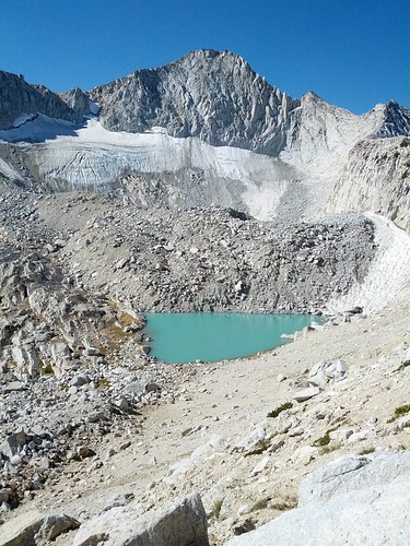
A couple weeks ago I posted that we tried to get up to the tarn above Upper Conness Lake but took the wrong route and failed. We tried a different route last week and were successful. Here is a link to a detailed image with the route we took:
http://images.aa6g.org/YosemiteForums/Route-to-ConnessTarn.jpg
As long as you can get to the north side of the upper lake, I think this route is easier than climbing far above and crossing through all that rock. The sections of the route marked with orange ovals are places where you have to cross rocks but they are fairly short. The red oval is a short section of loose rock and sand on a fairly steep slope but again it is very short. The blue oval which is located at the bottom of the climb up to the tarn is a where some of the water from Conness glacier is coming out from underground. There are a number of spots where water is emerging from the ground and joins together to go over the falls. From the blue oval up we climbed along the border of rocks and the granite slope, going back and forth on whatever looked easiest. About half the way was on grass and dirt. Overall it was much easier than I expected. The red dots are the spots I photographed from.
Here's a couple of images from up there.
http://panoramas.aa6g.org/ConnessLakes/ConnessLakesPan180.html
http://panoramas.aa6g.org/ConnessLakes/ConnessTarn.html
The tarn was covered with a thin sheet of ice when we arrived and was mostly melted when we left.

The Moon is Waxing Gibbous (55% of Full)
Re: We Made It!
All posts are those of the individual authors and the owner
of this site does not endorse them. Content should be considered opinion
and not fact until verified independently.

Sorry, only registered users may post in this forum.

